
USA
May 10 to June 2 2018
Thursday may 10 : 3 am, the alarm clock rings for a departure from house before 4 am. We go to Parkinéo Roissy that will keep our car for 3 weeks at the price of 144 €. The shuttle takes us with other travelers to the airport. The driver falls asleep while driving, not reassuring! The various recordings, controls are going well. The plane takes off at 9:15 am to arrive 1 hour in advance in San Francisco. Then the flight to Las Vegas departs at 4:15 pm (local time) for an arrival at 6:15 pm. We then pick up the car at Hertz, which is tested for the first time. Here, no choice, we are imposed a car: a Mazda CX-5 AWD.
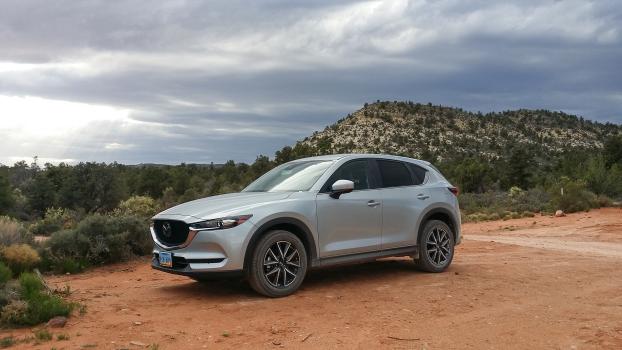
Smaller than usual but for us 2, it's enough. The ground clearance is not great. It should be hard for some tracks. Finally, we join our usual hotel, the Super 8 Ellis Island. We are so tired that we do not have the courage to go to the Strip. We go to 7Eleven next door to buy salads that we eat in the room.
Friday may 11 : up at 5:30 am, not a good night! We are at breakfast at 6:30 am. We are preparing bags for tonight's backpacking at Yant Flat. We leave the hotel at 9:00 am to go shopping at Walmart on Tropicana Avenue. Departure for St George at 10:20 am, it is already 91°, where we have an appointment with Michele and Jean-Michel Perrousset, who finish their journey and join Las Vegas. On the way, the temperature rises to 97 °. We meet our friends at MacDo where we have lunch together while talking ... USA! They give us a lot of things: cooler, boxes, tuna, beefaroni ... We leave at the beginning of the afternoon. We are looking for a hotel for tonight rather than camping at Yant Flat: too hot for a first day and especially since we are tired. There is a room at Motel 6 for $ 88. We buy some fresh produce now that we have the cooler. Then we leave for Yant Flat at 4 pm. The track is still good. We will explore the western area. Following the trail, we continue instead of turning to the main area. It's smaller but very steep.
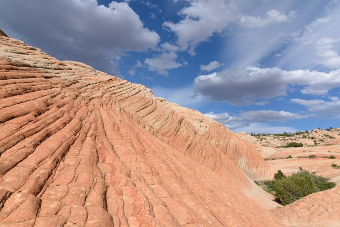
It's very nice. We are alone !
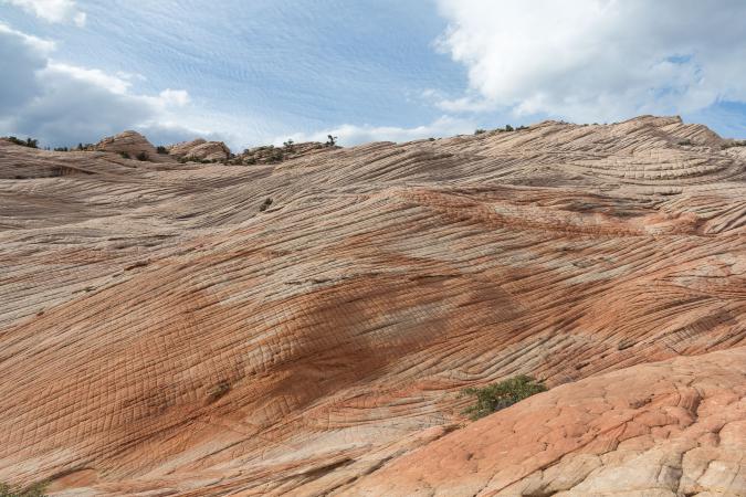
Jean-Michel told us about a «pool» and actually there is a little water left.
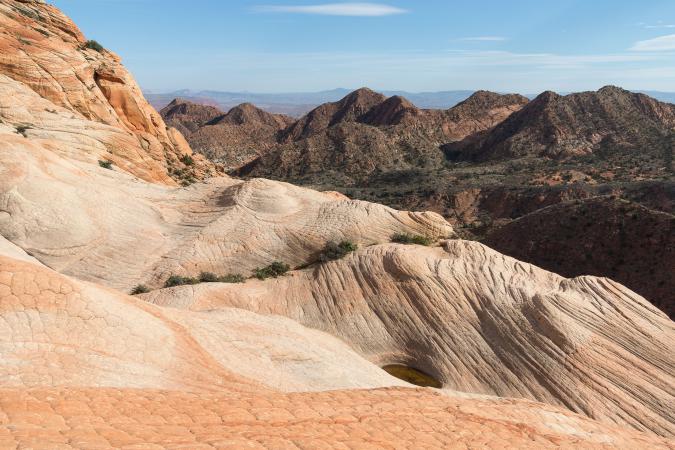
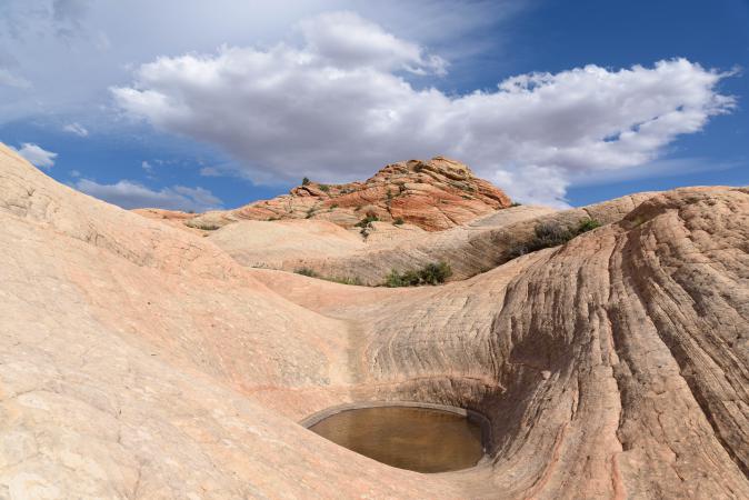
There is a lot of wind and the clouds at the bottom are very dark. We did 3,4 miles roundtrip. The temperature dropped to 81 ° then 70 °. We arrive in St George at 8 pm (back to 88 °!) and we go for dinner at Denny's. The wait is long...
Saturday may 12 : up at 6 am. Departure at 7:10 am. The sky is overcast and it is 62 °. We're on our way to Zion. We arrive in Springdale at 8:15 am (58 °). We decide to start with the Deertrap Mountain hike. For this, we cross the entire park because it is in the eastern part. But arrived at the beginning of the track, it is blocked. There is a race. Gosh ! Turn around. What a lost time! And in addition, it starts to fall a few drops of rain. So, on the return to Zion on Route 9, we park at the starting point of the hike to Separation Canyon. We walk on passing under the bridge and following the dry wash. The walk is a little boring in the sand and stones but it is not very long.
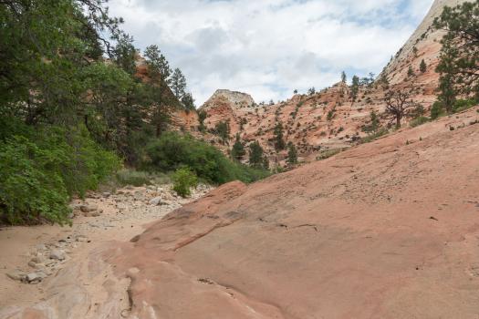
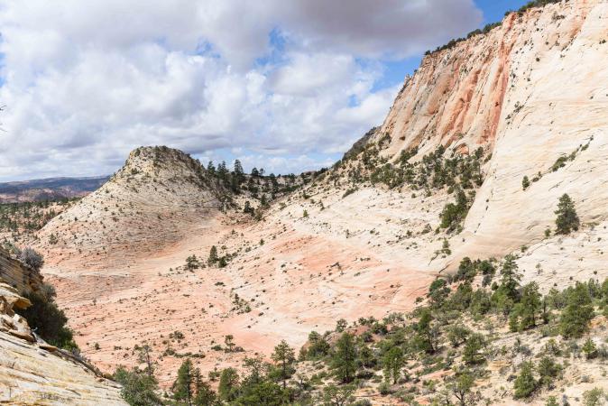
Then we have to turn on the left but we do not know where, we do not see a path and it's a bit of a joke. Once past, we follow the GPS track and it goes up, sometimes steep, sometimes quiet! The landscape is very beautiful and we are all alone!
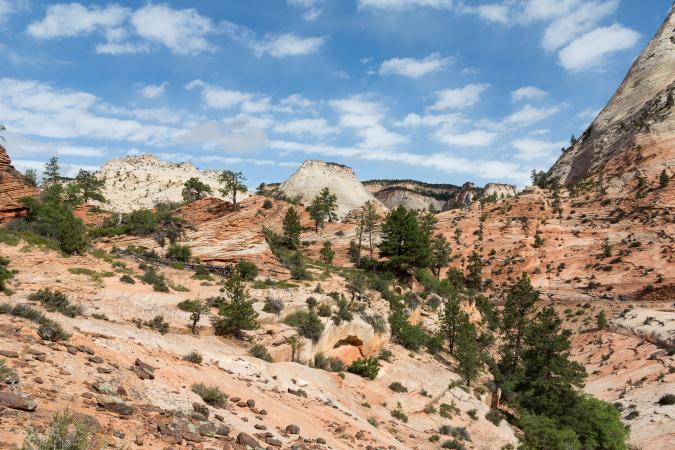
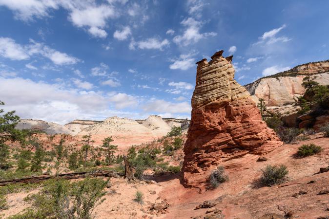
We continue to climb, we walk the 2,1 miles indicated and we find ourselves facing the "peaks": Separation Peak, Nippletop Peak and Lonely Peak. Well, the view to the south is blocked by a rocky peak that we can not climb. But the view is superb.
We take the opportunity to nibble, trying to shelter from the wind.
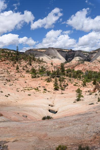
We return to the car in the early afternoon after 4,2 miles roundtrip. We go to the Zion Canyon Campground and RV Resort, which we had booked in advance, to be sure to keep our site. It is not cheap ($ 50 for a tent site) but the setting is nice. We go up the tent by the river
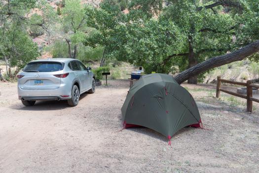
and we have a walk in Springdale (shopping and gallery) and eat an ice cream. Back to the campground for dinner.
Sunday may 13 : departure for Zion with the shuttle at 8 am. We go down the bus at the Weeping Rock stop. Goal of the day: Observation Point. We start the hike at 9 am. It climbs as soon as the beginning and all the time.
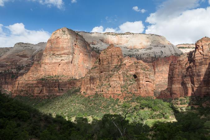
We go through narrows that are actually part of Echo Canyon. It's very nice and it's flat here!
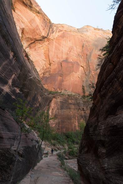
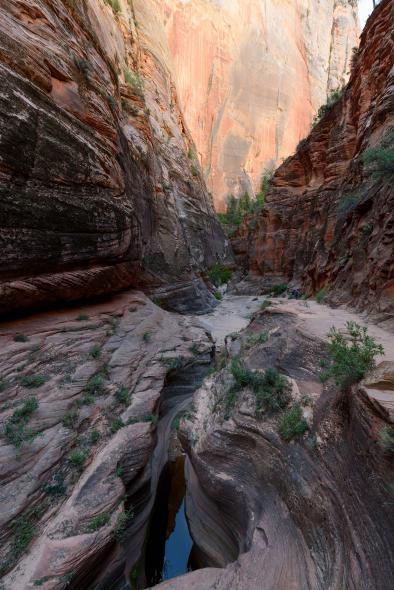
Then it climbs again. It's stiff! Arrived at the shore, it is flat to the final viewpoint. And there ... wow! The view is slightly foggy but impressive.
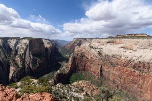
There are a few people, anyway. We did 4 miles with a difference in altitude of 2150 feet and 2h30. From here we have a bird's eye view of Angel's Landing. We isolate ourselves from the world for a picnic. There is a lot of wind, it cools and we put the jackets. We start the descent at 12:10. As much as the climb breaks the thighs, as the descent breaks the knees. By the way, we fork to Hidden Canyon. It goes up a little bit. Then, it's quite fun with passages with chains because it's close to the void, steps (50, I counted them!), Passages on tree trunks
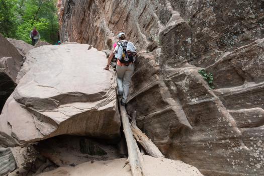
or under branches ... It's funny! Some narrow passages but nothing more. We go to Hidden Arch, which is almost stuck to the wall. It is pretty cool.
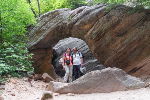
We continue a little and then a sign indicates the end of the trail. After it's a bit of climbing on big rocks. We go back on our steps. It's a little slot canyon but it does not break 3 legs to a duck! In the descent, there is a small crowd of people looking towards the wall. But what did they see?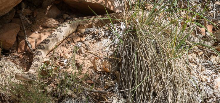
Gloups ... a rattlesnake! This is the first time we see one. Back to the shuttle at 4:00 pm then return to the campsite in Springdale at 5:00 pm. In all, we walked 9,2 miles. Dinner of beefaroni and campfire.
Monday may 14 : we drive to the Deertrap Mountain parking lot. The track is open. We can not go to the parking lot, there is a wash to cross, it is dry but there are too big stones for the car. We park just before. We start the hike at 10 am. The beginning is under the pines, it smells good. It is relatively flat with some parts of sand, some small climbs and once out of the undergrowth there is no more shade. The trail has no interest. We arrive at 12.00 at a first viewpoint (sign "Caution" fall).
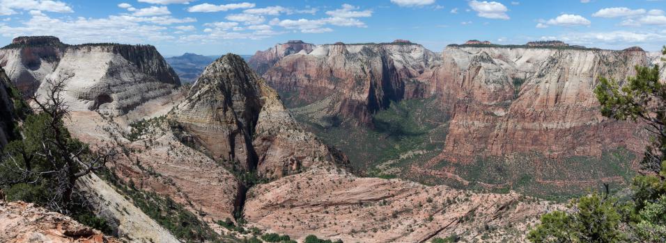
We continue along the rim for 0,3 mile to reach a second viewpoint. The view is impressive and once again we are alone.
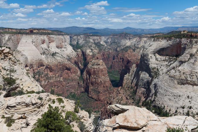
We picnic and we leave at 1 pm. It's long and it's hot. We arrive at the car at 3:30 pm after 10,5 miles roundtrip (73 °). We take the road to get closer to Escalante and we stop for the night in the city of Hatch on Highway 89. We take a room at the Hatch Station ($ 94 with 2 beds), it's very classy, the room is big and clean, bathroom not bad. We dine burgers at Hatch C-Store. Not bad.
Tuesday may 15 : up at 7:30 am. Breakfast in our room (not included), David goes for a coffee and a hot chocolate at the C-Store. Departure at 9:20 am (51°). We take the beautiful road 12. There, we change our program since, once again, our car clearance is not high enough, so we won't try the secondary tracks ont the Hole in the Rock Road in Escalante. We had planned Neon Canyon. We have spotted scenic roads on the internet. So we turn right on the Scenic Backway East Fork Sevier River Road (n°087). The track is graveled, it's ok for the car.
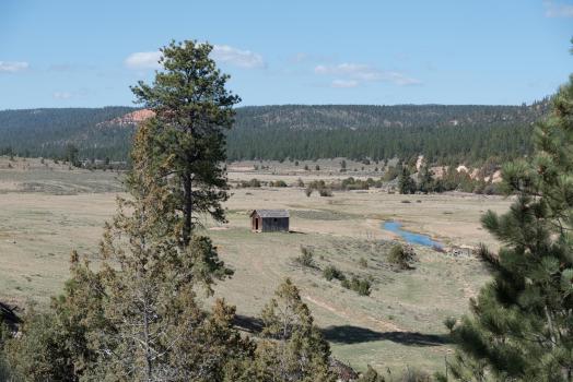
Lined with pine trees, the track offers views of red rocks. Tracks go off in every direction. A few miles and we take a right towards Kings Creek Campground. We arrive at a huge lake.
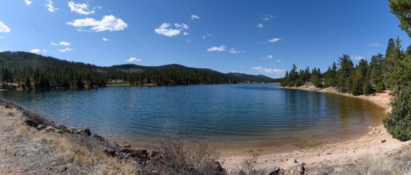
It is Tropic Reservoir. It's nice. Continuing, we arrive at a campsite. We take a look to see: $ 15 with sanitary. It must be nice to camp here. So we go past the campsite to follow the trail by housing the lake. At the end of the lake, we turn right (track 109) again because we can see red rock. We arrive at a sign that says:
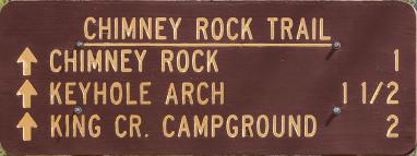
In order to stretch our legs, we go hiking to the ark. We pass Chimney Rock and we find ourselves in a mini Bryce Canyon, same colors same shapes. We continue and we arrive at Keyhole Arch.
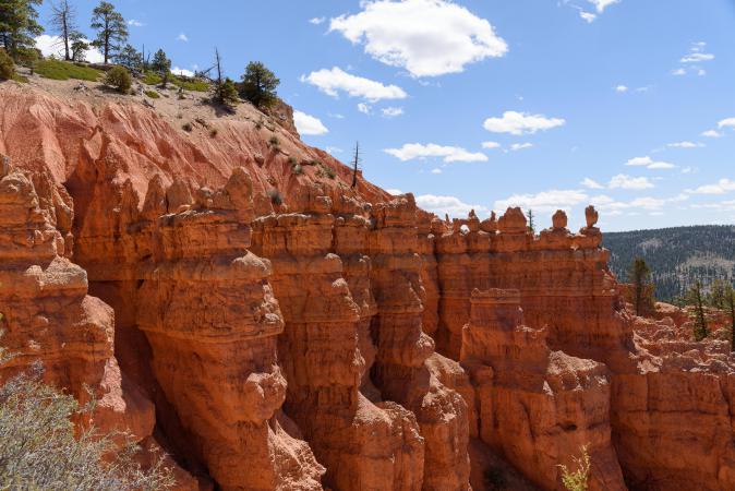
It's nice and we are almost alone. We meet a couple not very young who makes the loop from the campsite. Then we cut through to reach the 1st point of view and be more in the heart of this mini park. Still some photos and we reached the car: 2,5 miles roundtrip, 730 feet of altitude difference, 1h50 with photos, 8500 feet of altitude. Nice discovery! Picnic a little further down the track, once in the shade, once in the sun. It's crazy the temperature difference between the shadow and the sun. Well, we are still at 8200 feet altitude and it's windy. We take the road, well the track, and we go back to the lake. At the junction of tracks 109 and 091, we bypass the lake and we reach the Scenic Backway 087. The view is pretty.
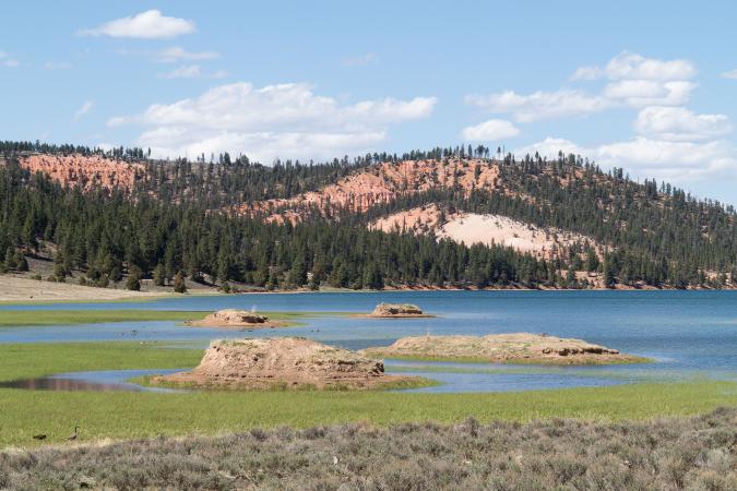
We continue on the Scenic. We cross the East Fork Creek River. Then there are meadows, fir forests as far as the eye can see. We pass a small river that forms a small lake with a view of red rocks. Then we reach a junction that says "Bryce Canyon Park Bndry 3" (track number 099). We follow to the left to see ... The track is a little less rolling: risk of puncture! At a crossroads, we take a small track which is always the 099 which is more chaotic and pierced. But it passes. When we reach a "Cougar Hollow" sign, you should take the track on the left for Bryce. But it is smashed, we think that the bottom of the car could touch so we turn around. We were not far from the boundaries of Bryce Park but we do not know the state of the track further. On the return, we stop a moment at the foot of a nest of balbuzard in which there is a small balbuzard. We leave the track at 4:20 pm after 38 miles on this track. We decide to go camping in Kodachrome, the campsite is nice. But arriving at the junction with the Cottonwood, on the Kodachrome sign is noted "campground full". Turn around. What a waste of time ! The Grand Staircace Inn on Route 12 is full too. At the entrance of the campsite Koa in Cannonville, it is noted "Full no RV sites". We try and there are still places for tents: $ 37. The location is top, a bit high with views of the mountains. Nice as a campsite. Dinner and campfire.
Wednesday may 16 : up at 7 am. We pack our tent and we leave at 9 am toward Escalante. We arrive at 9:50 am and we stop at the Visitors Center. Then we go to the campground in Petrified Forest and we install our tent (20$ the campsite, entrance of the park included). At 10:50, we go on the Pine Creek Road then Hell’s Backbone Road. We follow the sign Posey Lake (scenic backway). The track offers views of white and yellow rocks
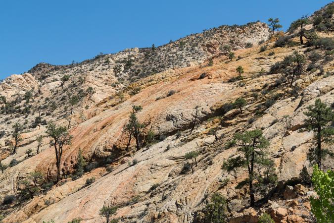
then on a fir forest. At the intersection, we turn left, Posey Lake Campground. This lake is lost in the middle of nowhere, it's quiet. We take the opportunity to picnic in the sun. There is a small breeze but we are at altitude. We go to the end of the lake to take some pictures. The primitive campsite has 23 pitches and several dry toilets. There are also trails departures. We leave and we join the main track (65 °). We do not see much landscape ... but only pines. We arrive at Pine Creek at a junction indicating 2 campsites on the left. We continue to the right. We pass in front of a "Death Hollow Access" sign. We arrive at Hell's Backbone Bridge. Finally nice views. We stop to take pictures of the bridge and the mountains.
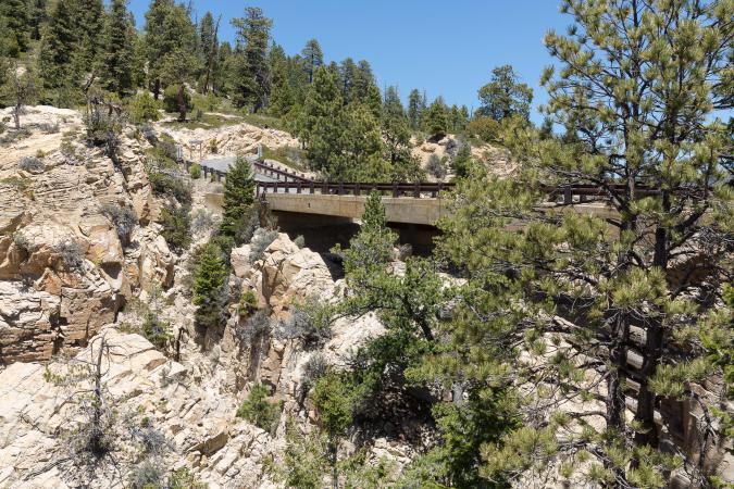
And here begins the Hell's Backbone Road and again fir trees. Not very interesting track! After 42 miles on this track, we arrive on route 12 at the beginning of the afternoon. We make photo stops at the viewpoints between Boulder and Escalante.
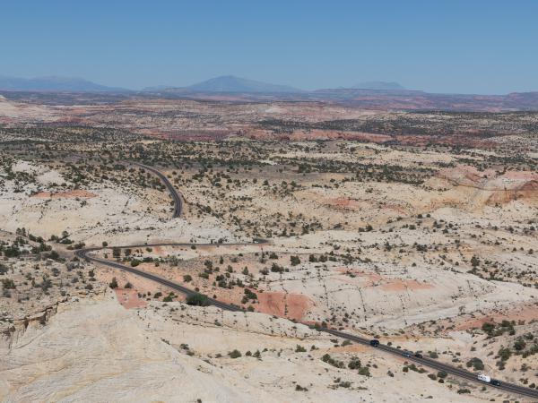
Then we go on the Spencer Flat Road. There are plenty of places to camp. It's good to know ! After a while, we see a yellow mound with a white bottom, but the track becomes very sandy. Not wanting to get soggy, we turn around. Back on the 12, direction Escalante. We do some shopping and we return to the campsite at 4:30 pm. It's full. We did well to settle down this morning. The day is not over, we decide to visit Petrified Forest State Park. No need for a car, the trails start from the campsite. We start with Petrified Wood Cove (500 feet long) then we hike the Petrified Forest Trail (1 mile) which starts with a good climb. Yeah ... well ... we're not convinced! We continue on Sleeping Rainbows Trail (0,75 mile) called "very steep". Indeed, it goes down steep in the pebble and it goes up stiff too. But this is where there is the most petrified wood.
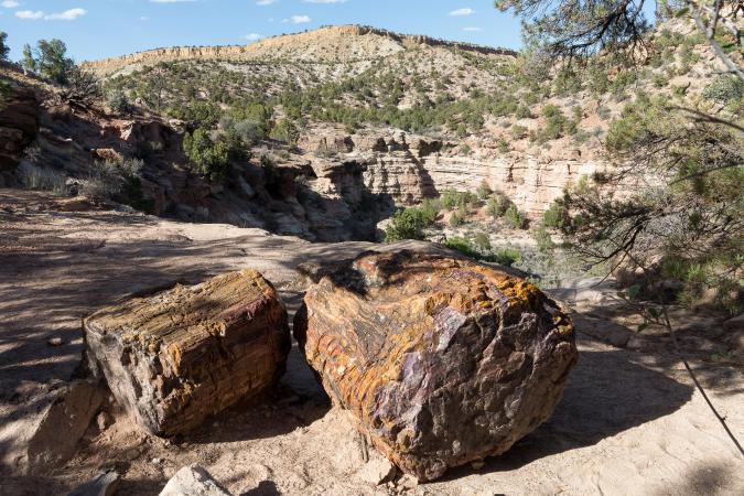
Back at 6:15 pm after 1,8 mile. We go straight to eat a pizza at the Escalante Outfitters : we take a Kings Mesa. Back to the campground at 7:50 pm.
Thursday may 17 : we go back on the route 12 to reach the Burr Trail and use it all along, which we never did before. From the beginning of the track, the landscape is pretty. It looks a bit like Yant Flat.
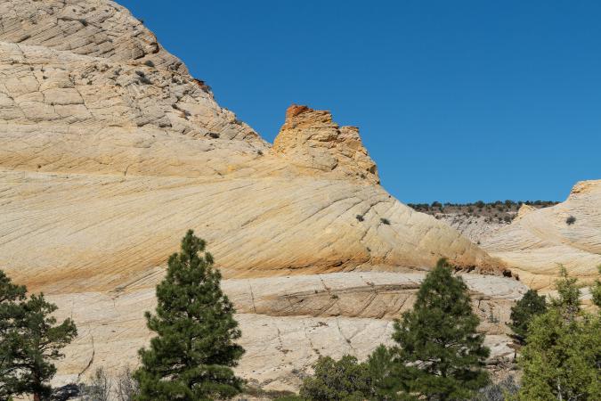
We make several photo stops. At the end of Long Canyon, the view is great but then, after a few miles, the views are less interesting, there are only groves. At 11:10 am, we enter Capitol Reef and the concrete road becomes "gravel". At the junction of Upper Muley Twist, we turn left and arrive at a 1st car park. We park to walk to Strike Valley Overlook by the track. There is a 2nd car park closer but you need a 4WD high enough to cross the holes and rocks on the track. At the first car park, we register on the register and we start the hike. The track goes down in a sandy area (which must be steep to get back in a car) and then the pebble, then the track is good until two new delicate places for cars too low. The landscape is nice but it is hot 81°. We take advantage of the shadows of the rocks to drink. At the 2nd car park, we turn right onto a small path that leads to slickrock. Here you have to go straight to the breathtaking view of Strike Valley Overlook. It's great. We are blown away.
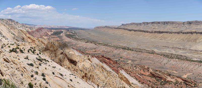
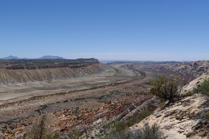
We nibble with this amazing view and we take the same path to go back to the car. The hike is 5,6 miles roundtrip. Departure from the parking at 2:45 pm. At the end of the Upper Muley Twist track, a Ford Expedition is stopped: flat tire. It's ugly ! It's a Canadian couple and they can not find the place to put the jack to get the car up. We stop anyway to give a hand. We leave at 3:15 pm. 20 minutes later, we turn on the Nottom Road to make the 34 miles that separate us from the UT24. It's corrugated iron for at least 16 miles, it's very unpleasant. Fortunately, the landscape is beautiful. Finally, we reach the UT24 at 5:15 pm, toward Torrey. We stop at Sand Creek RV Park to see if we can stay overnight. The manager drives us to the tent sites. It's rotten: unserviced lot with tall grass, no table, full sun and full wind ... He is not ashamed to propose that ?? We pass our turn ... We stop at the next campsite, the Thousand Lakes: $ 20 per night plus taxes. The site is not very big but equipped with a table, a pit fire, sheltered from the wind by wooden palisades, with showers, restaurant, store and laundry. Top ! We settle the tent
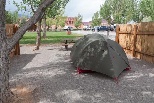
and we have dinner at the Torrey Grill & BBQ in the campground : 20$ the menu for ribs and brownies. Not bad.
Friday may 18 : we take breakfast under the big yard in the campsite sheltered from the wind. At 9:30 am, we leave for Capitol Reef to hike. We combine several trails: Cohab Canyon - Frying Pan Trail - Cassidy Trail Arch - Grand Wash Road - Scenic Drive: 10,2 miles, 1900 feet elevation gain in cumulative, 81°. We go from 5410 feet to 6415 feet. We will put 5:30 with pictures breaks and picnic. All in all, it's a beautiful hike with beautiful views, Cassidy Arch is impressive, but sometimes the view is average.
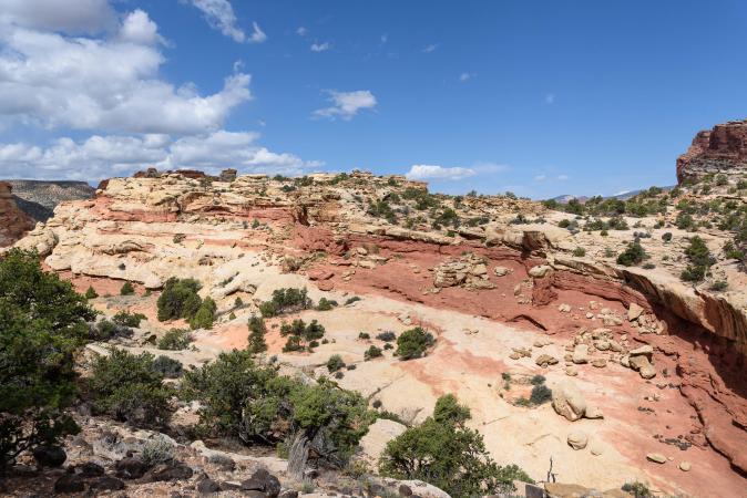
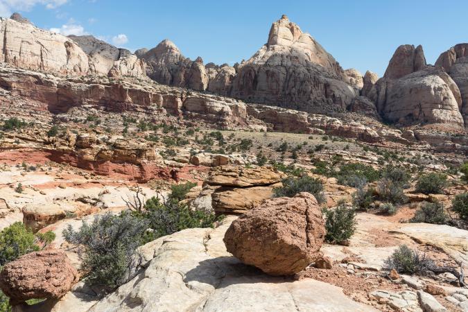
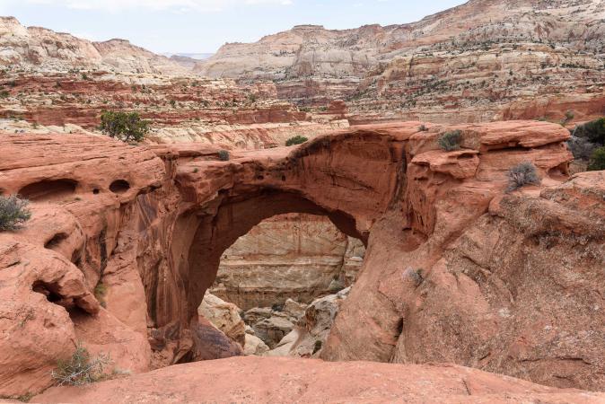
It climbs a lot and the end, on the Scenic Drive, is rotten. It's bad this return by the road! We reach our car at 3 pm. Shopping. Laundries. Dinner at the campsite. The sky is black threatening in the distance!
Saturday may 19 : up at 7 am. It's cold 48° and windy. Departure at 8:30 am for Capitol Reef. We make several stops today :
- Panorama Point : it's against the light, probably better in the evening.
- Gooseneck : not bad, to do in the morning.
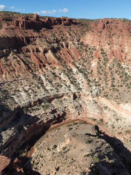
- Petroglyph Panel : they are to far.
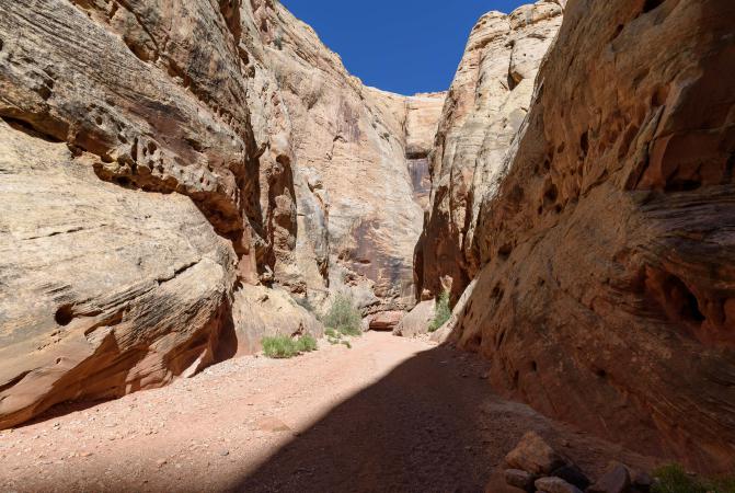
- Grand Wash (from the parking lot on UT24) : we hike about 4 miles roundtrip (1h25) up to the narrows (the whole trail is 4,5 miles roundtrip). Back to the car at 11:10 (67°).
- Fremont River Trail : 3 miles from the picnic area. The trail runs along the river but we don't see it much. Then big climb of almost 500 feet that leads to 2 pretty viewpoints.
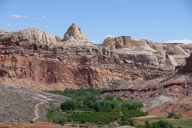
12:45, picnic on the area. And we leave at 1:30 pm.
- Scenic Drive with many photos stops :
- Danish Hill : nice view
- Slickrock Divide : superb view
- Capitol Gorge Road (track of 2,3 miles)
- Capitol Gorge Trail to The Tanks : 2,9 miles roundtrip on foot. The part to The Tanks is quite fun, there are “pools”.
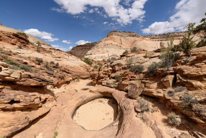 The sky is darkening at 3pm. Back to the car at 4:15 pm as it starts to rain. 4:30 pm : back on Scenic Drive.
Total hike of the day : 10 miles. We stop at the Visistors Center. It's closing time. The ranger is struggling to unhook the American flag because of the wind. So, David gives him a hand. He is very proud to have touched the US flag !! Shopping at the mini market next to which there is a small craftsmen market / yard sale with a country music band of old grandpas. Back to the campsite at 6 pm. Dinner and campfire.
Sunday may 20 : direction North Caineville Mesa. By the way, we stop at the Capitol Reef Visitors Center to see the weather and get information on the Factory Butte track but they have no info. The sky is getting cloudy on Capitol Reef side. At North Caineville Mesa, we park on a small parking lot in front of the famous cement mixer
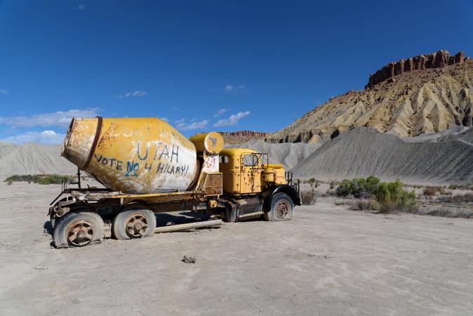
and we start to climb.
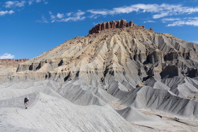
We will do only 1,2 miles and 482 feet of elevation. The start of the climb is rather easy on the mesas but then it is more rugged and in the pebble. We do not feel it too much to continue. The view is not bad but we expected better.
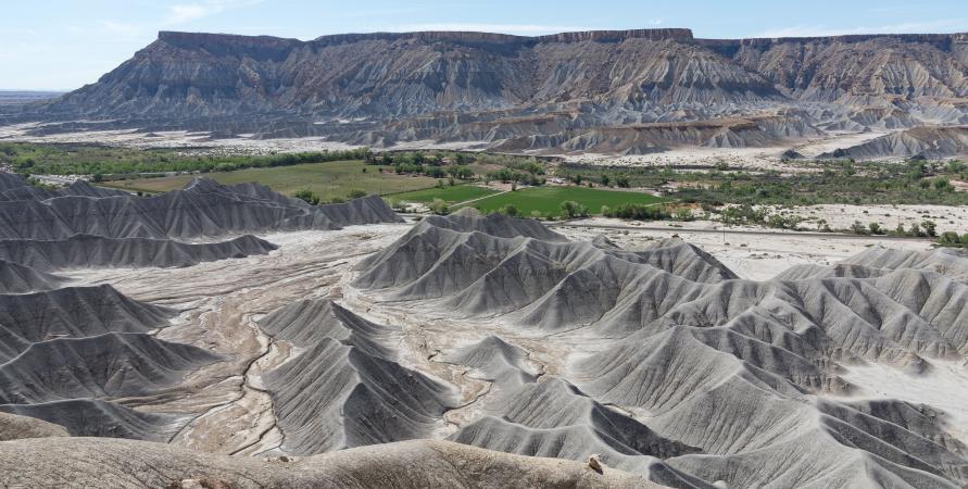
We are back at the car at 11:30 am. We had planned to camp tonight at Moonscape but the weather is too threatening. So we decided to continue the program and come back to Moonscape later. We take the road to Leprechaun Canyon. Another great discovery for us. The access walk is done in a sandy wash dotted with tall bamboo style grass. We arrive in front of 2 canyons. The one on the left is blocked immediately by a rock. The one on the right is also blocked by a stone but we can go around this part by going up on the slickrock. From the top, we see the area blocked by the stone which looks very narrow. We continue walking towards the canyon.
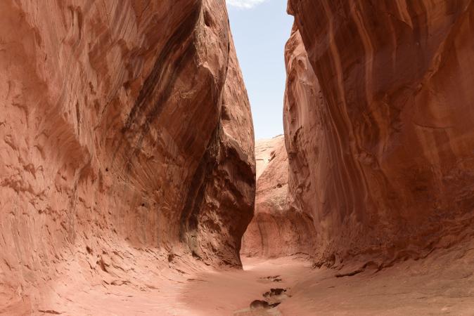
This one is very beautiful with pink colors and it narrows a lot.
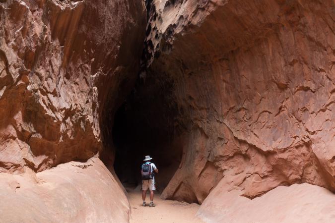
Then it is so narrow that it is dark inside and the progression is possible only by side and without backpack, and especially you should not be too big or claustrophobic!
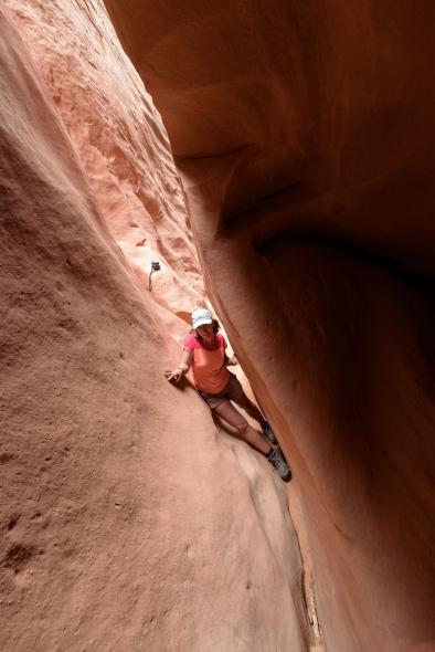
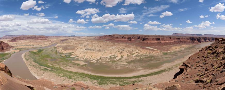
We therefore hear rustling and gling gling. 3 women arrive: it is impressive the way they move aside, their bodies completely marry the shape of the rock and undulate depending on the bumps and hollows. We talk a little with them, they did not go very far because the canyon is very long. We return to the car at 2.30 pm after 2,2 miles roundtrip and 2 hours on the spot (84 °). We stop for a picnic at Hog Spring Picnic Area. We continue our route to Hite Overlook. The view is amazing, beautiful.
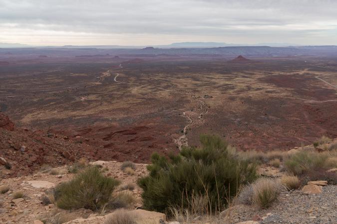
We then arrive at Natural Bridges National Monument around 4:50 pm. We would like to camp here but the campground is full. We turn around to go to Mexican Hat to find a hotel. The road 261 passes by the unpaved switchbacks of the Moki Dugway. First time for us. The view is ... waouh !
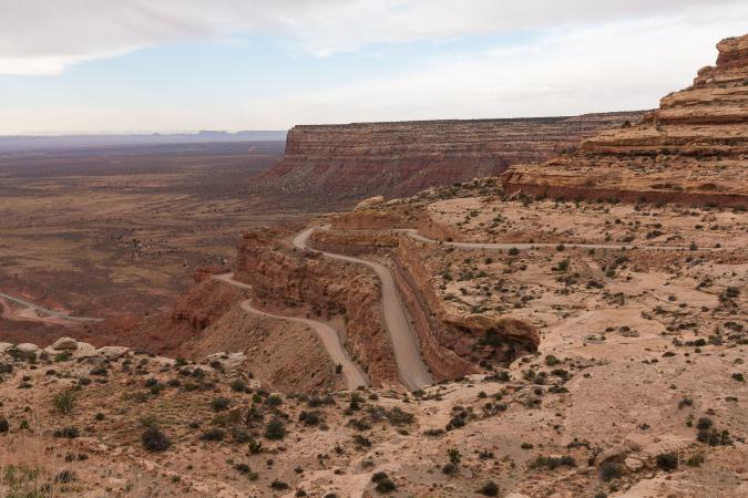
At Mexican Hat, we go to the Hat Rock Inn. The Indian announces us $ 130 !! What ?? Bye !! We will see Canyonlands Motel: it is less classy but it is cheaper $ 63. We take 2 nights. It does not look like it but there are 2 beds, 1 bath, but no fridge, no microwave, no breakfast, no TV but we do not care. We buy mixed salads at 7Eleven next door and eat at the hotel on the chairs outside our room. The night is very calm.
Monday may 21 : up at 6:15 am. Breakfast in the room. At 7:20 am we leave for Valley of The Gods via road 163. The track starts with the crossing of a wash that is a little wet. The remain of the track is very good. At several places, it is possible to camp, we are on the BLM lands.

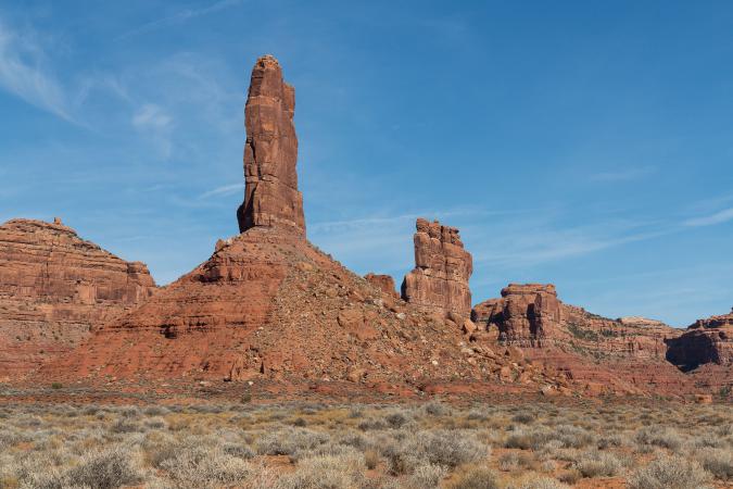
It's nice but ... not so impressive after 10 trips to the west. After 2h30 and 17 miles, we leave the park at 10:00 am and we go to Goosenecks State Park. Admission fee is $ 5 and the Navajo not very friendly or smiling: "Hello 5 dollars" will be the only 3 words she will tell us! It is possible to camp here. We have a great view of the San Juan River and its meanders.
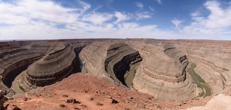
We take pictures for 15 minutes and we leave. We take once again the Moki Dugway going up this time (count about 10 minutes) to take the track to Muley Point, on the left of the exit of the Moki. This track is a mixture of corrugated iron and earth. The 1st viewpoint is 4 miles away. It's nice.
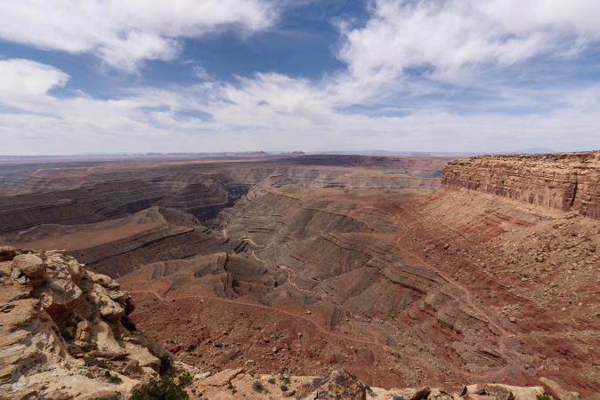
The 2nd viewpoint is 1,2 miles further and the track is almost only corrugated iron. The view is less good because a little blocked by big rocks. We go back on Route 261 to go on Cigarette Springs Road (right side of the road coming from Mexican Hat). We arrive at a sign announcing that the area of Cedar Mesa is paying: $ 2 per person per day. We follow the Cigarette Springs for 3,4 miles before turning left on a small track and then we park in the parking lot. We continue on foot on a path that combines small forest, sand, wash, slickrok, tall grass. In 1,2 miles, we reach the ruin of Fallen Roof after a good climb. We, who are not very interested in ruins, we are amazed and we find it beautiful. The colors are incredible.
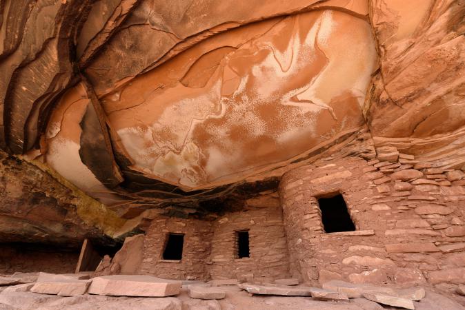
We love! We continue about half a mile, it climbs hard, to see a second ruin.
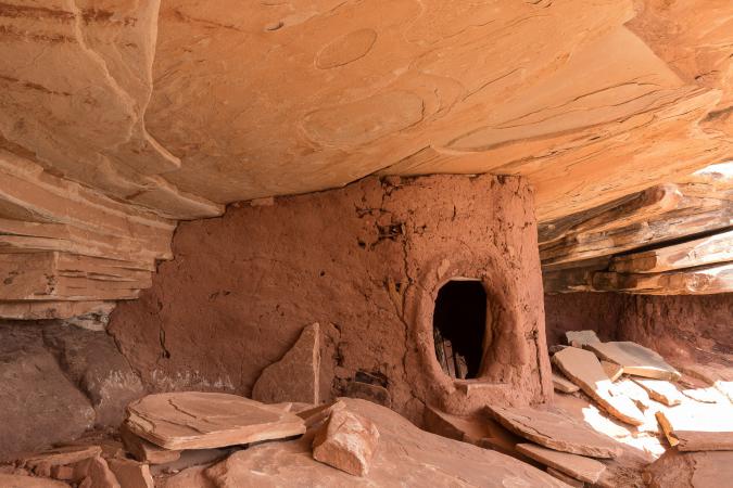
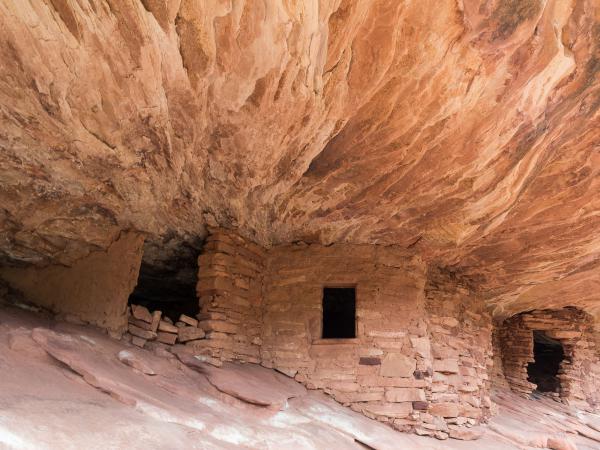
Back to the car at 3.30pm after 3,6 miles roundtrip, we take the direction of Mule Canyon to another ruin, House of Fire. We follow the Texas Flat Road track which is quite rotten and full of pebbles. We park at a wash. It is also paying because we are still in Cedar Mesa. It is assumed that our license is valid so we do not pay. We register on the register. The walk is easy in the wash, sometimes in the sand sometimes on slickrock, and is only 1 mile one way. We meet a couple who tells us not to have found the ruins. Weird, we were told it was easy to get there. Still in the wash, at one point we see cairns on the right, we raise our heads and we see the ruins. The couple did not go far enough in the wash! House of Fire Ruins is very beautiful but there is no sun, the sky is covered so no nice colors for the "flames".
Back to the car at 6:25 pm. No time to go to Recapture Pocket. We find ourselves again on the Moki Dugway and there, the sky is all weird: there is a sandstorm. In Mexican Hat, it blows and we see the sand fly. We buy hot dogs and yogurt at 7Eleven and we will lock ourselves in the hotel room not to fly !!
Tuesday may 22 : departure for Natural Bridges National Monument. The sky is overcat and it's 60°. We leave the car at the parking lot for the viewpoint for Sipapu Bridge (that we can't see well from here) and at 9 am we start the "Loop Trail" that goes at the bottom of the canyon at the foot of the bridges. The descent for Sipapu Bridge is fun with passages on ladders, tree trunks.
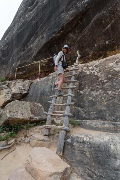
Sipapu is huge and impressive.
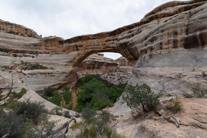
We continue the trail that passes by some ruins and then Kachina Bridge.
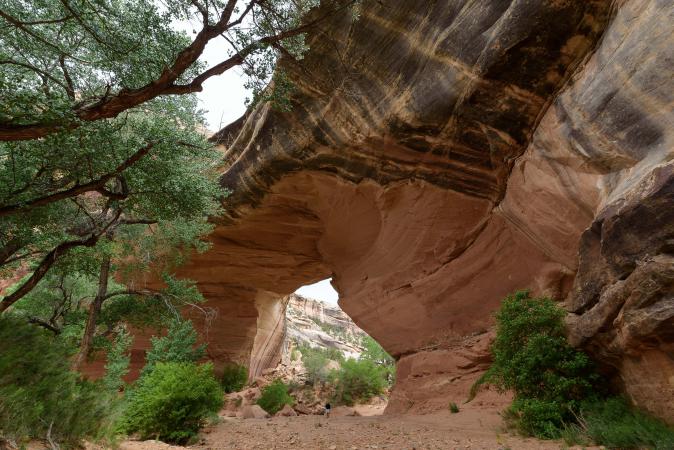
We are well, a little in the shade and cool. The trail to Owachomo Bridge is monotonous, long and boring because sometimes there are big herbes that tickle the underside of the arms! It then goes up a bit under an alcove where we picnic. Finally we see the third bridge which is longer and thin. It's nice.
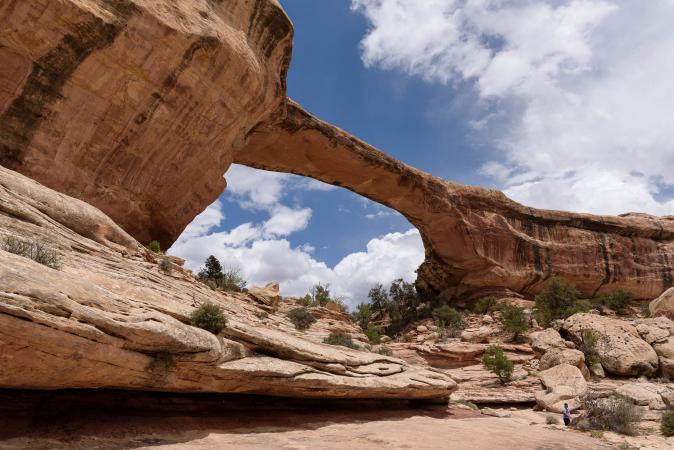
We leave the trail to take Mesa Trail and go back to Sipapu parking lot and our car. And this part in groves is very boring and long, without any interest. The car is in sight at 2:45pm after 5h45 of hiking and 9 miles. We are happy to find fresh fruit in the cooler. We take the car and we still stop at the viewpoints of the ruins but we can not see anything, we must take the small trail of 0.3 mile (not the courage!). From Kachina car park and the small path, we can not see the bridge. In Owachomo, we do not see well either without going down the trail. Finally, the hike has the advantage of seeing very well the bridges. Other stops at Pygmy Forest and Bear Ears viewpoints are uninteresting. We leave the park at 3:30 pm and we go back to Hanksville. On the initial program, we were supposed to make a loop and join Page but as we have not yet been able to go to Moonscape, we take the same route. We moved to the Hanksville Campground, the Duke's Slickrock Campround & RV ($ 17) at 5:30 pm. It is very well this campsite: lawn, table, showers.
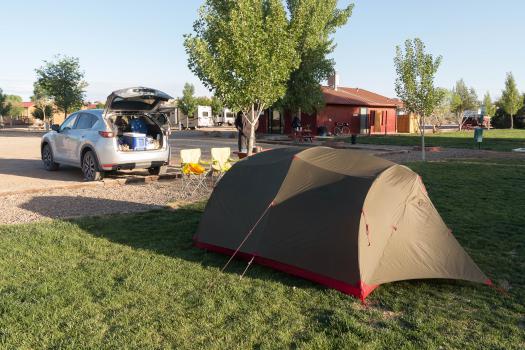
We dinne at the nearest restaurant, the Duke’s Grill, some burgers.
Wednesday may 23 : we visit the BLM to have informations on the tracks. At 9:20 am, we're heading to Cathedral Valley Road from UT24. We see a ponghorn in a wash.
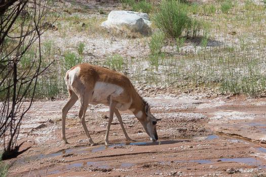
We need 2 hours to drive the 17 miles to reach Temple of the Sun. The track is once again in corrugated sheet metal, with rocks, sand, a few dry washes to cross.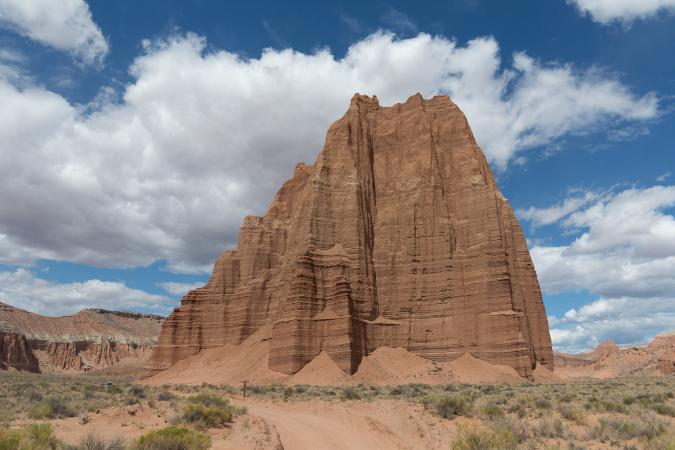
A few more yards to be at the foot of Temple of the Moon.
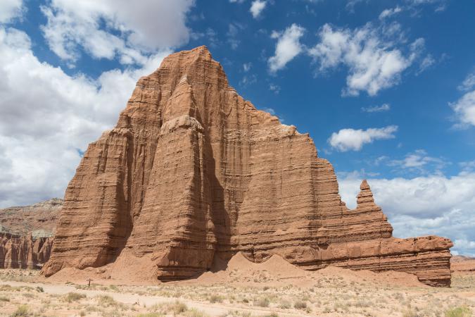
It's beautiful but from there to do all this track ... We leave at 11:40 am. The return is made in 1h25 and 34 miles roundtrip. We miss the first track for Lith Canyon. Must say that we do not see it well. A small sign announces "Mars Module 4 miles". The track is all rotten: sand, holes ... the 1st hole, it's good, the 2nd, it always goes, the 3rd, the hollow is too deep and the sand is very soft. We turn around. And we realize that we are not on the right track. Several accesses seem to be possible but we found a less complicated track. In fact, it is too stony for the 3,1 miles one way to go, it will take time and we prefer to go directly to Moonscape Overlook. We refuel at Hanksville. At 2:30 pm, we are at the beginning of the track to Moonscape. We make photo stops on Factory Butte.
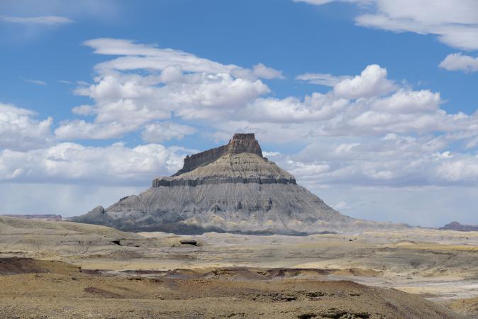
8,6 miles and 43 minutes later, we arrive at Moonscape. The view is superb, impressive.
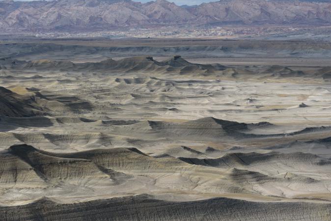
Look forward to seeing all that at sunset! But the sky is overcast and threatening in the background and there is wind. We finally install the tent at 6 pm
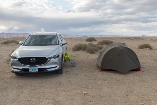
and we heat soups of noodles for dinner in front of this fabulous panorama that we have for ourselves. There is finally a thinning for some pictures at sunset.
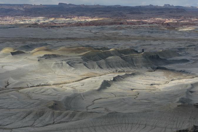
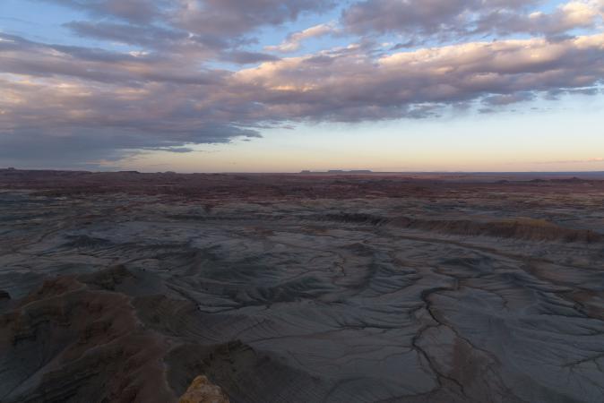
Thursday may 24 : up at 5:15 after a very calm night (not even a scream of coyotes for wake up !) to see the sunrise on Moonscape Overlook
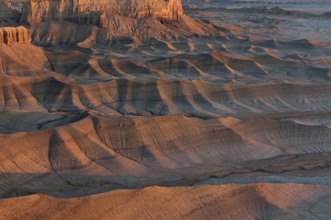
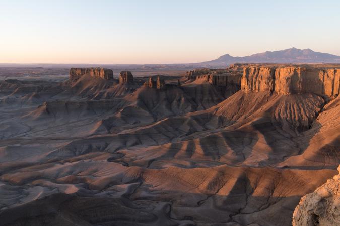
and Factory Butte behind us.
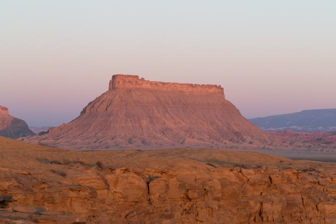
We then take our breakfast and we leave at 8 am. Still a few photo stops at Factory Butte and we go to Page via the routes 24, 12 and then the Cottonwood Canyon Road. Here, there is water in the first wash. We go a little on the right side which is shallower. The track still consists of corrugated iron (it's tiring of being shaken!), pebbles and sand brought by the wind. A quick stop to Candyland for a photo. We wanted to go to the narrows but it's not the right time (1:15 pm). We go to Paria Outpost to confirm the "tour" of May 26 but there is no one. We go to Page at the Wahweap Campground to try to get a place. We arrive at 2:20 pm (AZ time). There is just one avalaible place for this night ($ 30). Well, we suspected a bit, it's Memorial Day and therefore a holiday this weekend and Monday. We thought we'd go camping wild or go to Lone Rock. We settle down and then we nibble. It is very hot 96°. We planned lots of hikes in the area but I think it will be too hot. We will see the viewpoint behind the Denny's: bof.
Back to the campground. Dinner and campfire, as if it was not hot enough !!...
Friday may 25 : up at 5:15. We're packing the tent. We start the hike to the White Rocks at 7:30 am. The hike has no interest and we did not see much hoodoos.
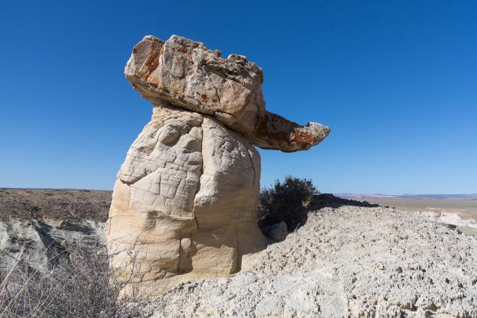
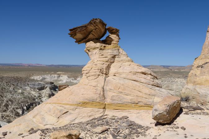
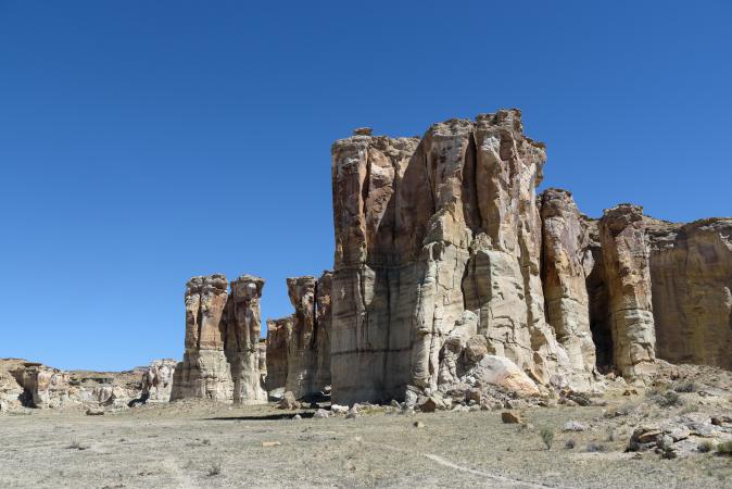
6,8 miles roundtrip. We return to the car late in the morning. We go back to Paria Outpost but still nobody. We go to Lone Rock and we take 3 nights of camping at $ 14 each night. We set up the tent. At 1:10 pm we go back to Page. We're going to have a cool break at Burger King: salad and Oreo milshake. We then go in search of a mattress because mine has a leak but we can not find, we buy some glue. The temperature continues to rise 95° ... 97° ... 99° ... Well, we do not do anything ... We go to the Wahweap Campground to enjoy the showers and picnic table before returning to Lone Rock.
Saturday may 26 : up at 6:15 am after a calm night. Passage to the sanitary block then to the service station next door for coffee and hot chocolate. 7:15 am: direction Paria Outpost for an expedition to Soap Creek. Appointment is taken for 8 am. Susan receives us, gives us our picnics and introduces us to our guide: Steve in person! We travel, in his 4WD, the 48 miles (2h30) that separates us from the site. Steve makes two detours to show us a nice hoodoo
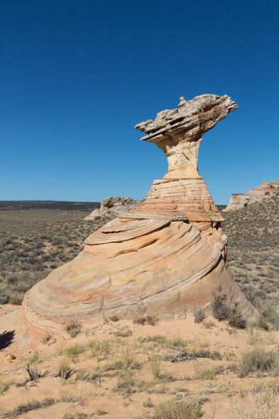
and an area called Joes Tank.
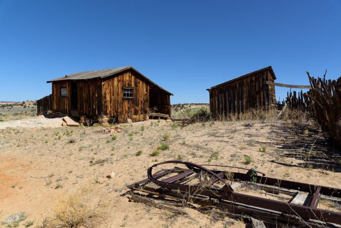
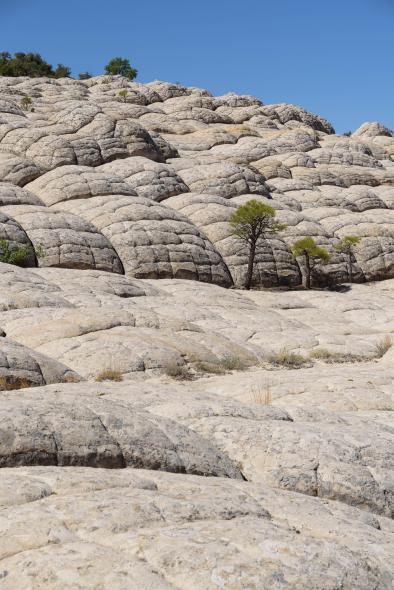
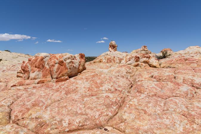
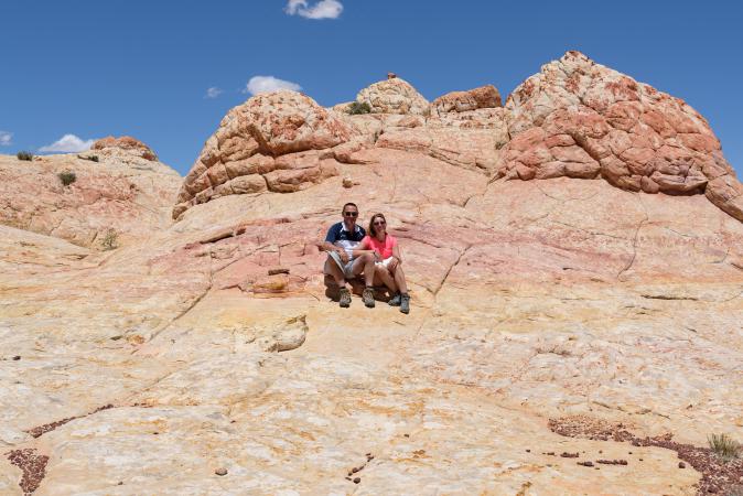
Then we arrive at Soap Creek. We follow our guide during 4 miles, discovering this place full of colors - pink, yellow, orange.
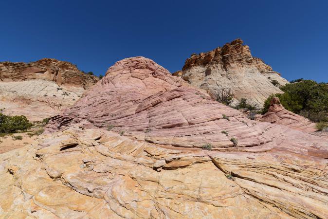
It's magnificent. It goes up, then down. It's a nice surprise for us, we had never been here.
.jpg?v=1ds1q8k)
We even have the chance to see bighorns.
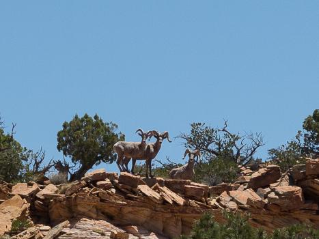
Steve himself is surprised, he had never seen some in this area.
We leave Soap Creek at 3 pm and we are back at Paria Outpost at 5:15 pm. After a good shower at the Wahweap Campground, we have dinner at the Stromboli in Page (pizza). Back to the campground of Lone Rock at 9 pm. We have the bad surprise to find plenty of sand in our tent because of the wind during the day. By chance, we had packed our sleeping bags in case, otherwise it would have scratched us all night long! Anyway, once we're lying down, we still feel sand falling from the mosquito net.
Sunday may 27 : up at 6 am. Breakfast at the marina/picnic area. We then go to White Valley on the Cottonwood Canyon Road. We park along the road and we follow the trail. At the end of this trail, we must find a passage to go down to the hoodoos, and the denivelation is 600 feet.
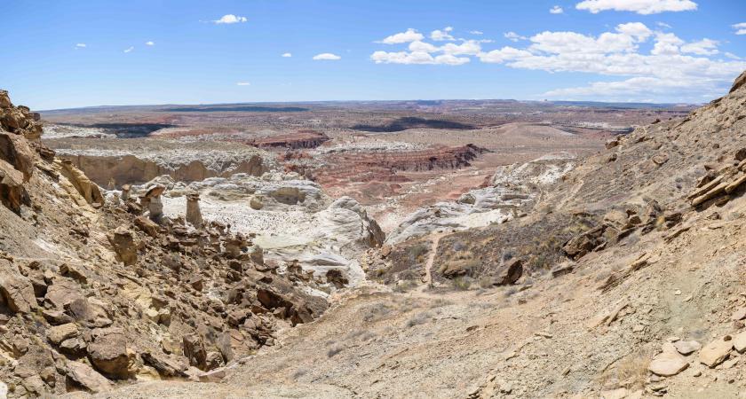
They are huge, we don't remember to have already seen such big ones. We feel very small next to them.
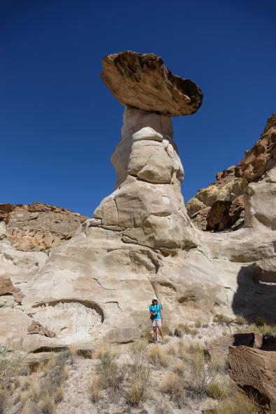
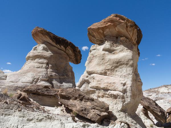
After 2:15 of photos and hiking (2,7 miles roundtrip), we reached the car at 12:30. Picnic in Wahweap. Shopping. Then we drive to Lee's Ferry early in the afternoon. Passing the parking Horseshoe Bend, there is a lot of cars on the 89, the parking is full. We start the Spencer Trail which is 1640 feet of vertical drop and 4,5 miles long. Just at the foot of the mountain, we say "but where is the trail? ". I do not feel it too much, furthermore it's hot. It climbs very steep. The view is already very beautiful.
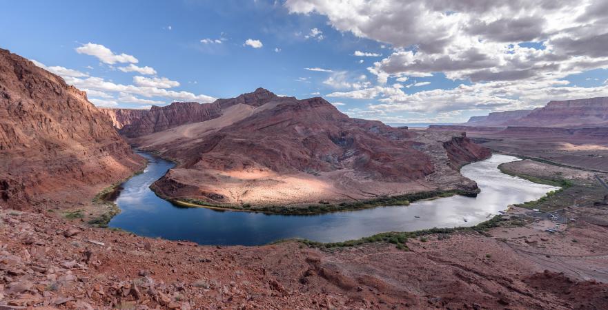
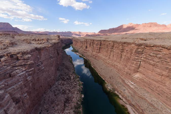
But after 650 feet uphill, we turn around, I can not anymore. Too hot, too hard. It would have been better if it was not so hot. We did only 2,1 miles roundtrip. On the way back, we stop at Navajo Bridge.
Stop also at Waterholes Canyon, in front of the new layout of the entrance. Now, the site visit is only done with a Navajo guide and it is more expensive than before. At this time it's closed, so the walks at sunset to Great Wall are no longer possible. Dinner and return to the campsite. Just lying down, we hear a big PAFF and David says "my mattress broke". I feel "well, no, it is still inflated." In fact, one of the sausages dissociated from the others, it is a big sausage and 3 small ones. So, David slept leaning!
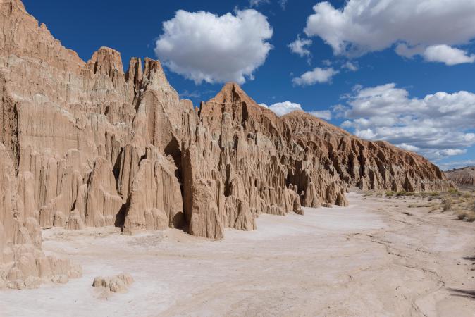
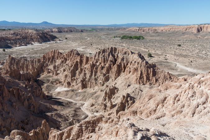
Monday may 28 : Wahweap picnic area direction for breakfast, shaking of the tent and duvets full of sand, storage of the car ... and there, an Indian speaks to us! He sees that we are foreigners and he asks us where we come from. We answer from France. And his response made us burst out laughing (after the fact, not before him anyway!): "Wow, France, wow ... where is France?". He never went further than New Mexico. He told us about his life. This is the first time that an Indian speaks to us so much. Departure at 9:15 am for Cathedral Gorge via Cedar City. It's Memorial Day today, the flags are out, there's a ceremony in the Kanab cemetery. We take the road 14, it is rather pretty: aspens, fir trees, lakes, black volcanic rocks ... The higher up the altitude and the cooler it is: 41°, and there drops a few drops of rain, then hail. There are no leaves on trees, it's weird but we are at 9800 feet of altitude. There is still snow in places. We take a break at Cedar City: David's stomach calls for a "baconator" from Wendy's. We arrived at Cathedal Gorge at 2:55 pm (UT time) / 1:55 pm (NV time) and we move to the campsite. It's $ 15 for the combined entry / camping ($ 5 for a single entry). We settle up the tent and we will buy ice for the cooler. At 4:30 pm, we leave the campsite on foot to hike. We combine Nature Trail, Canyon Cave with Moon Cave and Cathedral Cave, Miller Point Trail, one piece of the Juniper Trail (until the big bend), back by the rest of Nature Trail. It was 4,1 miles in 2:45. We liked the cellars and its little "slot canyons".
.jpg?v=1ds1r88)
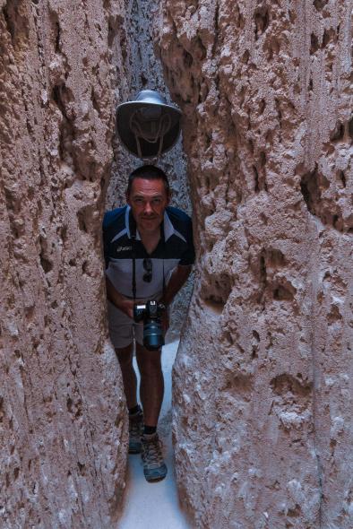
It's quite funny to slip into the slots, sometimes you have to remove the bag from the back otherwise you can't pass! The Miller Point Trail is interesting too.
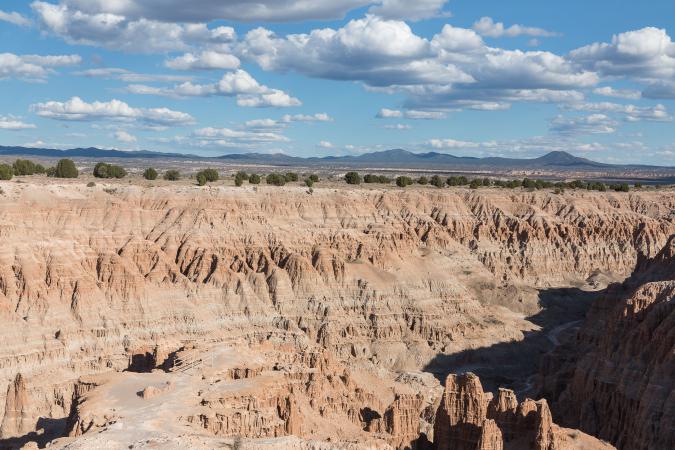
Back on a section of the Juniper Trail.
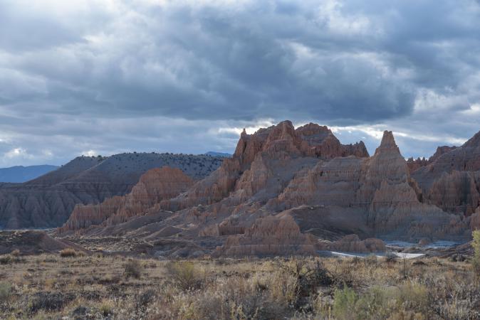
It is a nice park and not very busy. The campsite is very good with hot shower
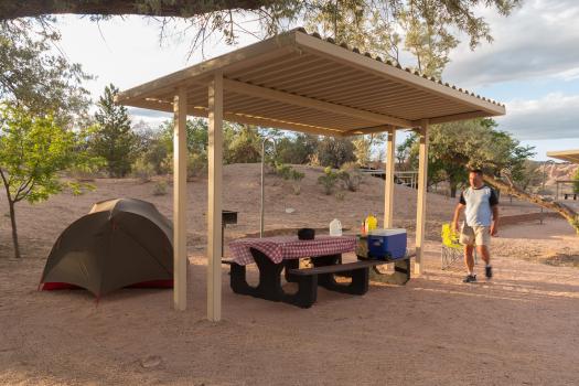
and it's calm. Dinner and campfire.
Tuesday may 29 : the night was very calm. We wake up at 6 am. We have breakfast and we prepare our bags for the backpacking at Yant Flat tonight with our friends Annick and Eric. Departure at 8:10 am for another short hike in Cathedral Gorge : Eagle Point Trail 1 mile roundtrip. It gives a view from above.
Then we're heading toward St George where we arrive at noon. We go to the Desert Rat shop to buy a new airbed and small and lightweight pillows. We then go to MacDonald's to meet Annick and Eric at 12:30 pm. They arrived in the USA a few days ago only, it's the beginning of their trip. We eat a salad. We finish to prepare our bags on the parking lot of Smith's and we leave (94°). We arrive at the car park for Yant Flat at 3:40 pm (82°). We take drinks and food and we start the hike at 4 pm. We go slowly. Annick and Eric are not used to carrying heavy bags, nor are we! furthermore it's hot. One hour later we leave our bags on our « primitive campground » and we explore the area. The late afternoon light is superb. We love this place! it's too beautiful.
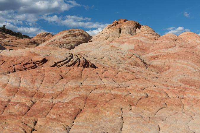
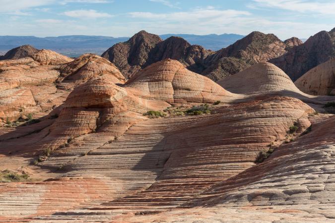
We set up the tents
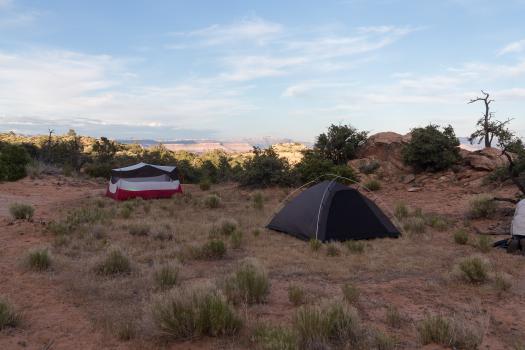
and we share a pinic. We are alone here and it's very calm.
Wednesday may 30 : up at 5:30 for the sunrise.
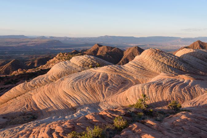
Breakfast together and at 6:45 am, with David, we're going to try to find The Turtle, that we miss last year. Annick and Eric will continue exploring the main area, it's their first time here. We reach The Turtle in half an hour. We were not very far last year. We have to climb a little at the end and go around a small hill to take advantage of the rising sun. This hill is magnificent.
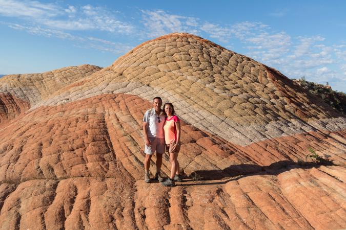
It's not very large but it's superb and colorful. We go back to the main area to meet our friends.
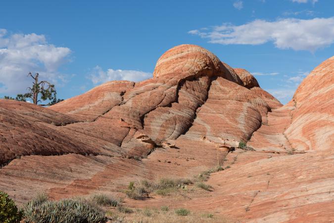
We dismantle the tents and we leave at 9:40 am to avoid the rising heat. We arrive at the car at 10:45 am (85°) and we drive toward St George to have a lunch at MacDonald's (93°). Then we do some shopping for tonight camping at Valley of Fire. We leave at 1:30 pm and the more we approach Valley of Fire the more it's hot : 98°, 100°, 106° in Overton. At the entrance of the park, a big sign "Warning" advises us that it's very hot and that we must be very careful. So, as a precaution, we decide not to visit VOF and we turn around to find a hotel. At the North Shore Inn at Lake Mead in Overton, we are priced at 90$ plus tax!... well, what can we say… no thank you !! We drive back to Mesquite where we find a room way less expansive at the Virgin River Hotel & Casino for 36$. At 4:15, it is still 104°. We stay in our cool room and we go for dinner at the casino's buffet (14$). It's fine.
Thursday may 31 : we have breakfast in our room. It's our last day, so we give Annick et Eric, the cooler bought by Michèle and Jean-Michel (that's a traveling cooler!) and the food we have left, our chairs… We leave them at 9:45 am to drive to Las Vegas. As we won't have our room before 3 pm, we're not in a hurry, so we'll take "small roads". It's already 95° at 10 am. The road to Overton Beach is closed. We continue the road to Hoover Dam. Short stop at Stewart’s Point (100° at11:30 am).
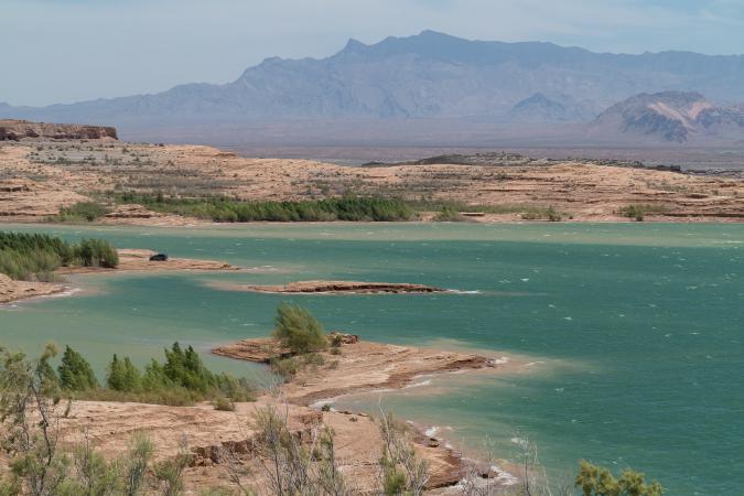
At noon, we stop at Echo Bay. It looks like an old marina but everything is abandoned, the store the buildings are definitely closed. On the road between Echo Bay and Callville Bay, there are nice views of the colorful mountains.
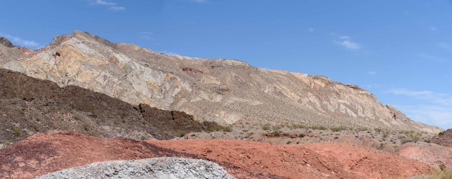
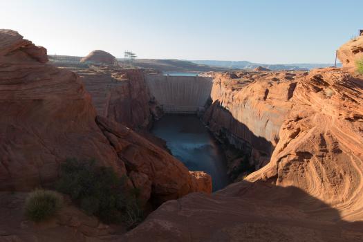
At 1:30 pm we picnic quickly at Las Vegas Bay Overlook. It's very windy and there is no real overlook! Next stop is at Sunset View Scenic Overlook. Since we're not very far, we stop at Hoover Dam, the dam on lake Mead. We go through a security barrier and we park. Since our first visit here in 2000, car access to the dam has been restricted to visitors and a new bridge was built. It's 275 feet high.
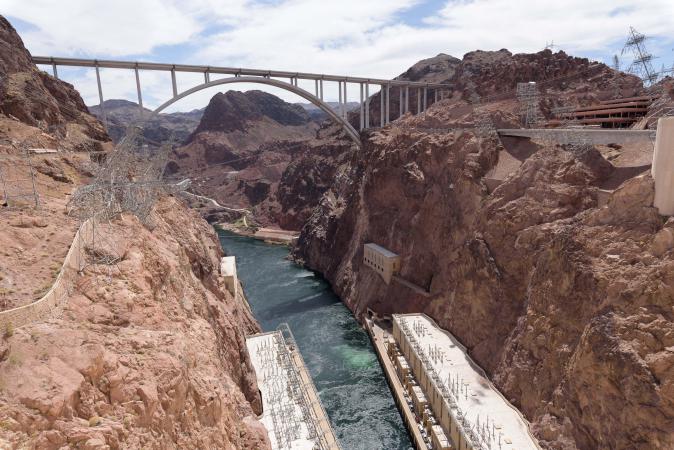 We walk a little on the dam and we can see the white area on the rocks : the water level has dropped dramatically. Then we go on the bridge. It's windy and the view from above is very impressive.
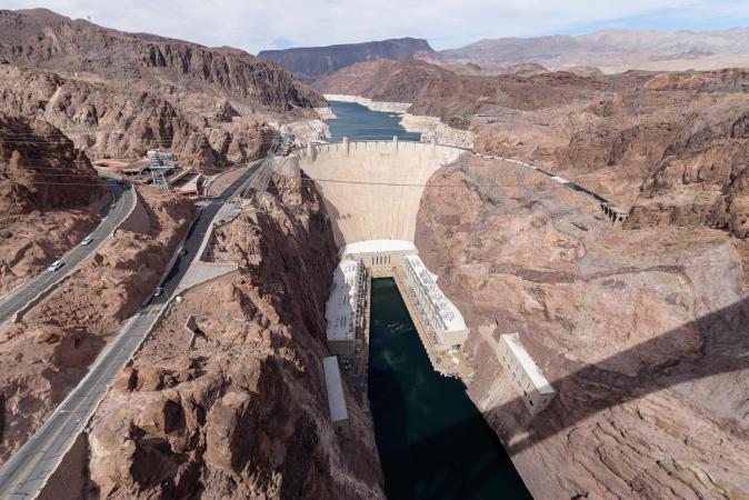
We leave for Las Vegas. We arrive at the Super 8 Ellis Island at 4:30 pm. We drop our things and prepare our bags for departure tomorrow. Then we go on the Strip and we have dinner at the Paris Las Vegas buffet : 67$ for 2 and it's not great!
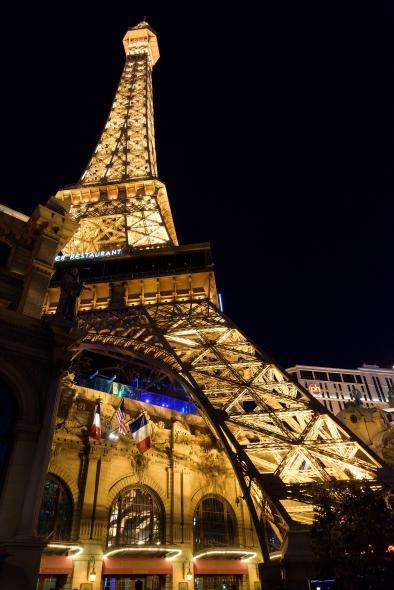
Friday june 1st : up at 7 am. We drop of the car at Hertz and the shuttle drives us to the airport. The flight to New York is delayed of 45 minutes because of the weather on the east coast. Then, a new delay of 15 more minutes is announced. As our stopover is only 50 minutes, we'll probably miss our flight to Paris. Great! What a pain. Finally, we're boarding and we arrive at Newark airport. Fortunately, the flight to Paris is also delayed. We see that on our e-mails and on the internet but departure times announced are different. When leaving the plane, there is an employee of United Airlines that tells us that our flight is at 11:50 pm. Cool, we will not have to run in the airport! We're boarding but we are waiting for a long time before take-off. Finally, we leave with 3 hours late.
Saturday june 2 : at Roissy CDG, Parkineo also makes us wait 45 minutes to pick us up. There is a lot of cars on the road, so we take the Francilienne. At last, we arrive at home at 5:30 pm. Tired but happy with our trip.
Copyright Magali and David BELLEC