
USA
September 6 to october 2 2014
Saturday september 6 : departure from home at 6:30 am for Roissy CDG. In 50 minutes, we register and we pass the security without problem. On the other hand, we take off with a delay of 45 minutes (fortunately we have about 5 hours of stopover). We arrive in Dallas at 3:30 pm (local time). We pass the immigration service that is done on terminals : we scan the passports ourselves, we make the photos and footprints. Then we collect the luggage and we go back to customs and security. The flight to Denver takes off on time. We take the shuttle to Alamo to pick up our car : a Chevrolet Equinoxe, then head for the Days Inn.
.jpg?v=1d69889)
Sunday september 7 : the morning is devoted to the first big shopping. In the afternoon, we will visit Roxborough. It is 95 °. The entrance is $ 7. We go for the Foutain Valley Loop of 2,2 miles which is not too bad and that of Willow Creek (1,4 miles) which has no interest.
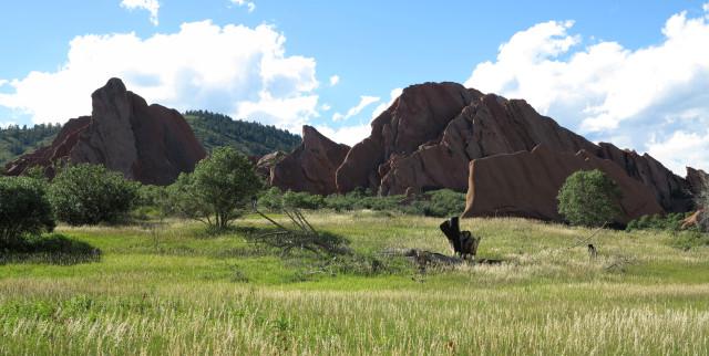
This park has not left us with an unforgettable memory. We leave at 5:15 pm : we plan to go camping at Garden of the Gods. Unfortunately, after 1h30 of road, we find the rain and it is only 68° ! We go to a motel in Manitou Springs : the Eagle Motel ($ 76 for 3 people). Manitou Springs is a nice city. We're going to eat our 1st baconator and Dr. Pepper at Wendy's.
Monday september 8 : the sky is overcast and it is 68°. We leave at 8:15 am for Garden of the Gods. We begin with the short hike Garden Central Trail (1,2 miles) under a few drops of rain. This trail is very well laid out : paved path, steps.
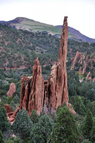
Then we make a stop at Balanced Rock. Bof ! Finally, we do the trail of Spring Canyon that leads to Siamese Twin : pretty! Oh yes, this park is free. At noon, we take the road to Black Canyon of the Gunnison. On the way, we drive along meadows as far as the eye can see with cows that have a view of the surrounding mountains. They must be happy, cows, here ! They have super big playground ! We pass a pass at 11309 feet, it is 46°. We take a break at Gunnison and coming out of the station, it's raining. We're out of luck, definitely. We arrive at Black Canyon of the Gunnison around 4:50 pm, it is 55° and it also rains. We visit a few viewpoints : Gunnison Overlook (with a view of the river: the most beautiful in my opinion), Pulpit, Cross Fissures, Chasm View (beautiful and impressive, furthermore a small ray of sunshine appears) and finally Painted Wall (incredible view of the high cliffs).
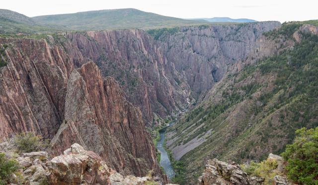
Around 6:20 pm, while it starts to rain again, we look for a hotel. We take a room at the Day's Inn Montrose and we eat at the Red Barn in front of the hotel : cowboy decor quite warm ... held by Asian !
Tuesday september 9 : it rained again last night. The weather forecast announce a tropical storm (Norbert) that comes from California and must pass in the places where we go. It reminds me of last year ! We arrive at Ouray at 10:30 am, it is 55°. We will look for documentation at Visitor Information then ... well ... we can not do anything because it is raining and foggy, we do not see the top of the mountains. We hang out by car, we will locate tracks along the CO62. The Last Dollar Road is well practicable until the intersection. The CR9, it's ok at the beginning then it's a little worst. The CR7 and the CR5, it rolls. But to see after the rain... We return to Ouray to look for a hotel. The Old West cowboy style city looks cool. We take a room at the Comfort Inn. In the middle of the afternoon, we take advantage of a lull to go around the city.
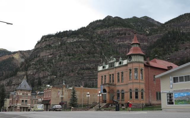
It seems like time has stopped and the city has stopped evolving. Some shops have kept the windows of the 60s-70s, it's pretty kitschy and old-fashioned. But it's nice. Some roads are not even concreted. Back at the hotel, we do some laundry and we unload the SD cards. We dine in the room.
Wednesday september 10 : blue sky this morning almost everywhere but it's cold 53°. We leave for Cascade Falls which is located in Ouray. It's very tall, pretty enough but not easy to photograph because it is half in the shade half in the sun. We then go to Yankee Boy Basin. This track is nice and easy up to the abandoned mine. We stop to take pictures.
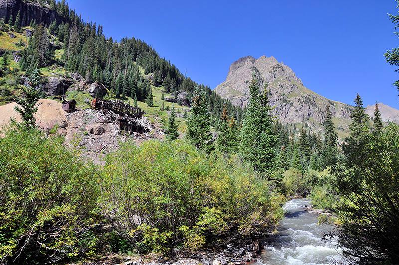
We are at an altitude of 10587 feet and it is 50°. A little further after the fork with Govenor, we must turn around because the car is too low to pass a crevasse. Pity. Down the road, we will visit Box Canyon Falls. Entrance is 4$ per person. A little expensive for what it is : a small waterfall in a cave. Not easy to take pictures. We do the 3 small trails. In the early afternoon, we will take a site at the Koa campground in Ouray, we mount the tents and nibble a piece. A little before 4 pm, we enter the track CR5. The scenery is nice but not at this time. With the colors of autumn, it must be superb. After a few miles, we turn around because of a huge muddy puddle. We do not want to stay bogged down ! We join the CO62 to go on the track CR9. The view of the fields with its bales of straw and the mountains in the distance is magnificent.
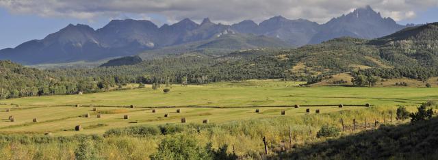
Once again limited by the car, we turn around at the track 850. Back to the campsite for dinner in the light of the campfire.
Thursday september 11 : we wake up at 8 am while the sun is just rising over the mountains. First breakfast outside ! Too good !
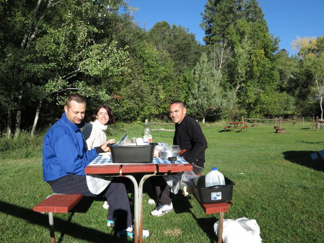
We leave for the Last Dollar Road still on the CO62. After 6 miles, we are blocked by a wash to cross too deep for our car. Turn around. At the junction, we turn left, on road 58. As we approach the CO145, the scenery changes : the meadows give way to pine forests and red rocks. We join Telluride. The main street is under construction. The city is pretty with its colorful houses but it seems swell. We can't find the hiking path to Bridal Veil. Turn back to join the CO145, then the CO62 and finally the track CR7 which leads to the Blue Lakes. At the fork between the CR7 and the CR7A, we take the CR7 on the right (trailhead sign). We arrive at the car park at an altitude of 9186 feet (61°). We start the trail at 2 pm. It climbs straight at the beginning ! We walk up to an altitude of 10826 feet above sea level on 3,5 miles of hiking. It's quite hard especially for the breath. We arrive at the Lower Blue Lake around 3:50 pm. It is magnificent.
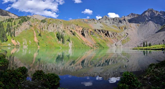
We do a lot of photos quickly because the sun will soon hide behind the mountain. We talk a lot with an American who camp at the lake. He saw traces of bears a little higher up the hill. We do not have time to go to the 2nd lake. Around 5 pm, we go down. It is cool 52°. After 1h30, we find the car and we go for some shopping before returning to the campsite.
Friday september 12 : the night was cold. We leave Ouray at 10:30 am via route 550. On our way, we stop at Red Mountain overlook to take pictures of Yankee Girl Mine (abandoned mine). Further, we stop at Molas Pass Summit at an altitude of 10910 feet which gives a view over 2 small lakes.
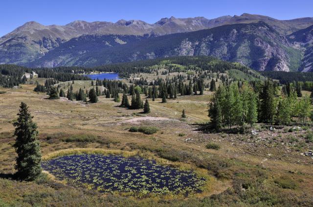
We try to take the Old Lim Creek Road but it is too chaotic and bad for our car. So we continue on road 550. As would say David : « in Colorado, it's better to have a good car than good shoes ! » We pass in Durango. We do some shopping. In the middle of the afternoon, we arrive in Farmington. We go to the Visitors Center to get informations on campgrounds but we are told that there is no campground in Farmington. So we go to Bloomfield at the Desert Rose Resort : 30$ the site, pool, spa, laundry, wifi, clean restrooms ! Not much shade except on pitches 8 and 9 which have a wooden awning over the table. We nibble a little and we settle up the tents. We go in the city to buy firewood as there is no at the campground registration. Back, we jump in the pool and the spa. For dinner tonight : hot dog heated by a wood fire.
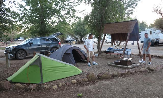
Saturday september 13 : we found the night quite noisy. At wake up, wind and ... caterpillars rain ! They fall from the trees that are invaded by some kind of white cocoons. It's disgusting ! We ask ourselves if they are processionary caterpillars. We ask the manager if we can change our places and move elsewhere without being under the trees. It delays us. We start the treasure hunt in search of Aztec Arches. We start to go on road 173. After 20,5 miles we take a track on the left. A coyote crosses the road in front of the car. Despite GPS coordinates of the documentation taken at the visitors center in Farmington, we can't find the arches of Caballo and Crow Canyons. We look on our tablets the pdf documents found on the internet (aztecnm.com) and we realize that we are on the wrong side of the canyon. That said, the GPS unit doesn't have the same number of digit to program. With all this, it's already noon so we decide to give up otherwise we won't have enough time to go to De-Na-Zin and Bisti. We will have seen 2 arches by car ! Arriving at De-Na-Zin, we explore the area without finding the rock formations seen on the net. But we see others !
.jpg?v=1d69889)
We are in the middle of nowhere surrounded by badlands. Not really alone as we can see a porcupine in a shrub. It's big, this beast ! We explore the area for a little more than 2 hours and 4 miles under a suffocating heat (84° and no wind). We then go to Bisti Badlands. We have a 1 hour drive. We start the visit with white hoodoos, nice ones ! Then towards the mythical eggs. Impressive ! In fact, they are small. After a moment at picturing them, we finally head for the wings for the sunset. It's a bit of a race because the wings are not close and the field is chaotic. We arrrive right on time for the nice colors of the sunset. Very, very beautiful !
.jpg?v=1d69889)
We leave quickly around 7:15 pm as the night will come soon. We meet an alcoholic indian on a horse that looks for people. We don't linger. We arrive at the car park at 8 pm in the dark but we didn't need our headlamps. We will have walk for 5,6 miles. We did everything in a hurry today, we struggled like hell : in fact, we lost our time at the Aztec Arches. We should not have gone. We have dinner at Denny’s in Farmington. Then we go back to « caterpillar campground » !
Sunday september 14 : we start the day with repairing a leak in David's slepping pad who had to inflate it 3 times during the night. We take the road to Lybrook. We pass the road leading to Chaco Canyon and we take the first track on the left and another one on the left again after a gas extraction site. We park and mop 4,3 miles under a temperature of 97°. We are all alone.
.jpg?v=1d69889)
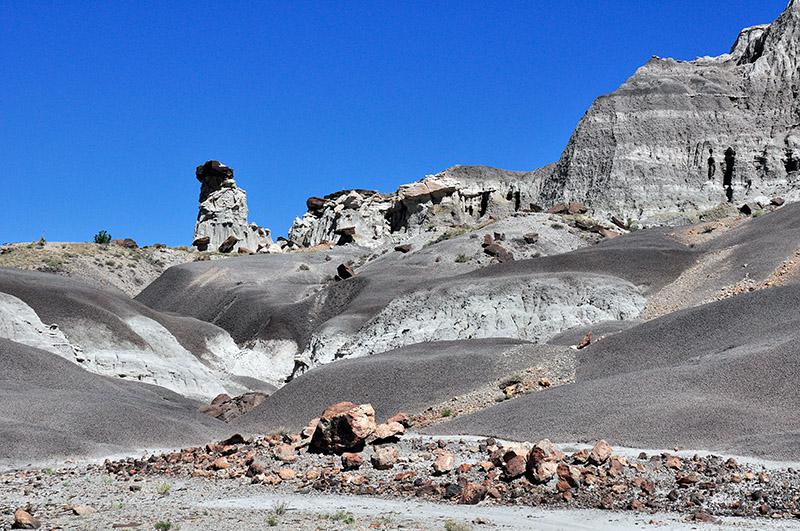
There are pretty corners, we do a lot of photos. We return to the car in the early afternoon and nibble a little. Then direction Ah Shi Sle Pah. On Route 550, we take Highway 57 next to the Blanco Trading Post. After 18 miles, we take a track on the right (there are 2, one with a BLM sign in the middle of the road and a US flag at the end). The path on the right is a cul-de-sac. We park next to the BLM sign. We take the trail left for about 1 mile but at the end there is nothing. Turn around and take the right track by car to the end of the cul-de-sac. Then, we follow on foot an old track that was covered with shrubs probably to prevent traffic. Straight ahead, we arrive at the heart of the canyon. We go down inside : it is better to go along the rim on the right, it is less difficult. Then we walk for 3,7 miles.
.jpg?v=1d69889) We have eyes everywhere. We have the place for us alone. We assist the beginning of the sunset on a first group of hoodoos but the shadows come quickly. We return to the car and leave. On the track we are blocked by … lamas ! 2 adults and a little one. We're going to eat at Burger King.
We have eyes everywhere. We have the place for us alone. We assist the beginning of the sunset on a first group of hoodoos but the shadows come quickly. We return to the car and leave. On the track we are blocked by … lamas ! 2 adults and a little one. We're going to eat at Burger King.
Monday september 15 : disassembly of the tents then direction Ojito Wilderness. We leave Route 550 for the CR 906 Cabezon Road. At the first fork, turn left, leaving the first car park where there are trail runs for bicycles. We take the next right then always straight and it is ... a cul-de-sac! The GPS map we have is not good, it seems! it indicates that the road continues while there is a mountain facing us ! Turn around. We go back on our steps. We take the Cabezon Road at right. At the next junction, turn right and pass in front of a BLM sign "Ojito Wilderness". We finally arrive at the car park at 1 pm and it is 81°. The beginning of the trail (2 miles roundtrip) for the "wave" is before the car park. The wave is very small and in yellow tones. The hoodoo next to it is pretty but it does not "break 3 legs to a duck" !
.jpg?v=1d69889)
We leave at 3 pm and it's 90°. We arrive in Albuquerque and head toward Tent Rock. It rains and the temperature drops to 61°. We arrive at Tent Rock at 4:30 pm and the rain has stopped. At the entrance, a ranger tells us that Canyon trail closes at 5:30 pm and the park at 7 pm. So we hurry to do Canyon trail which is the most interesting. The canyon is nice and very narrow in some places but what a shame we don't have a better light. Then here come the hoodoos with there pointed hats. In the final climb to the overlook, the ranger arrives at the run to close the trail. He tells us "if you can follow me, you can go to the top". David starts to run. He arrives at the top, spitting out his lungs ! The ranger, very nice, takes pictures of David.
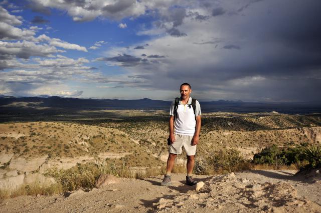
With Florent, we followed but not til the end. The view over the pointed hats is already superb with the setting sun eventhough the shadows arrive quickly. We are the last to go down, followed by the ranger as a "car broom".
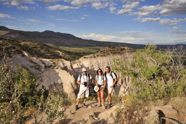
Cave Loop Trail closes at 6 pm. Too late to do it. We leave the park at 6:15 pm always followed by the ranger in his car. The sky is very overcasted over Albuquerque. So we choose to sleep in a hotel. Good choice because it starts to rain again with storm. We take a room at the Day’s Inn in Bernalillo. We eat at the Denny’s.
Tuesday september 16 : we go to Flagstaff. We won't have time to stop every where we planned (Hope Arch, Little Painted Desert, Grand Falls, Sunset Crater, Route 66). The sky is very overcasted and a tropical storm is approaching. In I40, we take exit 257 and AZ87 north and we arrive at Little Painted Desert at 1:15 pm. Like most indian territories, the site is dirty : bottles, plastic bags ... but it's free ! The viewpoint is fantastic. We follow the rim drive and we take plenty of photos.
.jpg?v=1d69889)
We continue our road to Flagstaff. We do some shopping at the outdoor store Peace Surplus. There is a large choice of camping and hiking gear. Given the weather, we take a room at the Travelodge. Damn, we wanted to camp at the Woody Mountain campground. We had not been there for many years. To console we took king size beds. Too good ! We do laundry and we dine in the room.
Wednesday september 17 : tropical storm Odile arrives on us. Maybe we'll have to change our plans. The worth day is scheduled for tomorrow. Departure at 9:50 am under a threatening sky (62°). We don't think it would be a good idea to go to Blue Canyon, especially since we need a permit as well as for Coal Mine Canyon to buy at Cameron. After leaving Flagstaff, we stop at Sunset Crater (accessible with the annual pass). The best viewpoint is at Lava Flow Trail. We first do the mini trail in the lava on the left of the road and we go to Lava Flow Trail which is 1 mile.
.jpg?v=1d69889)
On the course, we leave the concrete path to take the gravel path. Nice view of the volcano, pity that the sky is leaded.

We leave at the end of the morning for Cameron: we make a quick tour to the Trading Post and the Visitors Center which is further on the 89 road in front of the Conoco gas station and next to the Navajo Arts & Crafts. The permit for Coal Mine Canyon is $12 per person. The site belongs to the Najavos. On the road, we stop at Moenkopi, a Hopi village near Tuba City, to find out if they are giving Blue Canyon permits here. The Hopi woman at the Administration Office tells us to go to Kykotsmovi Village on Route 264, 50 miles away. We go before going to Coal Mine. We speak to an Indian who tells us that we have to go to the building next door but there is no one : they left to do a dance ! Shit. David still tries to go there, he ends up seeing someone who tells him that they do no longer deliver permits, that the access to Blue Canyon is forbidden. Beasts and disciplined, we make a cross on Blue Canyon: we do not want to end up in a tribal prison! What a waste of time. We take the road direction Coal Mine. On the 264, near mile marker 337, take the track that leads to the wind turbine. We arrive at 4:30 pm or 5:30 pm, we do not know too much between Navajo time or Hopi time !! We make photos from the rim, there are beautiful colors.
.jpg?v=1d69889)
But $ 12 is a bit expensive. For this price, you can camp on site but with no other convenience than tables ... leaning! So let's go to Tuba City and take a camping pitch at the Quality Inn / Rv Park for $ 19.
Thursday september 18 : the night was quite noisy. We leave at 9am for Page. It's a big blue sky. We go shopping at Page. At 11:45 am, we arrive at Lower Antelope Canyon and there is a crazy world. We will come back later. We drive to Kanab to camp at Hitch-N-Post and get closer to the lottery draw at The Wave. The cowboy manager is very nice and camping is not bad. It's $ 23 for the location. We pitch the tents. And we leave for Buckskin Gulch via House Rock Valley Road. The first "Buckskin Gulch Trailhead" car park leads to the canyon in its widest part tells us a ranger. We continue to the second parking "Wire Pass" where there is the slot canyon. The ranger tells us that there has been a flashfood and that there is probably mud. On arrival, we take the permit of $ 6 per person. The hike begins with Wire Pass which has a slightly tricky passage: you have to go down on a tree trunk.
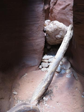
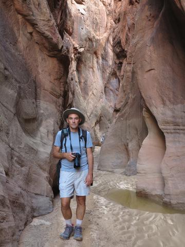
Once at the exit, at the intersection with Buckskin Gulch, we turn left. Indeed, it's quite muddy. But we realize that this is not the most beautiful part. We do not have time to do the other side: we have an appointment with French people met on Facebook before our departure: Etienne Sauvagère and his friends Claire and Stéphane. We have to meet at Paria Movie Set. When we arrive, the sun no longer illuminates the hills.
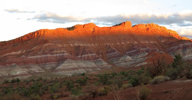
We go all 6 to Kanab to eat in a restaurant : the Big Al's Burger. It's a great meeting, we tell stories, we exchange information on sites seen and we give advice on sites to do. When the passion of the American Southwest brings people together ! We have a hard time leaving each other so we have things to say to each other ...
Friday september 19 : we go to the BLM to try the lottery for The Wave at 9 am. We find Claire, Etienne and Stéphane. There are plenty of people: 29 balls and 5 draws. It's a failure for us 6. We will try again tomorrow, so we go back to the camp for another night. On the advice of Etienne, we will see the Nautilus : a funny white form with a kind of swirl in the middle. On Route 89, after the Outpost restaurant, we take the direction of the BLM but we turn left before the BLM. We cross a wash then we arrive at a square parking after the wash. We are there at 11am. We follow the wash to the east to a white dome with yellow traces on it. It's the Nautilus. Astonishing.
.jpg?v=1d69889)
We then return to Lower Antelope Canyon. It is 86° at noon. We pay $ 84 for us 3. We follow our Najavo guide at 1:30 pm. We enter the canyon by the old exit and we come out by the entrance we knew. We feared to be led to the run but finally we could take pictures quietly. The tour lasted 1:30. It's good. We had beautiful colors.
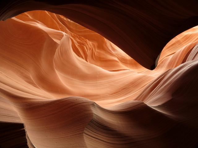
It is really too beautiful, this canyon. We leave at 3:15 pm to Wahweap to nibble a piece at a viewpoint of Lake Powell. It is very hot : 95 °. We're going to the BLM of Big Water for information on access to Wahweap Hoodoos. The ranger provided us a map very well done with photos and GPS points and the explanations that go with it. Really nice ! We will then go along the gray-black badlands in front of the BLM. It's very beautiful. We then return to Kanab to go back to the restaurant with Etienne & Co! We start with a beer bar between Kanab and Fredonia : the longest bar : 88 feet : the Buckskin tavern. Then we drive to the Houston's Trail End restaurant in Kanab. We eat well and we laugh a lot. We have a very good evening. We return to the campsite at 11:30 pm.
Saturday september 20 : we will try our luck again at the lottery for The Wave. 33 balls, 80 people and 5 draws. We loose once again ! We go back to the campground to dismantle the tents and we leave à 10:30 am to Buckskin Gulch to spend the beginnig of the afternoon in the freshness because it's very hot (82°). We do the right part after Wire Pass. At the entrance of the canyon, there is a large pool of mud to cross. We hesitate, the guys are not too motivated and turn back. People are going to the canyon, I follow them to see if they can pass and the mud level. Mid-thight, that's fine. I go back to find the guys to try to pass. I go first. Well, the mud goes up to my bottom and for the guys it's mid-tight.
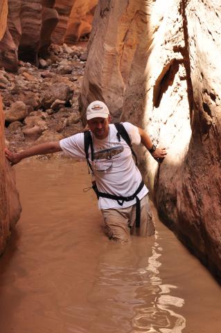
It's cold and slippery, the progression is slow and there are stones at the bottom. We are careful not to fall with the camera gear. There are several passages like this one. The canyon narrows and offers pretty colors. We do not regret. Then we come back on our way to the parking lot. The shoes are disgusting, full of mud.
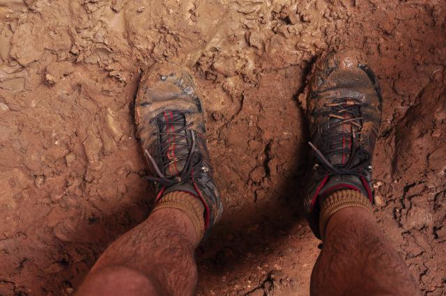
They are rinsed quickly with the water of the cooler and we clean the legs with baby wipes because the dried mud, it pulls a little! The sky is very threatening (89,6°). At the end of the afternoon, we go to see the track for Wahweap Hoodoos: it is good until the parking after the wash to cross. If it does not rain, it will be good. Given the color of the sky, very dark, we are looking for a hotel for the night but everything is full or too expensive ($ 199). Yes, it's Saturday! We fall back on camping Wahweap. We pitch the tents in the dark with a lot of wind. Must hold the tents! A hard time ! The sand returns a little in the tent. We are going to dinner at Burger King. We stop at the fish cleaning to wash the shoes.
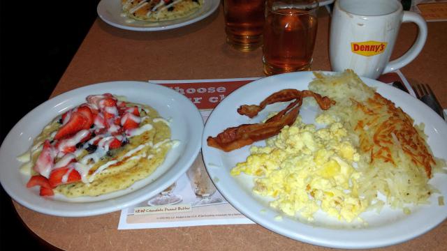
Sunday september 21 : it rained this night and there was a storm. We wake up in the rain at 7:30 am. We have our breakfast at the Denny’s : scrambled eggs, grilled bacon, potatoes, strawberry pancakes with cream, apple juice and chocolate with whipped cream. Too good !
When we go out, the weather is fine again. We reserve an extra night at the campsite for a chance to do the wahweap hoodoos on Tuesday morning and give the wash time to dry. At 11:30 am, we will make our "pilgrimage", almost annual, to Horseshoe bend, unable to do anything else because the tracks are wet and the hiking shoes soggy. We let them dry on the table at the campsite. It is 78° and it is heavy and wet. We'll take a ride to Lone Rock at the end of Lake Powell. We had never come here. We park in the parking lot, we nibble a bit and walk down the sand tracks to the lake. Attracted by the clear water, I do not resist to dive to the knees.
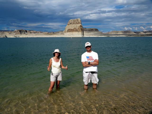
Finally, the guys follow me. The water is cool at first and then we get used to or our legs are anesthetized ! We leave at 3:15 pm to see Great Wall, which is above Waterholes Canyon. For that, we will take the permit at Upper Antelope Canyon. The Indian tells us he no longer has a permit. Shit. Must come back tomorrow except that we have to camp at the Wahweap Hoodoos car park tomorrow. So, we try Stud Horse. The track is easy until the last half mile, where there is a very steep and very sandy coast. It skates, we are within 2 fingers of sand. We prefer to go back, turn around and park before. We will finish on foot, we are not far. The site is small but it's pretty cool, especially with the sunset colors.
.jpg?v=1d69889)
Monday september 22 : dismantling of the tents. We leave at 10 am to do some shopping. At noon, we go to the BLM to inquire about access to the Wahweap Hoodoos. The ranger tells us that the road is ok but the wash is muddy. We take a look to know how it is. We park on a small parking before the wash. In fact, this one is wet and the river flows in some places. It's very muddy and slippery.
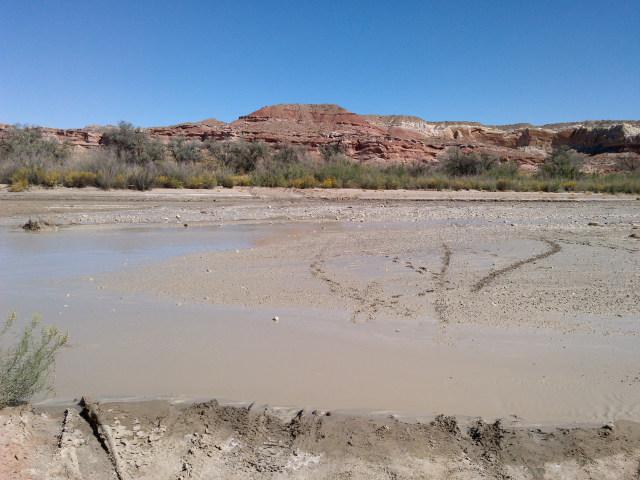
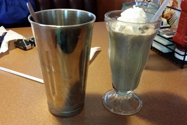
We walk a little to see how is the wash a little further. We meet 2 german tourists who come back, they tell us that everything is ok even if we have to walk in the water in some places. But by tomorrow, water will have more time to evacuate and the wash to dry. We leave to wash our shoes and picnic. And we go to eat an oreo shake at Denny’s. We return to Upper Antelope to buy a permit for Great Wall : 12$ per person. We stay at Great wall 2 hours with a temperature of 86°, until sunset.
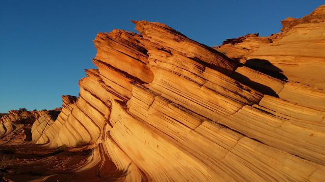
We are alone once again. It's wonderful. Thank you to Etienne Sauvagère who recommend us this place. We take our shower at the Wahweap campground and eat. Then we return to the parking lot for the Wahweap Hoodoos to spend the night in the car. It's deep darkl, the starry sky is superb. There is no noise except that of the wash.
Tuesday september 23 : we were too hot in the car at the beginning of the night so we opened the windows a little. We wake up at 4 am. We didn't sleep very well. We are not very hungry but we try to eat a little anyway. Then we start the hike with the light of our headlamps, because it's still dark. We croos the wash that is still wet, it's very slippery. Then we follow the sandy path before going back in the wash. We walk about 2 miles by night before the sunlight comes slowly. We alternate between wet wash and muddy or wet wash. We walk 5,6 miles to reach the famous big white hoodoo. At the end, we make the mistake to cut through, we turn left too early. So, we pain walking in the brushes. It's better to follow the wash until the end. We finally unpack the cameras and take a lot of pictures. That's superb, wonderful. We are there right on time to see the famous hoodoo exiting the shadow. It's very beutiful.
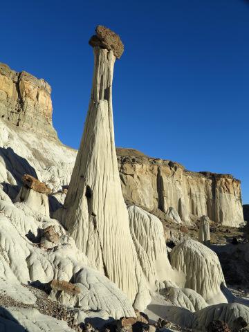
We have the place for us, we take full advantage. We come back on our steps to take photos of the other groups of hoodoos. Then we leave around 9 am and we walk for 5 miles. It's like we'll never see the end ! We have the impression that it is longer than on the go. Probably because of the heat (82°), or we gave everything on the go that we did quite fast. It's 11 am when we arrive at the car. We take the road to Escalante doing a large detour because the Cottonwood Road is closed. We set up the tens, as usual at the Outfitters Campground around 4 pm. We like this campsite and they have excellent pizzas. We're gonna eat one : the Kings Mesa with beers.

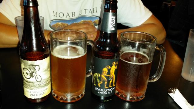
Wednesday september 24 : up at 8:30 am. At 10:30 am we go to a jeep rental in order to do our hikes on the Hole in the Rock road. But they have no more car. We go to the BLM to inquire about Zebra Slot : the ranger tells us that it is flooded and that is has been like that all year (6 to 6,5 feet of water). We give up with our program on the Hole in the Rock, because we think that the track for Neon Canyon should not be very good after the storm of the previous days. We'll have a cool day : scenic byway 12, photos, Burr Trail Road, photos. We had never done this road, there are nice views.
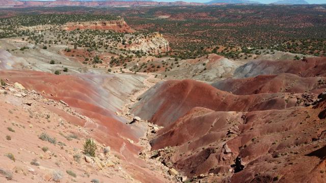
We drive for 35 miles and we turn around. We picnic near a small canyon in cul-de-sac. We come back to the campground to recharge the camera batteries. At the very end of the day, we go picninc at Devil's Garden in order to be there to take pictures by night with the milky way.
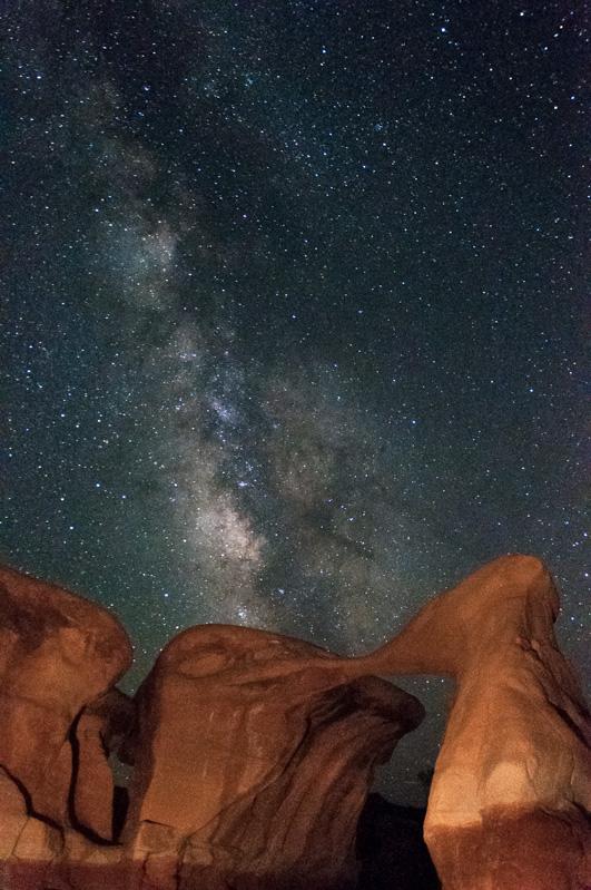
Back to the campground at 10:30 pm.
Thursday september 25 : dismantling of the tents. And it's the departure for Colorado National Monument. On the road we take a few pictures of the yellow aspens and the grey/black badlands.
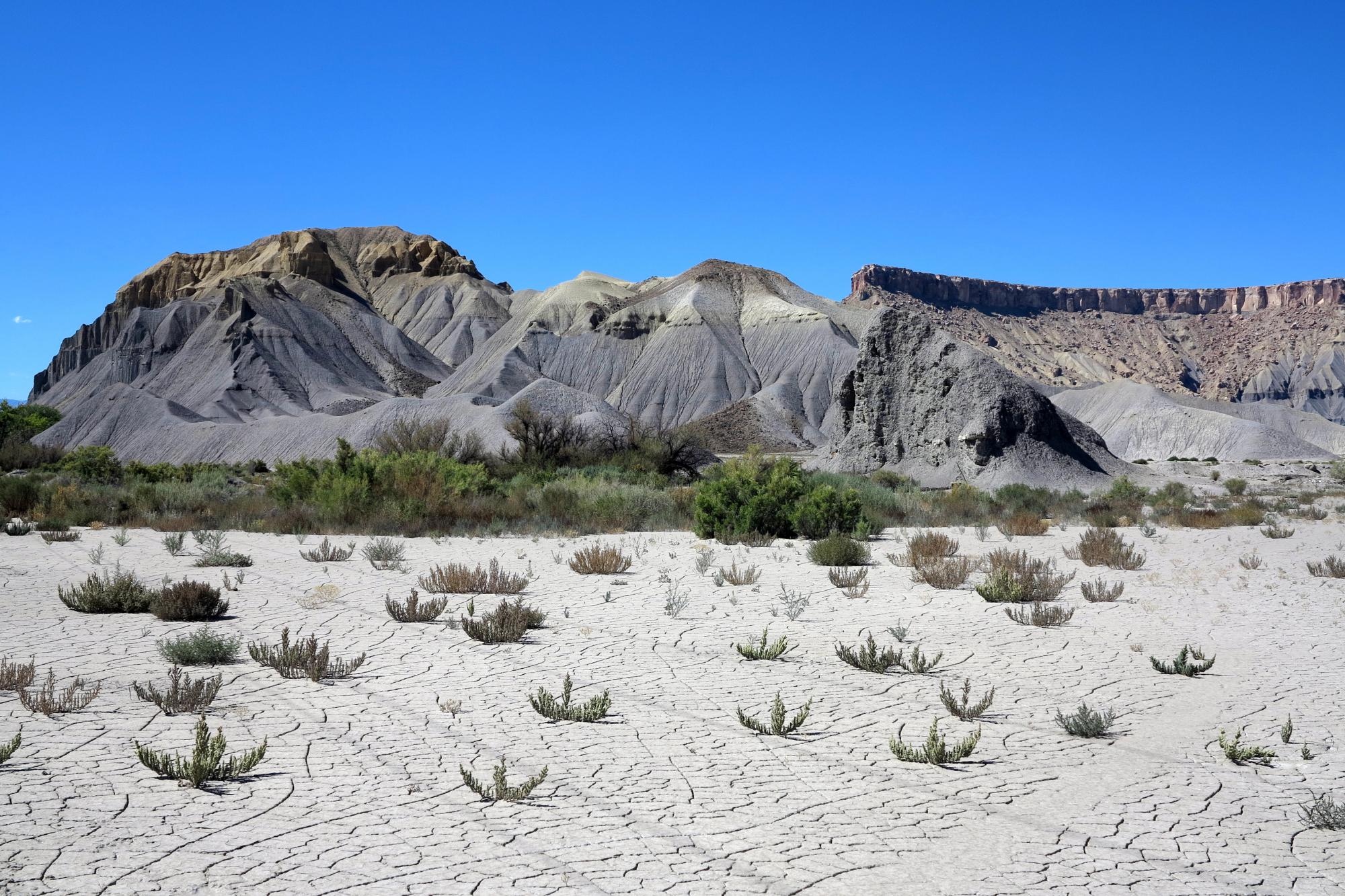
We arrive at Colorado NM at 4 pm. We set up our tents at the Saddlehorn campground (20$ per site). Quite expansive for a primitive campground and the ground is very hard to plant tent stakes. Then we tour the viewpoints to enjoy the sunset colors.
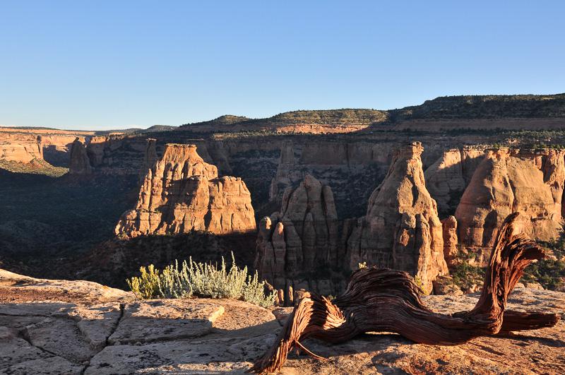
Dinner at the campground.
Friday september 26 : departure at 8:50 am for another tour of the viewpoints. We are not very excited about this park. From the viewpoints we see the town in the background, it's not great ! Then we go on the I70. We stop at Riffle Falls State Park (7$). We take a few pictures of the falls and we leave around 2:15 pm. We arrive at Meeker at 3:30 pm and we take the Flat Top Scenic Byway. There are wonderful views with the river and the colors of autumn, especially with this late afternoon light.
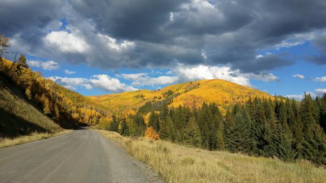
We pass the highest point at 10275 feet (63°). It is 7 pm, we are still on the road. The sun no longer illuminates the aspens and it is 52 °. At 7:30 pm, we finally get out of the Flat Top Scenic Byway (75 miles), it's dark. We thought we could find a campsite or motel in Yampa but there's not ! We continue the road until joining the I70. We are fed up. We stop at Eagle and get a room at the Holiday Inn for $ 119 at 8:30 pm. We dine at Wendy's.
Saturday september 27 : at 9 am, direction Marble and its superb raods : the CO133 and the FR314 to Beaver Lake. The lake is very pretty with the reflections.
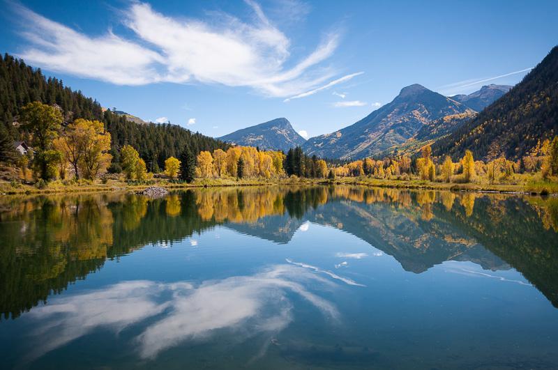
Back on CO133 toward Paonia : highest point is McClure Pass at 8700 feet. We stop at Erikson Springs campground. Normaly it's 14$ but the manager does not charge us because there is a water cutoff. No sanitary, just dry toilets.
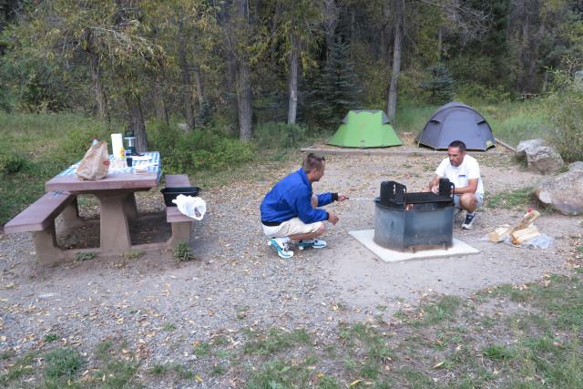
We nibble a little and we are back on the road. It's very busy. We often stop to take pictures.
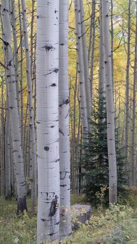
There are very beautiful views. We arrive at Crested Butte by CR12. We refuel, eat a small ice cream and visit the city by car. We leave at 5 pm to our campsite. After 1 hour drive, we finally arrive. Small dusting of arms and legs with baby wipes. And we light a fire to make hot dogs and marshmallows.
Sunday september 28 : it rained last night. We wake up at 7:45 am and we dismantle the tents during a lull. We have breakfast in the cold. We leave at 9:30 in the rain. We finished just on time. We redo a part of the road of yesterday but it's foggy (48°). Turn around. Suddenly, we realize that we have a pressure problem with our left rear tire. It's too low. Mission of the day : finiding a pressure station. We go back to Gleenwood Springs and we search .... we find garages but they are closed : we're on sunday ! That's a bad luck ! We finally find a gas station equipped to inflate our tire. And here we go. Seen the weather, we take a room here : the Silver Spruce Motel (69$). But the room won't be ready before 1:30 pm. We havea walk in the city. And we go to our room. The manager told us that he gave us a big one. Indeed, we have a sitting area with sofa, armchair and coffee table. Luxury at low price.
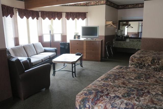
The manager is a very nice Polish. We do nothing in the afternoon as it rains more or less. We just do laundry at the hotel. In the evening, we go for dinner at the Village Inn. The menu looks like the one of Denny’s.
Monday september 29 : 9 am, direction Aspen. There are gaps of blue sky. But a few clouds are very low. We arrive at Maroon Creek Road at 9:50 am. It's 45 °. There is a fee to go on the road : 10$ per vehicle, free with the annual pass. We often stop to take photos. We are not the only one ! It's very busy. The road ends with a cul-de-sac that leads to Maroon Lake. The must in Colorado .... when it's sunny ! We are at an altitude of 9550 feet. The trail is short to get there and therefore overcrowded. The view on the Maroon Bells and the lake is amazing.
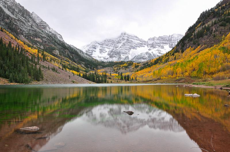
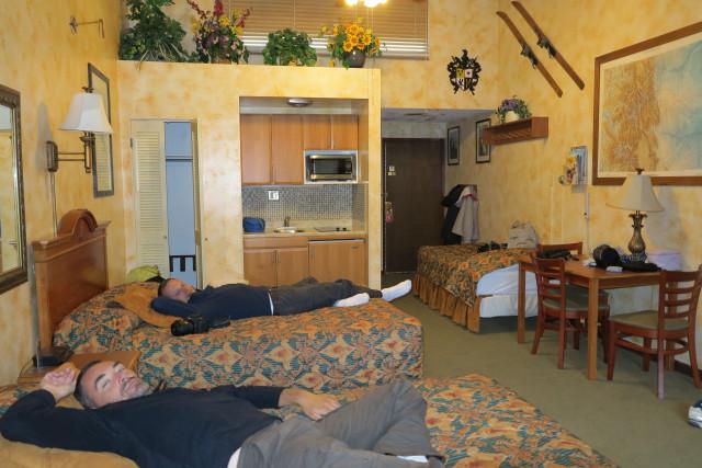
Too bad the sky is covered. At some moments it rains. The mountain is covered with snow. We walk a little along the lake. Then we come back to the car around noon, it's cold, it's raining and sometimes it's falling snowflakes. We are going to Aspen to find a room for the night. First attempt: $ 169. Second attempt: $ 105 at Tyrolean Lodge. We will not find cheaper here. The manager shows us around the room, this is his last. It is large: 2 large beds and 1 small, 1 kitchenette. The class ! It will be ready at 3 pm. We will take care for 2 hours while shopping in the rain. Parking in the city is not free. These are just luxury shops. Rich city! We enter a creperie but when we see the price of crepes suzettes ($ 15), we turn around. We will drink hot chocolate in a bakery near our hotel. Finally, we take possession of our room and we will not leave for the end of the afternoon.
Tuesday september 30 : at 8:40 am we go back to Maroon Lake. The snow descended a little lower on the mountains. It's very cold : 36°. We hike to Crater Lake in the snow. We walk up to an altitude of 10170 feet. We cross a forest of aspens then a kind of lava field before reaching the lake. It's less pretty.
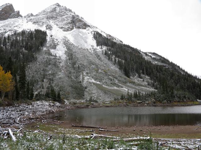
Then we go back down to the waterfall. Small but nice. One last photo...
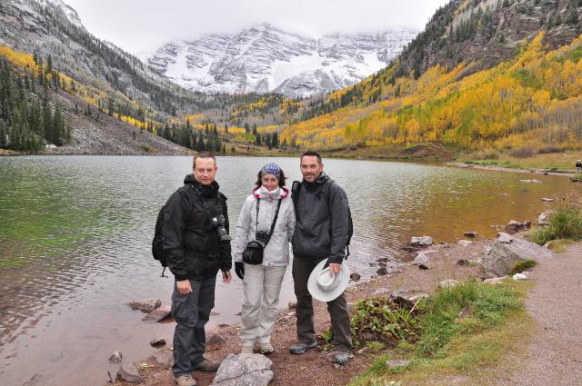
and we return to the car at 2:15 pm. Direction Leadville via the Scenic Road CO82. we croos forests of yellow aspens and snowy firs. The temperature drops to 31° when we arrive at Independance Pass at an elevation of 12093 feet. It's snowing, it's windy. It's very cold ! Anyway, we go out of the car to take pictures ... but very quickly ! There is ice on the path to the viewpoint.
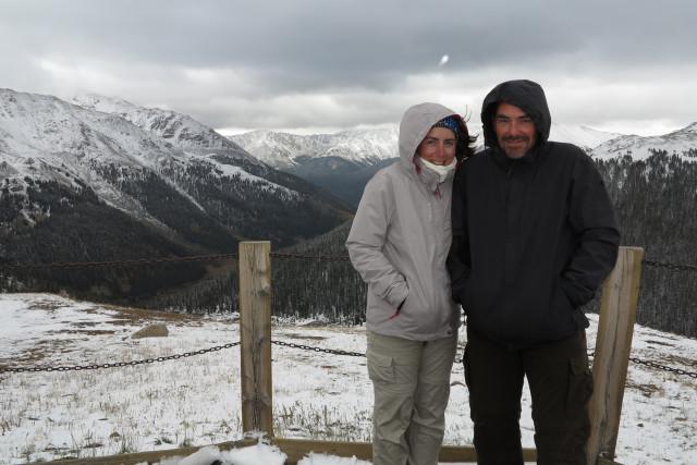
On the way, we see the Twin Lakes. We pass Leadville then back on the I70. It's raining / snow, there's fog. We can not see anything, it's a galley. We stay in Idaho Springs at the Argo Inn & Suite ($ 105). We are going to dinner at Beau Jo's Pizza. We have -15% with the VIP card of the hotel. It's not worth Escalante's pizza but it's not bad. We completely redo the bags in view of the departure of tomorrow.
Wednesday october 1 : up at 8 am. Breakfast at the hotel, not very good ! Departure to the small shops of the city to buy some t-shirts. On the road, we stop at a photo shop in Wheat Ridge: the Mike's Camera. We buy some accessories. Then we go to Red Rock at 12:30 pm. A concert is being prepared in the stands. We do the Trading Post Trail : we are not very excited.
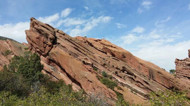
We finish the hike quickly before taking a storm on the head. To console before departure, we eat an oreo shake at Denny’s. Too good !
Around 4 pm, we're back on the road : direction Alamo to return the car. And we go to the airport. We take off from Denver with a 30 minutes delay and we also take off with 30 minutes delay from London.
Thursday october 2 : we arrive in Paris around 5:30 pm.
Copyright Magali and David BELLEC