![]()
![]()
![]()
![]()

In this page, you will find informations and advices we can give, based on our experience
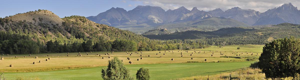
Ouray's area - Colorado
What to do if you have little time : Blue Lakes
Personal Note : in Ouray it's better to have a good car than some good shoes !! In fact, if you do not have the right vehicle, you will often be forced to turn back. The more beautiful area to visit are often at the end of tracks and sometimes those tracks are worth the seeing.
Time to spend : if you are equipped with a high clearance 4WD, allow at least 3 days.
Roads CR5, CR7 (Blue Lakes), CR9 and Last Dollar Road
![]()
 For Blue Lakes 3,4 miles one way
![]() 4 hours
4 hours
![]()
Free

GPS tracks to download
![]()
GPS trail to download
All these tracks are really worth. We particularly recommend the CR7 leading to the car park of Blue Lakes. However, regardless of the track, it is best to venture there only with a vehicle with a high clearance and 4WD. Some tracks become impassable after heavy rains and others, even by dry weather are so brittle that you will be forced to turn back.
The hike to Blue Lakes (CR7) is breathtaking, literally !! It is not very long (about 3.4 miles) but the elevation is high (1640 feet) and it starts at 9200 feet above sea level and ends at 10820 feet.
Access CR5 track : at the western exit of Ridgway, turn left on South Amelia Street and after 1450 feet turn right CR5. Continue as far as you want or can.
Access CR7 track : access to this track is 4,3 miles west of Ridgway on CO 62. Drive 2 miles to the intersection with the CR7-A. Turn right on CR7 (trailhead sign) and continue for 6,8 miles to the parking lot of the Blue Lakes.
Access CR9 track : on CO 62, 5,5 miles west of Ridgway, turn left on CR9 also called Dallas West Fork Creek. Go as far as you want.
Access Last Dollar Road track : located 11,5 miles west of Ridgway on CO 62. A sign clearly indicates its access. At the other end of this road you reach CO 145 and Telluride.
.jpg)
.jpg)
.jpg)
.jpg)
.jpg)
.jpg)
.jpg)
.jpg)
.jpg)
.jpg)
.jpg)
Yankee Boy Basin
![]()
No hike
![]() 2 hours
2 hours
![]()
Free
GPS tracks to download
The track to Yankee Boy Basin is one of the many tracks in the area to which we had to turn back before reaching our goal, Twin Falls and Yankee Boy Basin. But the track itself is worth a visit. It passes through very narrow paths where two cars can not intersect with a rock wall on one side and vacuum on the other. It offers stunning mountain scenery. Towards the end of the most traveled portion at the junction with Govenor, we can see an old mine.
Access : exit Ouray by the south via the US550. After a few bends, turn right onto the CR361 as far as you can.
.jpg)
.jpg)
.jpg)
.jpg)
Ouray and Cascade Falls
![]()
0,2 mile one way
![]() 30 minutes
30 minutes
![]()
Gratuit
GPS tracks to download
Ouray is a cowboy-style town. Some windows have remained as 50 years ago, dust included! It's kitsch and dated but nice. Some "roads" are not concrete. With Ridgway, it's a good base to hike and visit the area. Cascade Falls is a pretty big waterfall, but the flow is low (in September 2014). So, its interest is limited. Depending on the time of day, it may be partially to the sun which is a problem for photographers.
Access : from Main Street, take 8th Avenue to the east, to the car park 1300 feet away. The waterfall is accessible after a 800 feet walk.
.jpg)
.jpg)
.jpg)
.jpg)
.jpg)
.jpg)
Box Canyon Falls Park
![]()
0,4 mile one way
![]() 30 minutes
30 minutes
![]()
4$ per person
GPS tracks to download
![]()
GPS trail to download
Small waterfall in a boxed canyon. 3 trails allow you to see the waterfall from different angles and overview the town of Ouray. Access is not free ($ 4 per person in September 2014).
Access : exit Ouray by the south via the US550. After a few bends, turn right onto the CR361 then right again on Box Canyon Road to reach the parking lot.
.jpg)
.jpg)
.jpg)
.jpg)
.jpg)
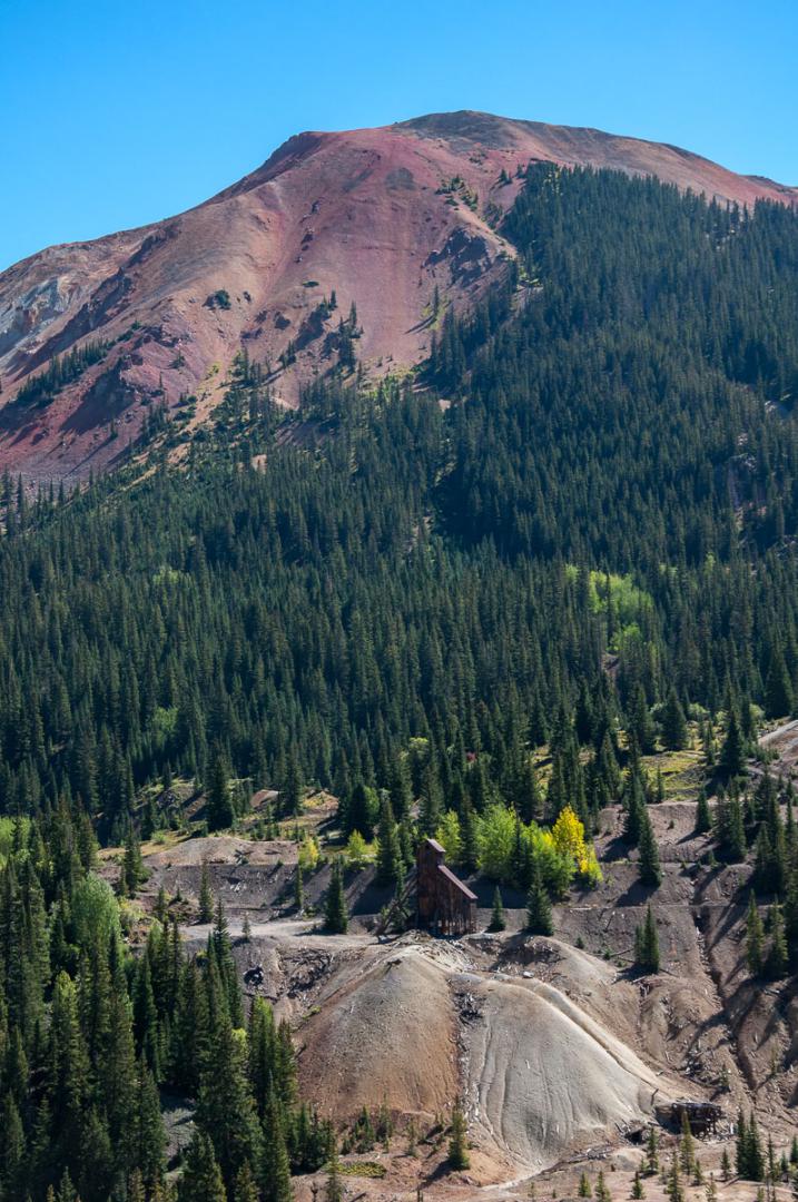
Yankee Girl Mine et Red Mountain
![]()
No hike
![]() 30 minutes
30 minutes
![]()
Free
View on an old abandoned mine at the foot of mountains with red tops.
Access : exit Ouray by the south via the US550. The car park is located about 11,2 miles.
.jpg)
.jpg)
.jpg)
To see around
Lodging
Wa have tested :
Copyright Magali and David BELLEC