![]()
![]()
![]()
![]()

In this page, you will find informations and advices we can give, based on our experience
Ecrins National ParK
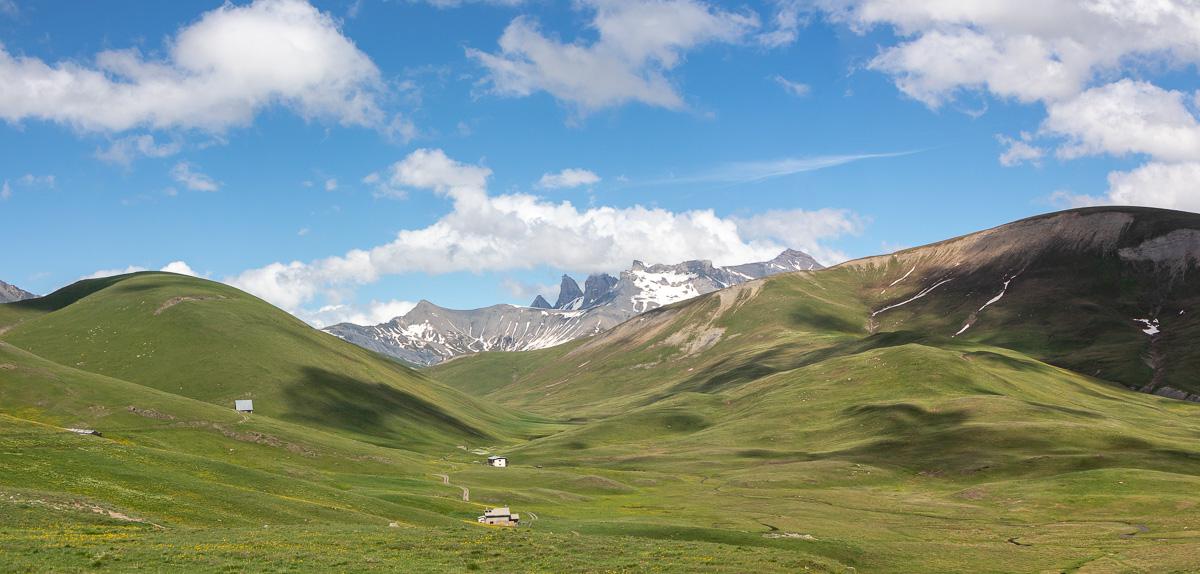
What to do if you have little time : source of Veneon, Emparis Plateau, Petarel Lakes
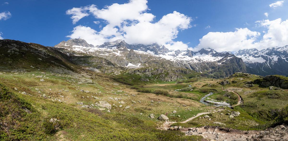
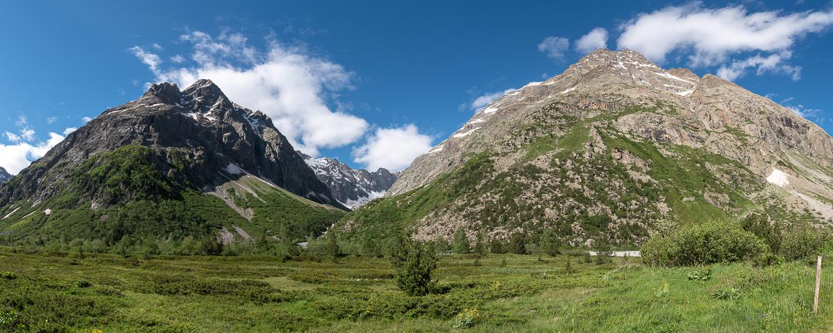
The Ecrins National Park is home to a large mountain range including 2 peaks of more than 4000 meters of altitude and many glaciers. The heart of the park is very wild and beautiful. The park is composed of 7 valleys : Oisans, Brianconnais, Valbonnais, Vallouise, Valgaudemar, Champsaur and Embrunais. For the moment, we have only visited 3 of them.
Advice : before going on a hike, check the weather forecast because it can change quickly in the mountains. Bring warm clothing.
We advise you to download on your phone the "Rando Ecrins" application which lists all the hikes in the park and which allows you to navigate with the interactive map. It can be used off-line once you have downloaded the hiking maps. For more informations, click here.
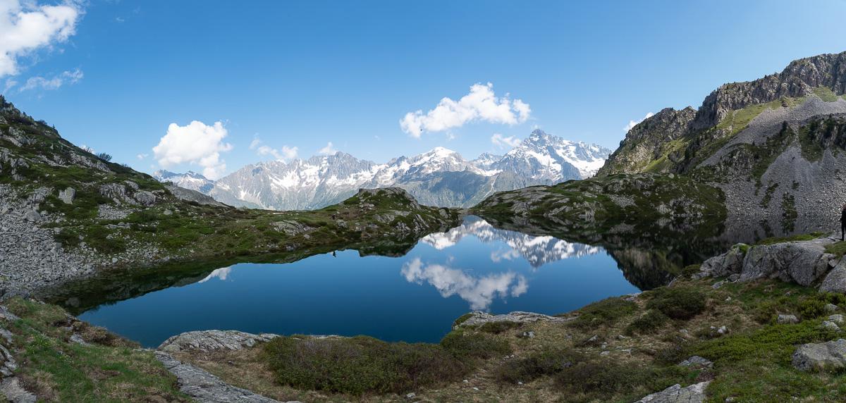
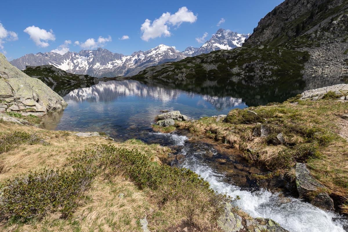
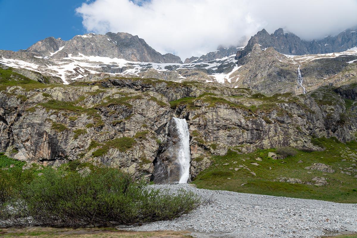
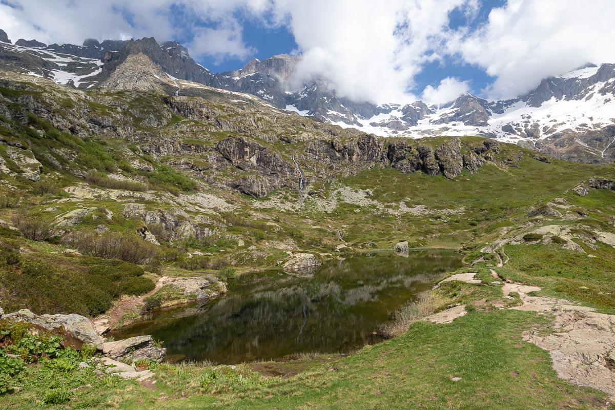
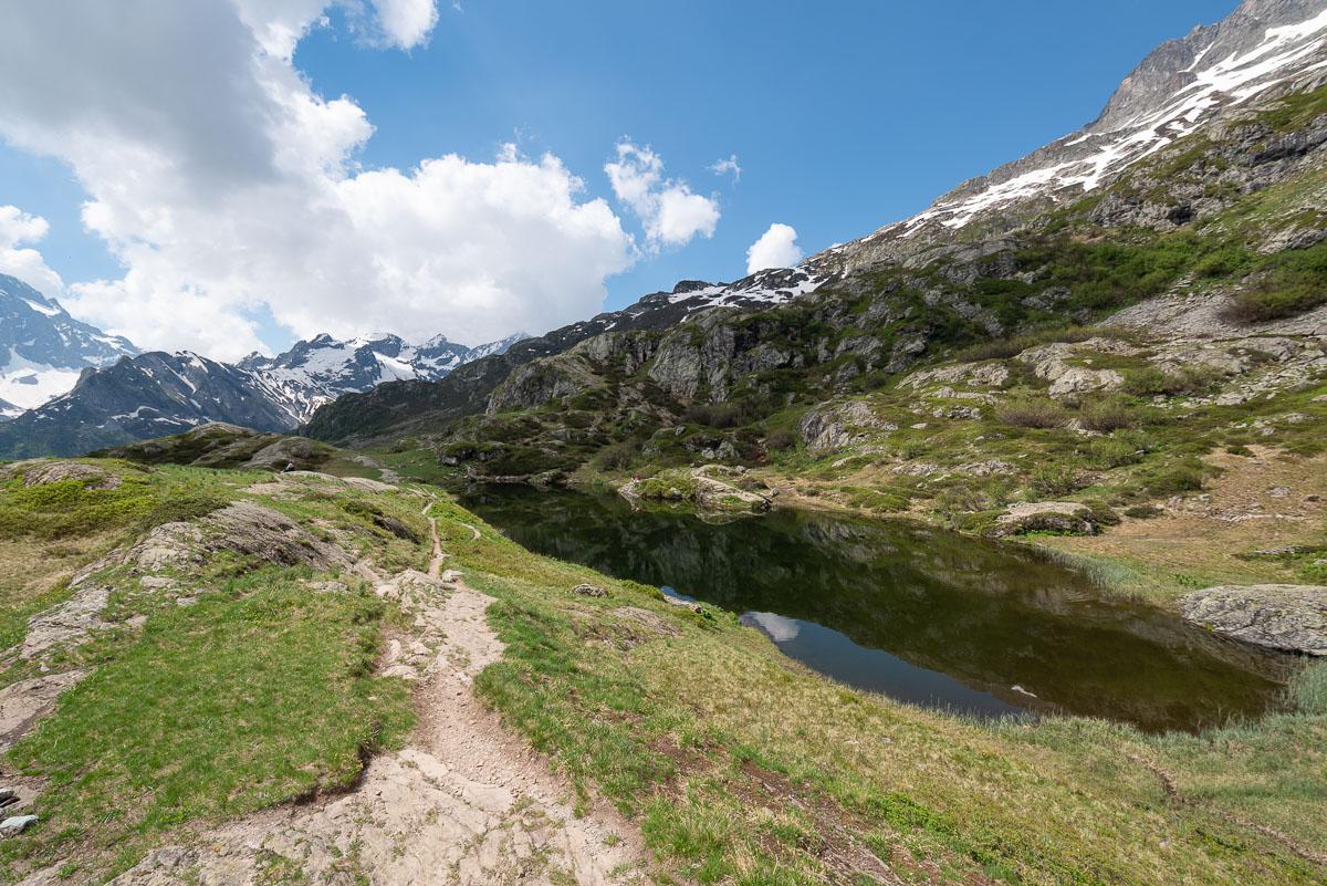
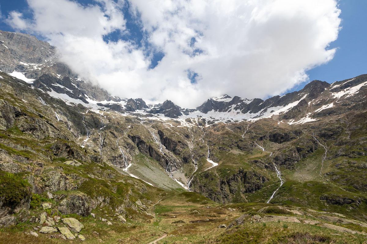
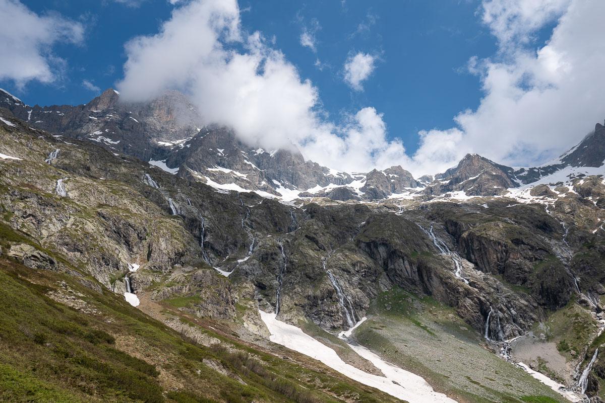
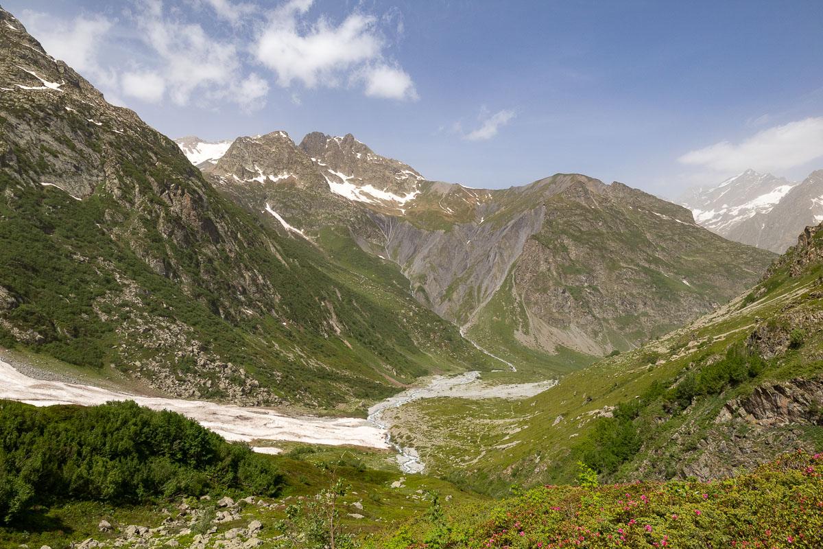
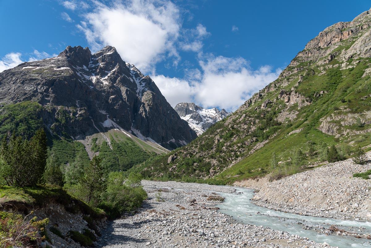
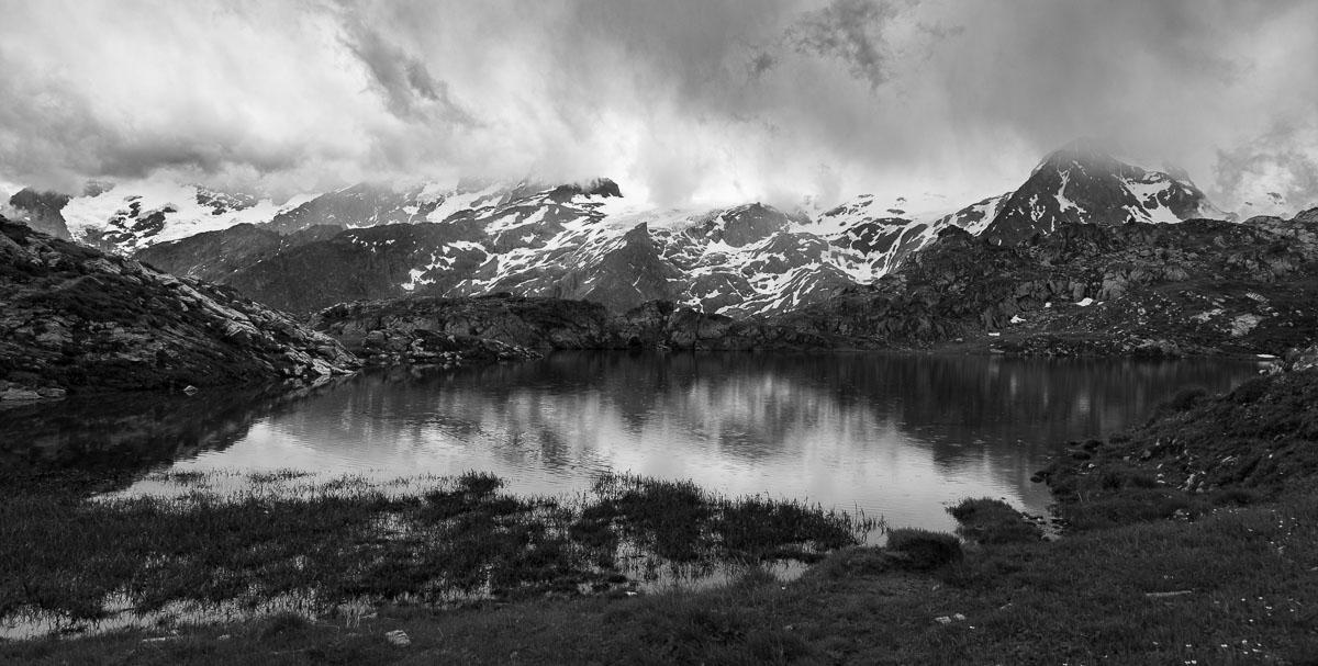
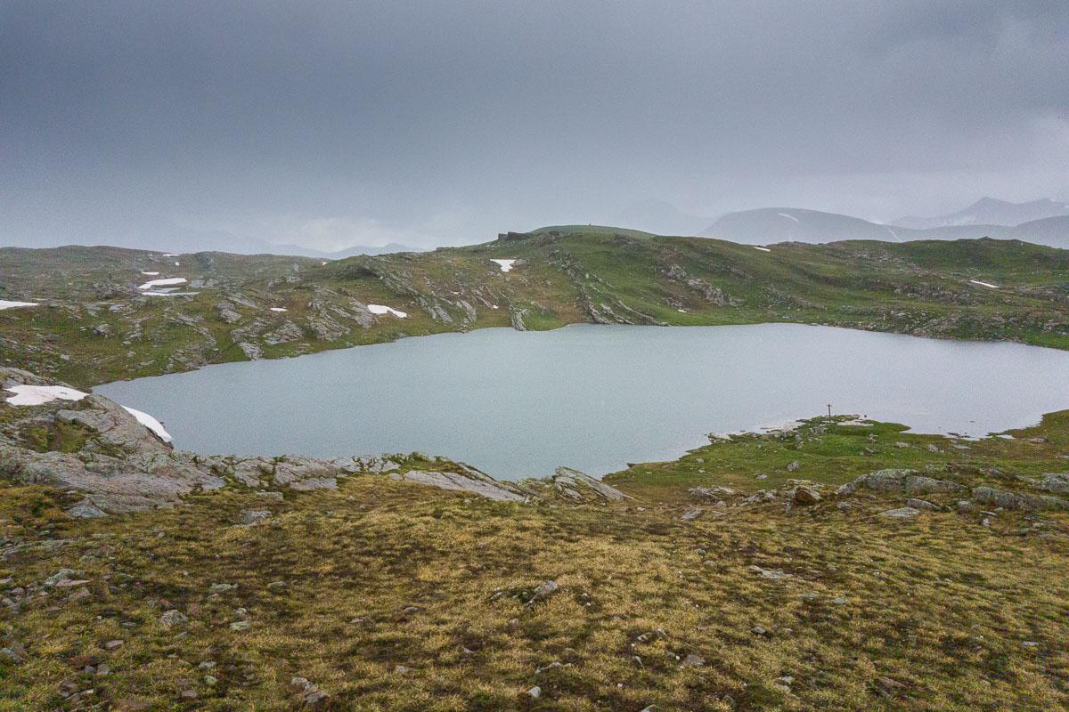
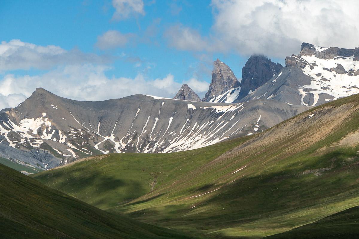
Valgaudemar : Petarel Lakes
![]()
 7,8 kms one way -
850 meters of altitude difference - 3h00
![]() 1 day
1 day
![]()
Free
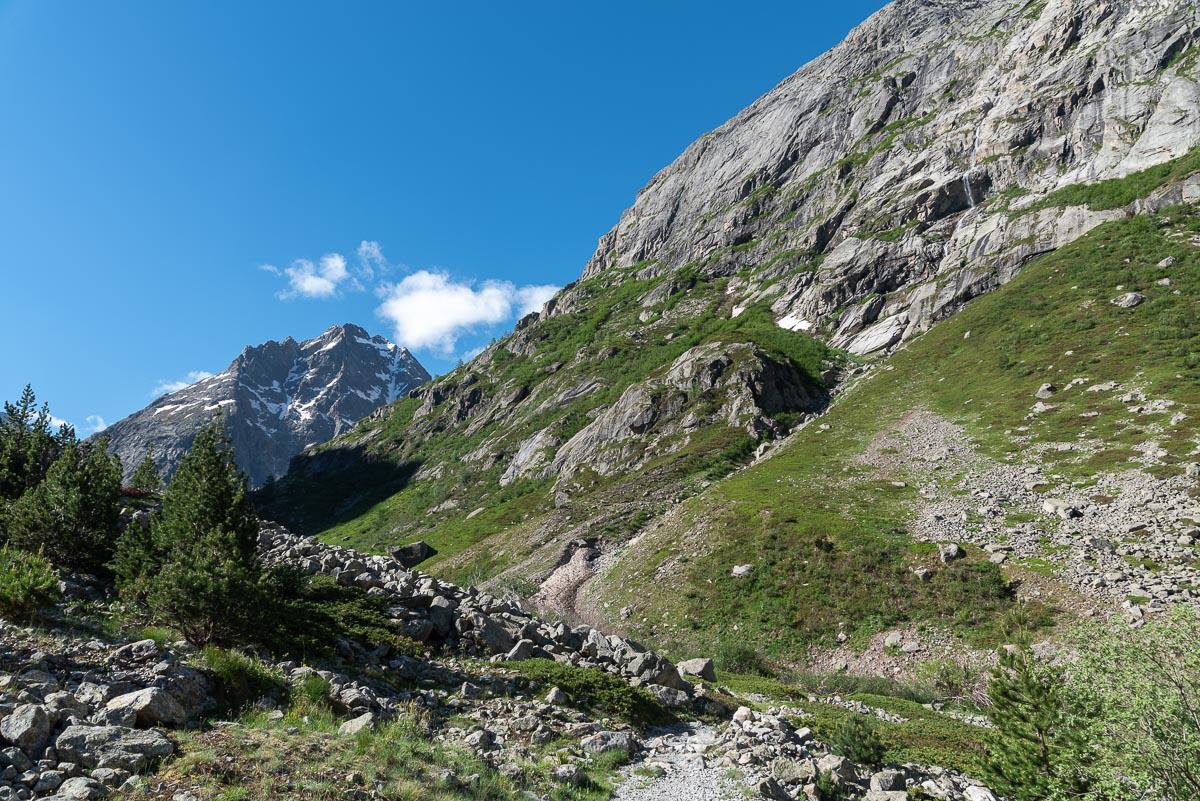
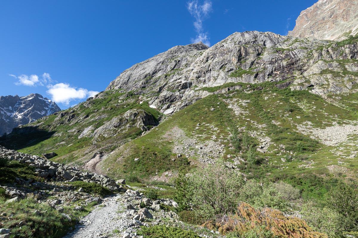
The lakes of Petarel are accessible from several places : Villard-Loubière, Les Andrieux or Les Portes. We chose this last version.
The hike is about 8 kms one way and goes up continuously in the forest, it is rather pleasant when it is hot. However, the fact of being under the trees hides the view on the landscape. Once out of the forest, the view opens up on the mountain range in front. The climb continues on a balcony to the lakes. Several lakes are nestled in the hollow of the mountain, one of which offers us magnificent reflections in the water. The view is splendid. The place is ideal for a picnic or a bivouac. On this version, the return is done by the same way.
Access : from the village of Les Portes, 1,5 km from La Chapelle-en-Valgaudemar. Parking before the village. The path is on the right between the houses.

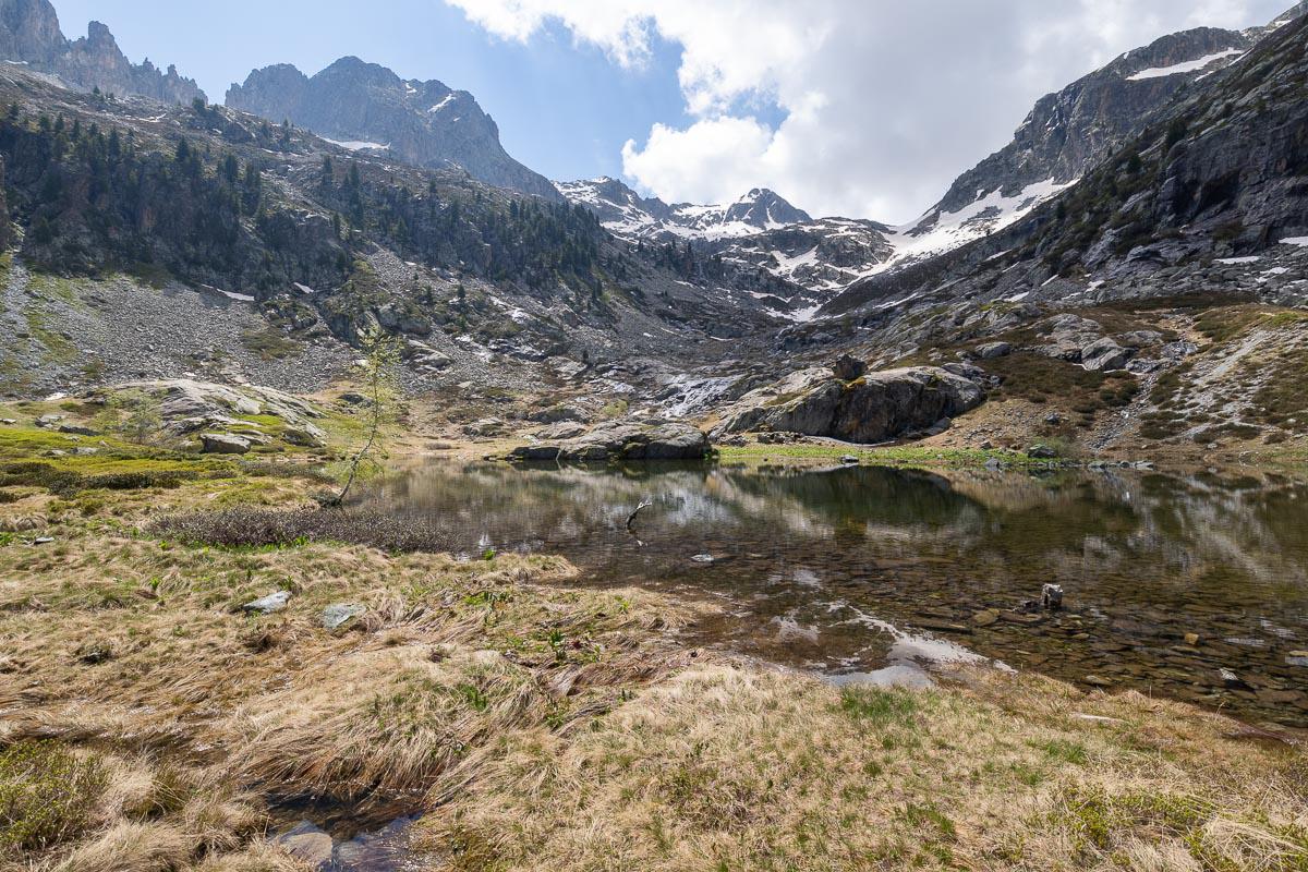
Valgaudemar : Lauzon Lake
![]()
Loop of 7,4 kms - 450 meters of altitude difference - 2h30
![]() 1/2 day
1/2 day
![]()
Free
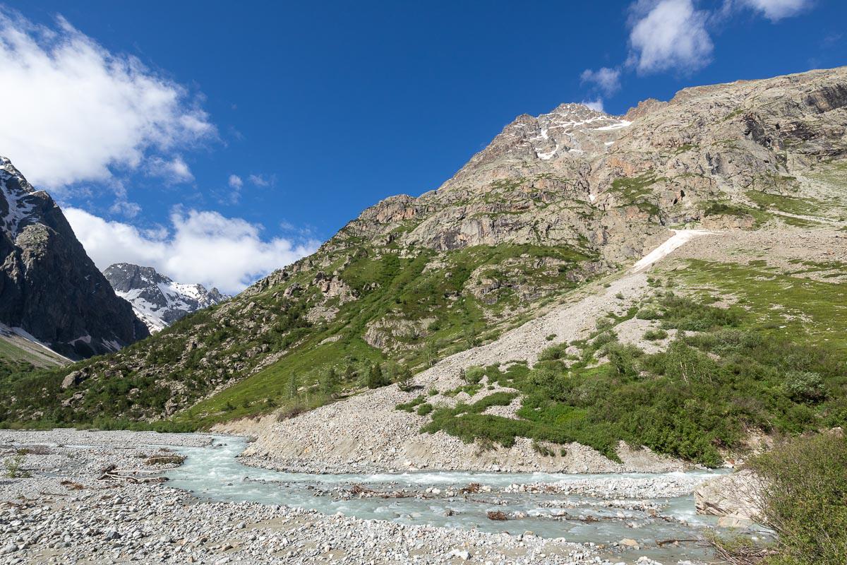
Very beautiful hike which has for decoration the cirque of Gioberney. The 7,4 kms loop starts on the left and crosses a stream. Waterfalls embellish the walk. Then the path leads to a lake, ideal for a picnic with a view. The descent goes along the torrent of the Muande Bellone. Close to the start of the hike, at the chalet, is the pretty waterfall of the Voile de la Mariée, a refreshing break after this walk.
Access : from Gioberney, 9 kms from La Chapelle-en-Valgaudemar. Parking at the chalet-hotel. Head north.
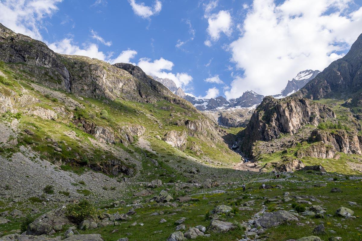
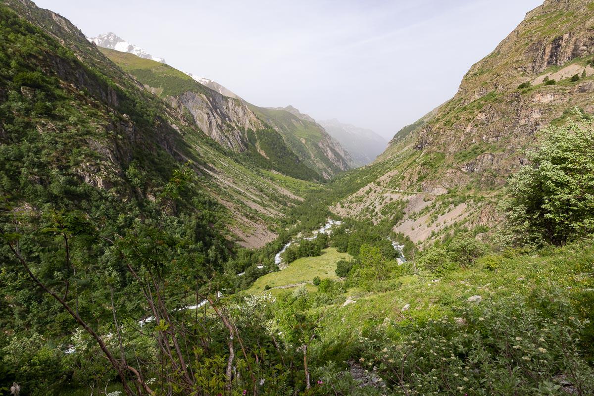
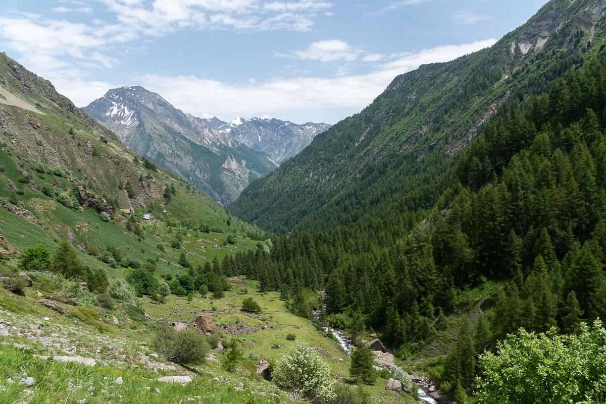
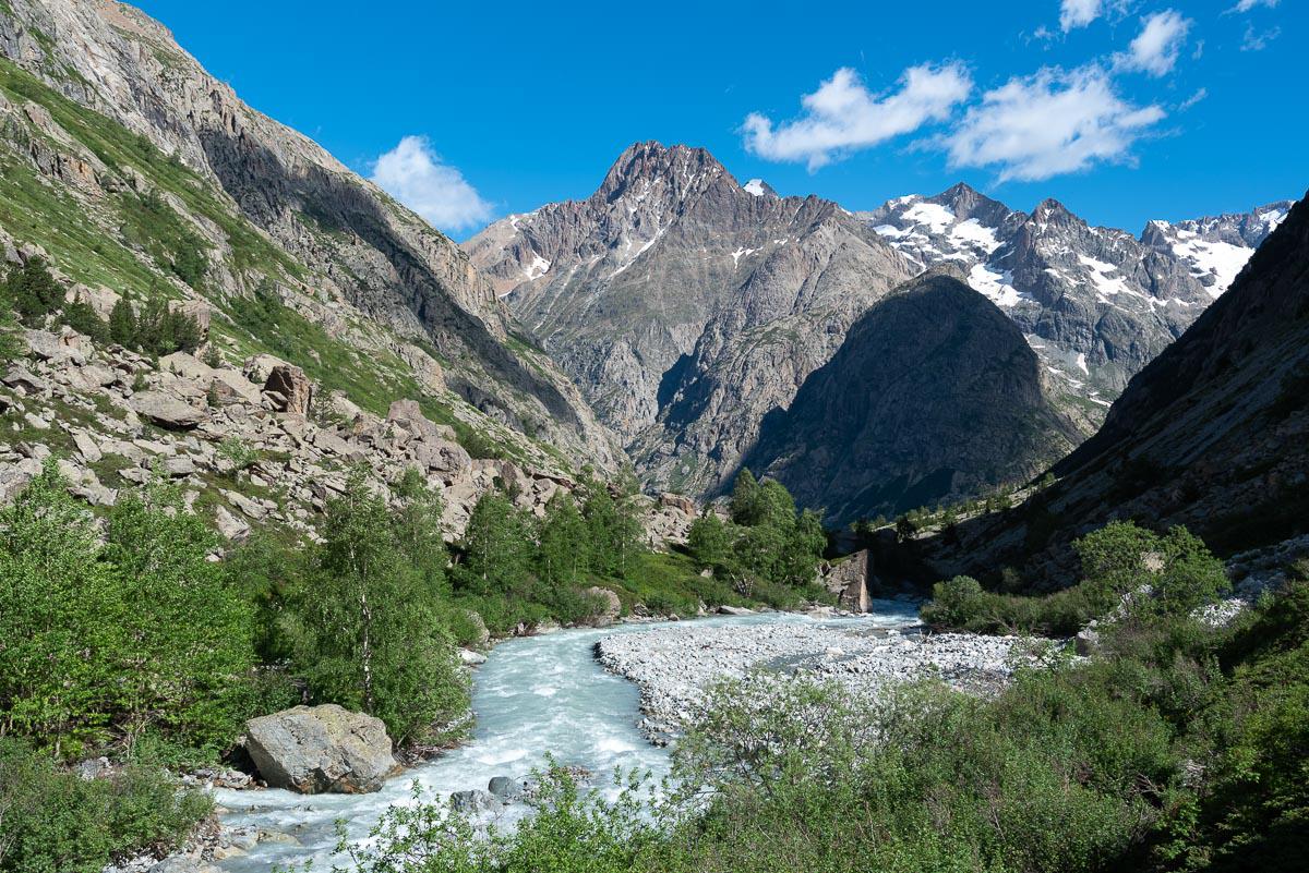
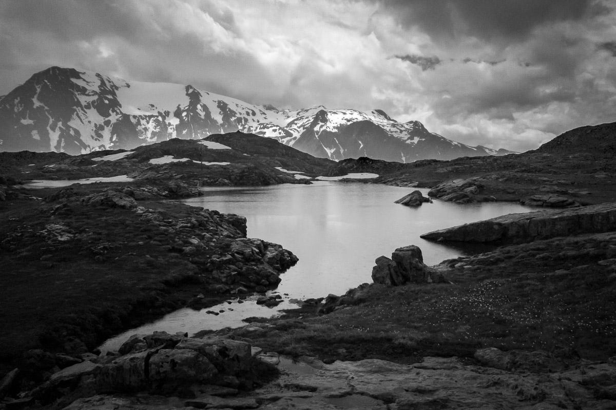
Valgaudemar : Chabourneou Refuge
![]()
6 kms one way - 460 meters of altitude difference - 1h30
![]() 1/2 day
1/2 day
![]()
Free
A 12 km round trip hike that leads to the Chabourneou Refuge. The trail follows the river and the open valley offers nice views. The last part of the walk climbs steeply to the refuge. From there, the view on the valley is superb.
Access : going to Gioberney, park about 500 meters before the chalet of Gioberney on a large parking on the right side of the road. Indication "Refuge du Clot (Xavier Blanc)".
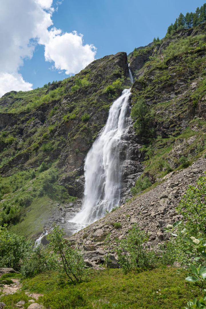
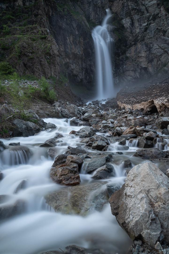
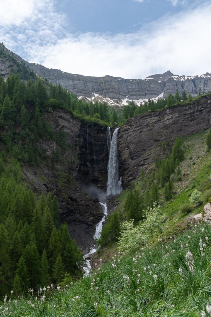
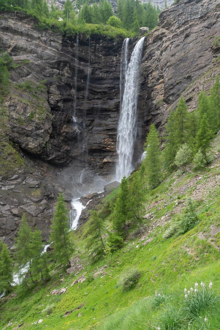
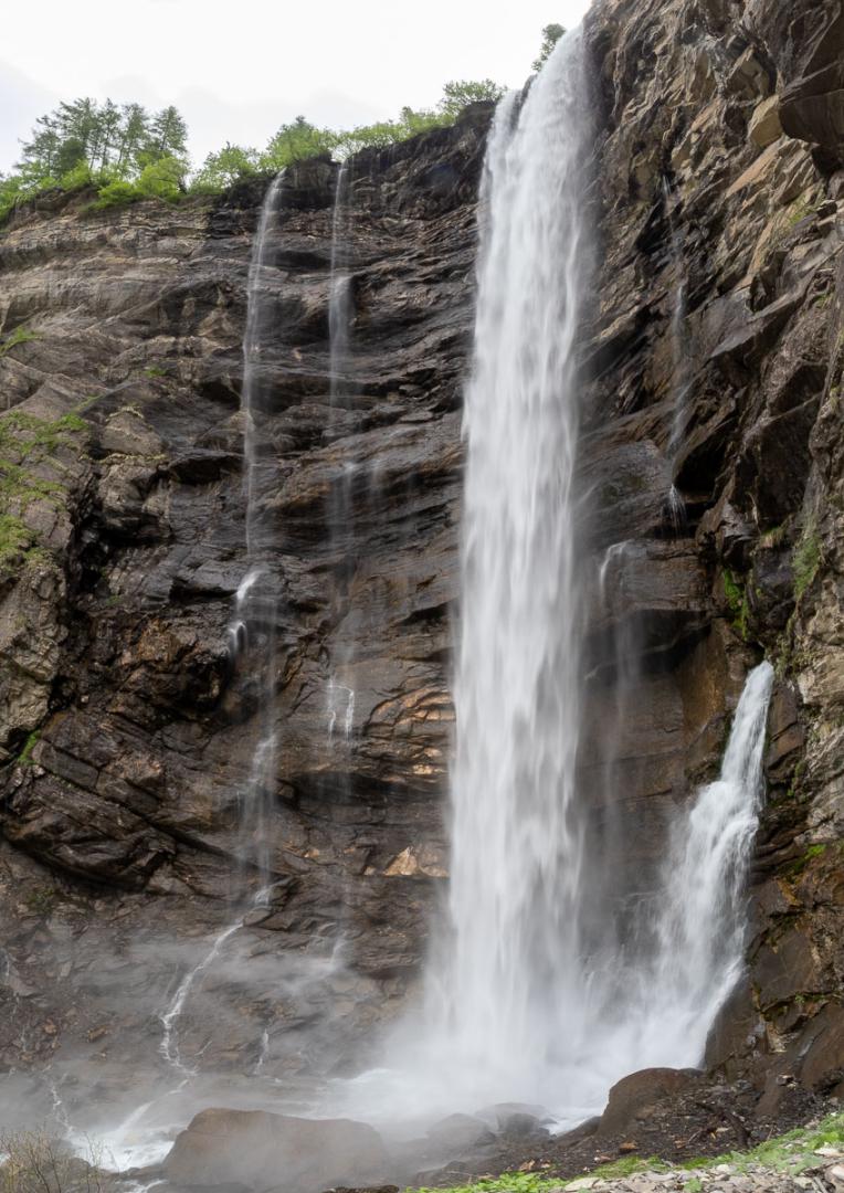
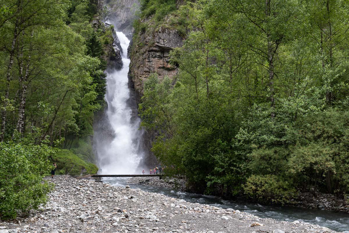
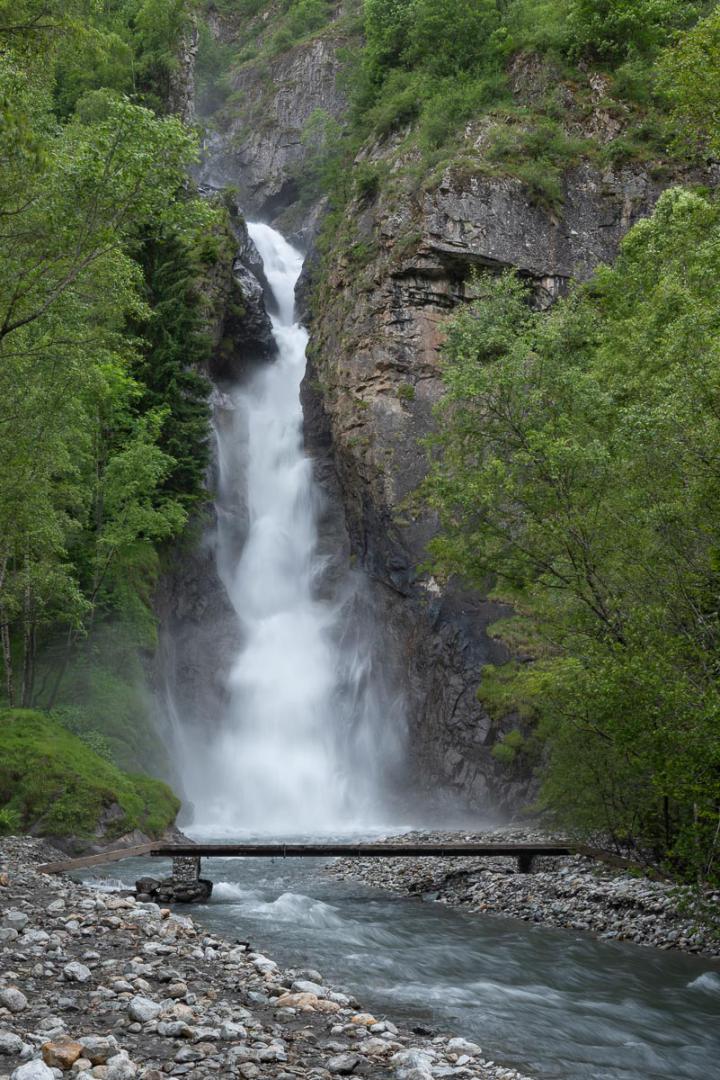
Valgaudemar : Voile de la Mariée Fall and Casset Fall
![]()
No hike
![]() 1 hour
1 hour
![]()
Free
Access : from Gioberney, 9 kms from La Chapelle-en-Valgaudemar. Parking at the chalet-hotel. The waterfall is visible from the chalet.
Access : on the road between La Chapelle-en-Valgaudemar and Gioberney.


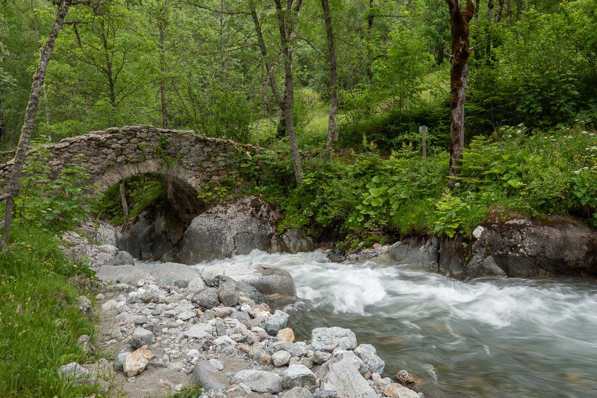
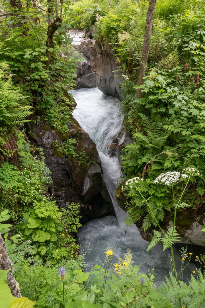
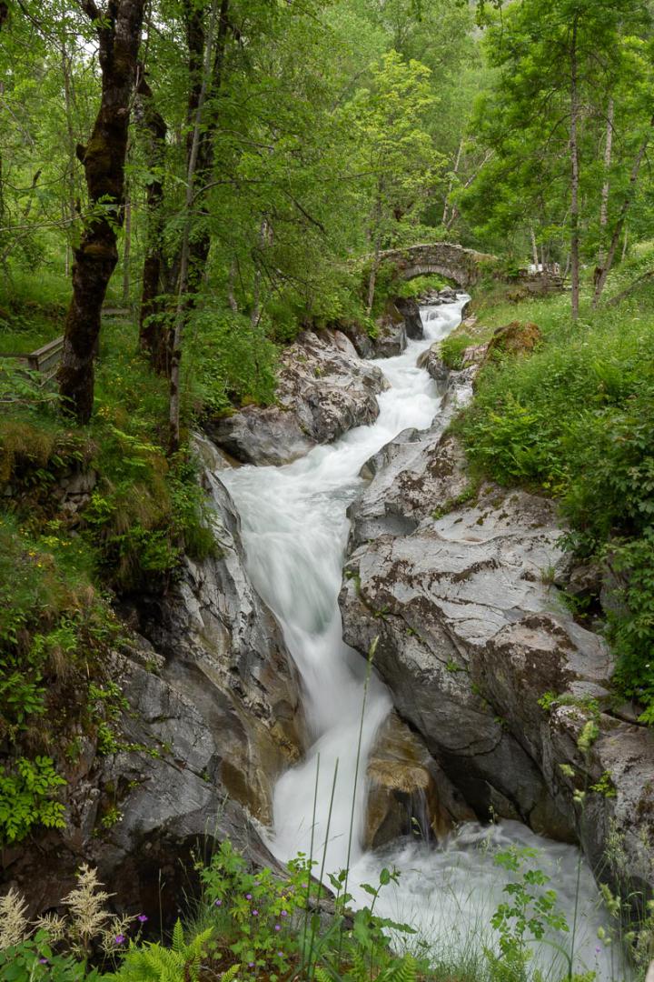
Valgaudemar : Oulles Bridge
![]()
1,7 kms round trip - 40 meters of altitude difference - 0h30
![]() 1 hour
1 hour
![]()
Free
Also called Les Oulles du Diable or Marmites de Géants, the river flows in small tight gorges after passing under a nice stone bridge.
Access : from the village of Les Portes, 1,5 km from La Chapelle-en-Valgaudemar. Parking before the village. Cross the village until the bridge.

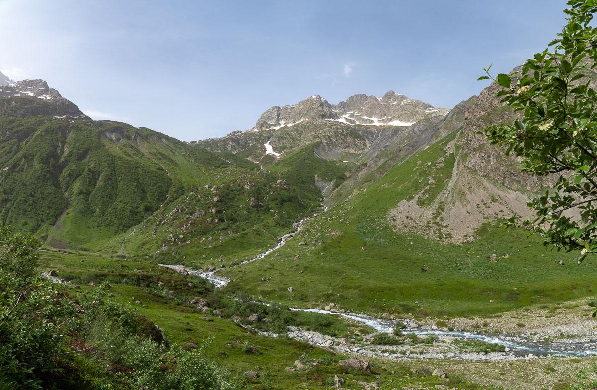
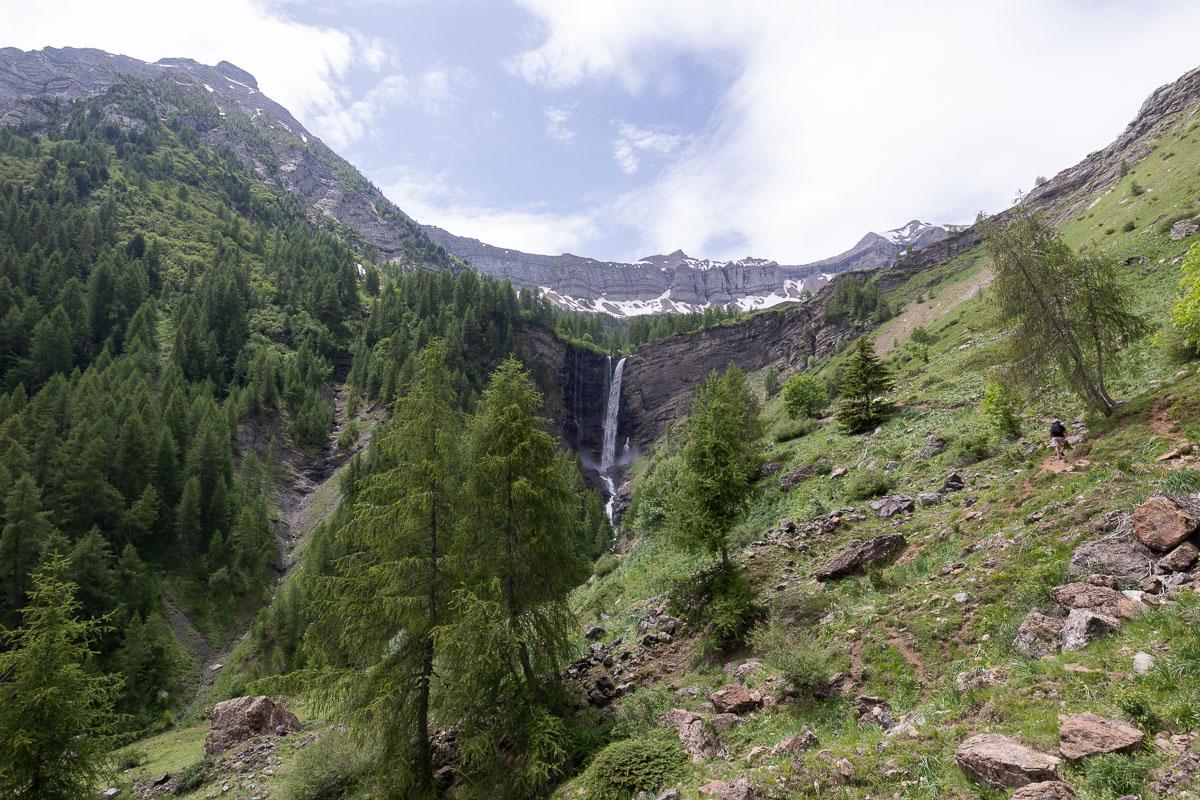
Champsaur : La Pisse Fall
![]()
5 kms one way - 455 meters af altitude difference - 1h30
![]() 4 hours
4 hours
![]()
Free
Located in the Tourond Valley, this 10 km round trip hike follows the river before leaving it to reach the Tourond Refuge. The path continues westward to La Pisse waterfall - very high and impressive.
Access : from the village of Les Borels. From the RN85, follow St Bonnet on the RD 945, then join the RD 944. Turn left towards Les Borels before arriving in Orcières.
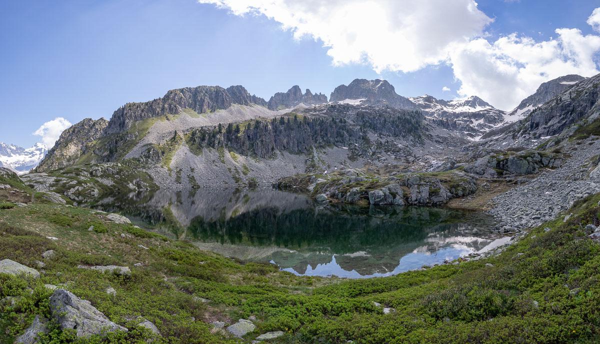
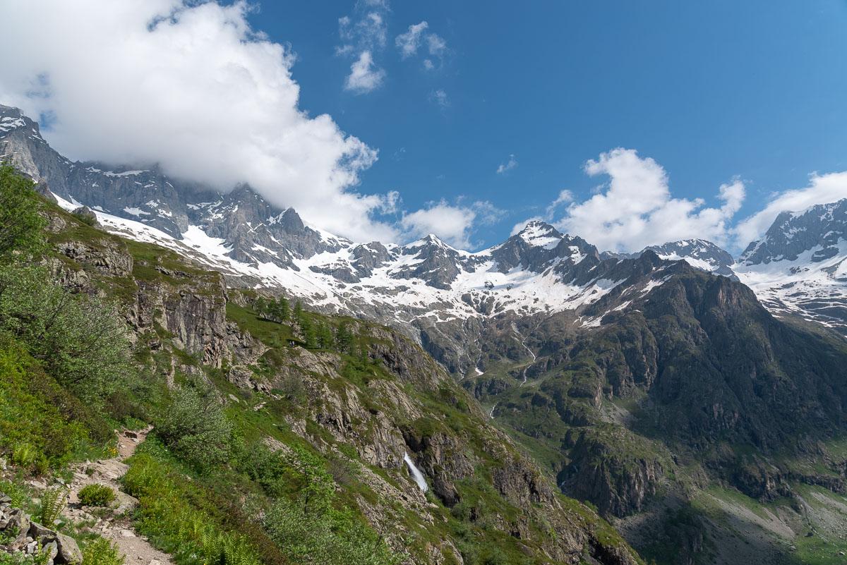
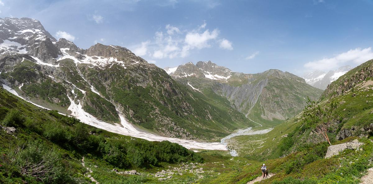
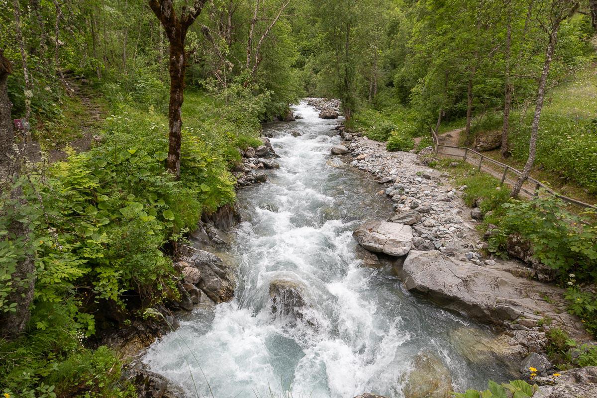
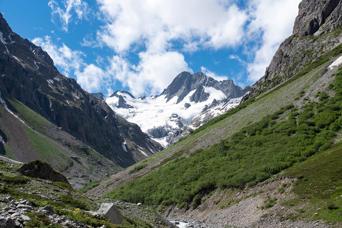
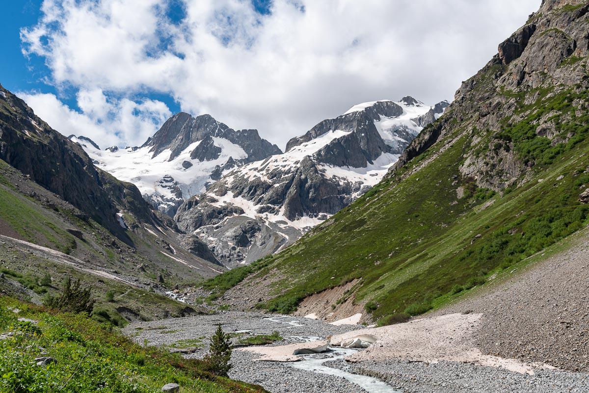
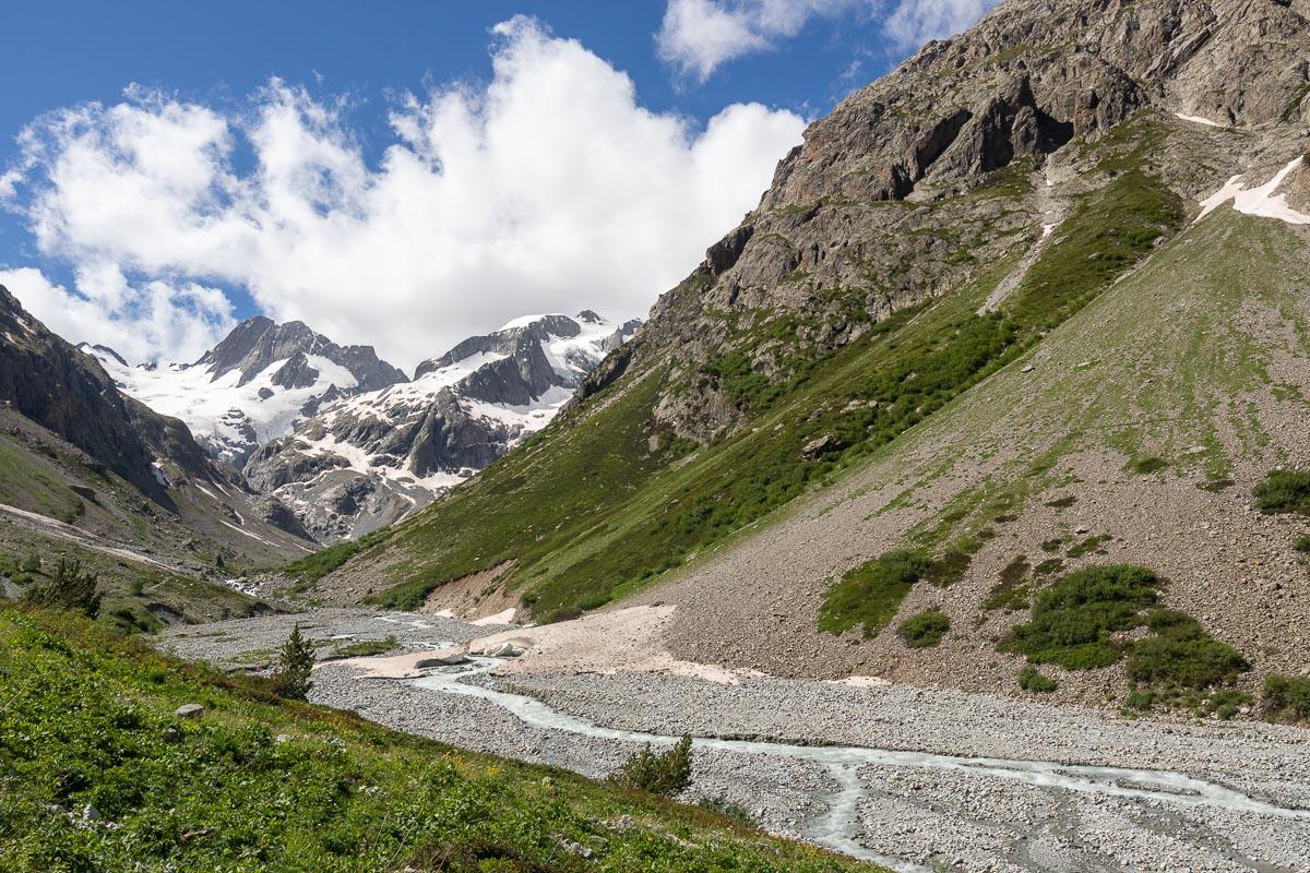
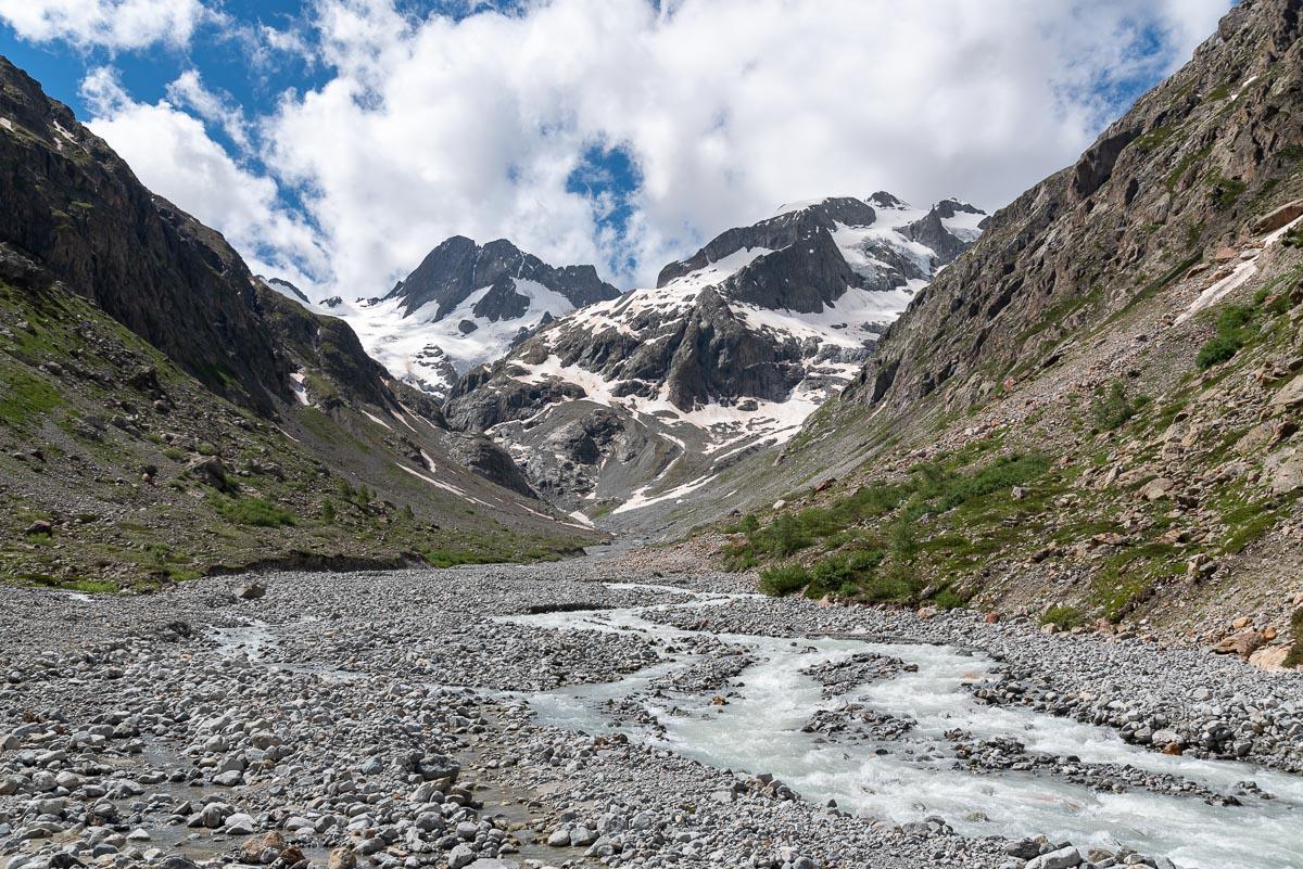
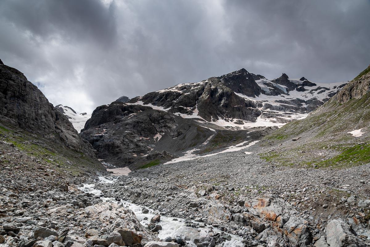
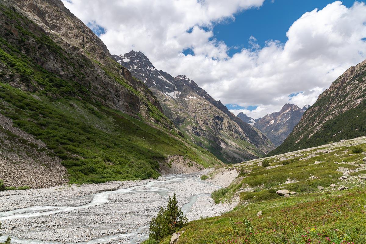
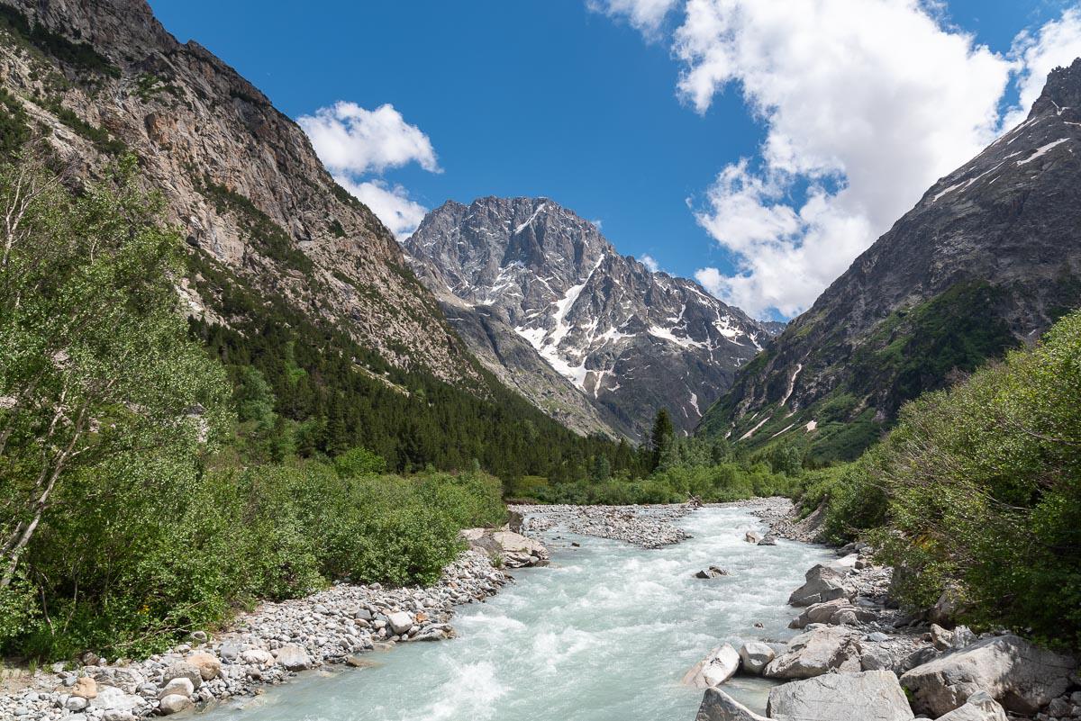
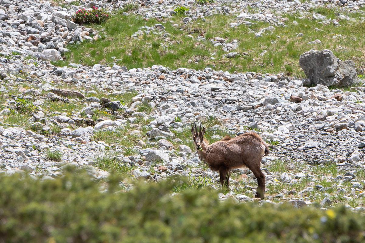
Oisans : Source of Veneon
![]()
8,7 kms one way - 470 meters of altitude difference - 2h30
![]() One day
One day
![]()
Free
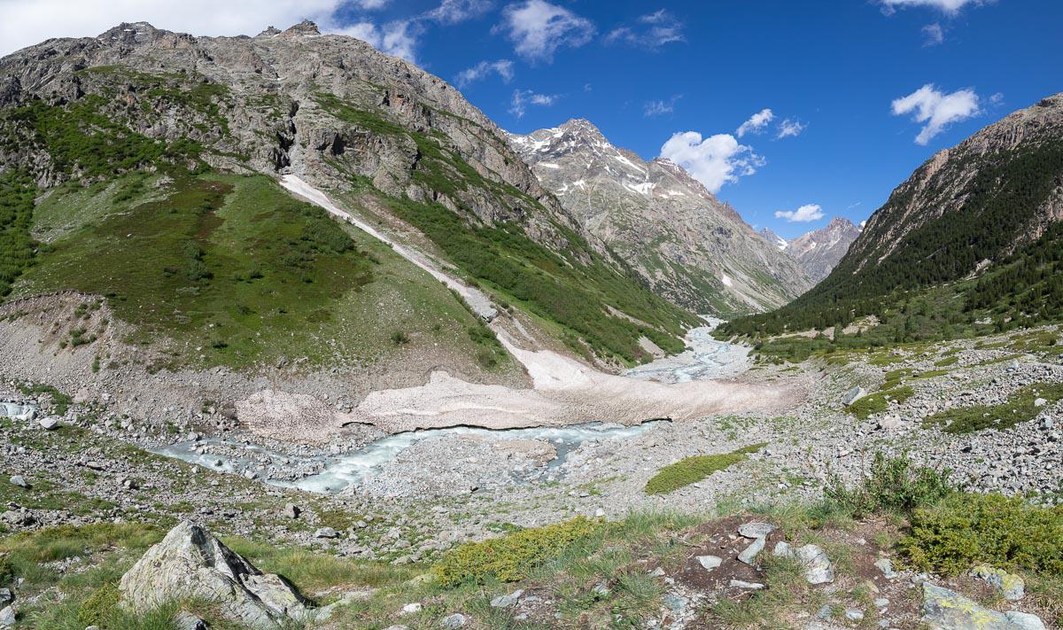
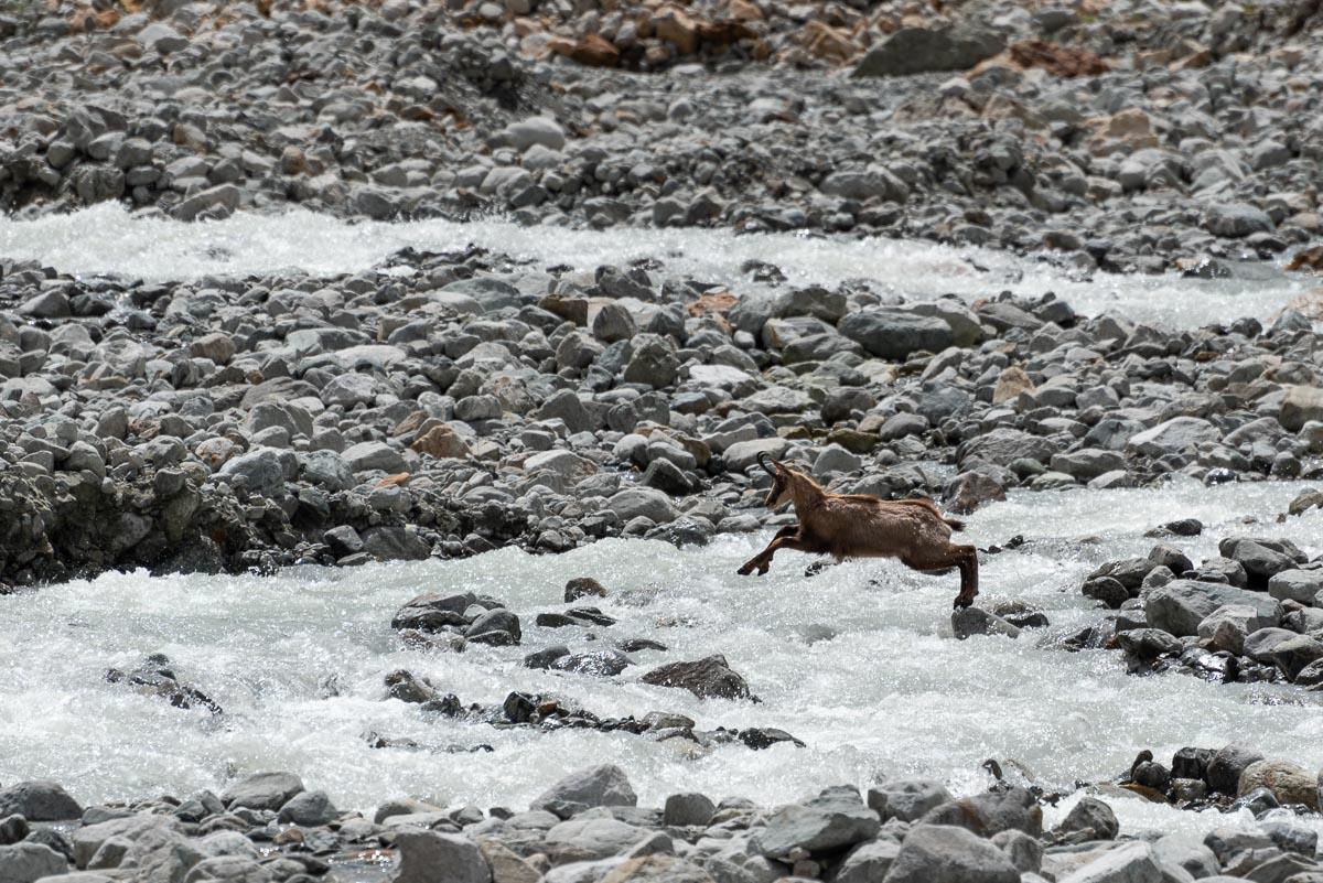
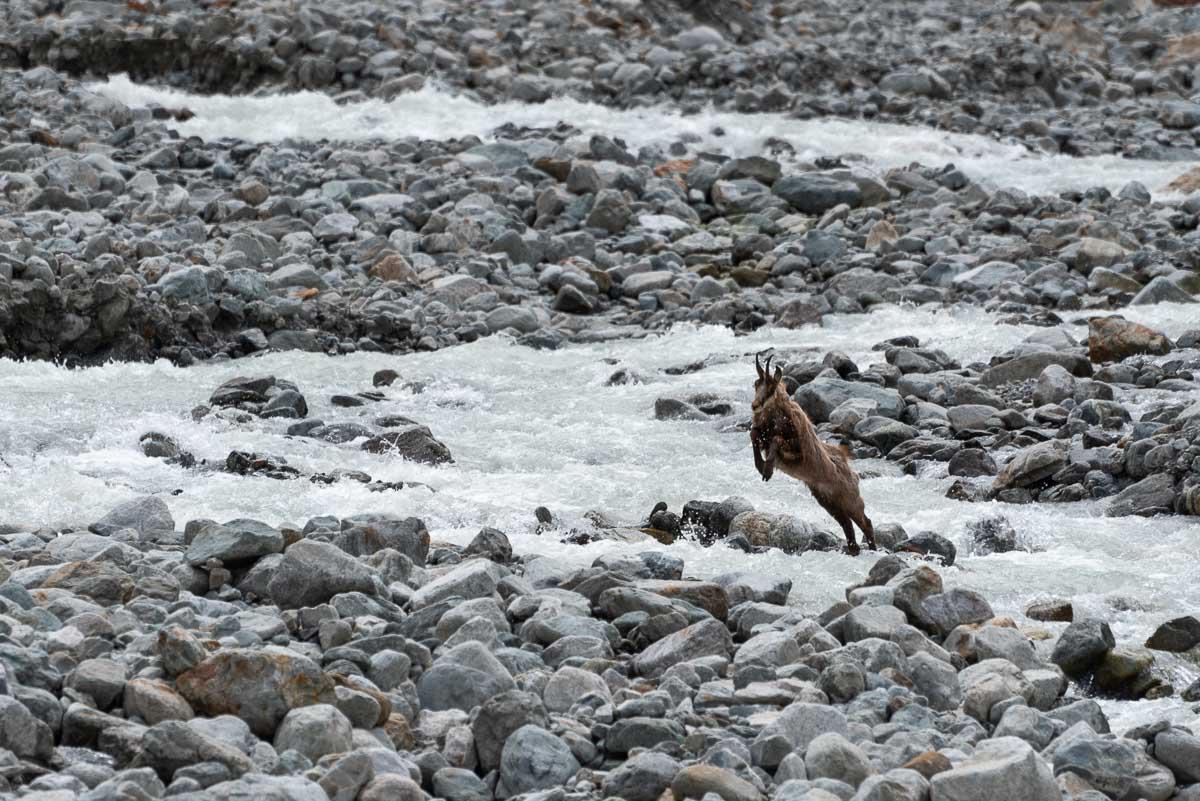
Wonderful hike of about 17 kms round trip which follows the Veneon river up to its source. Although relatively long, the walk is easy with a small elevation gain. The trail passes in front of the Carrelet Refuge, a nice place to bivouac, crosses several streams (which we cross on boards) and then continues to a bridge that spans the river. From there, you will see the Glacier de la Pilatte which gives its source to the Veneon (from here it is possible to go to the Pilatte Refuge, if this one is open because a prefectural decree forbade the access at the time of our visit). The return is done by the same way or on the other bank after crossing the bridge. During our visit in June 2021, we had the chance to see a chamois crossing the river.
Access : from the village La Bérarde, 28 kms from Bourg d'Oisans. Follow the sign "Refuge du Carrelet".


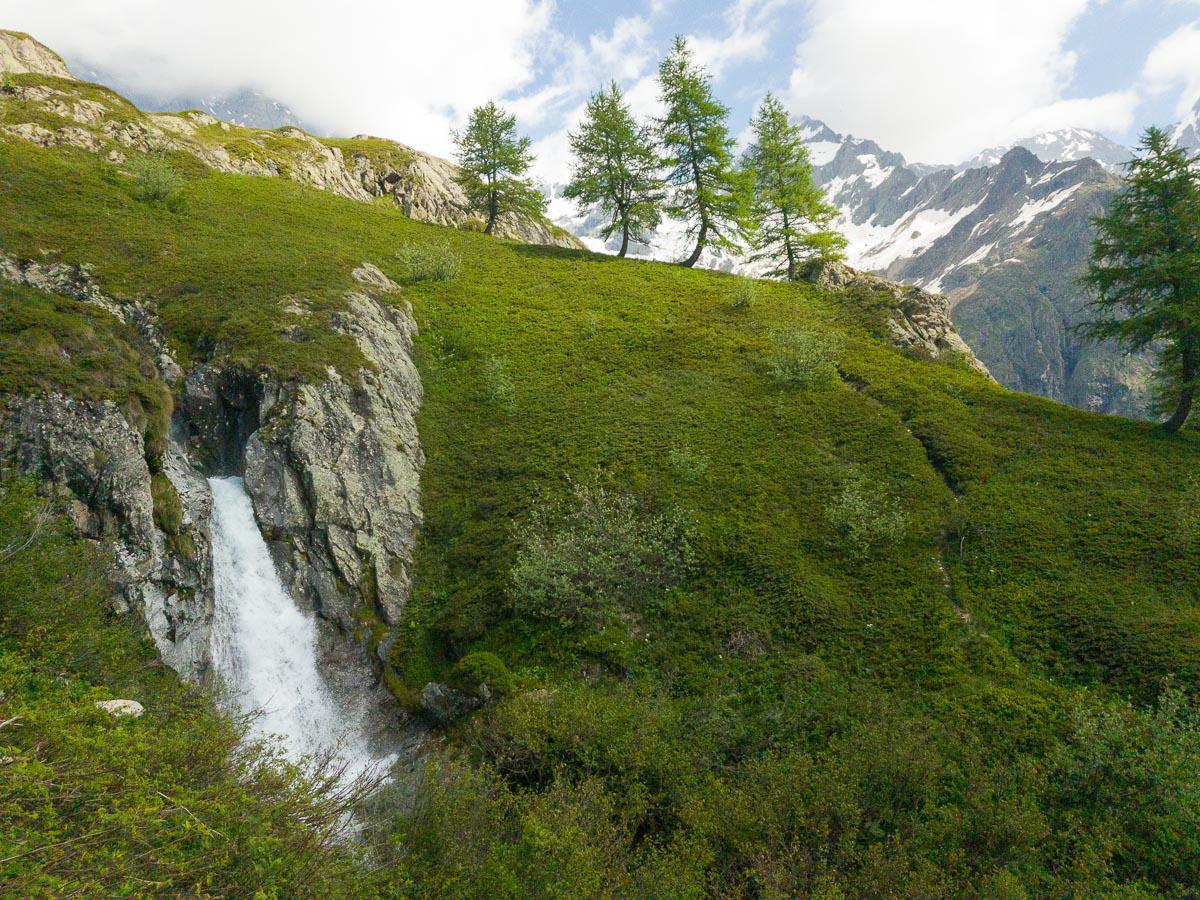
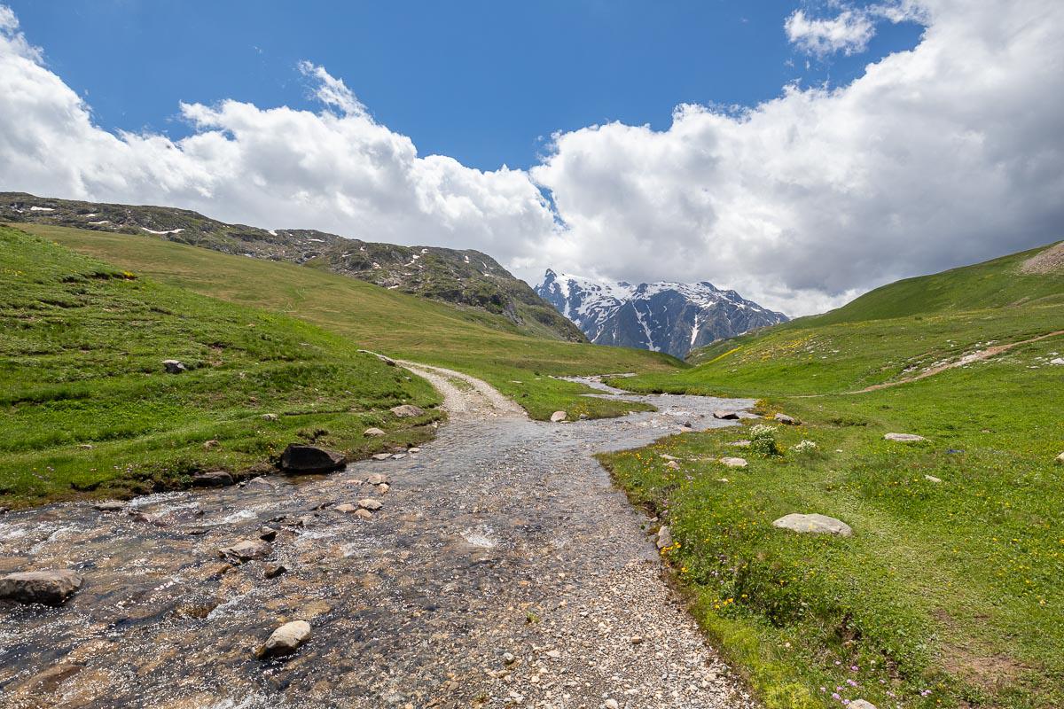
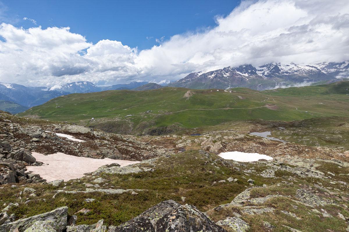
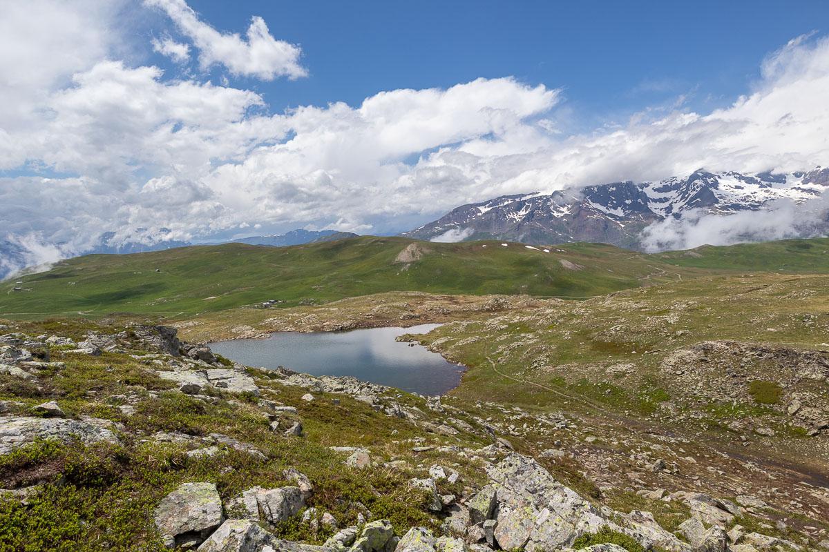
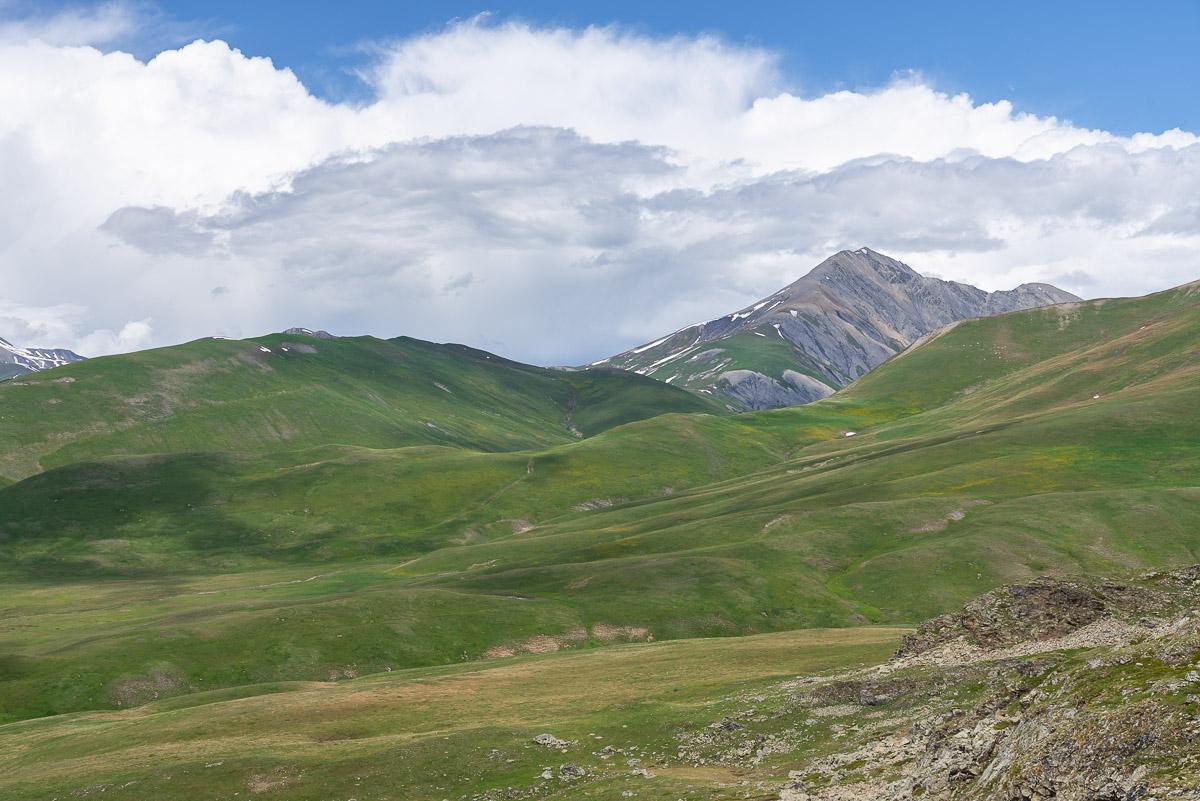
Oisans : Emparis Plateau
![]()
Loop of 9,6 kms - 395 meters of altitude difference - 2h30
![]() 3 to 4 hours
3 to 4 hours
![]()
Free
Emparis is a beautiful plateau with green and rounded hills at 2400 meters of altitude. A marmot's paradise! Follow the GR 54 which goes down slightly towards a river that you will have to cross then goes up again towards the Col du Souchet. From there, you will have a superb view on the Ecrins range and, if the sky is clear, on the Meije. Another small climb to the right and you arrive at the Lerie Lake. A steeper slope leads to the Black Lake. Continue to follow the path and discover other small lakes. The descent is gentle to join the river and go back to the parking. The plateau of Emparis is probably an ideal place for a bivouac.
Access : from Bourg d'Oisans, go to Besse at 22 kms. The most courageous will start the ascent to the plateau from Besse but it adds almost 700 meters of elevation gain. Otherwise, you can reach by car and following a rather vertiginous track of 10 kms, the parking lot located 400 meters before the Refuge of Rif Tort.


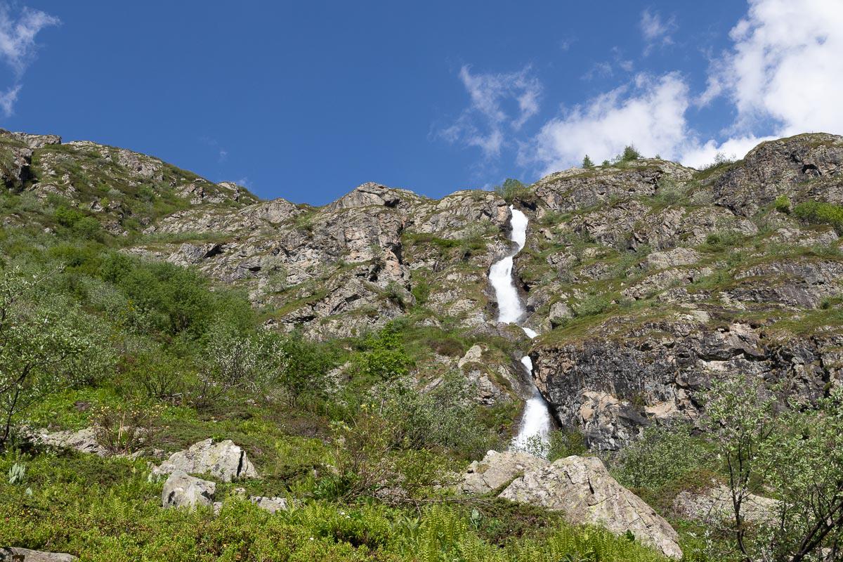
Oisans : Lanchatra Fall
![]()
No hike
![]() 30 minutes
30 minutes
![]()
Free
Waterfall which goes down from the mountains to throw itself in the Veneon river.
Access : about 19 kms from Bourg d'Oisans on the D530.
Copyright Magali and David BELLEC