![]()
![]()
![]()
![]()

In this page, you will find informations and advices we can give, based on our experience
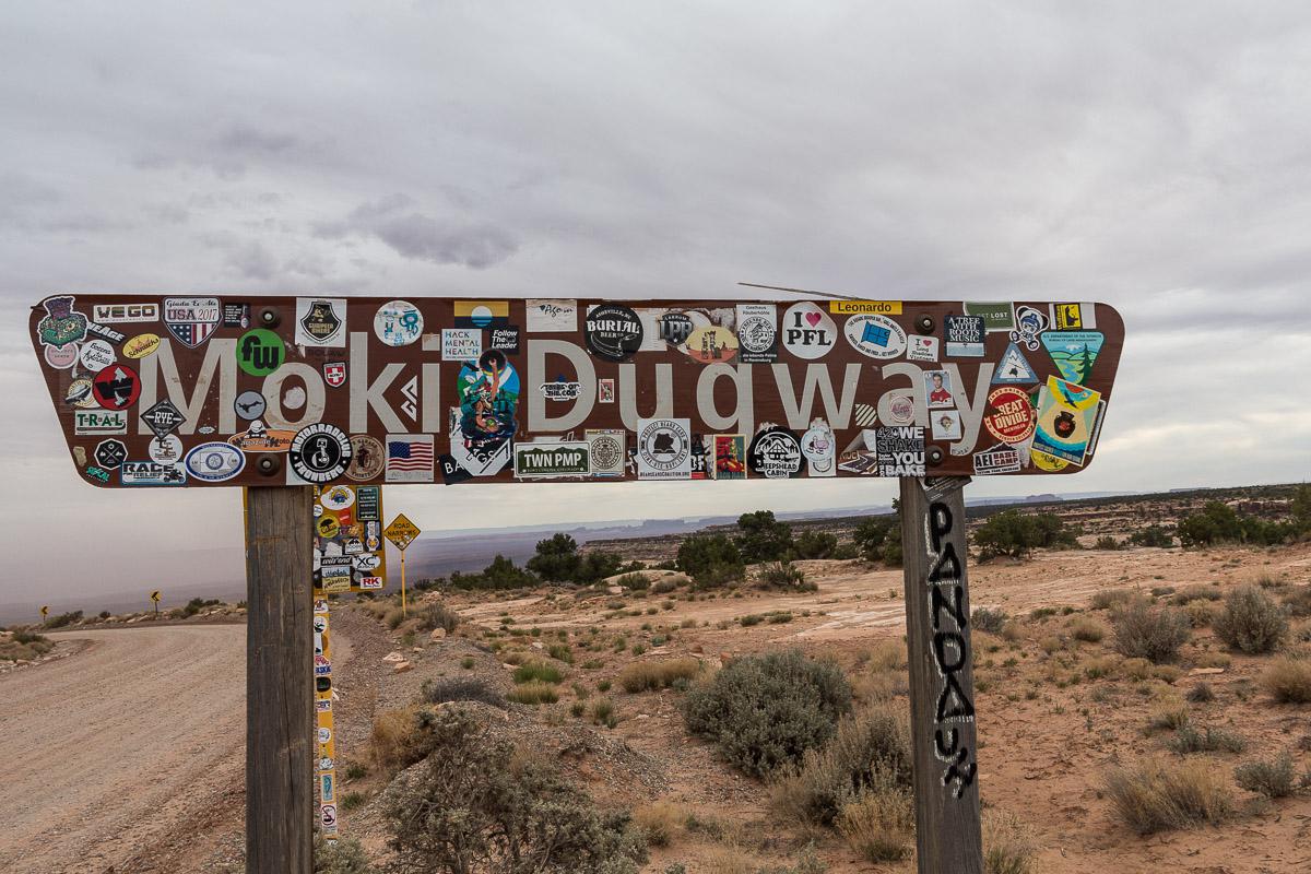
Moki Dugway & Muley POint - Utah
What to do if you have little time : Moki Dugway
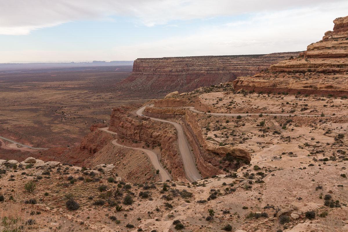
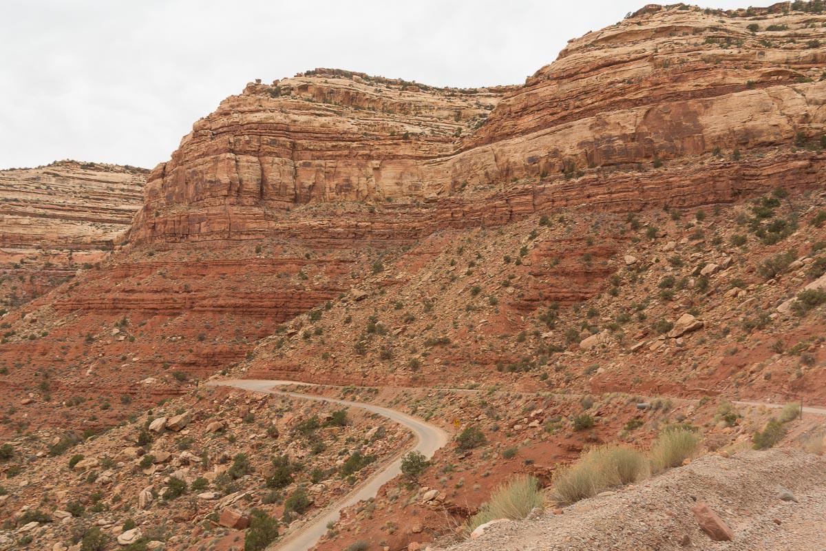
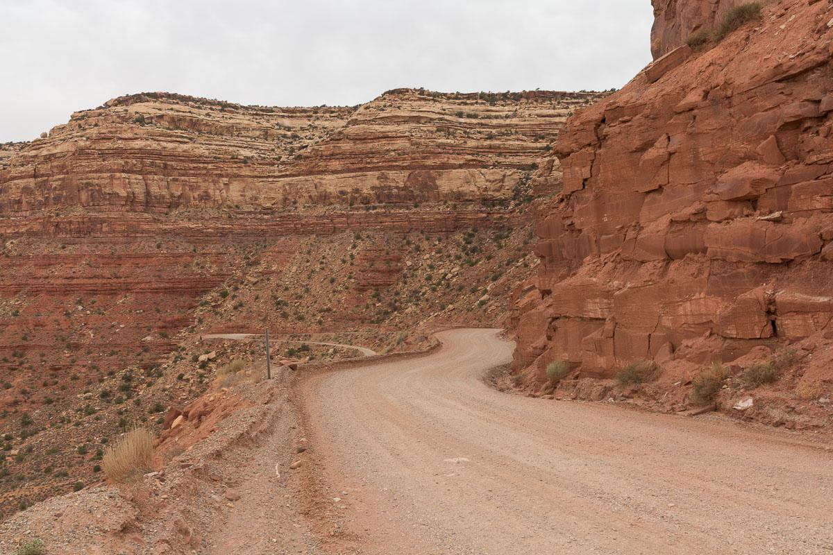
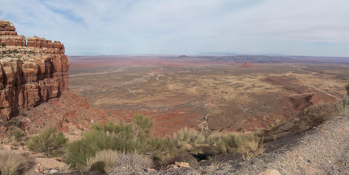
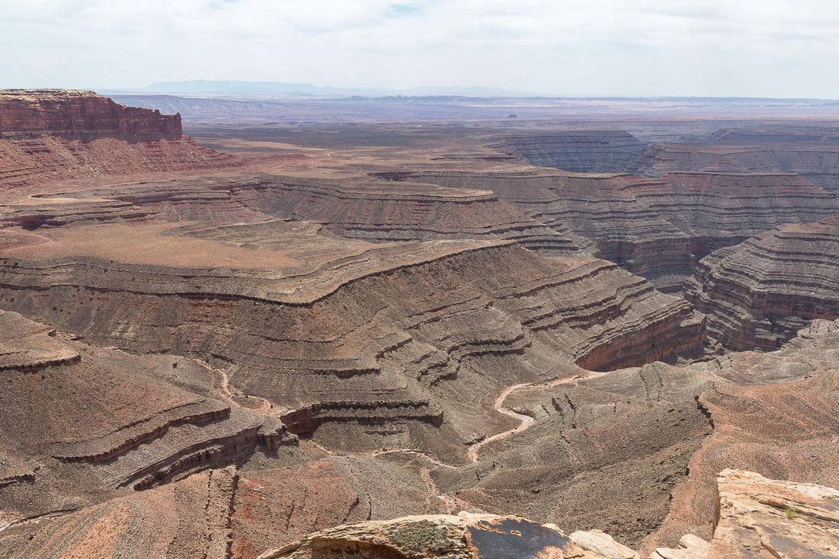
Route 261, which runs north from Mexican Hat, turns into a short section into a track: the Moki Dugway. This short stretch of the 261 is quite spectacular as it climbs steeply to climb onto a plateau from which you can overlook another plateau, including Valley of the Gods or Goosenecks State Park. The Moki Dugway, although easily passable in dry weather, can be difficult in wet weather. At its northernmost starting point (which is also its highest point) is another track that leads to Muley Point, another viewpoint.
These two sites, Moki and Muley, are uncrowded because off the usual circuits.
Moki Dugway
![]()
 No hike
![]() 15 minutes
15 minutes
![]()
Free
The moki Dugway is an unpaved winding track, without difficulty, of a few miles. It takes about fifteen minutes to cover it. In dry weather, do not hesitate to borrow it because it saves time on the way between Natural Bridges and Mexican Hat.
Access : from Mexican Hat, take Route 261 North to Moki Dugway.


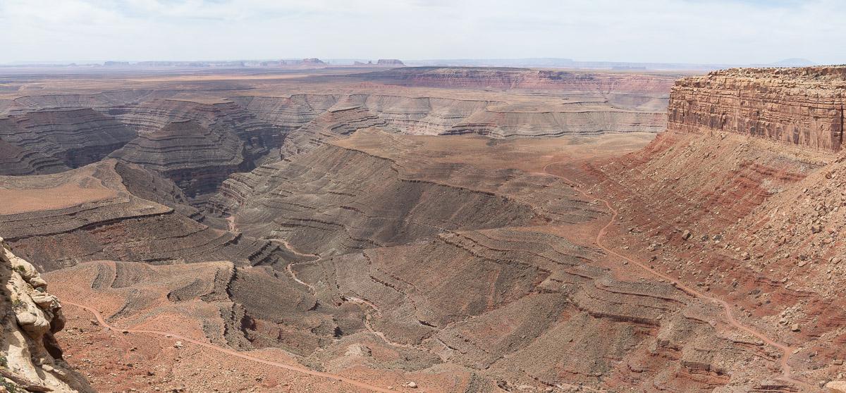
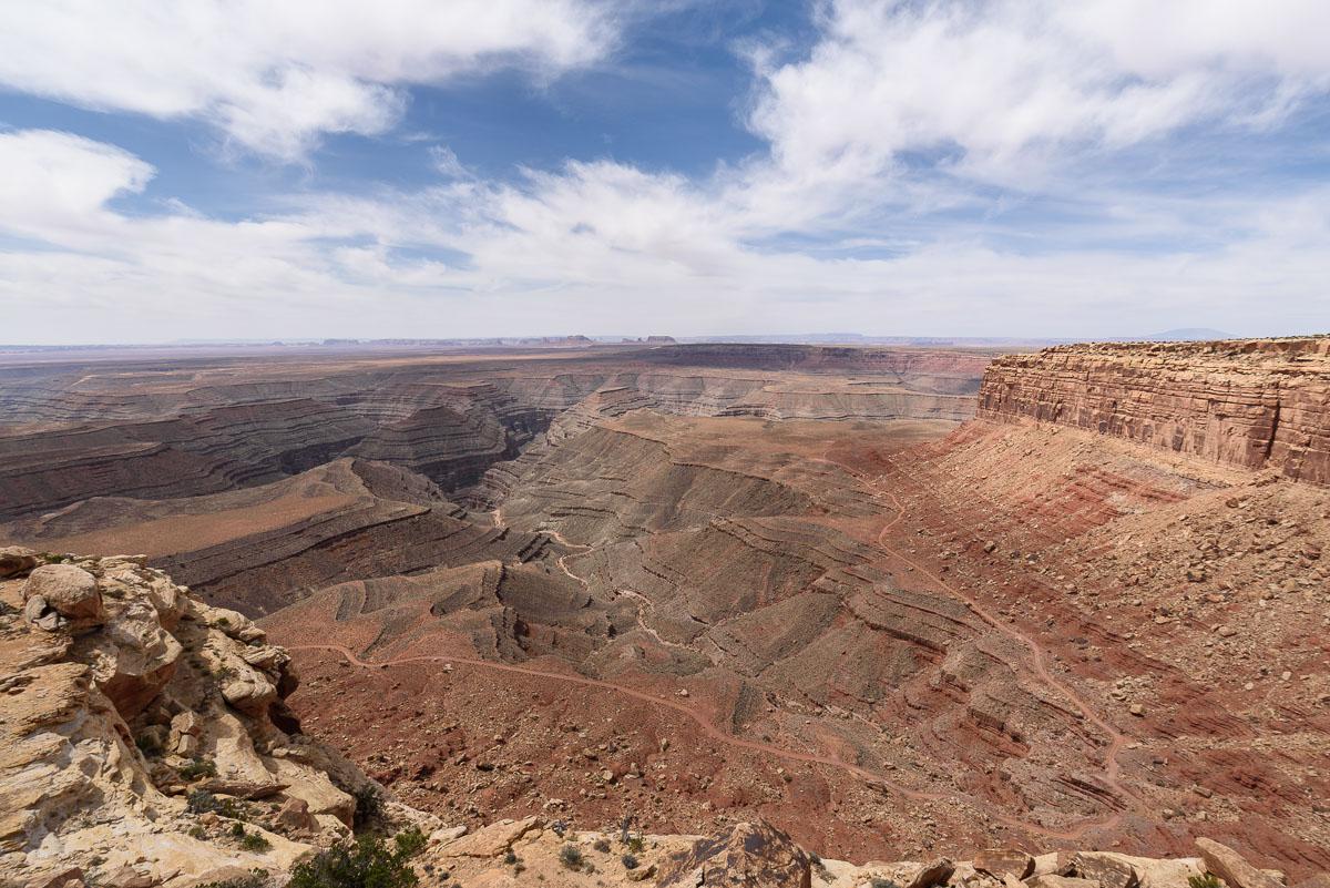
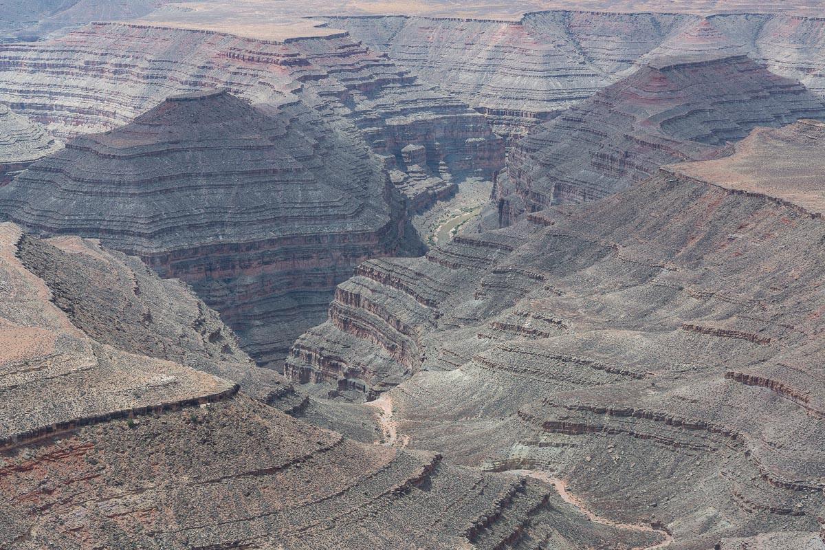
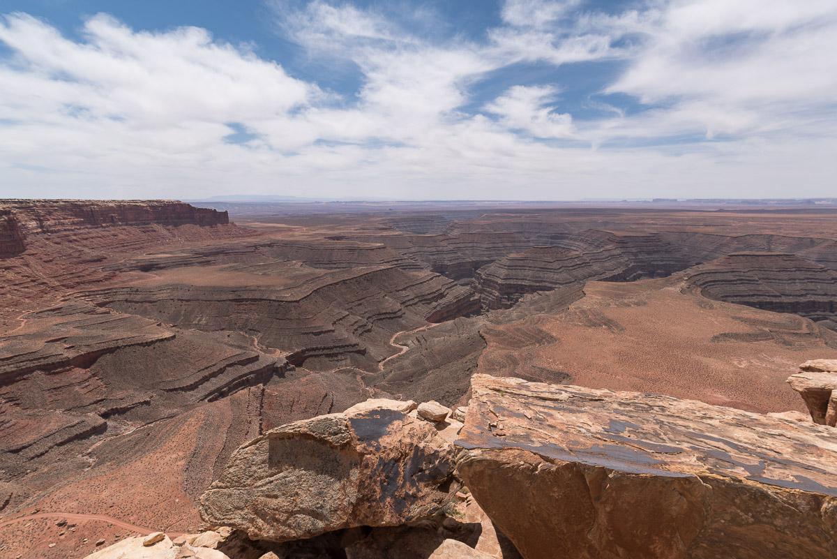
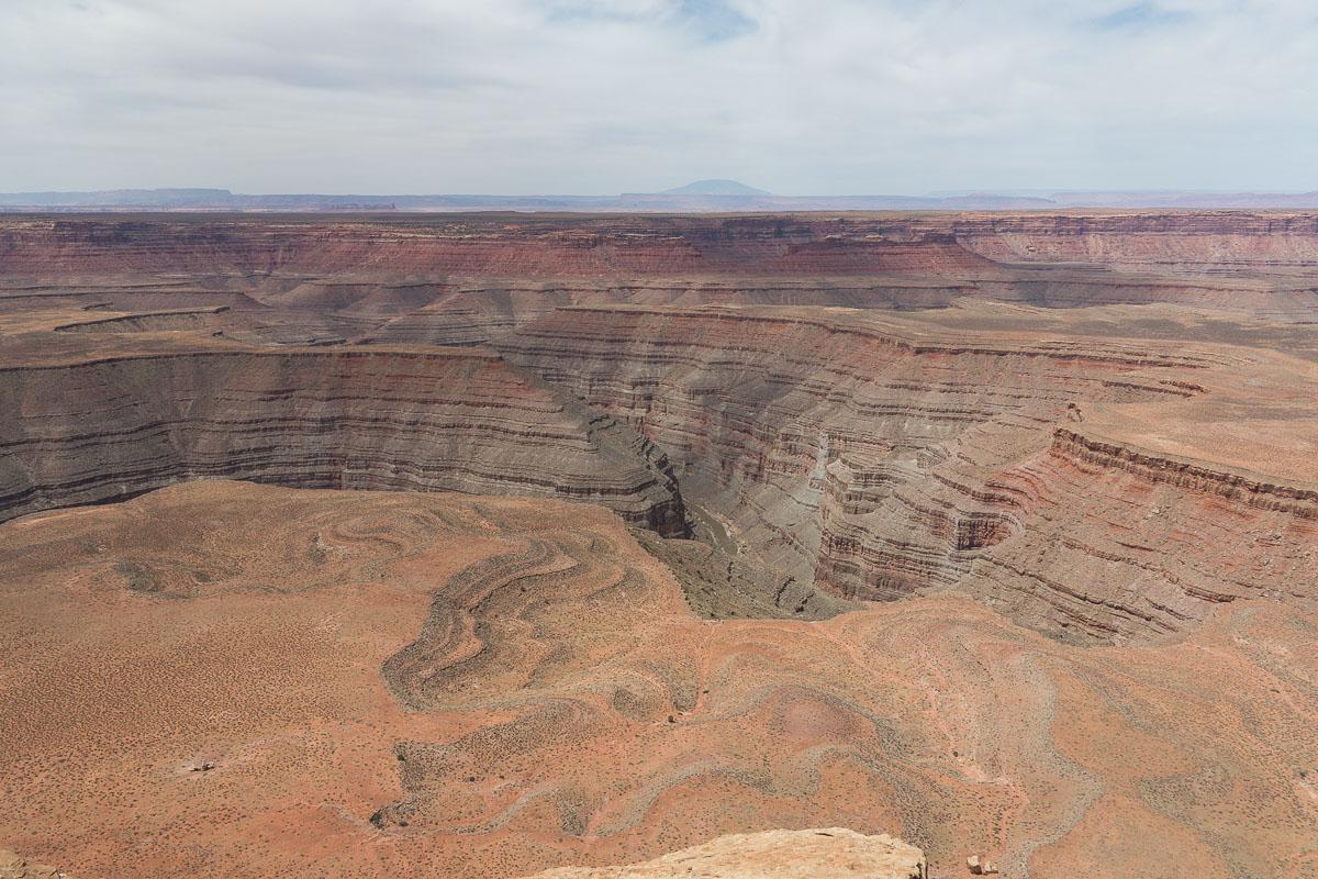
Muley Point
![]()
No hike
![]() 1 to 2 hours
1 to 2 hours
![]()
Free

GPS tracks to download
These are two viewpoints : the first is pretty but the second is less interesting.
Access : the trail is located before the descent of the Moki Dugway. It is a mixture of corrugated iron and earth. The first viewpoint of view is at 4 miles and the 2nd is 1,3 miles further, the track is almost only corrugated iron.


Lodging
We have tested :
Copyright Magali and David BELLEC