![]()
![]()
![]()
![]()

In this page, you will find informations and advices we can give, based on our experience
Waterfalls of the North Umpqua Highway - Oregon
What to do if you have little time : Whitehorse Falls, Toketee Falls
Highway 138, also known as the North Umpqua Highway, runs from East to West from I5 to I97. The portion between Glide and Diamond Hill is absolutely stunning and lined with a lot of cascades of all kinds.
The best advice to see these falls and especially to photograph them is to favor the morning or the late afternoon, that is to say the moments when the waterfalls are in the shade. This avoids the strong contrasts between very bright areas lit by the sun and the dark areas.
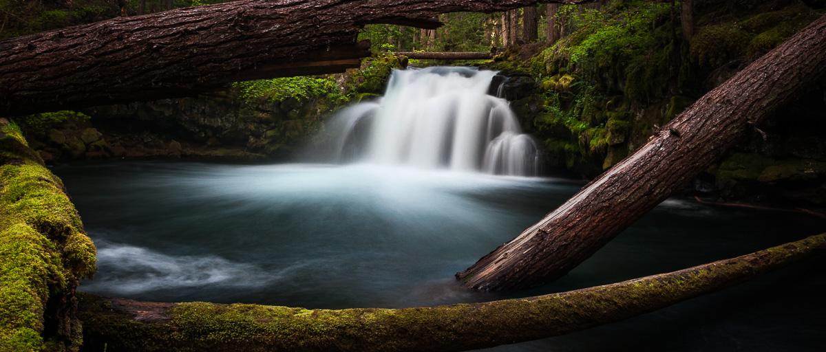
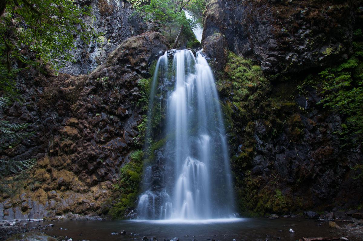
Whitehorse Falls
![]()
 No hike
![]() 1 hour
1 hour
![]()
Free

N 43° 14' 51.5"
W 122° 18' 17.1"
Beautiful waterfall, easily accessible by road as well as by walk. A wooden promontory is laid out and allows to se the waterfall from above. Although the view is beautiful from this gateway, try to go down to the river to have views of the waterfall surrounded by tree trunks.
This is one of our favorites in Oregon
Accès : on highway 138, 13.6 miles north of Diamond Lake, take exit to Whitehorse Falls.

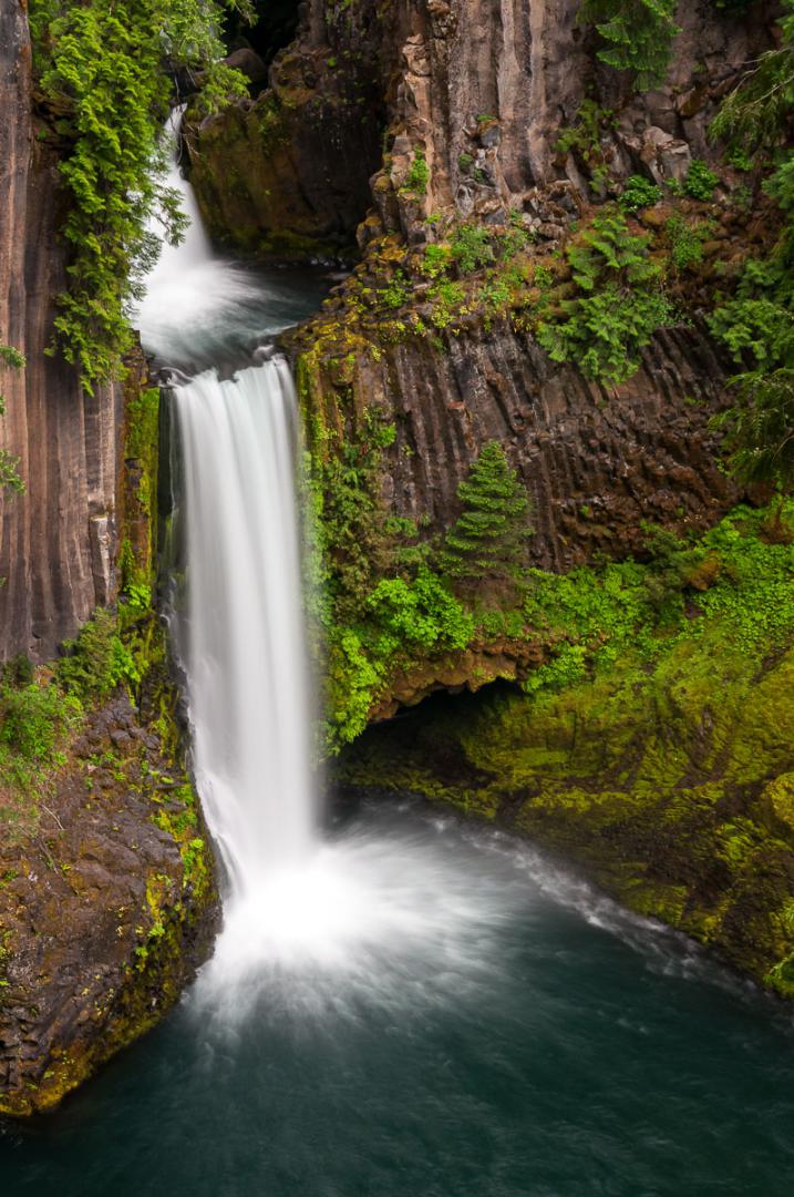
Toketee Falls
![]()
0,4 mile one way
![]() 1 hour
1 hour
![]()
Free
N 43° 15' 49.3"
W 122° 26' 00.3"
![]()
GPS trail to download
One more pretty waterfall. It is surrounded by basalt columns. It is actually a double fall. Its first smaller portion is difficult to see from the viewpoint. Toketee is visible from a boardwalk which is reached after a 0.8 mile roundtrip walk. This is not a very long walk but this trail is laid out and there are a hundred steps up and as much down. It is better to go in the morning because the falls can be quickly in the sun.
Access : another waterfall accessible from highway 138. Take the NF 34 for 1000 feet, turn left to cross the bridge and immediately left again.

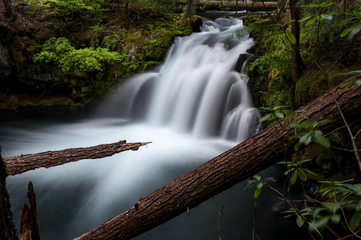
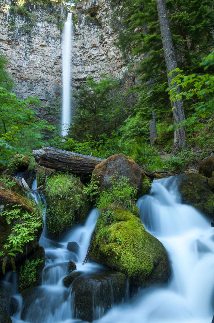
Fall Creek Falls
![]()
1 mile one way
![]() 1 hour
1 hour
![]()
Free
N 43° 19' 08.6"
W 122° 50' 23.6"
This beautiful waterfall evokes a bridal veil. It is completely in the shade and there is a mysterious side that reigns here. The hike which leads to it is 1,9 miles roundtrip.
Access : from Glide, take highway 138 East for 16 miles and turn left towards Fall Creek.
.jpg)
.jpg)
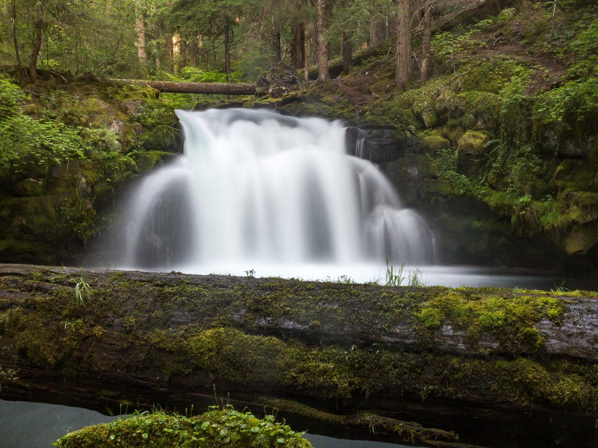
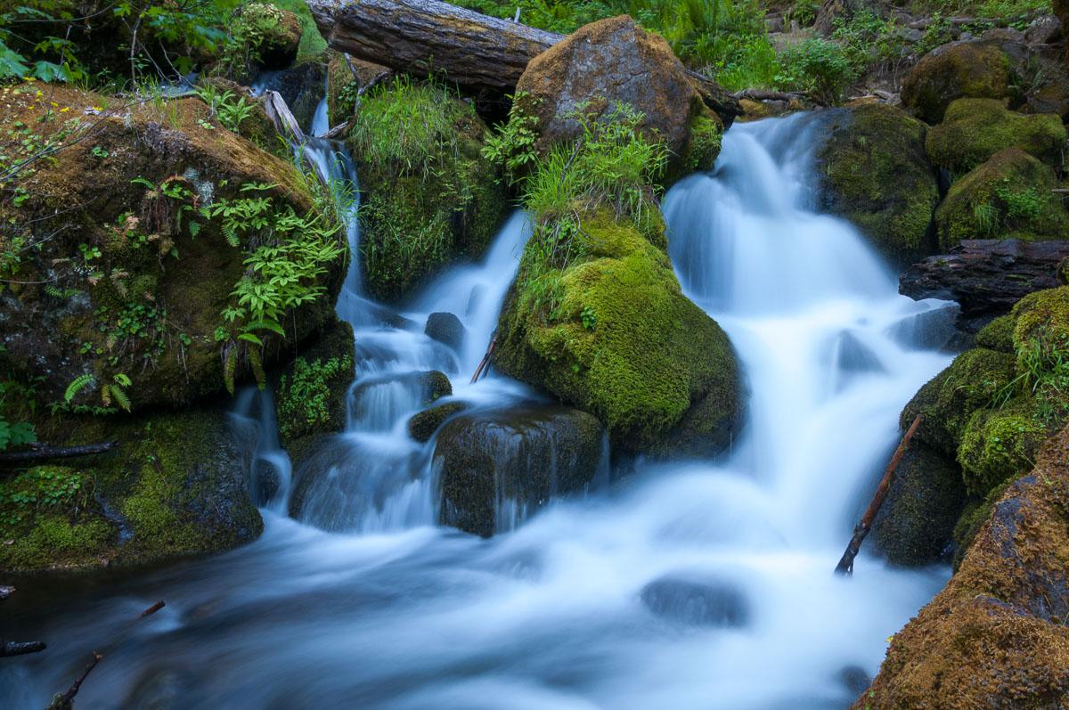
Watson Falls
![]()
0,3 mile one way
![]() 1 hour
1 hour
![]()
Free
N 43° 14' 29.4"
W 122° 23' 24.2"
This short hike af 0.6 mile roundtrip is going to a big cascade in the forest. The river downstream is also very photogenic.
Access : from highway 138, take NF 37. After 450 feet, park on your right.
.jpg)
.jpg)
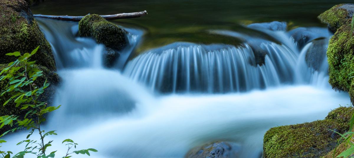
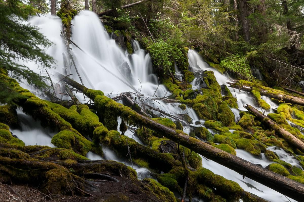
Clearwater Falls
![]()
No hike
![]() 15 to 30 minutes
15 to 30 minutes
![]()
Free
N 43° 14' 55.4"
W 122° 13' 40.5"
It could be a beautiful waterfall but a little wasted, in our opinion, by all that tangle of trees. There is no walk to access the waterfall. If you want to get closer to the top of the waterfall, a short walk of 500 feet will be necessary, without difficulty.
Access : from Diamond Lake, take highway 138 north for 8,7 miles to the sign for Clearwater Falls.


To see around
Lodging
We have tested :
Copyright Magali and David BELLEC