![]()
![]()
![]()
![]()

In this page, you will find informations and advices we can give, based on our experience
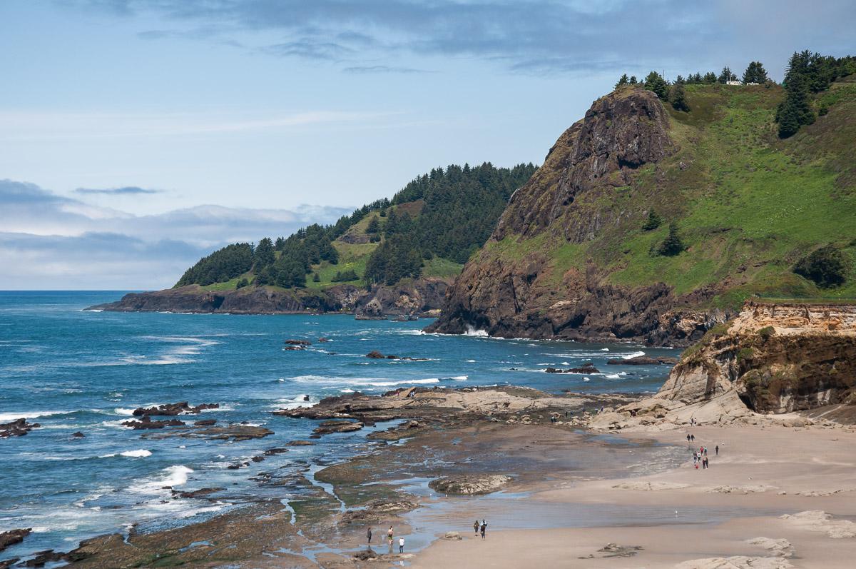
Pacific Coast - Oregon
What to do if you have little time : Thor's Well, Bandon, Oregon Dunes
Pacific Coast in Oregon, about 250 miles long, has a lot to explore : beaches, lighthouses and of course waterfalls. Make your choice !
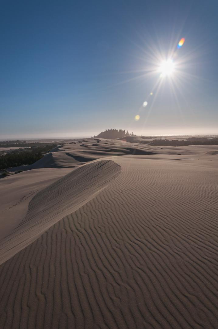
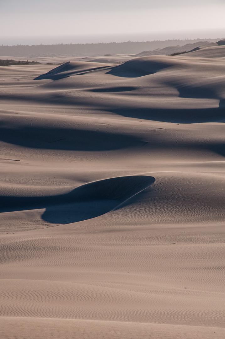
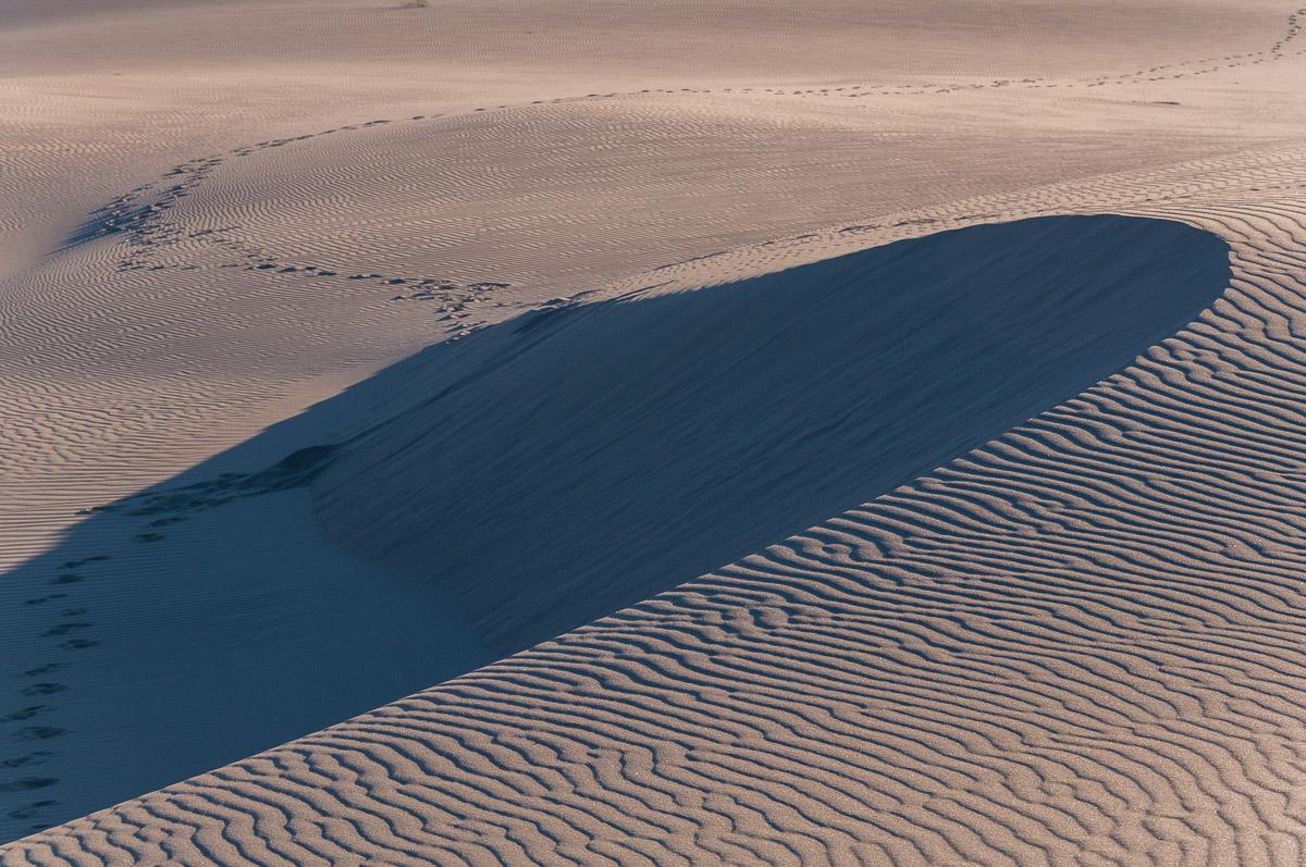
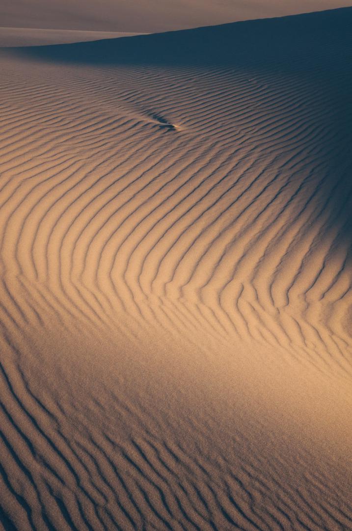
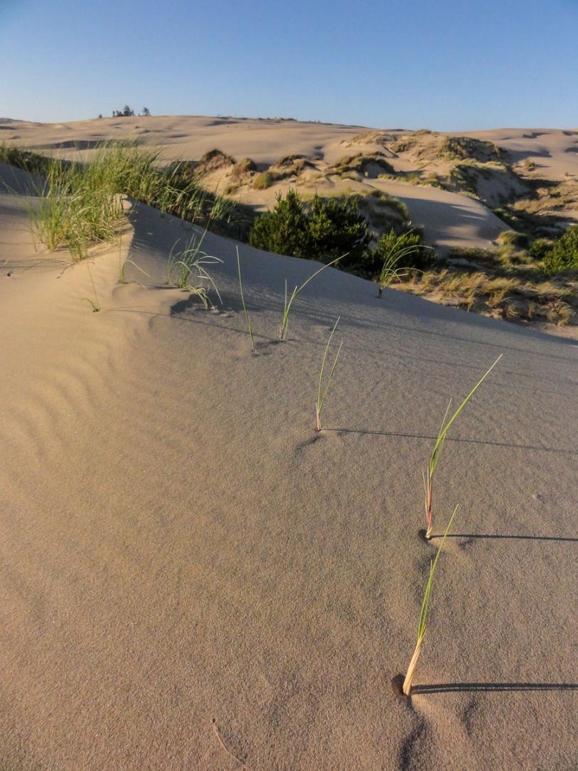
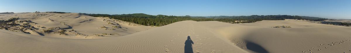
Oregon Dunes National Recration Area
![]()
 Depending on wish
![]() 2 to 3 hours
2 to 3 hours
![]()
5$ per vehicle
This park is a desert of white sand on US101 along the Pacific coast, between Coos Bay and Florence. This site is not free (5$ per vehicle per day) and it is not included in the pas "America the Beautiful". We used the John Dellenback Trail to go on the dunes. It's better to go in this park in late afternoon to have the best light. But keep in mind that the parking lot closes at 7 pm, so if you plan to stay here until sunset, you will have to park along US 101 and not in the parking lot.
Access : on US 101 between Winchester Bay and Hauser, take exit to Eel Creek Campground.


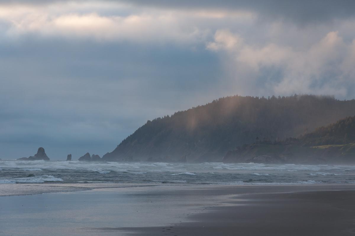
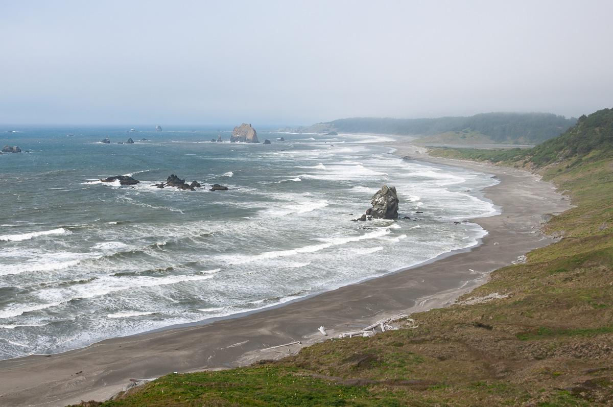
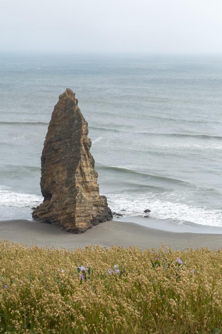
Bandon
![]()
No hike
![]() 1 hour
1 hour
![]()
Free
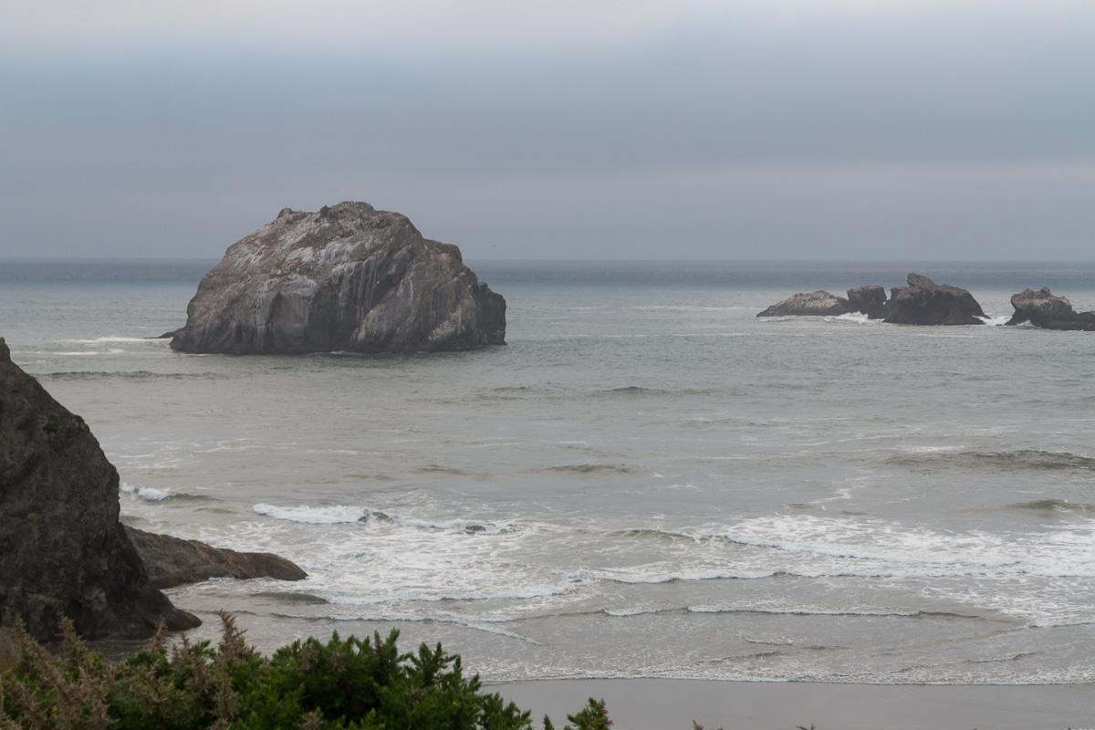
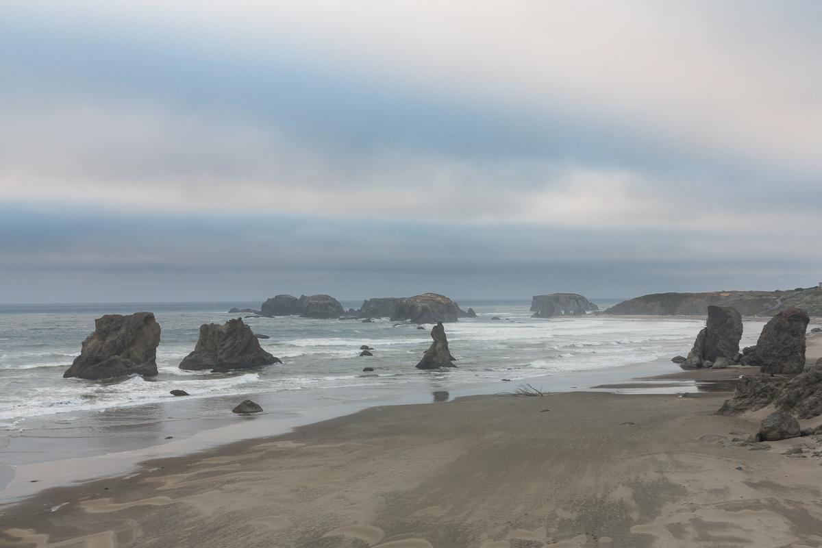
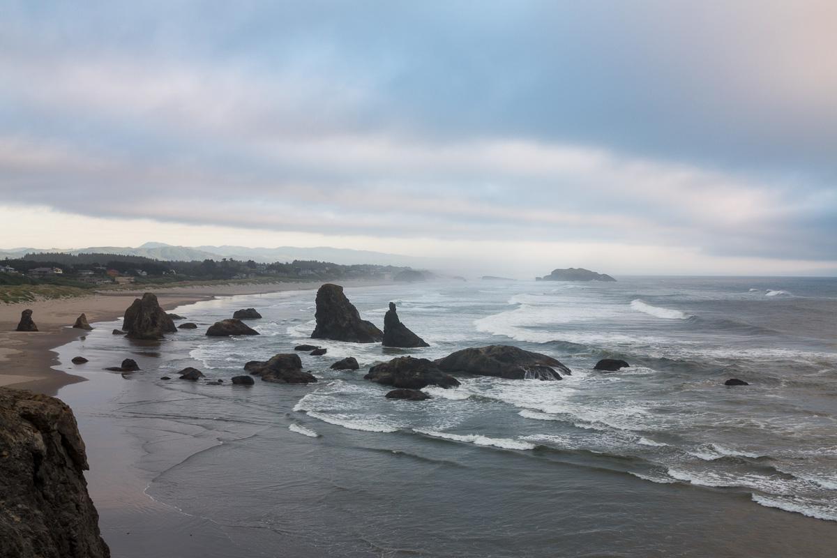
Nice beach with large submerged rocks, especially photogenic at sunset. Some of these rocks, with a little imagination, look like a face (Face Rock). There is a nice viewpoint at Face Rock State Scenic Viewpoint. It is also possible to go down to the beach.
Access : Bandon is located on US 101, in the south of the state. To access the viewpoint follow signs Face Rock SSV.
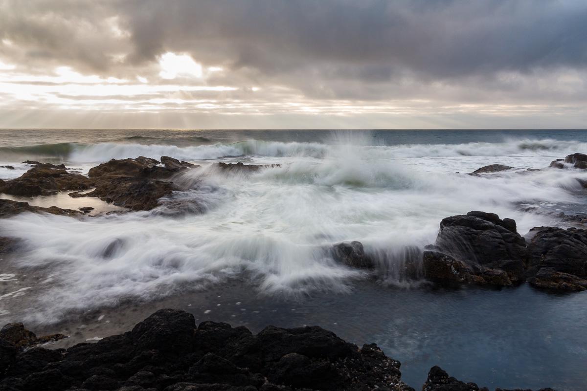
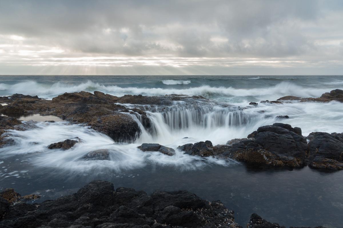
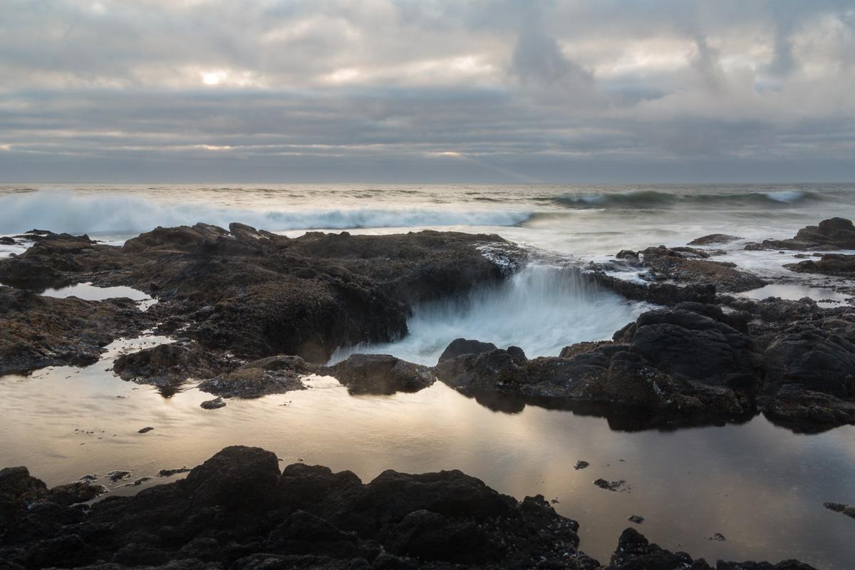
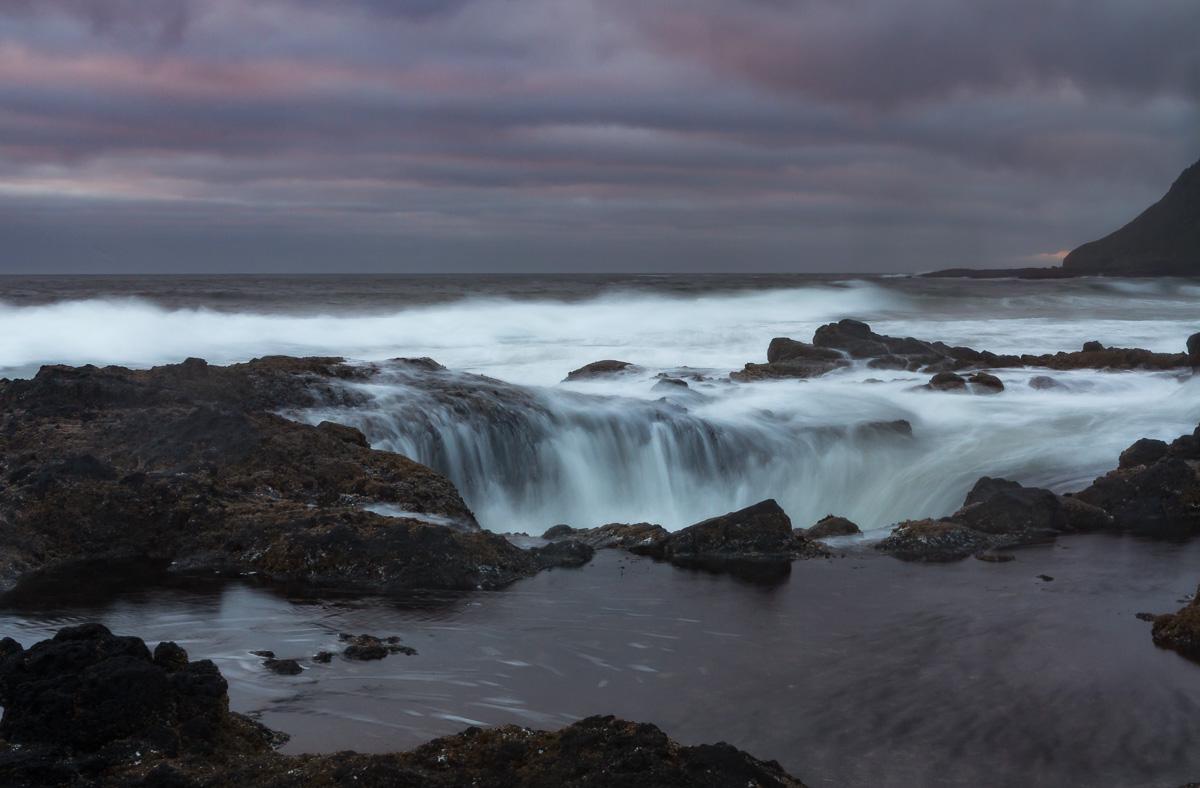
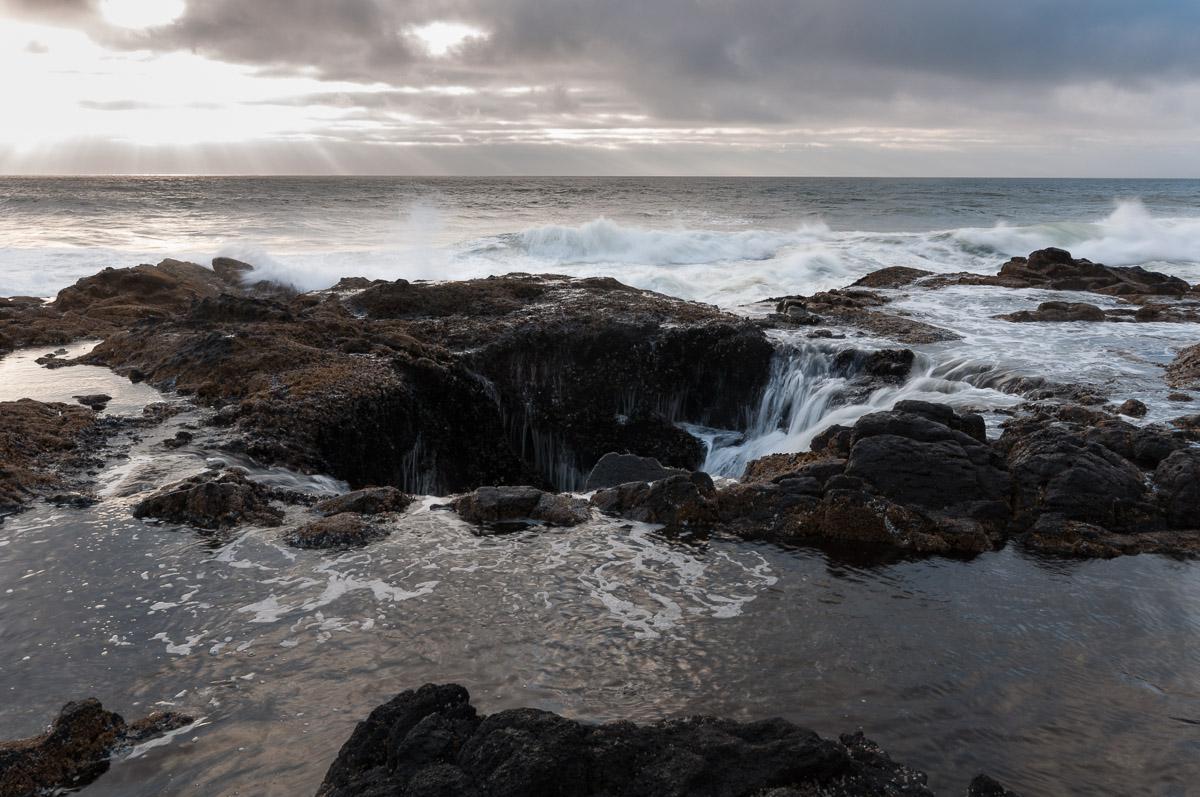
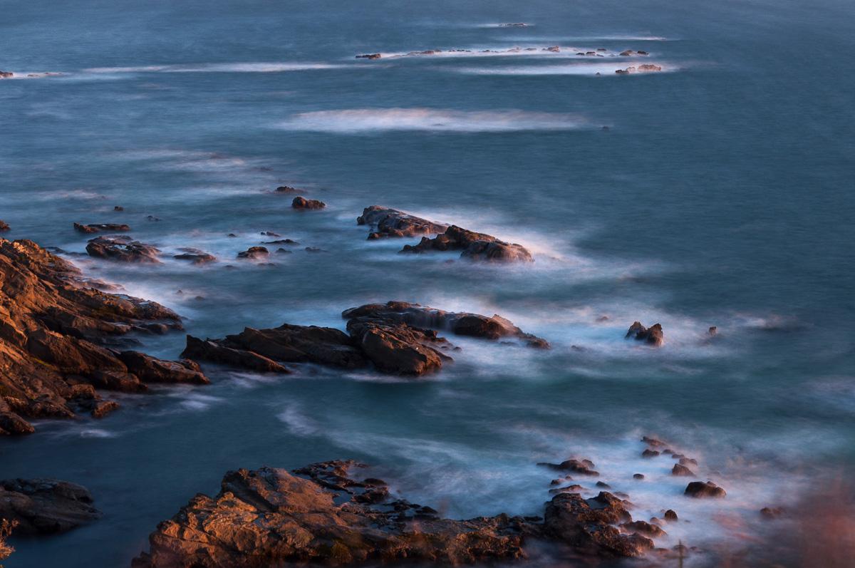
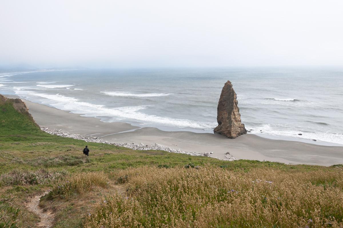
Thor's Well
![]()
No hike
![]() 1 hour
1 hour
![]()
Free

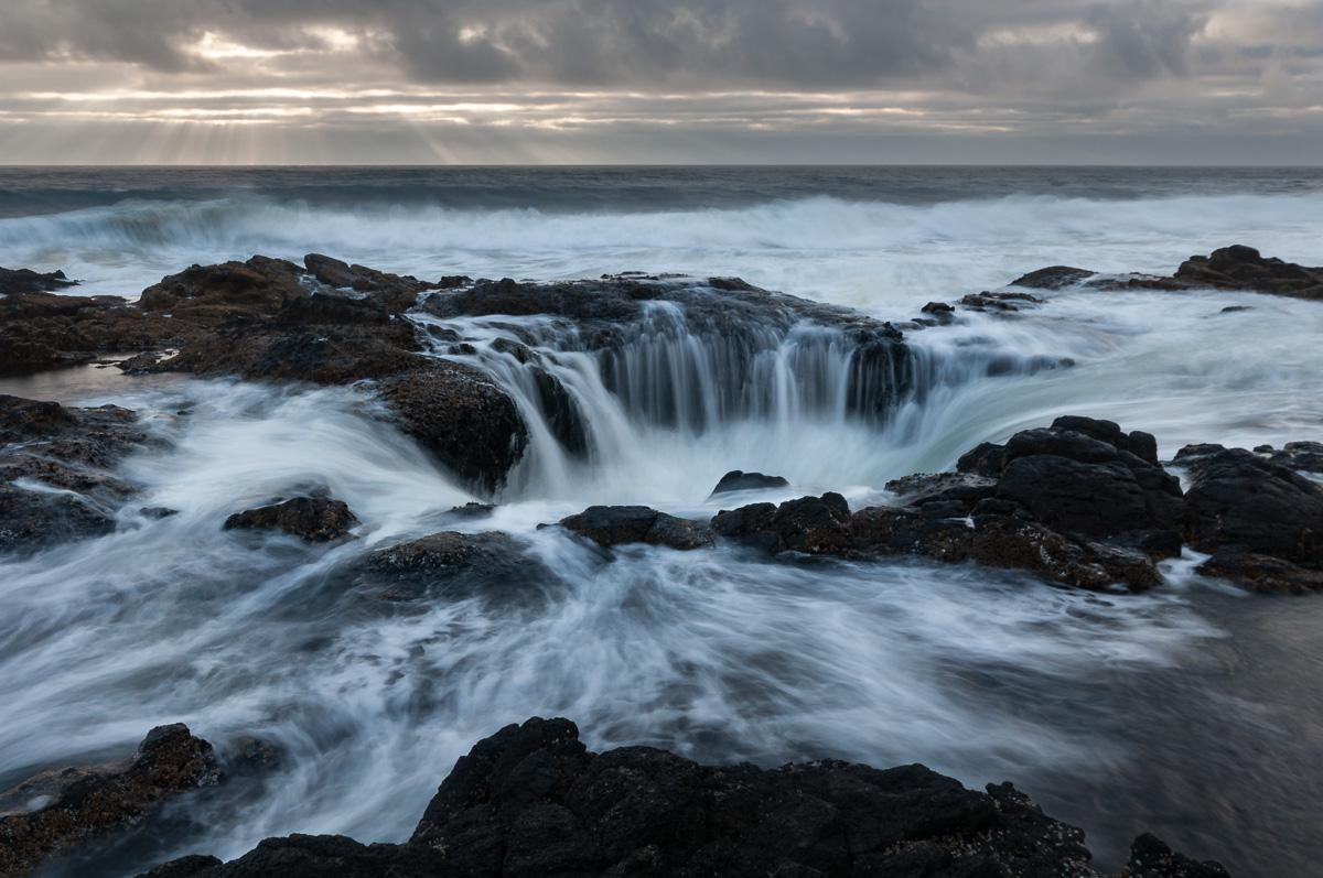
N 44° 16' 42.6"
W 124° 06' 48.7"
Thor's Well is a natural hole in the rocks. This is a kind of siphon through which water rushes and gushes with the waves. It's a really impressive place but can be proven to be very dangerous for the unwary. This site is very popular with photographers at sunset, it is almost like the sunrise at Mesa Arch in Utah.
Access : Thor's Well is located on US 101, about 5 minutes south of Yachats. Park in the car park on the roadside.
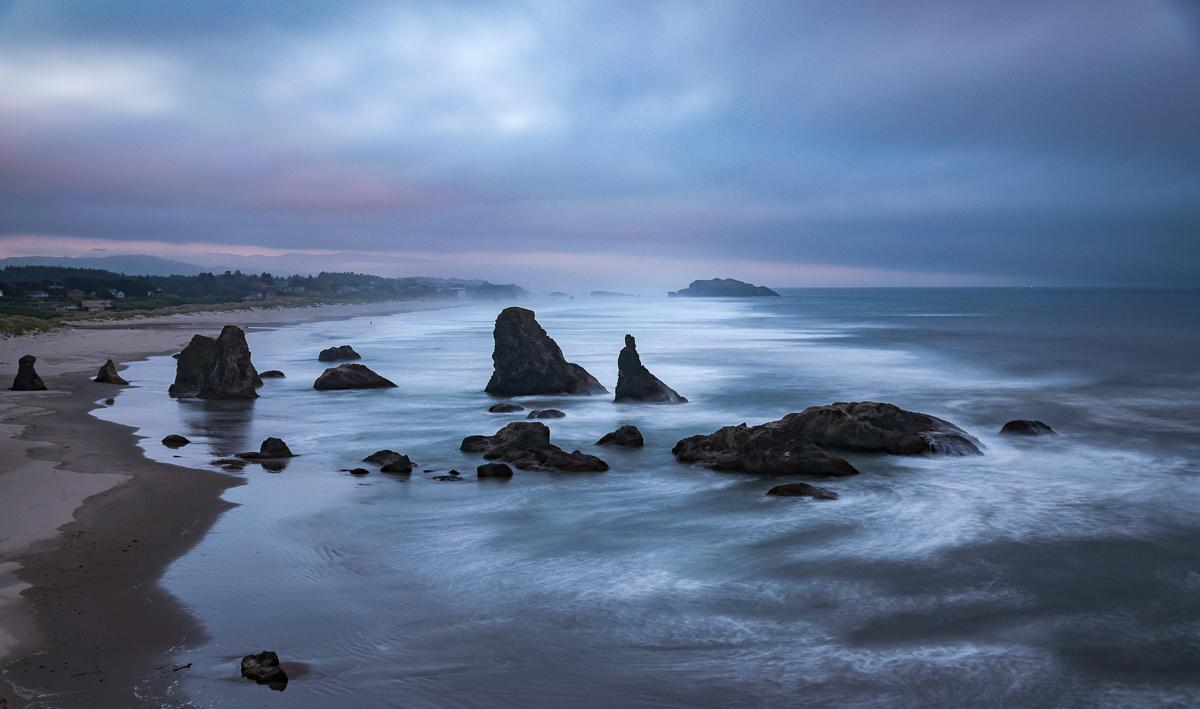
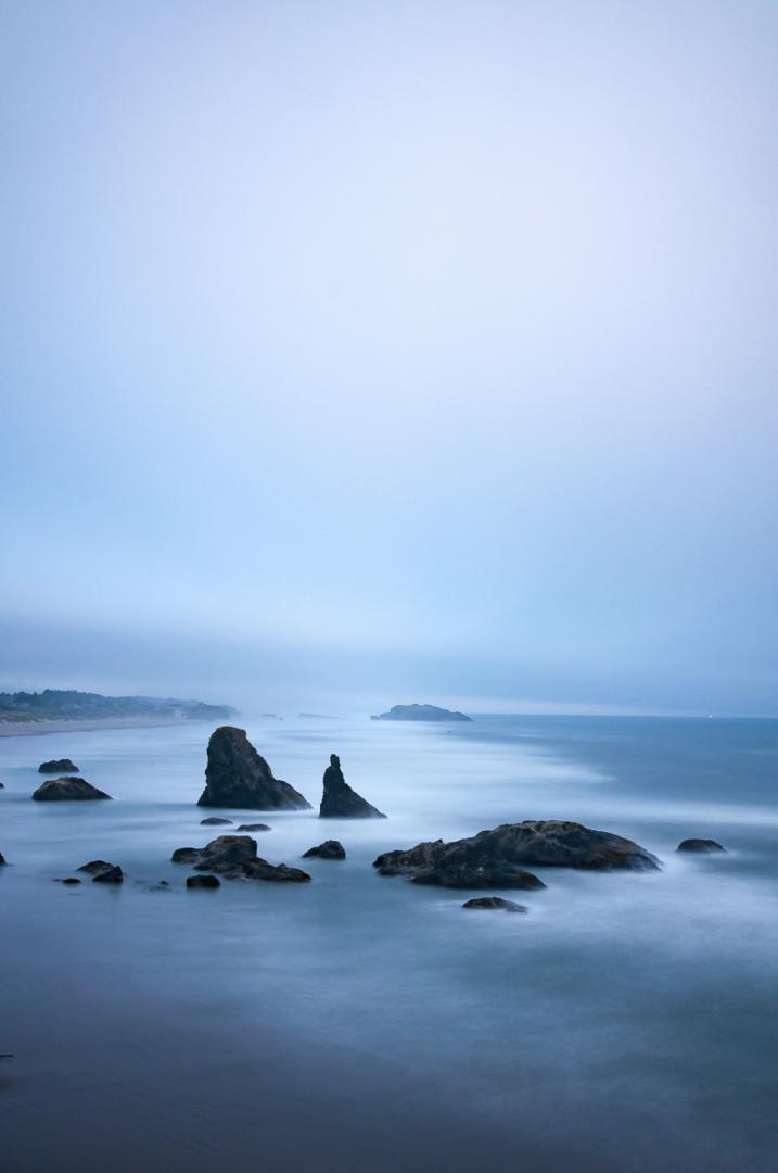
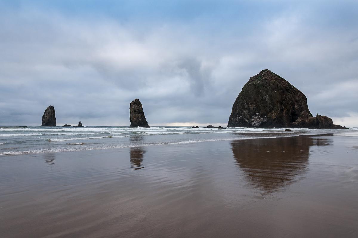
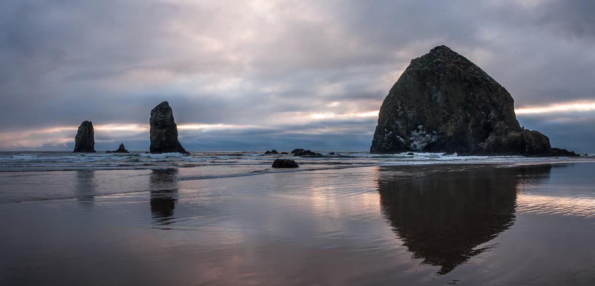
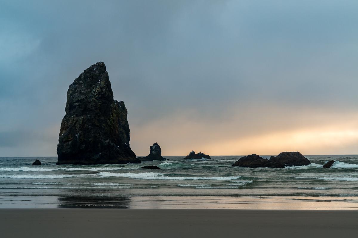
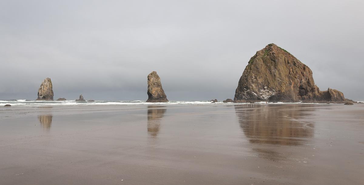
Cannon Beach
![]()
No hike
![]() 1 hour
1 hour
![]()
Free
Cannon Beach is one of those beautiful Pacific coast beaches. As in Bandon, there are huge submerged rocks including the famous Haystack Rock. Best done at sunset.
Access : Cannon Beach is located on US 101 about 1h30 drive west of Portland.


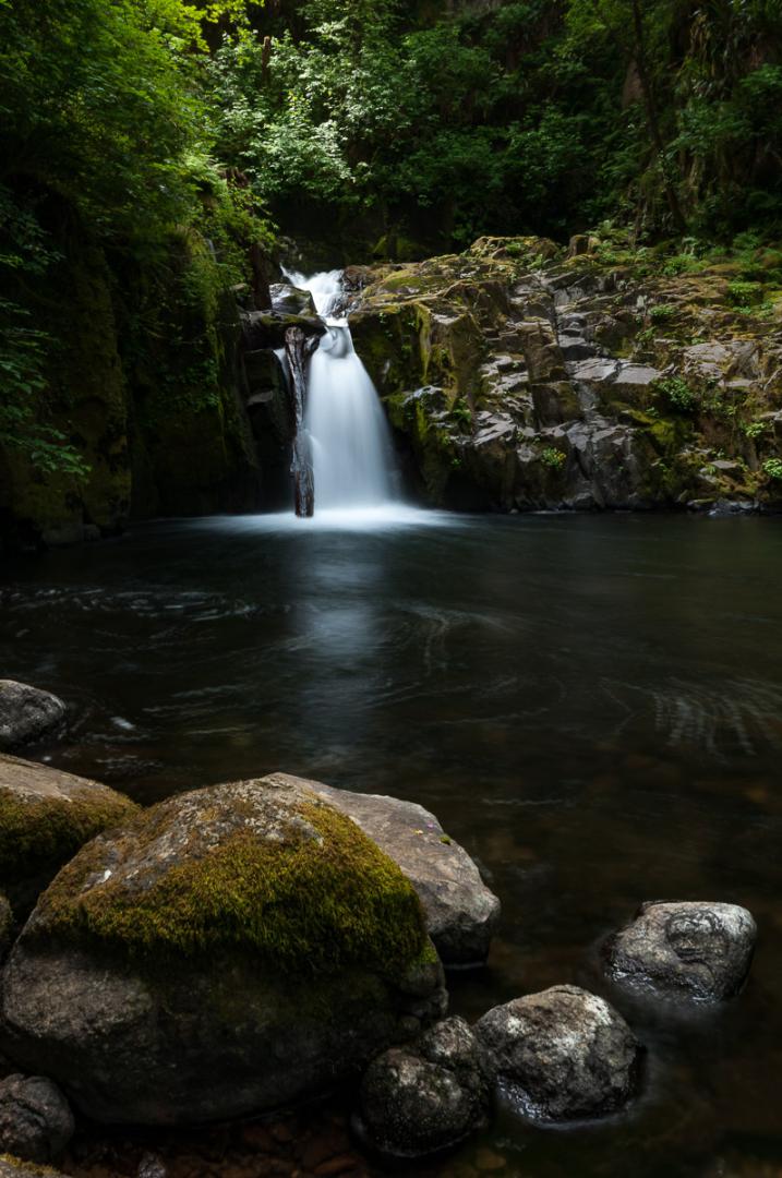
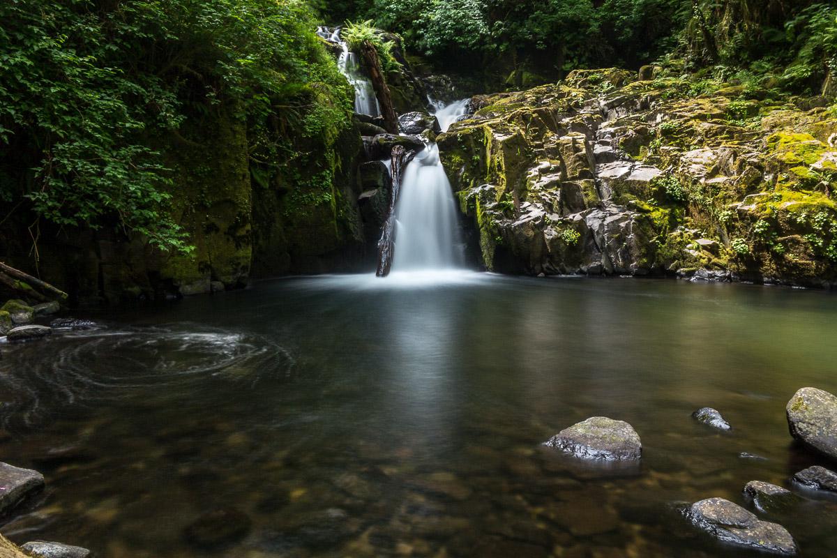
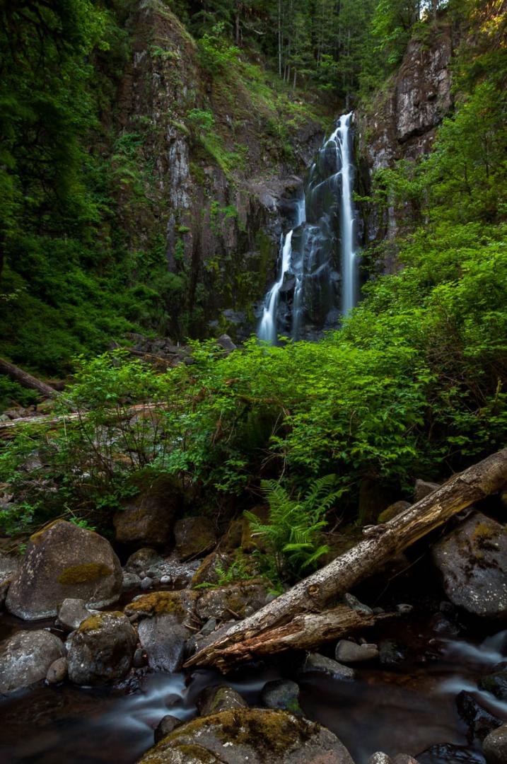
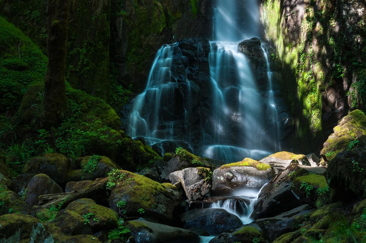
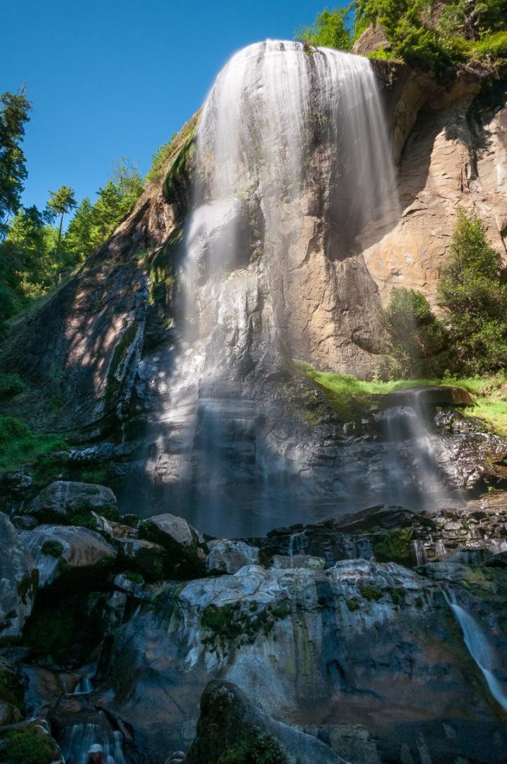
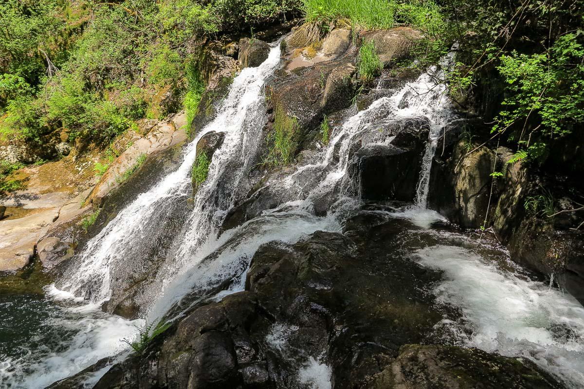
Sweet Creek Falls
![]()
1,1 mile one way
![]() 2 hours
2 hours
![]()
Free

GPS tracks to download
![]()
GPS trail to download
Small but photogenic waterfall, surrounded by trees as often in Oregon. It's best to be there when the sun is not too high in the sky. A 2.2 miles roundtrip hike allows to access the falls.
Access : from the coastal city of Florence, take OR 126 East for 14.8 miles to the tpwn of Mapleton. Once in Mapleton, turn right to cross the river and then immediatly right again on Sweet Creek Road. Continue on this road for 10,6 miles. The trailhead will be on the right.

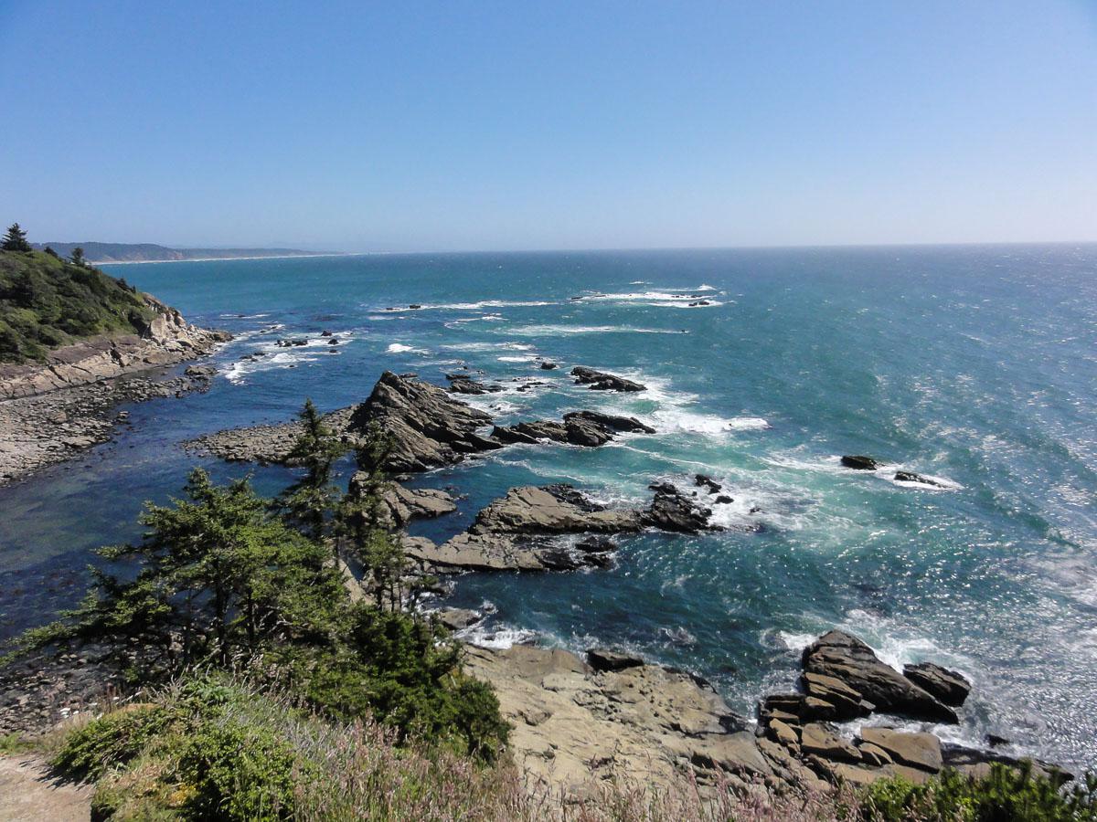
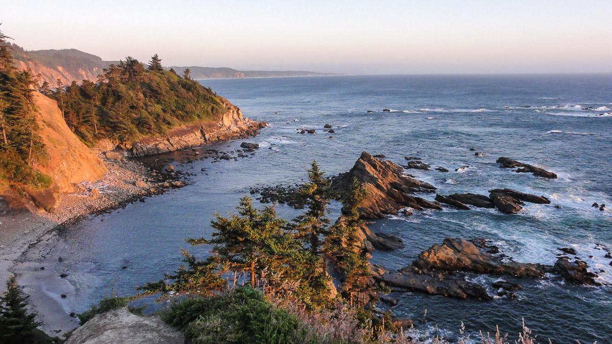
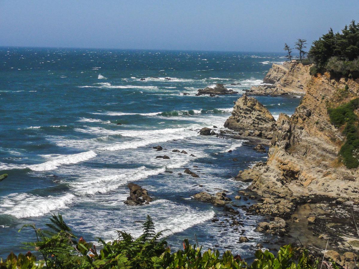
Cape Arago State Park
![]()
No hike
![]() 1 hour
1 hour
![]()
Free
It's a viewpoint on the Pacific Ocean, perfect for sunset. On the same road, there are other viewpoints, such as Sunset Bay, Simpson Reef, where you can see sea lions...
Access : from US 101, between North Bend and Coos Bay, drive west on Newark Avenue for 2,6 miles. Turn left on Cape Arago Highway. Drive through the city of Charleston and continue on Cape Arago Highway until you reach the State Park.

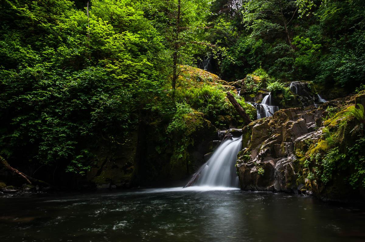
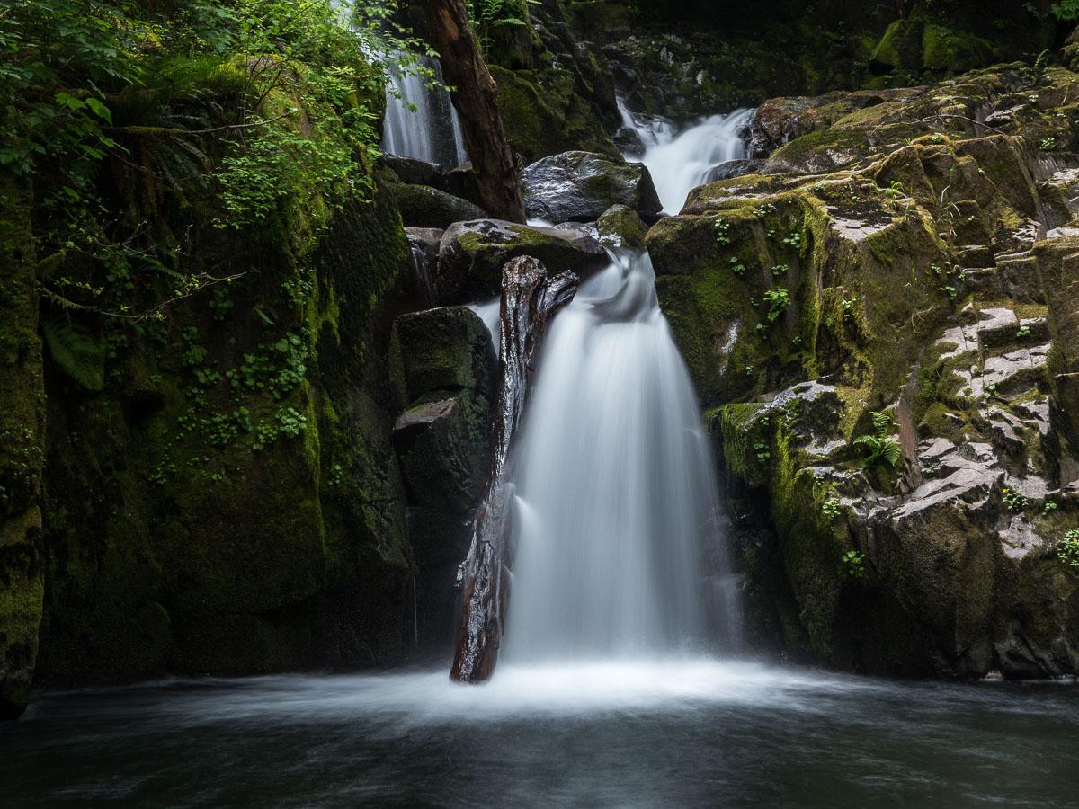
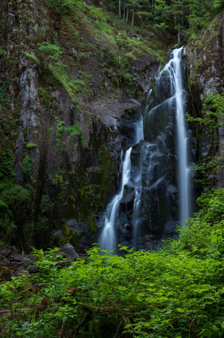
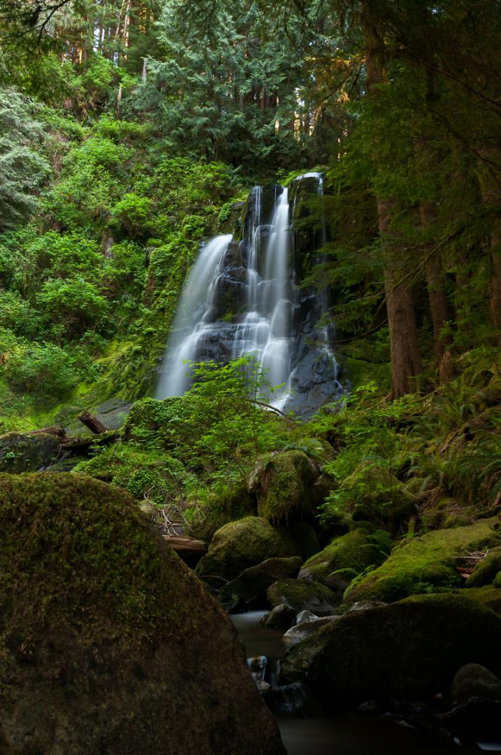
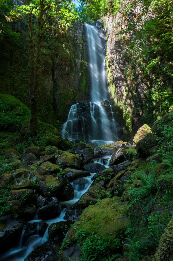
North Fork et Kentucky Falls
![]()
2 miles one way
![]() 2 hours
2 hours
![]()
Free
GPS tracks to download
![]()
GPS trail to download
1,9 mile walk downhill on the go, to access two big waterfalls almost side by side. Best done in the morning or on an overcast day to avoid direct sunlight on waterfalls. North Fork is prettier.
Access : from the town of Mapleton, take the 126 east for 11.8 miles. Turn right on the Siuslaw-Austa Road (No. 4390) for 1.6 miles. Turn right again and follow for 14.9 miles BLM Road 28-1 that becomes BLM Road 1 then National Forest 23 and finally National Forest Road 919. Allow time because it takes almost 1 hour to drive.
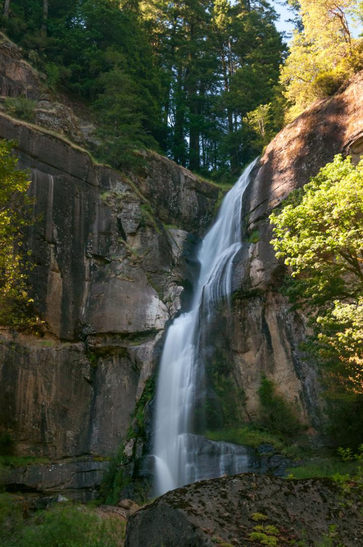
Golden & Silver Falls State Natural Area
![]()
0,9 mile one way
![]() 1 hour
1 hour
![]()
Free
Those waterfalls are located north of Coos Bay. The walk is about 15 minutes to go to Silver falls and 20 minutes to see Golden falls.
Access : from Coos Bay, take eastward Coos River Road then Coos River Hwy 241 then East Fork Road and finally the Glenn Creek Rd. The drive is 23.6 miles and takes about one hour.
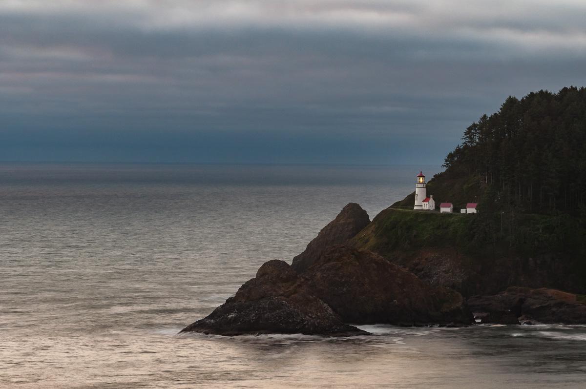
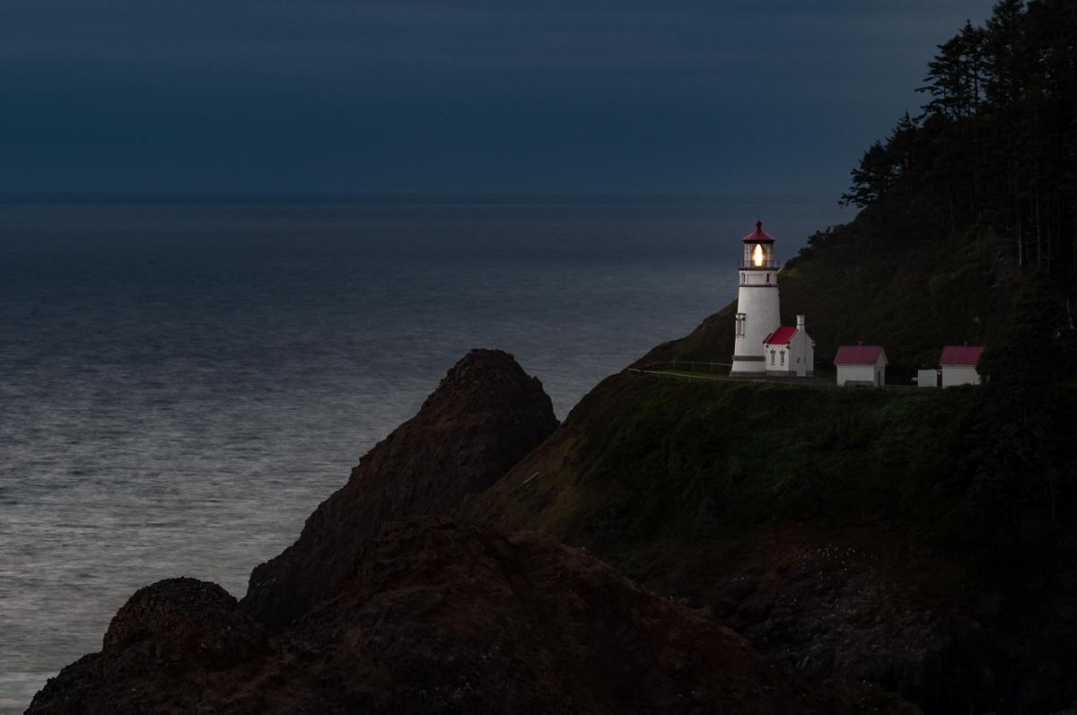
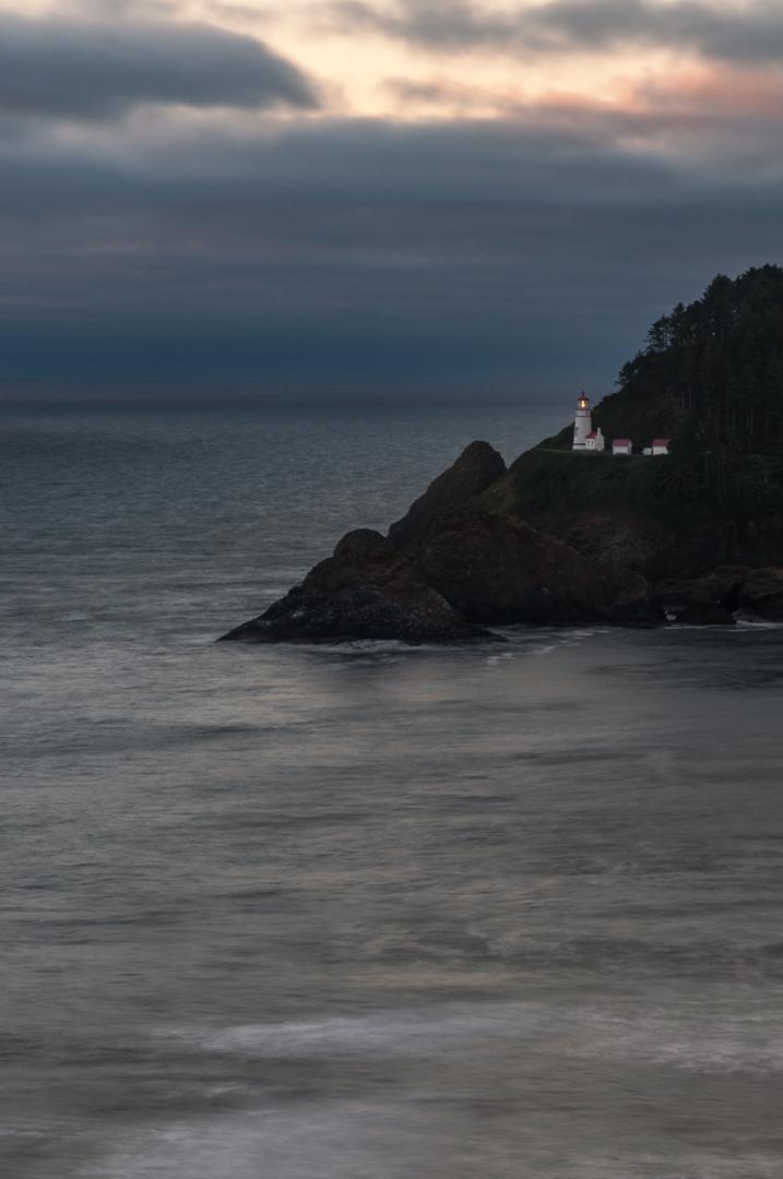
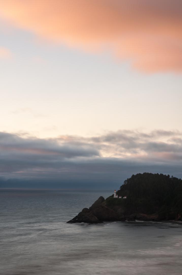
Heceta Head Lighthouse
![]()
No hike
![]() 30 minutes
30 minutes
![]()
Free
Nice viewpoint from where you can see Heceta Head Lighthouse. Very photogenic at sunset.
Access : this viewpoint is located on US101, about 13,6 miles south of Yachats.

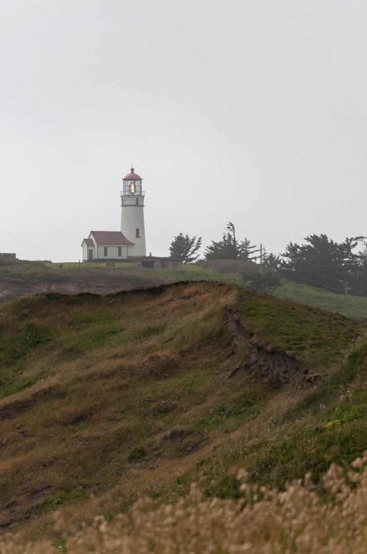
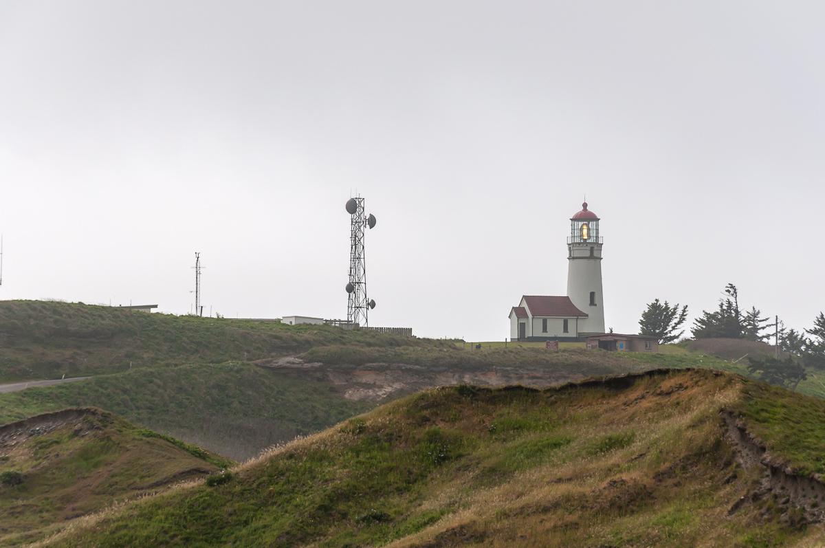
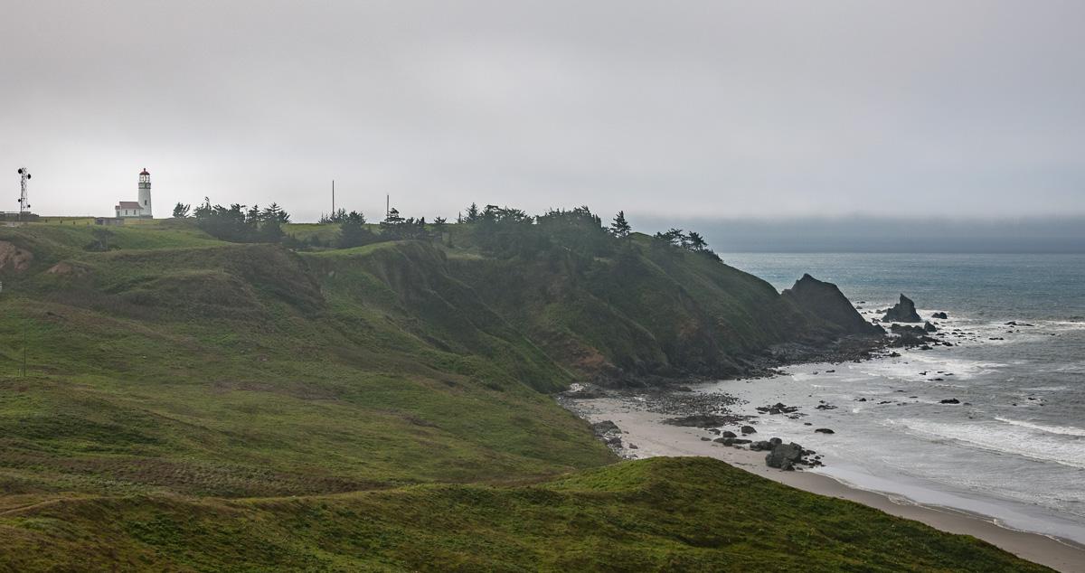
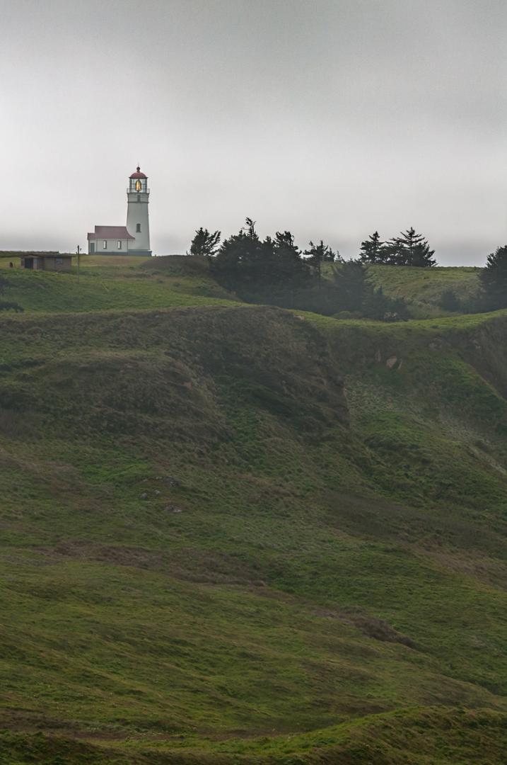
Cape Blanco
![]()
No hike
![]() 30 minutes
30 minutes
![]()
Free
View over the coast and the Cape Blanco lighthouse. There is also a nice rock on the beach.
Access : from Bandon, take US101 south for 22,3 miles and turn right on Cape Blanco Road for 3,5 miles.

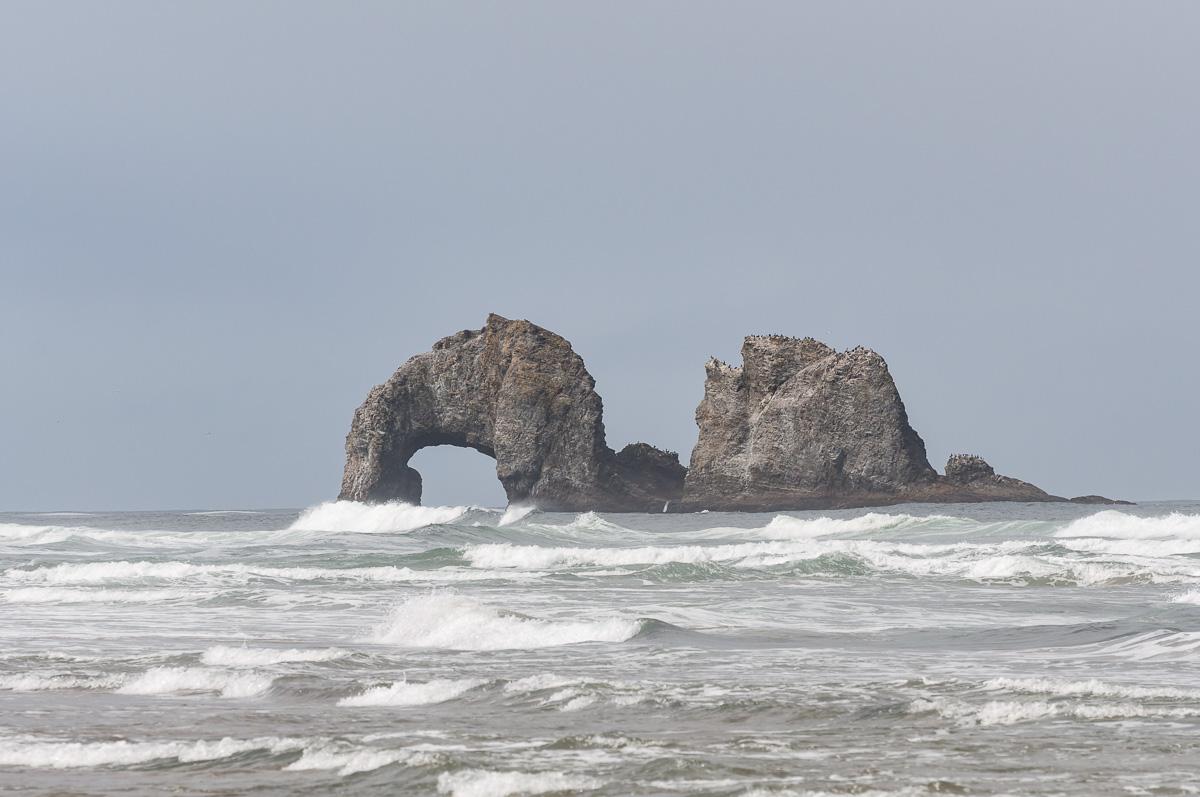
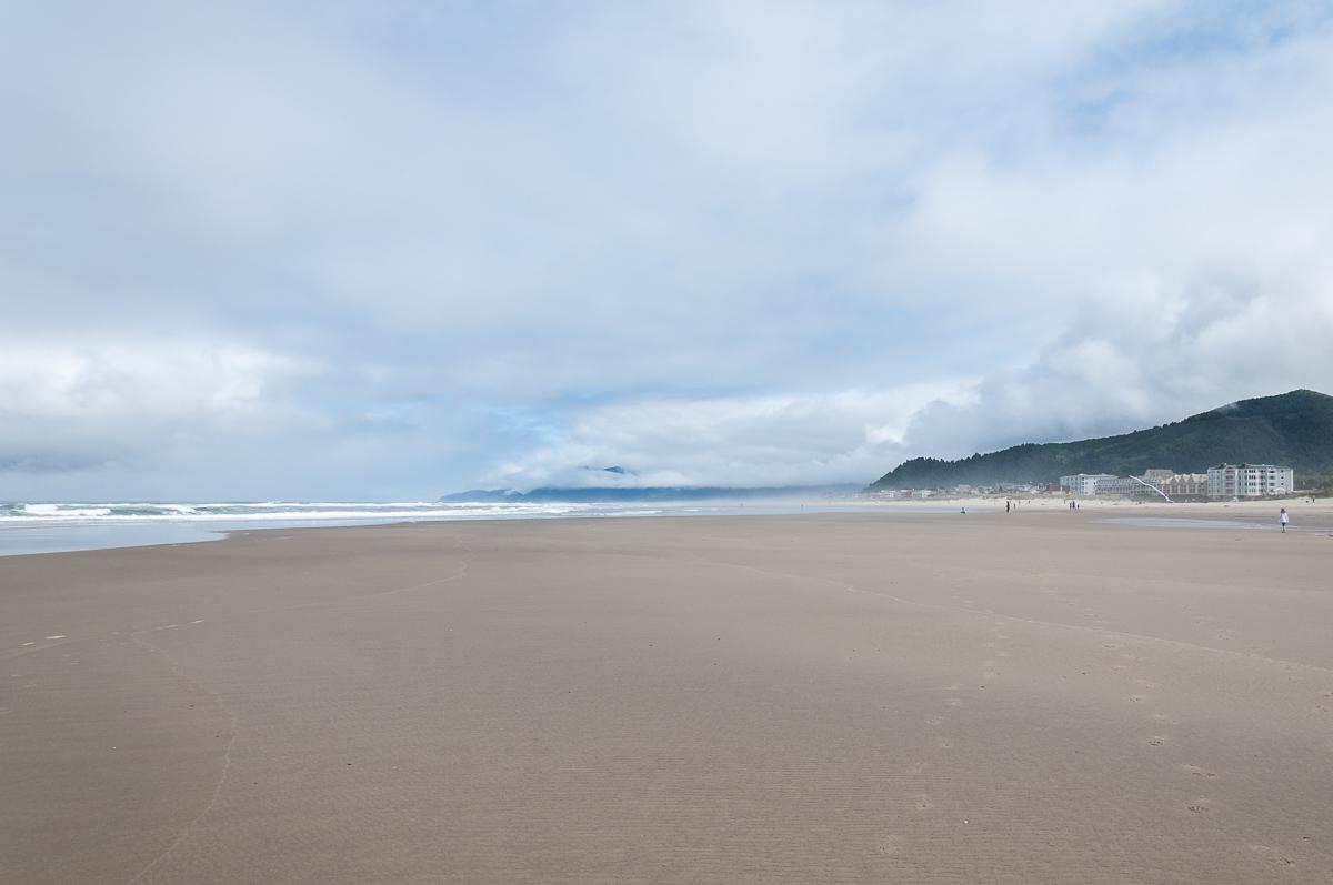
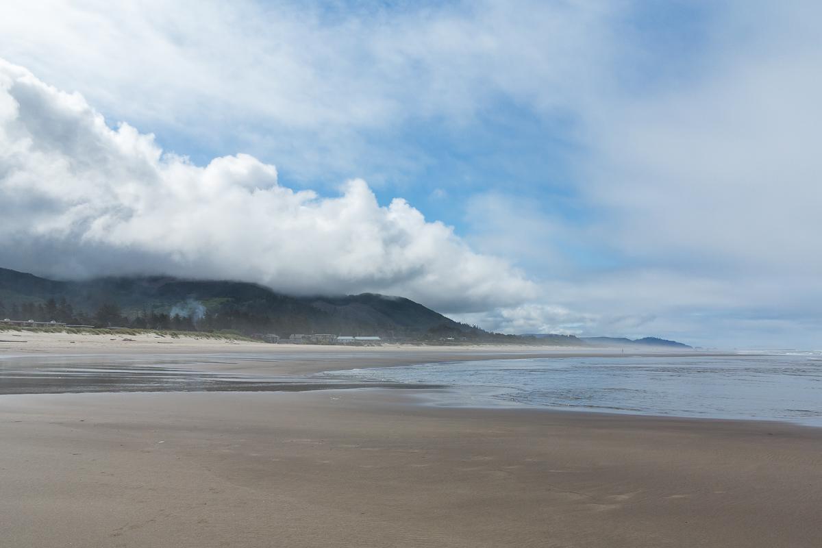
Rockaway Beach
![]()
0,6 mile one way
![]() 30 minutes
30 minutes
![]()
Free
Large sandy beach from where we can see an arch in the sea ... in the distance. Not of a great interest.
Access : Rockaway Beach is easy to find as it is on US 101 at about 1h45 of Portland.
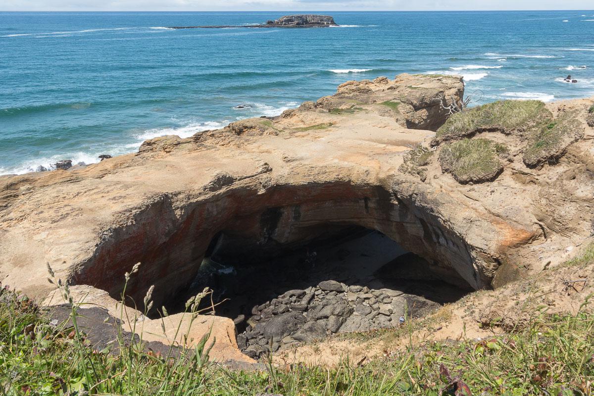
Devil's Punchbowl State Park
![]()
No hike
![]() 30 minutes
30 minutes
![]()
Free
N 44° 44' 50.5"
W 124° 03' 56.5"
This is a hole in cliff edge. The beach is nice, but what really makes the attraction of the place is still not very interesting.
Access : another site easy to locate as it is on US101 at about 8 miles north of Newport.

Beaver Creek Falls
![]()
0,2 mile one way
![]() 30 minutes
30 minutes
![]()
Free
Like most of the waterfalls, it's better to be there when it's in the shade or on an overcast day. This fall could be interesting, provided to go down in the river below. We did not because Beaver Falls was in full sun and we only view it from the top.
Access : from Sweet Creek Falls (see above for access) continue on Sweet Creek Road for 1.5 miles. Then turn left for about 0.3 mile. The trailhead is on the left. The trail is about 0.3 mile roundtrip.
To see around
Lodging
We have tested :
Copyright Magali and David BELLEC