![]()
![]()
![]()
![]()

In this page, you will find informations and advices we can give, based on our experience
Waterfalls of the Columbia River - Oregon
What to do if you have little time : Oneonta Gorge, Elowah Falls, Multnomah Falls
Waterfalls lovers, Oregon and especially the Columbia River Gorge are the place to go. Falls compete with beauty. For most the access is easy, but some require a little more effort. These efforts are amply rewarded.
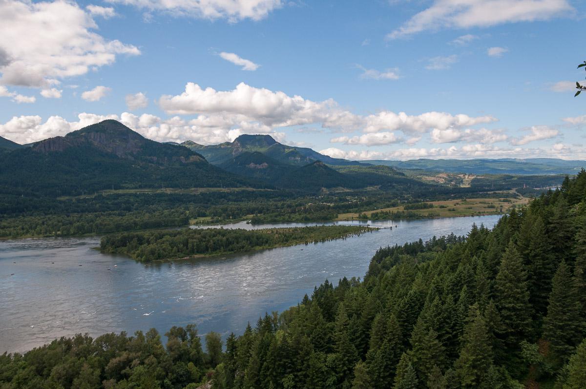
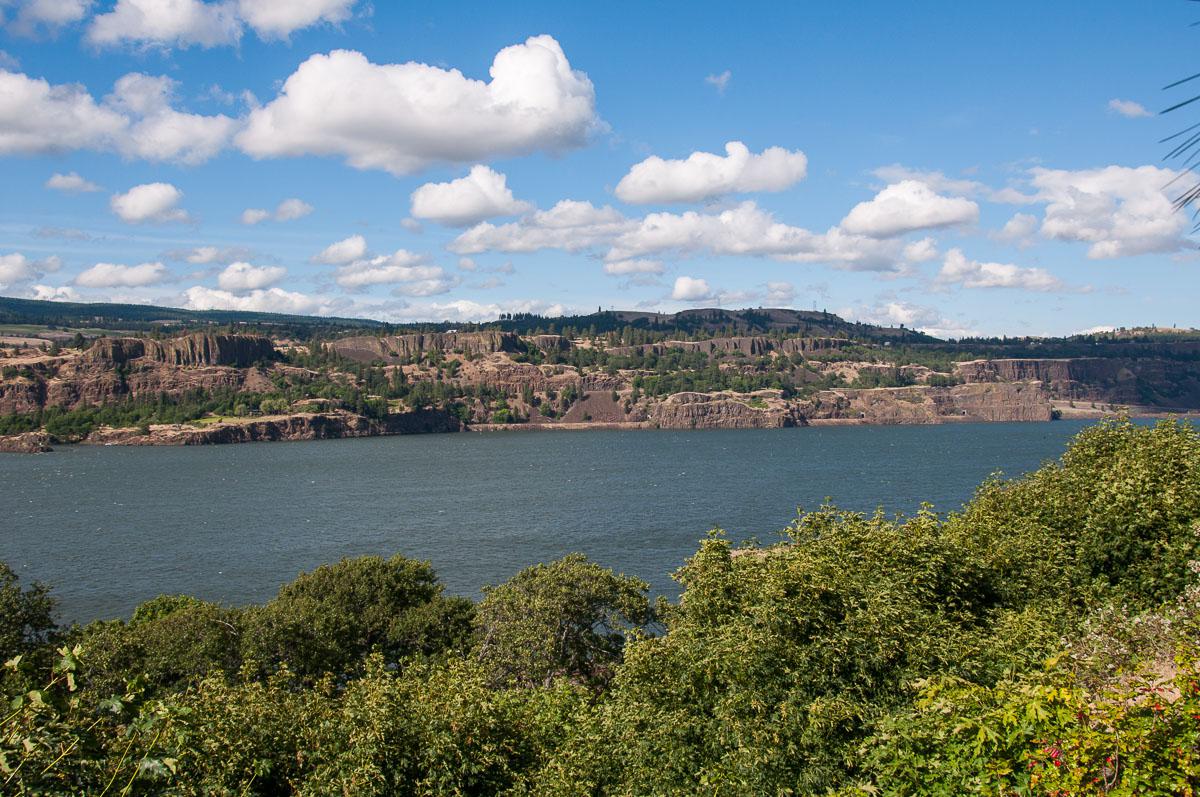
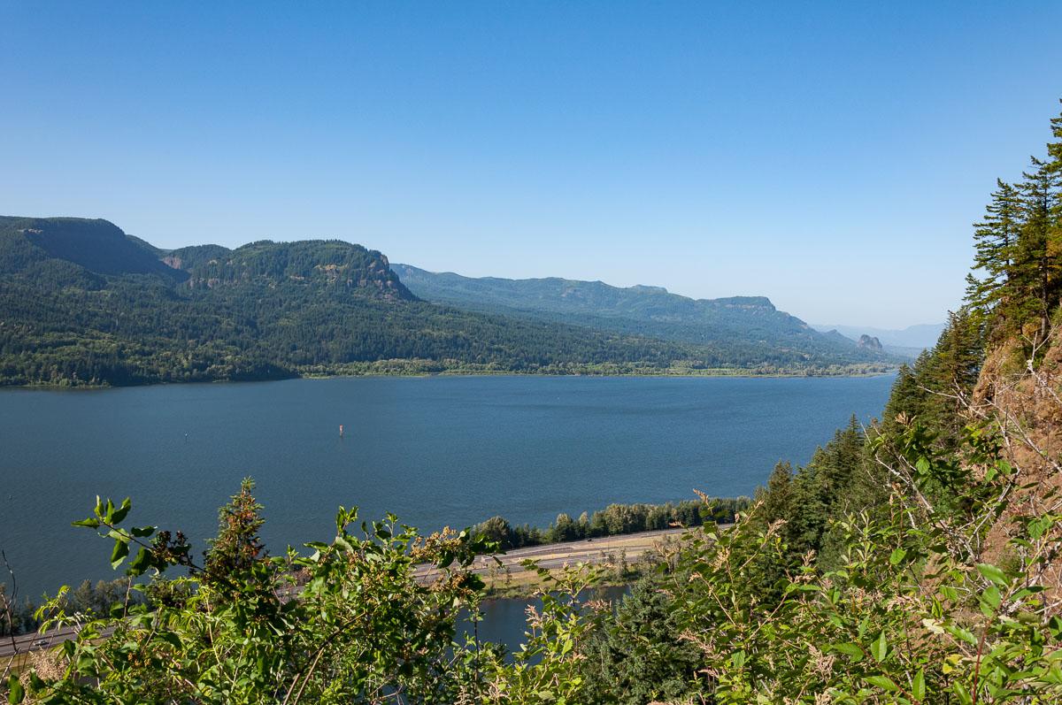
The Columbia River Gorge stretches from East to West over 80 miles and ends in Portland. This gorge is bordered by the Interstate highway 84. But it would be a shame to be satisfied with this road to visit the gorges. The Historic Columbia River Highway 30 is the one that loosens all waterfalls. It is absolutely necessary to go through this road to explore the gorges.
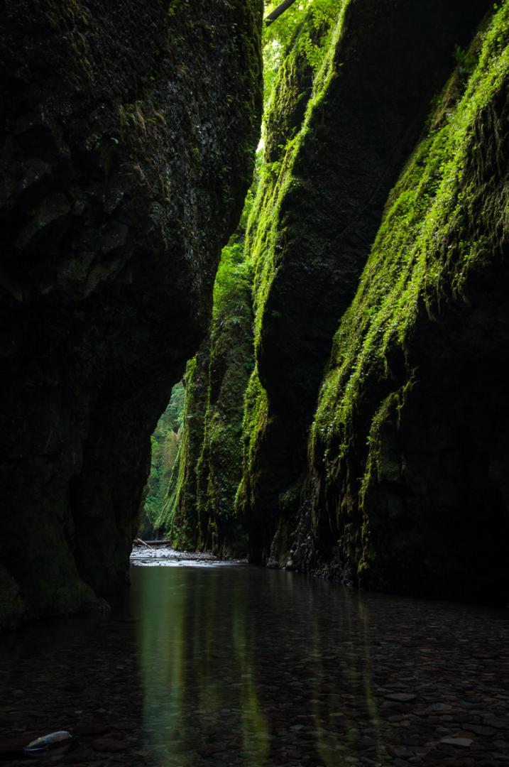
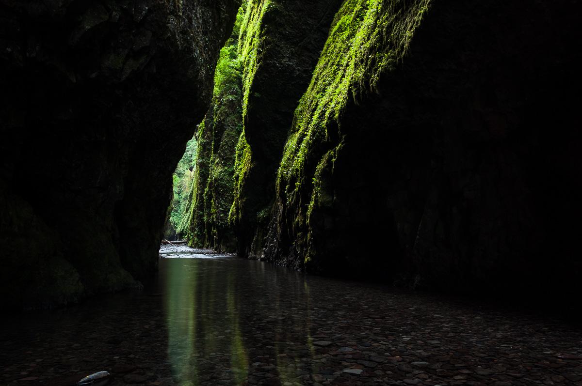
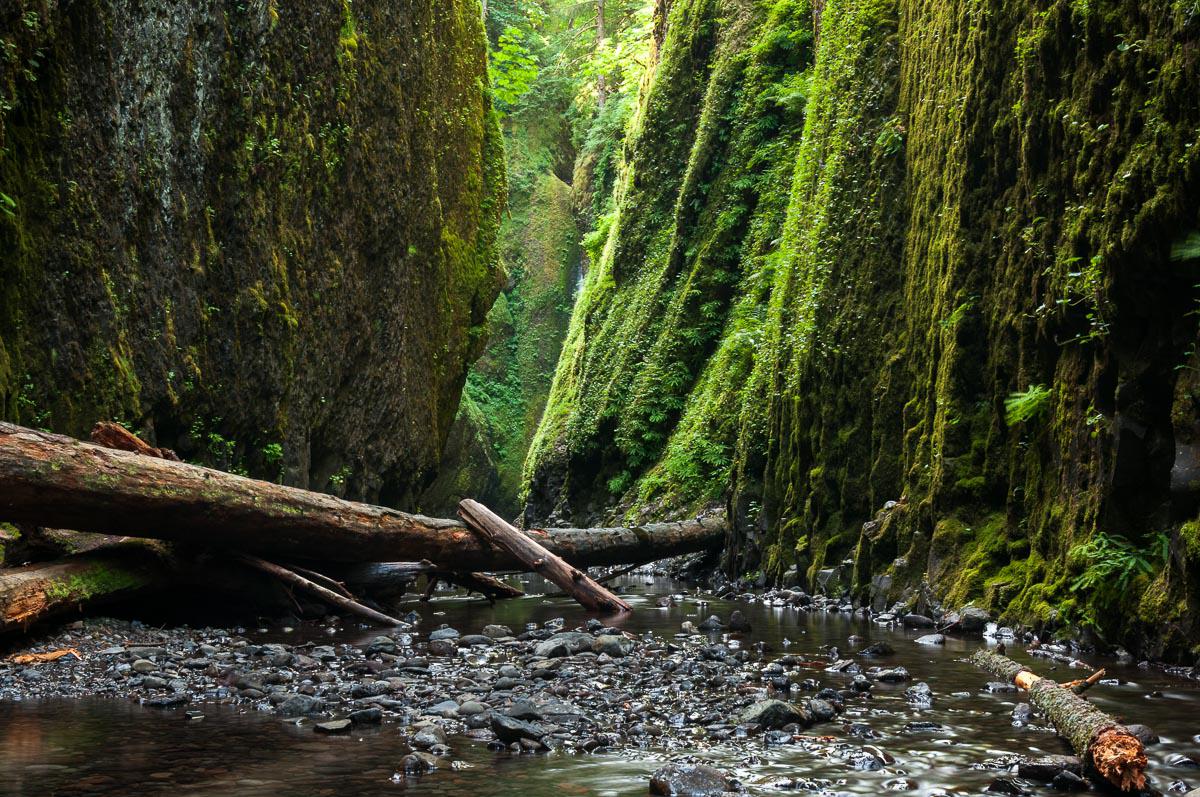
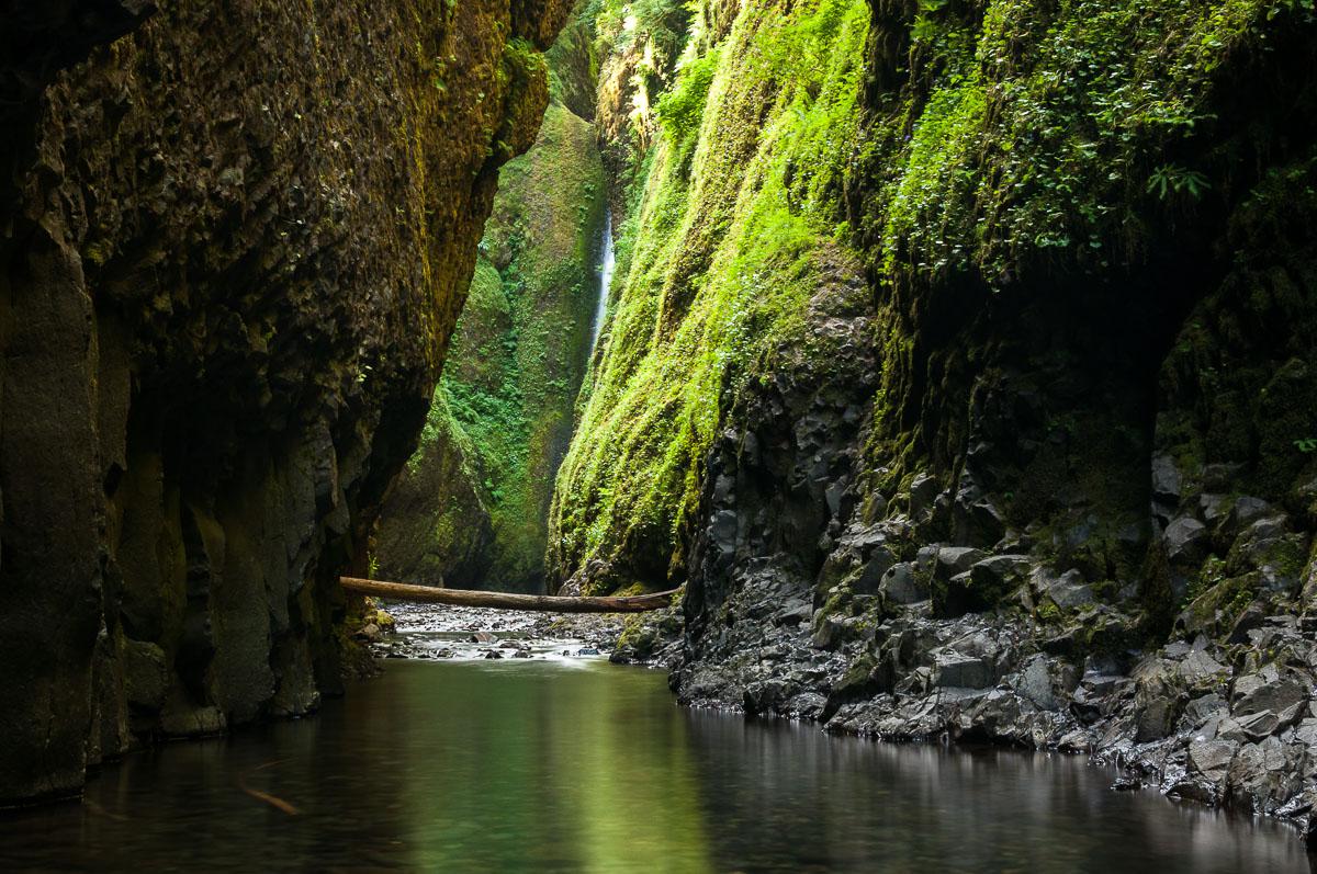
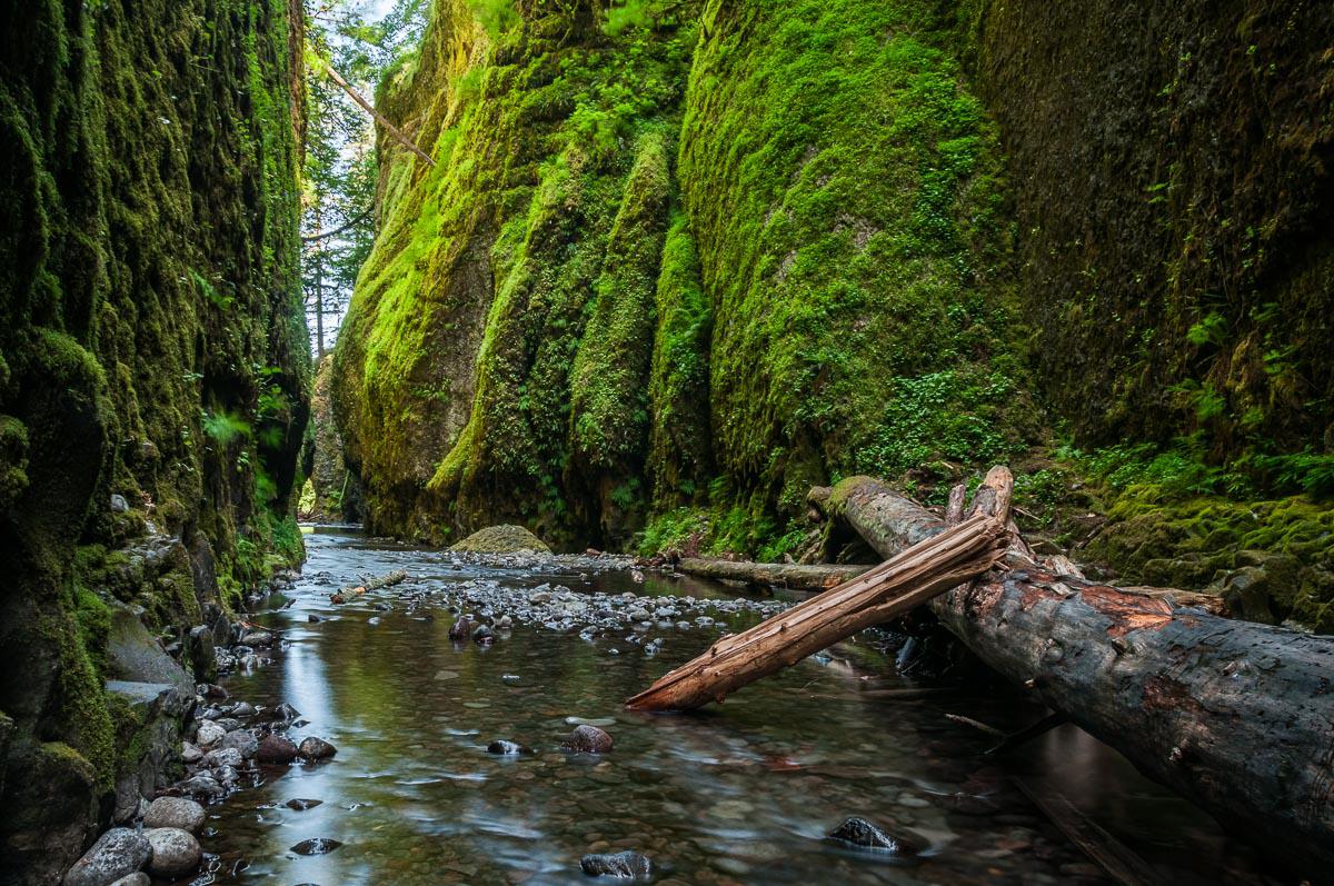
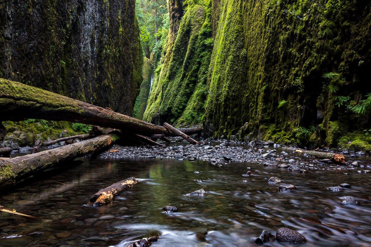
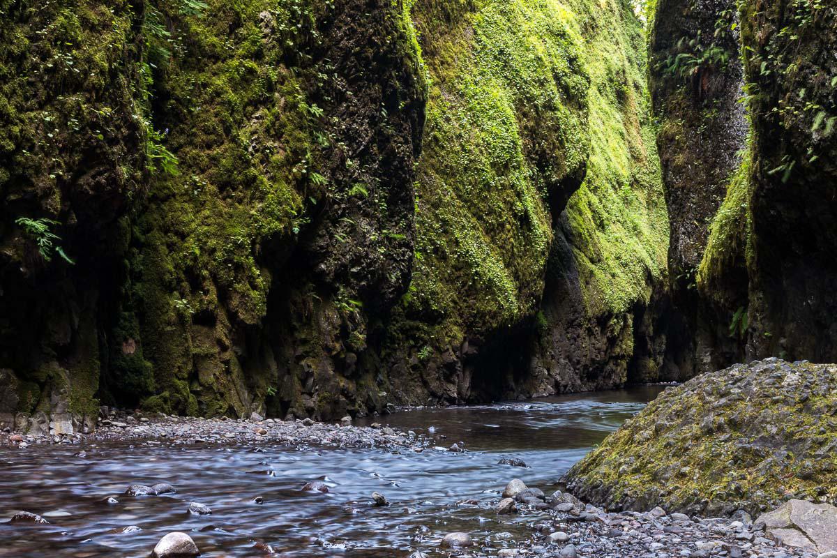
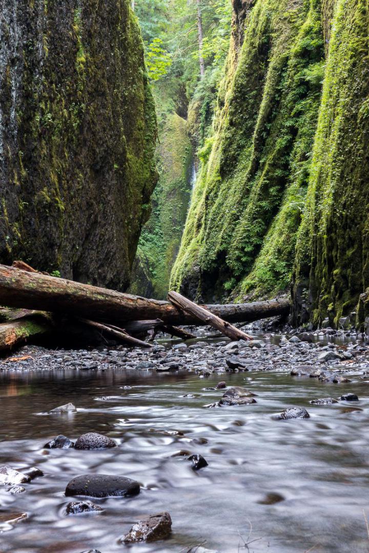
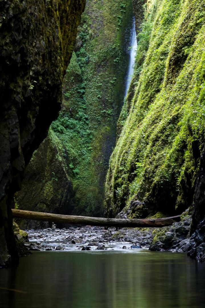
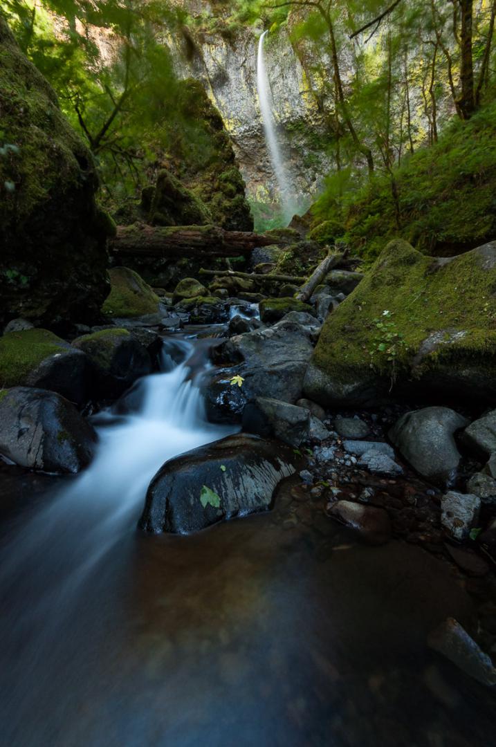
Oneonta Gorge
![]()
 0,4 mile one way
![]() 2 hours
2 hours
![]()
Free
![]()
GPS trail to download
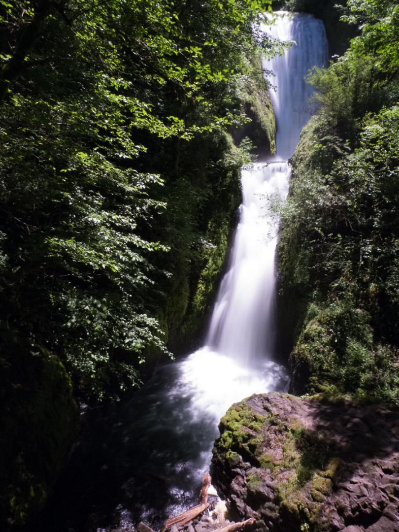
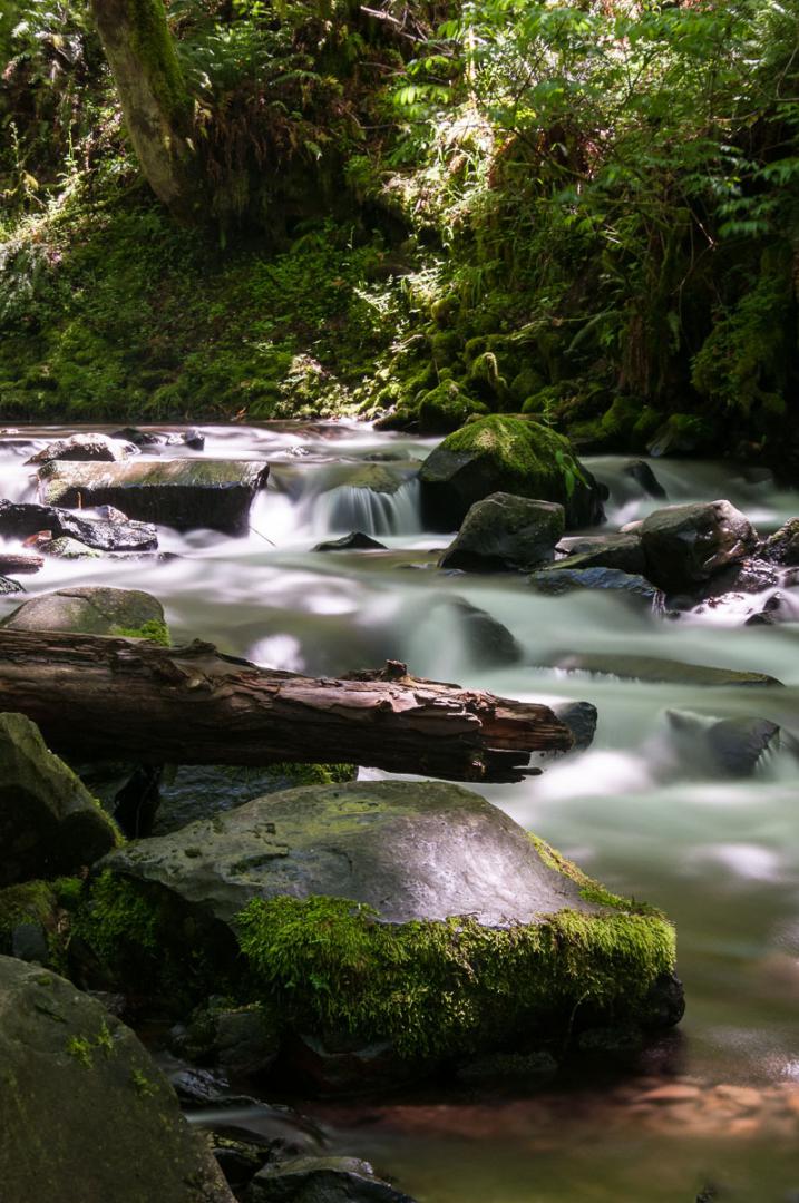
It was one of our regrets in 2012 : did not dare to cross this game of Mikado that blocks the entrance to the gorge. In 2015, we dared ! Entry is indeed cluttered with a pile of logs that are here after several storms. You really have to climb being careful not to slip. Once past this obstacle, just follow the river. The walk is about 0.4 mile one way. Depending on the season, the water level varies. But there is a portion just before the waterfall, where you will have water at least to the navel / torso. And water is not hot! Nevertheless, the effort is greatly rewarded. The gorge is beautiful: narrow, with high walls covered with green moss. Some tree trunks punctuate the walk and give a jurassic aspect to this gorge. Only downside : the site is extremely popular, especially in summer and on weekends because it's a refreshing break for many in Portland. To avoid the crowds, it is essential to be here as early as possible in the morning ie before 9:00 am.
Access : take exit 35 on I84 and follow Historic Columbia River Highway (highway 30) for 2 miles.


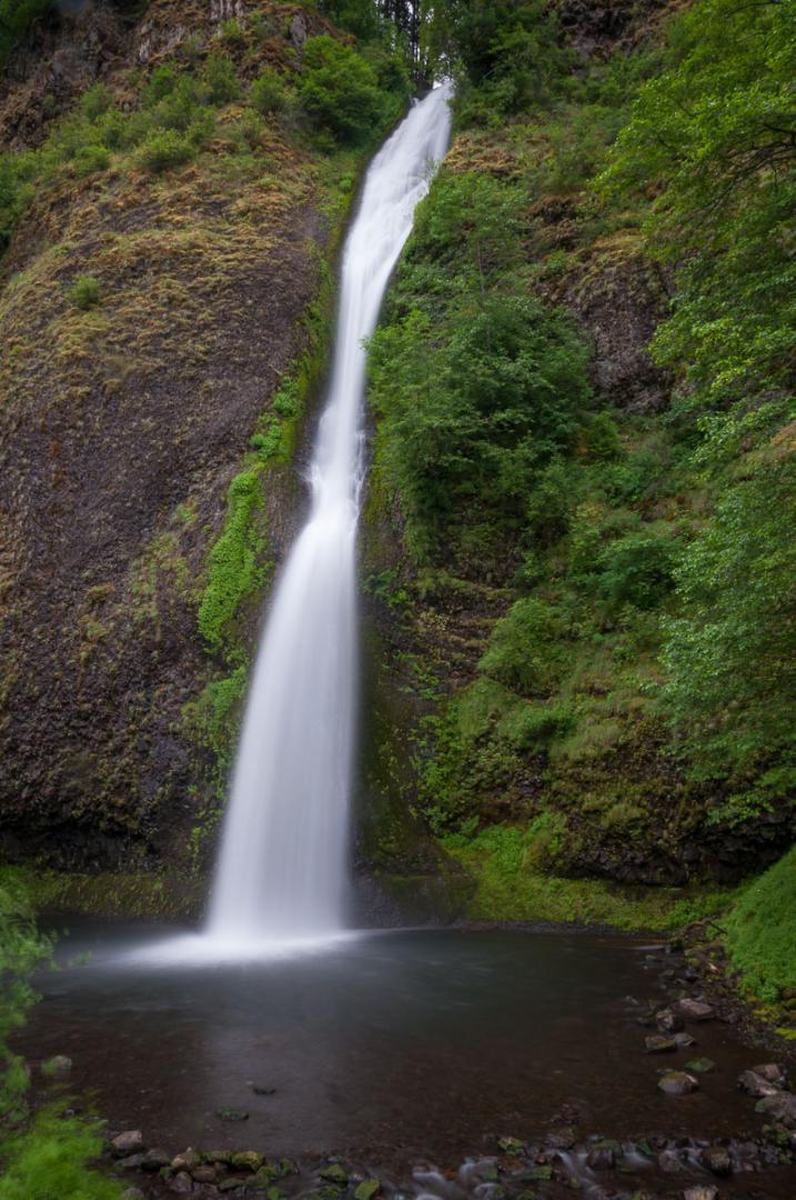
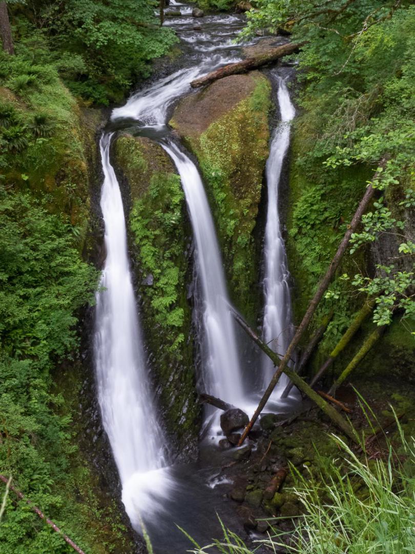
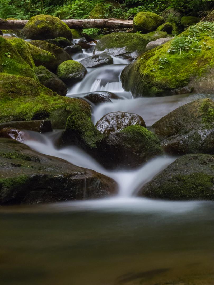
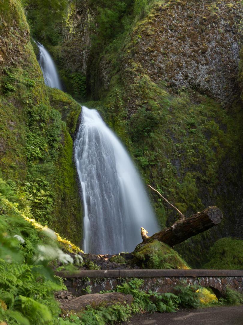
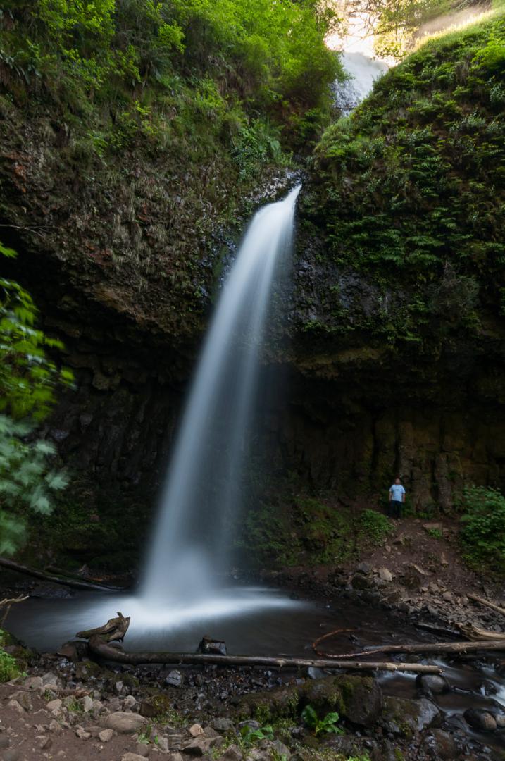
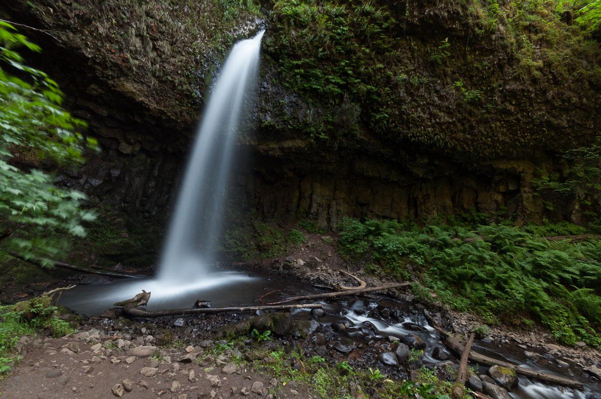
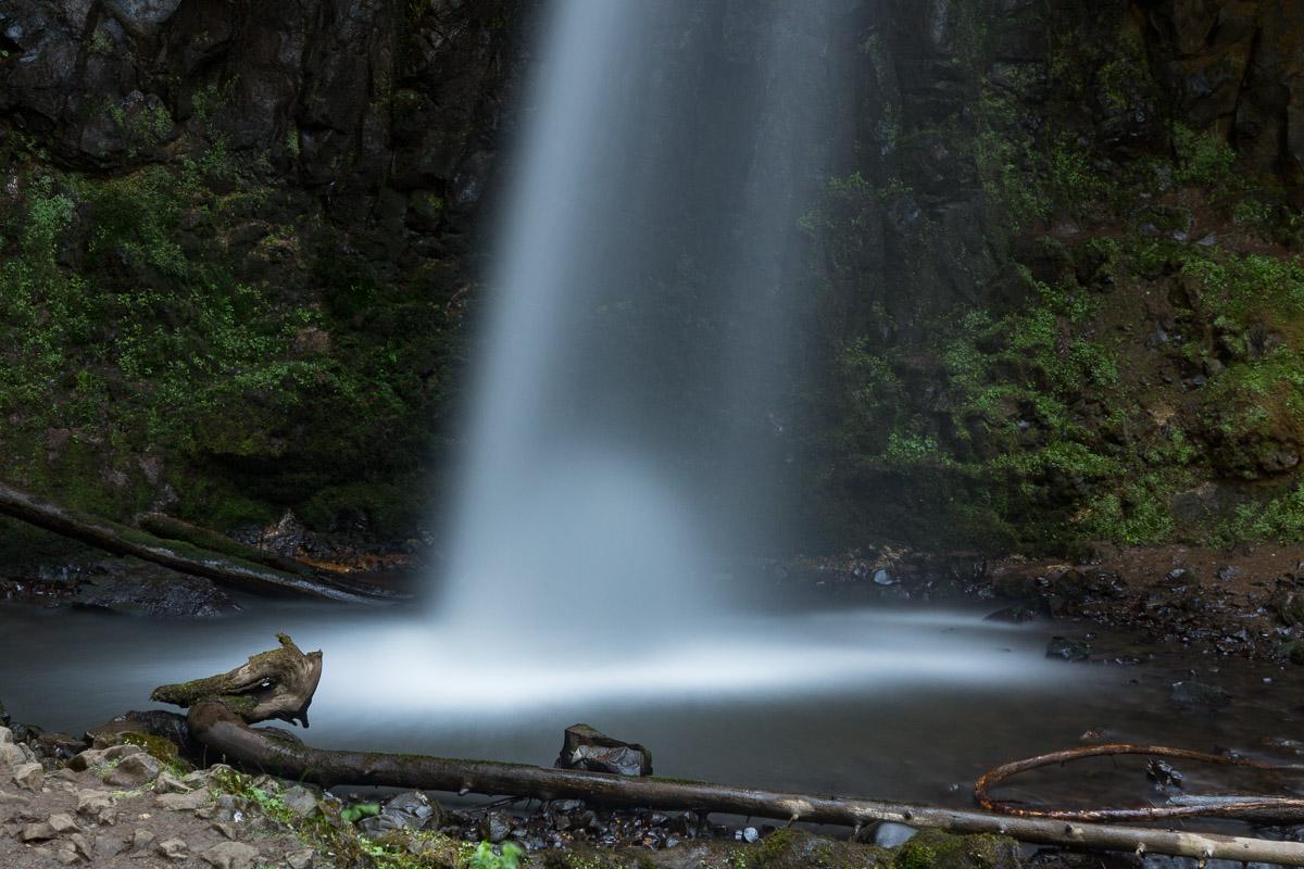
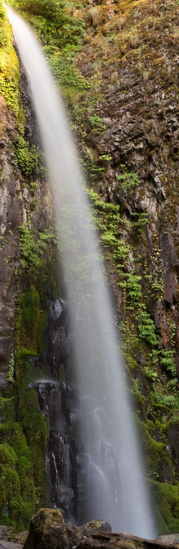
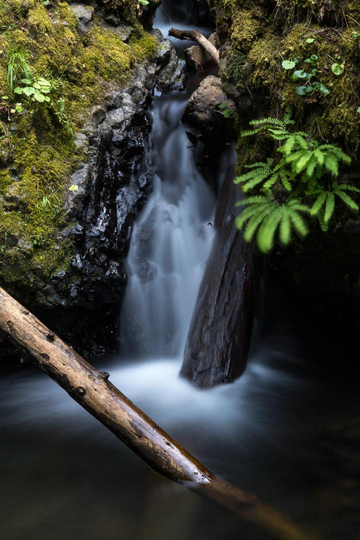
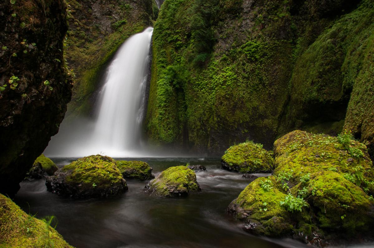
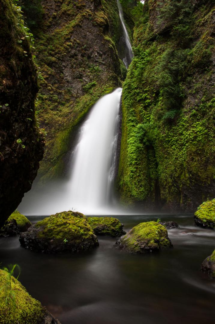
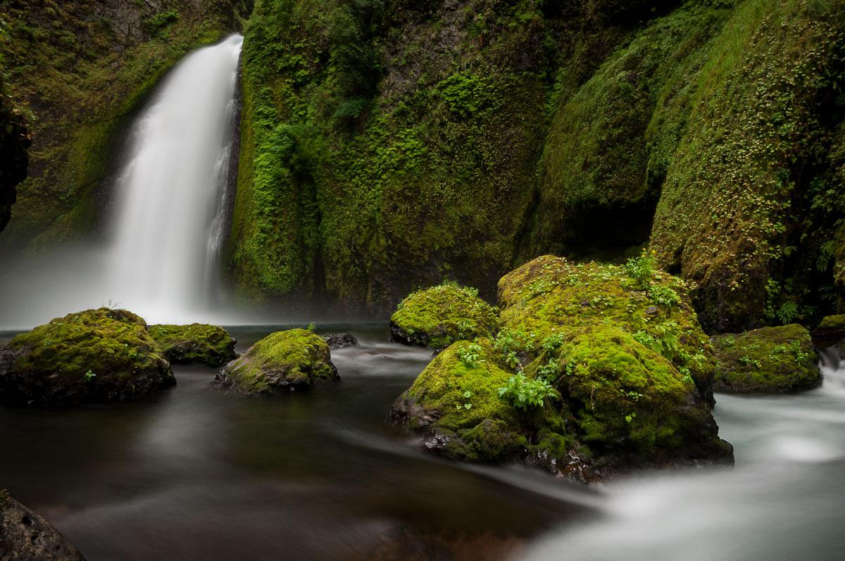
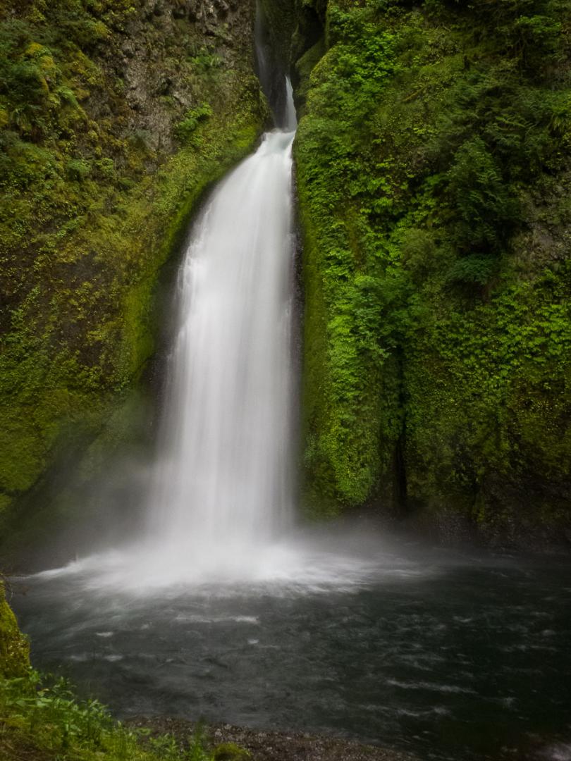
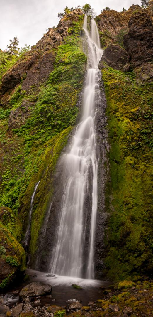
Horsetail Falls Trail
![]()
1,6 mile one way
![]() 2 hours
2 hours
![]()
Free
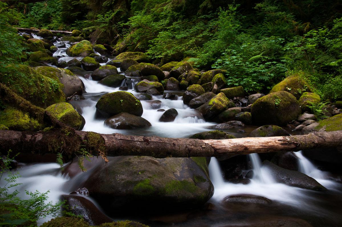
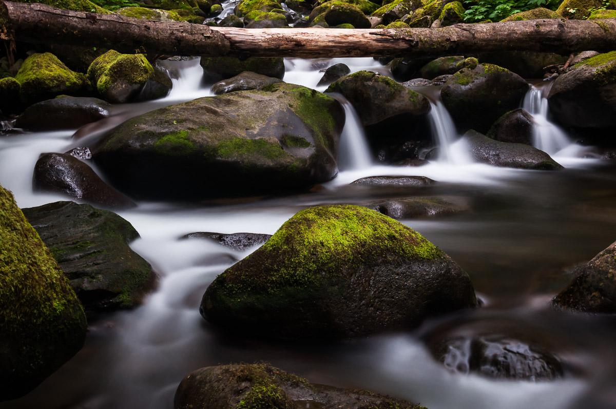
These are several hiking trails that can be associated to your liking. On our trip in June 2012, we followed the trail for 3.1 miles round trip that led us to Horsetail Falls (visible from the road), very pretty ; Ponytail Falls behind which we can pass ; Oneonta Falls and finally Triple Falls. This hike is very nice. There is the possibility to make beautiful photos with long exposures along the river.
Access : from the I84, exit 35. Parking is located in front of Horsetail Falls.
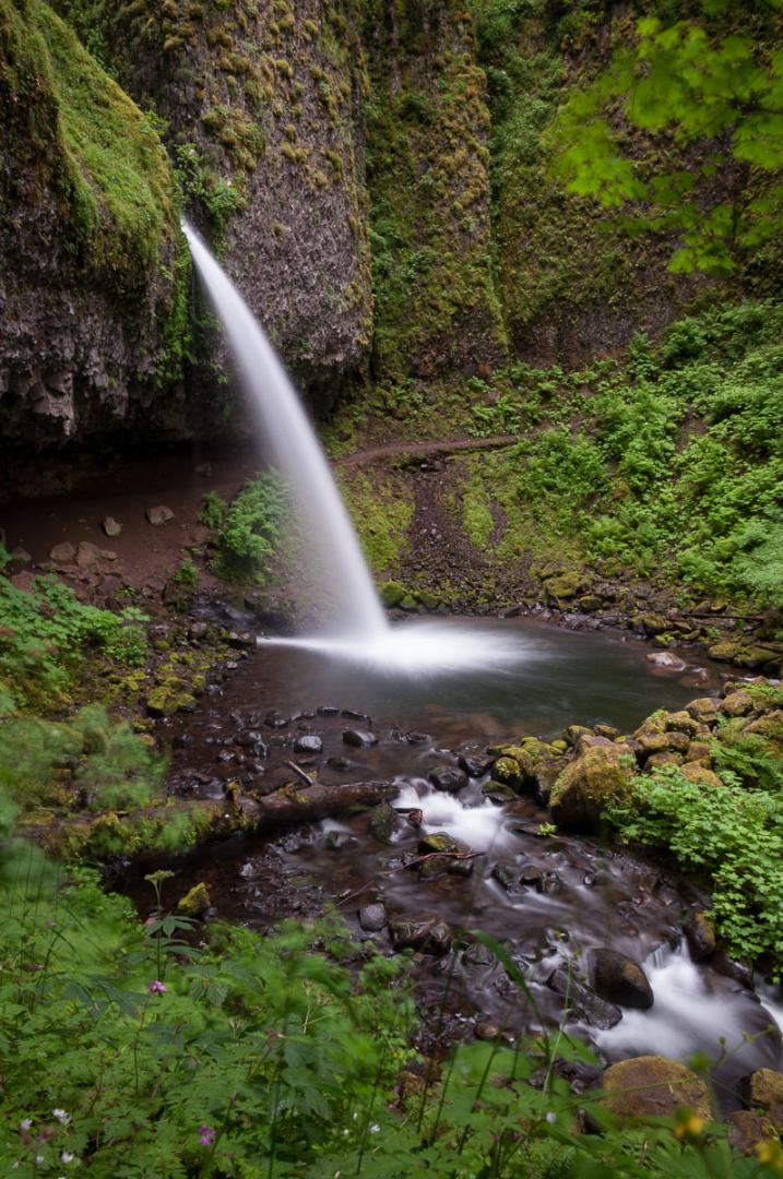

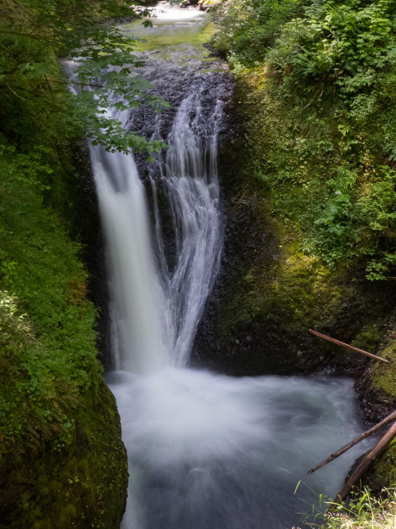
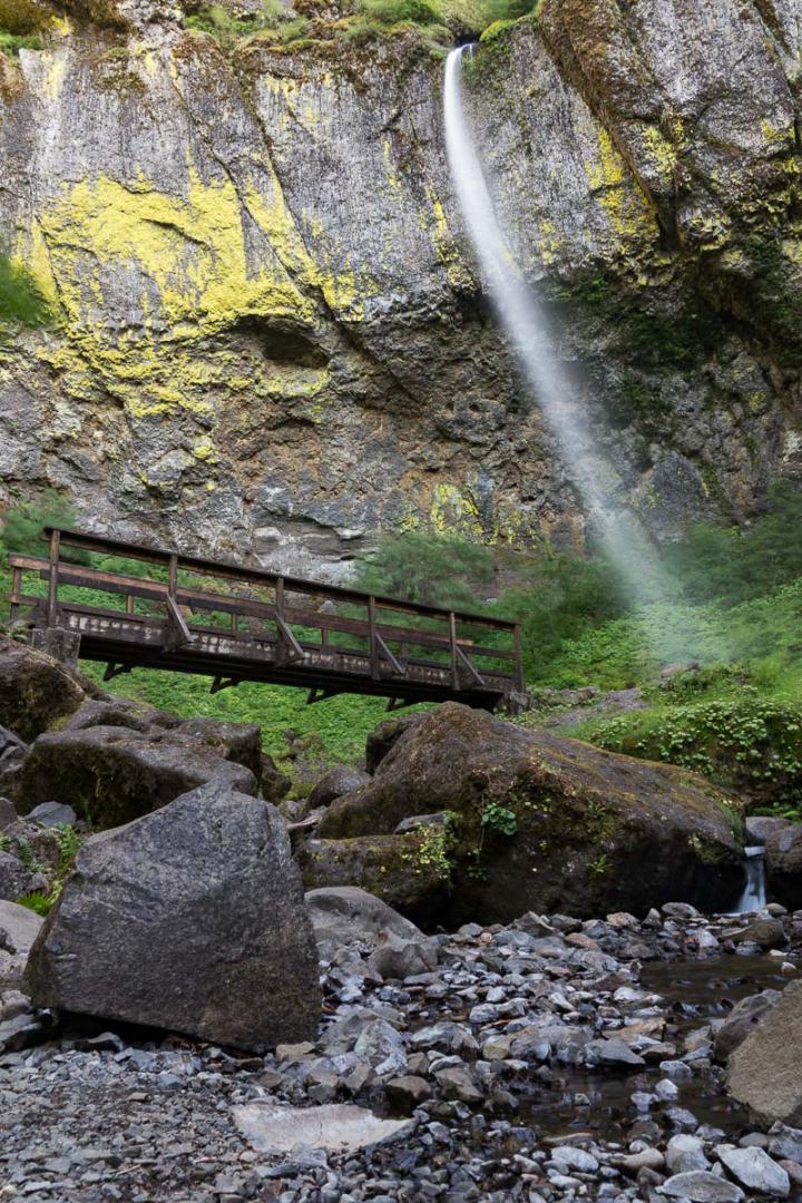
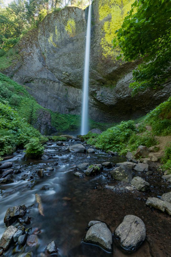
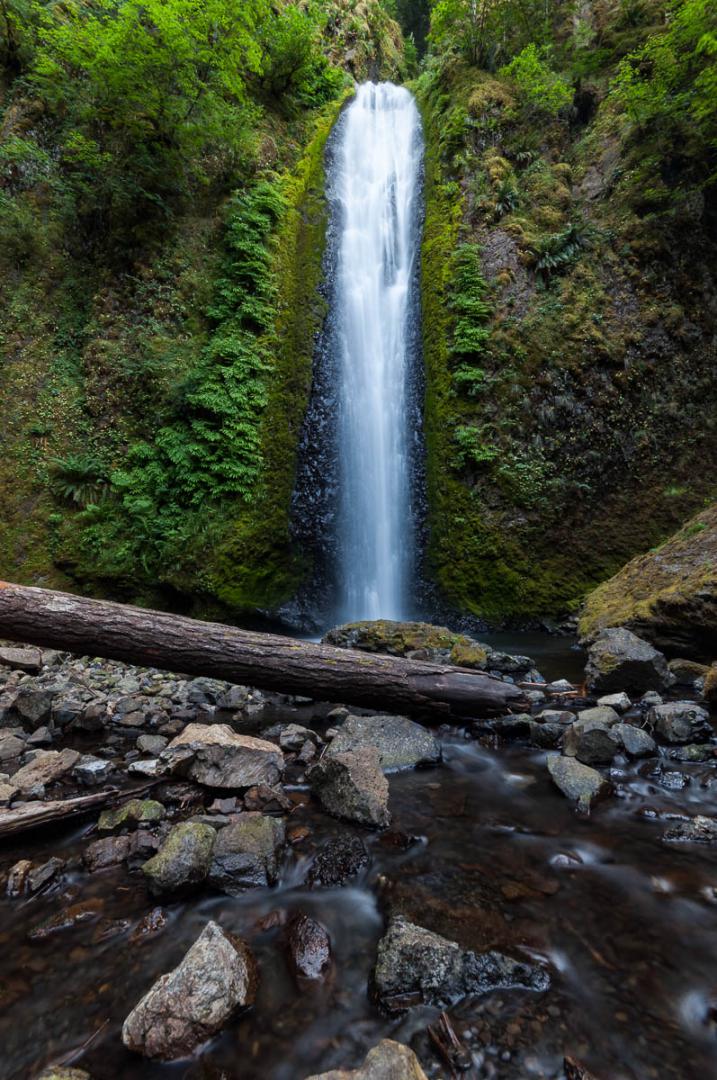
Elowah Falls
![]()
0,8 mile one way
![]() 1 hour
1 hour
![]()
Free
![]()
GPS trail to download
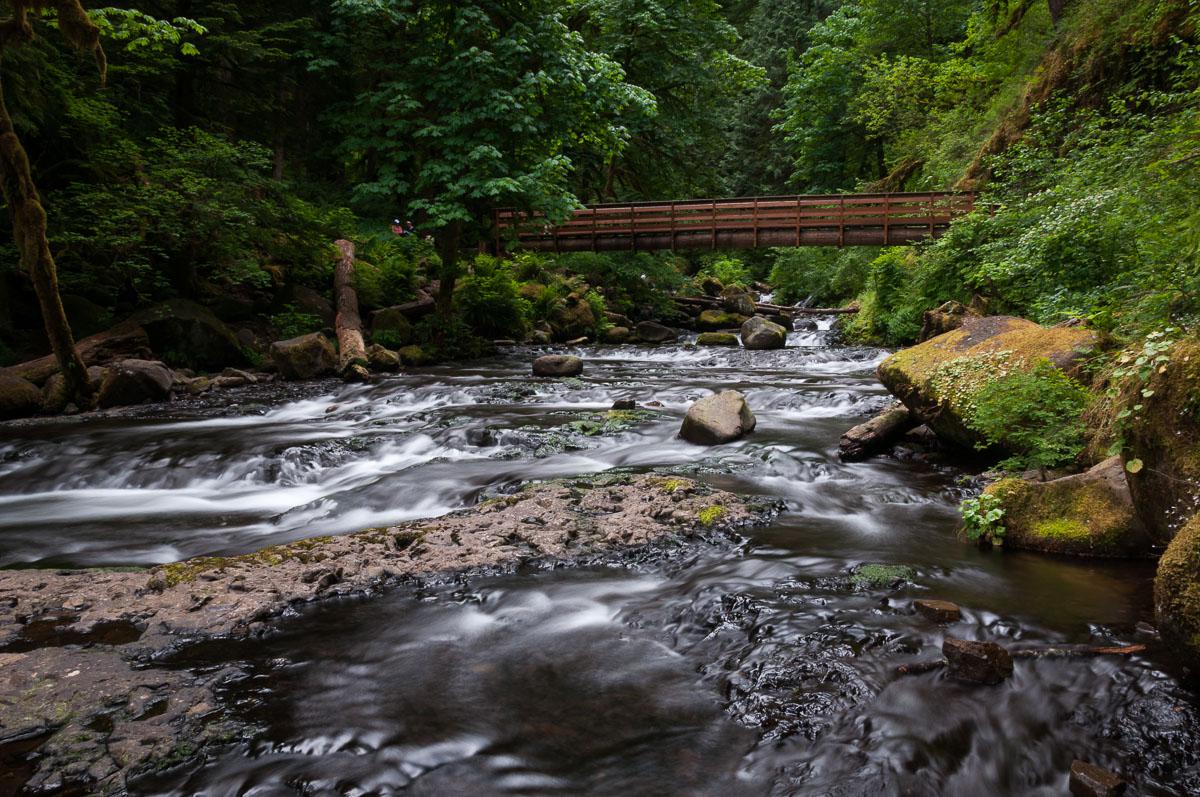
Elowah Falls is part of John B Yeon State Park. Very nice large waterfall cashed deep in a gorge. For a better view, do not hesitate to cross "the small wooden bridge" and get into the river to integrate the bridge to the photo. Hiking, rather pleasant, is 0.8 mile one way. On the way back, you can also access the upper falls located 0.2 mile. This second waterfall is not very interesting nor very easy to photograph, but the trail offers beautiful views of the Columbia River.
Access : exit 37 on I84 West. Follow signs for Yeon State Park.
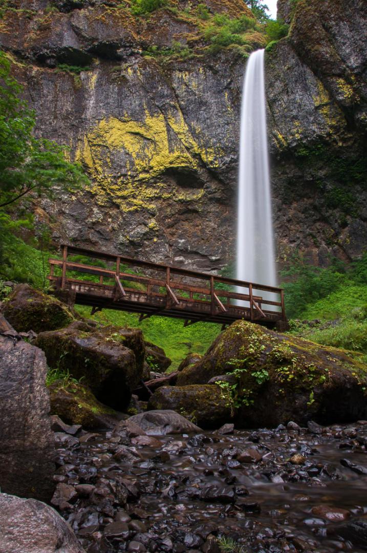
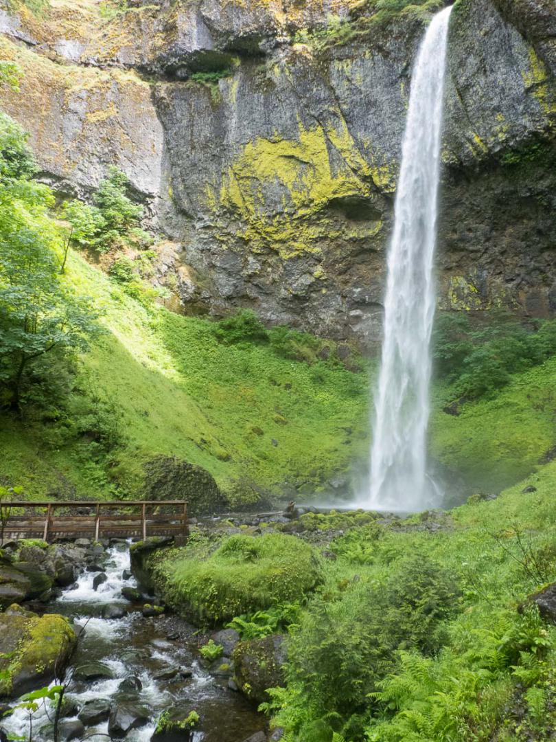

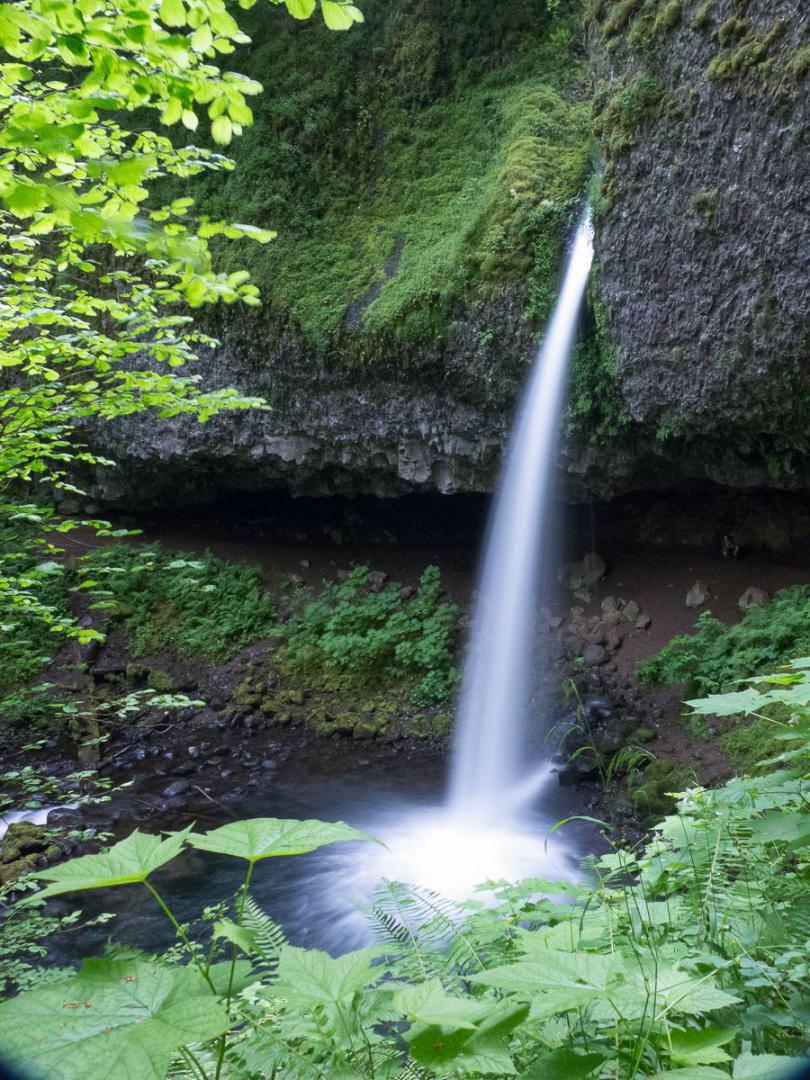
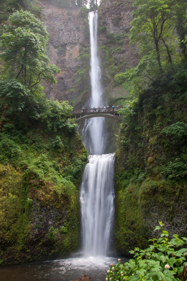
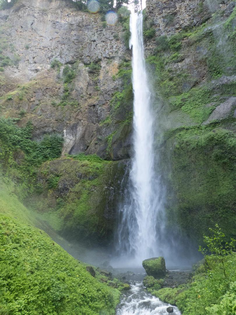
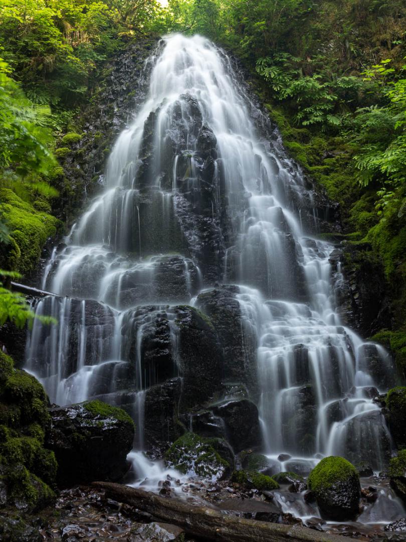
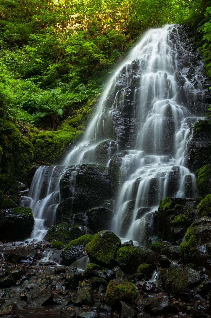
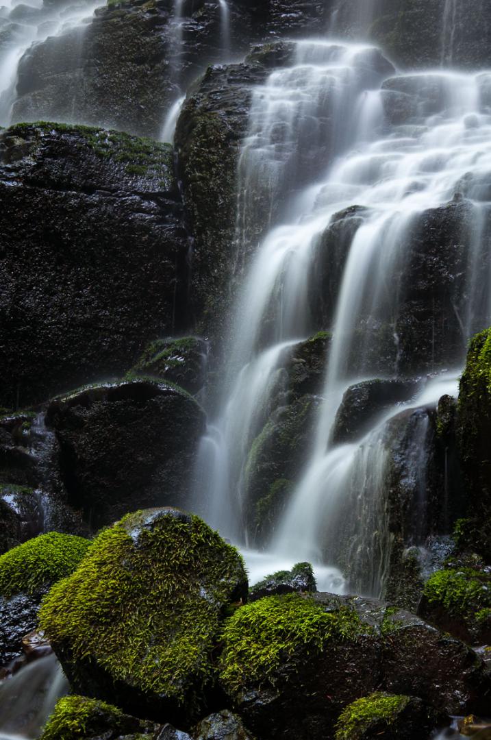
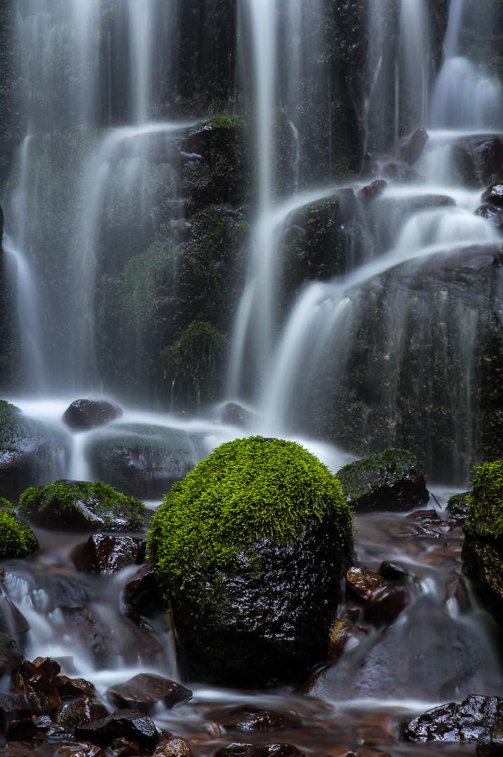
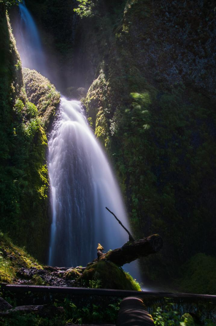
Larch Mountain Trail : Multnomah Falls / Weisenda,nger Falls / Fairy Falls / Wahkeena Falls
![]()
Loop of 5 miles
![]() 3 hours
3 hours
![]()
Free
![]()
GPS trail to download
5 miles loop starting at Multnomah Falls, on which we can see several waterfalls. Multnomah Falls is the most popular and touristic of the Columbia River Gorge waterfalls. From the bottom view you can appreciate the whole of this double falls. The trail No. 441 leads to Benson bridge located halfway up the waterfall. Once we passed the bridge, the trail takes a much steeper slope to the viewpoint on Multnomah (1 mile). The following falls is Weisendanger Falls (1.4 mile). Not well known, it is nevertheless pretty and photogenic. Continuing the walk, we guess Ecola Falls (1.6 mile), but it is hidden behind the trees and the trail down to the river is not easy to find. Then we arrive at a crossing of trails (1.9 mile). Turn right on trail No. 420 until you cross the trail 419C (3 miles). Take then right down to Fairy Falls (3.5 miles). This waterfall is beautiful and photographic possibilities are numerous both in wide shots and close-ups. Back down on trail, we walk along the Wahkeena Creek where you can take beautiful pictures of the river, especially from a wooden walkway. Further, there is the Lemmon's Viewpoint (3.9 miles) that gives a view of the Columbia River. Finally, we arrive at Wahkeena Falls (4.3 miles). Rather pretty little waterfall. The return to Multnomah (5.2 miles) is on trail No. 442 parallel to the road. For those who want to see only Wahkeena Falls, it is also accessible in 0.2 mile, from the Wahkeena picnic area.
Access : on the I84, take exit 31 and park at Multnomah Falls (busy on weekend). For Wahkeena Falls, continue west.


Latourel Falls
![]()
0,8 mile one way
![]() 1 hour
1 hour
![]()
Free
![]()
GPS trail to download
Latourel is one of the most famous and popular waterfalls of the Columbia River. Its proximity to Portland is not foreign. The waterfall is very high and beautiful. There are 2 waterfalls. The most visited and most easily accessible is Lower Latourel Falls (0.1 mile one way). Upper Latourel Falls requires a little extra effort : the trail of 0.8 mile one way that leads to the falls climbs damn. Result : it is much less crowded than lower. Yet it is beautiful.
Access : from Portland, take I84 east for 26 miles to Exit 28. Turn right on East Bridal Veil Road for 2.9 miles.


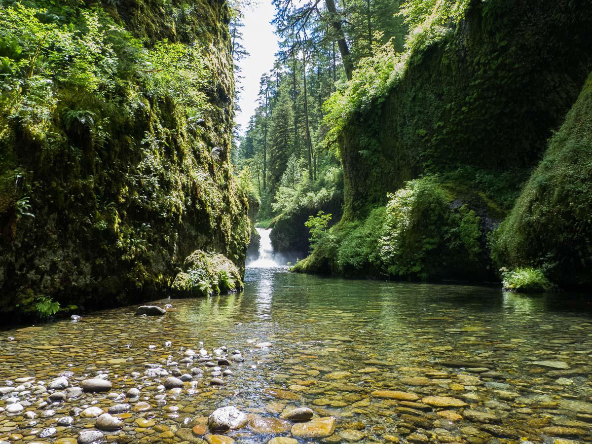
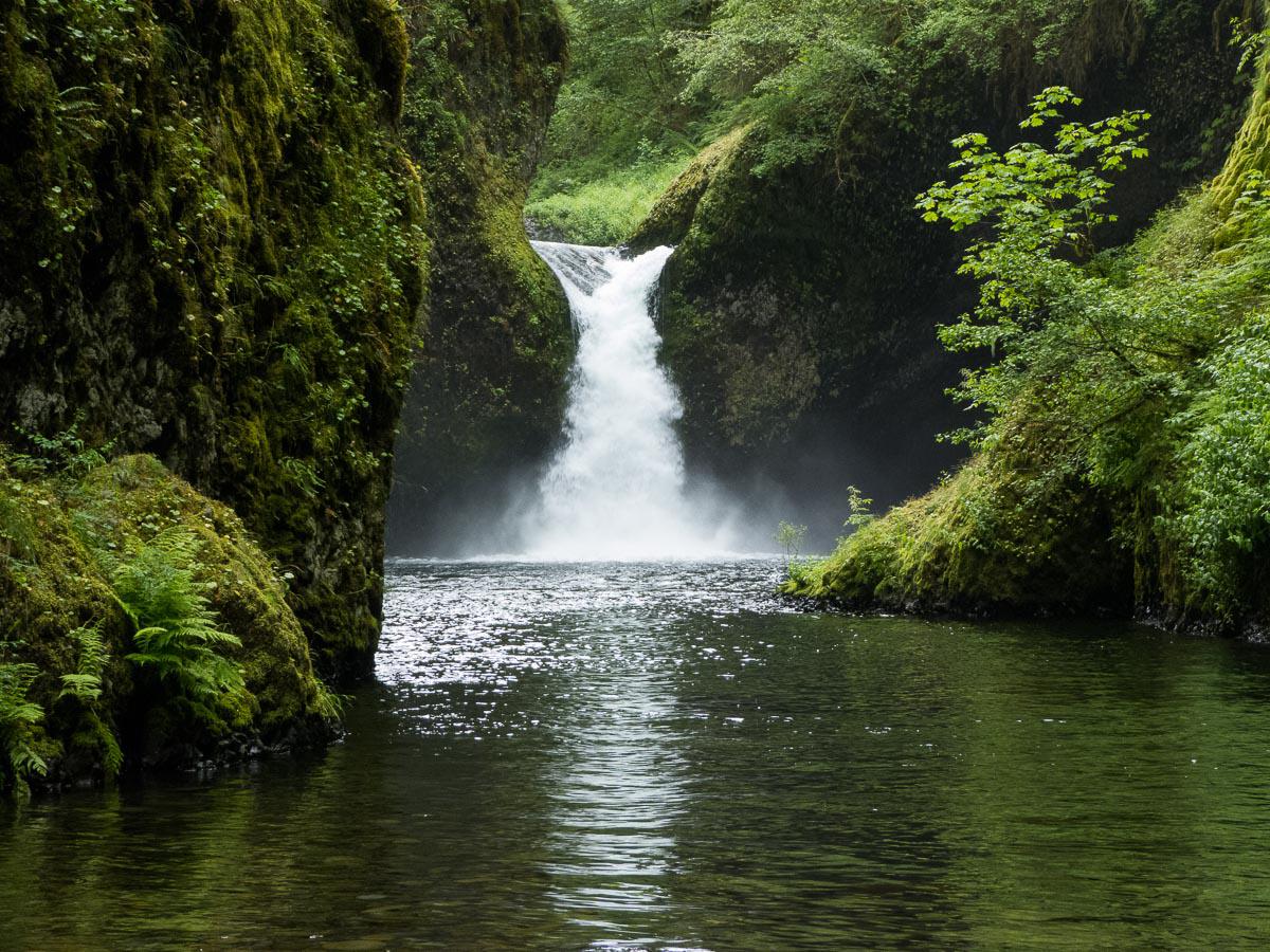
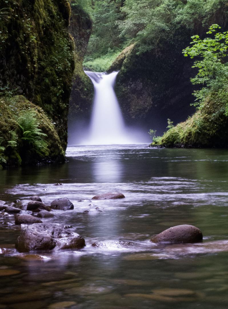
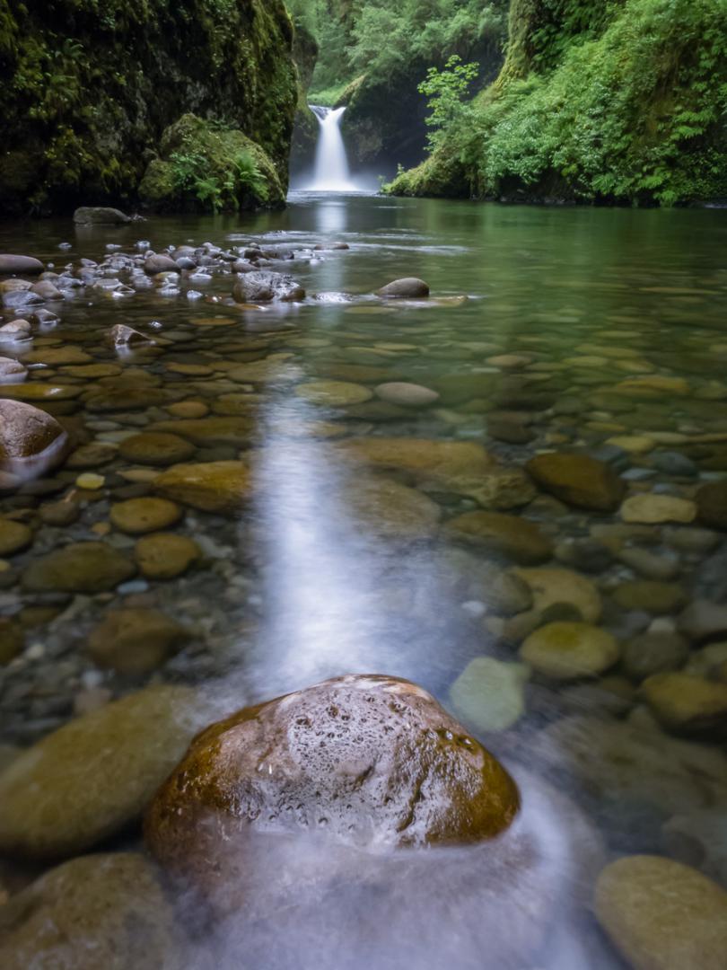
Eagle Creek Trail : Punchbowl / Metlako Falls
![]()
2,6 miles one way
![]() 3 hours
3 hours
![]()
5$ per vehicle
![]()
GPS trail to download
The hiking, 5,3 miles long roundtrip to Punchbowl leads to 2 waterfalls : Metlako that we can see above. It is not of great interest. By cons, Punchbowl Falls is worth seeing. It is collected at the bottom of the gorge. We must move forward in the middle of the river, on the stones (beware it is slippery) to see it well. It is beautiful but busy.
Access : exit 41 on I84 East. Follow Eagle Creek Trail. $5 entry, free with annual pass.
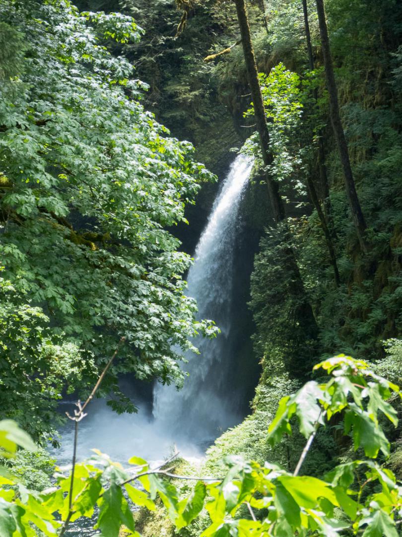
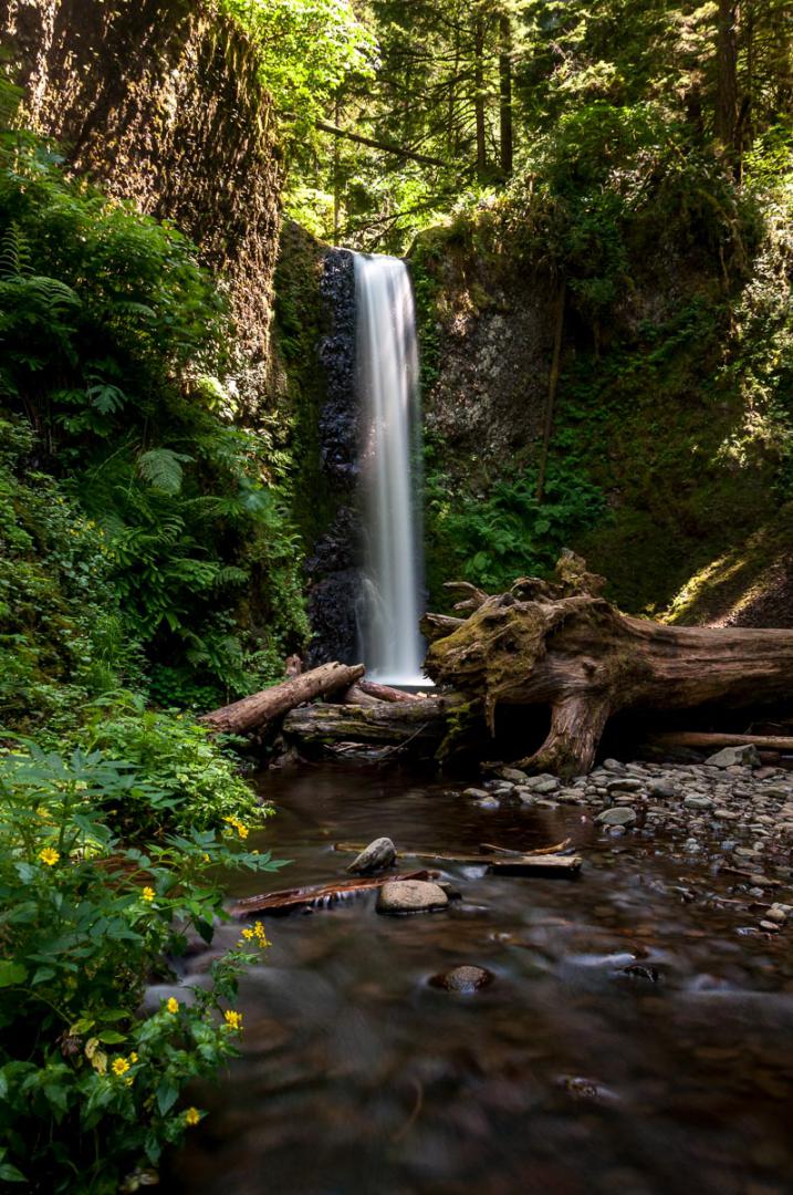
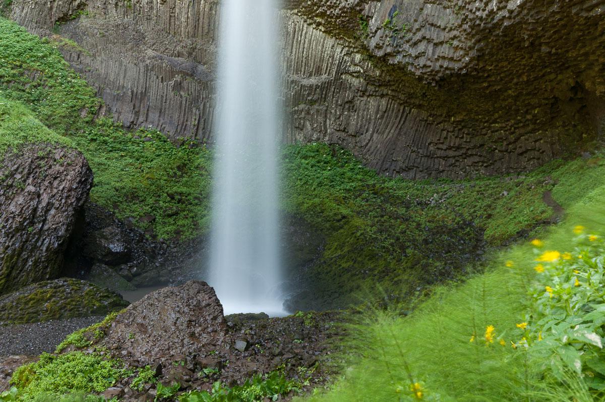
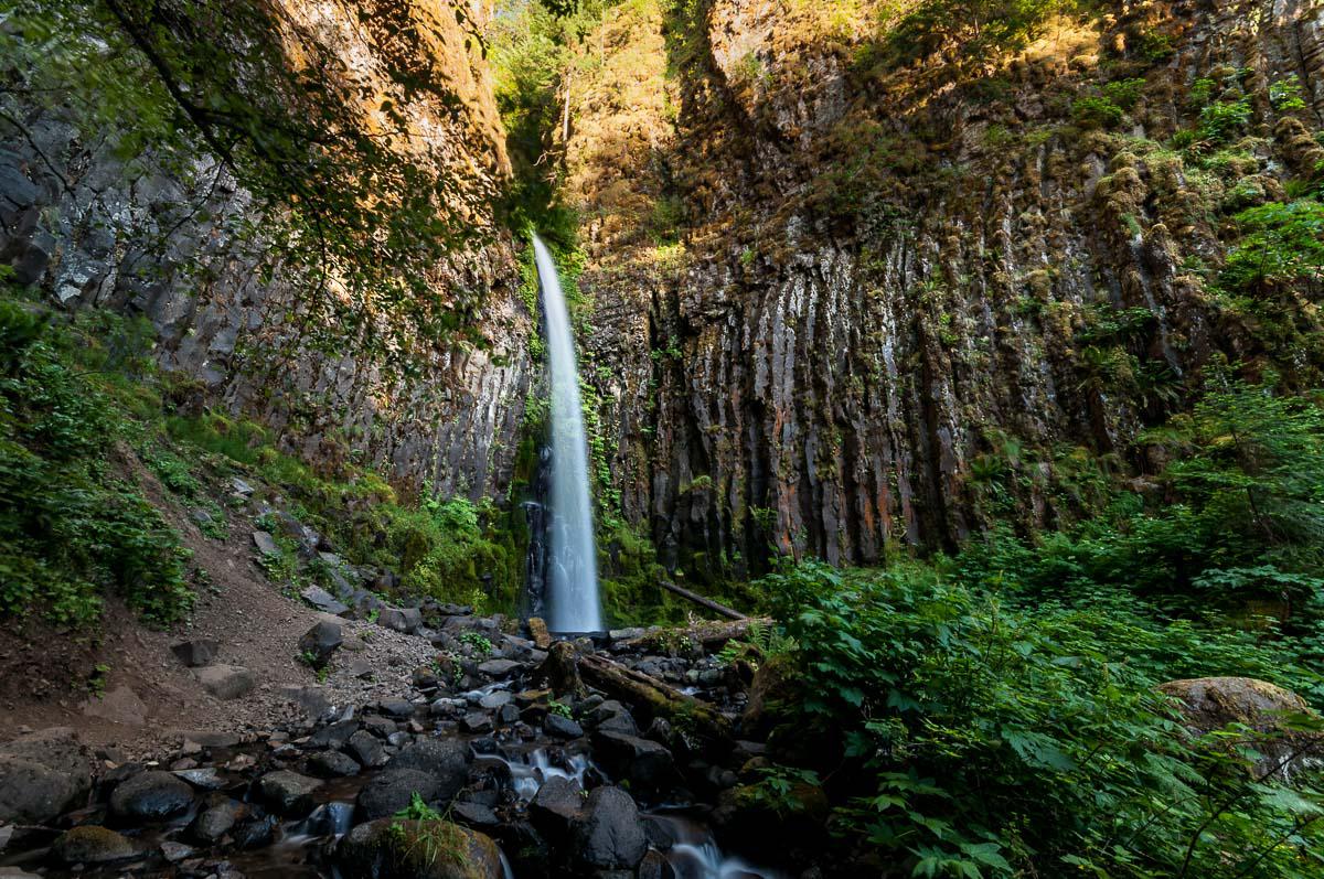
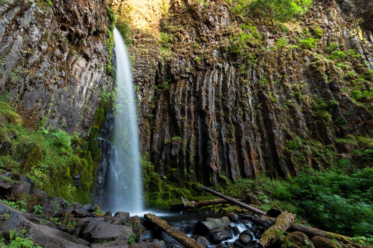
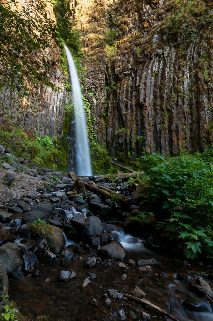
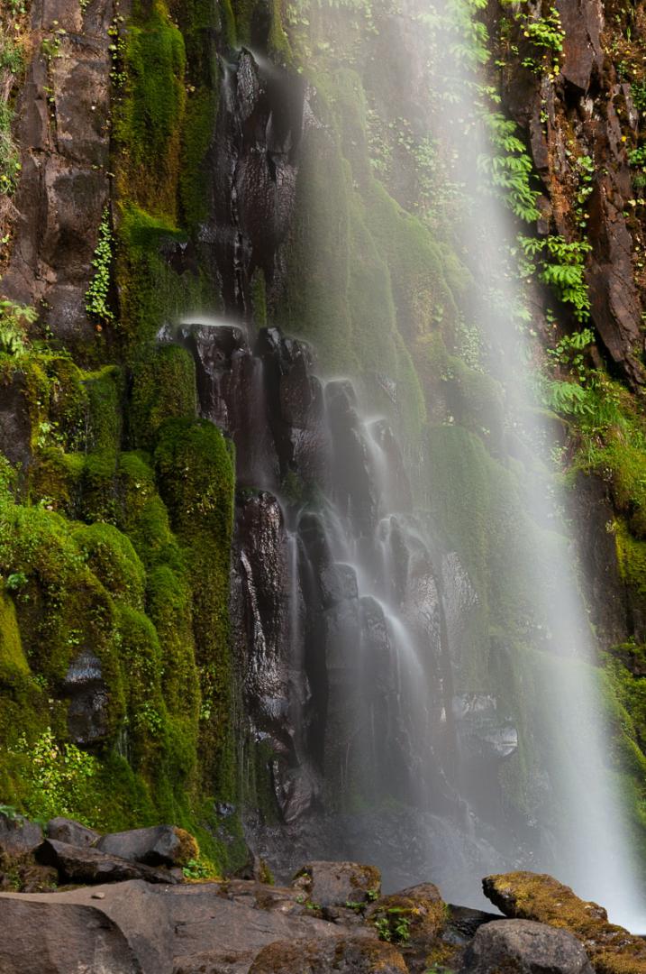
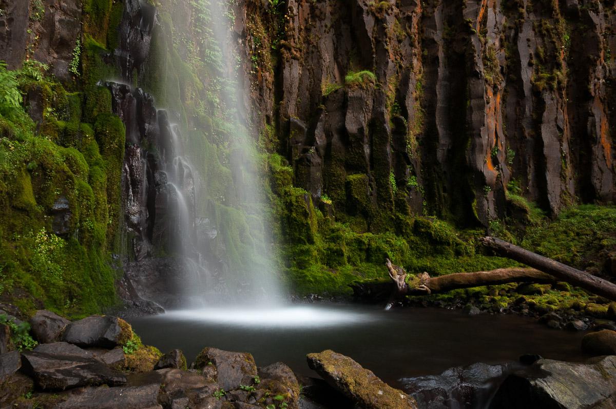
Dry Creek Falls
![]()
2,2 miles one way
![]() 2 to 3 hours
2 to 3 hours
![]()
Free
![]()
GPS trail to download
Dry Creek Falls is really a beautiful waterfall, surrounded by basalt columns. The rock takes orange colors.
Access : in Cascade Locks, park in the parking lot just before Bridge of the Gods. The start of the trail is on the other side of the road with your back to the bridge. The trail is 4.5 miles round trip. It presents no difficulty if not a steep climb at the beginning and the end.
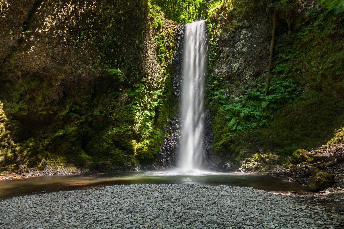
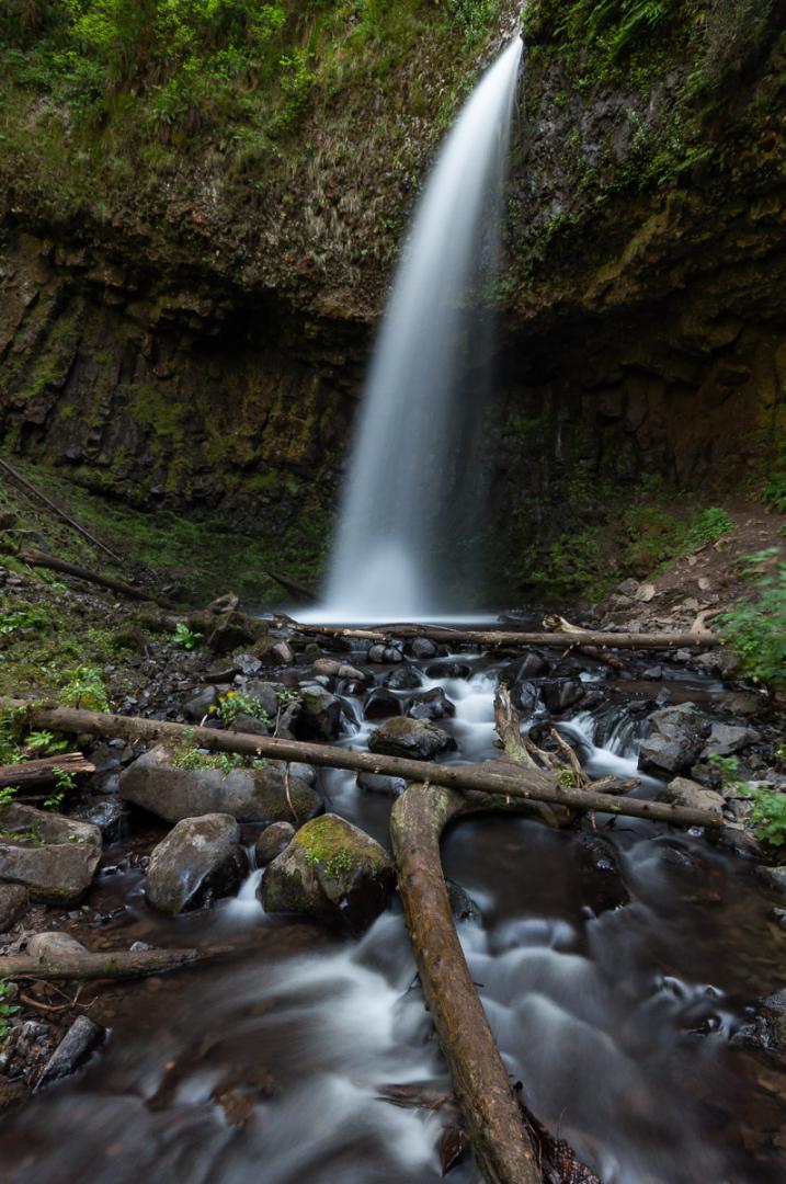
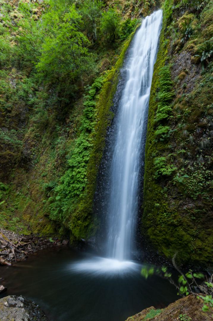
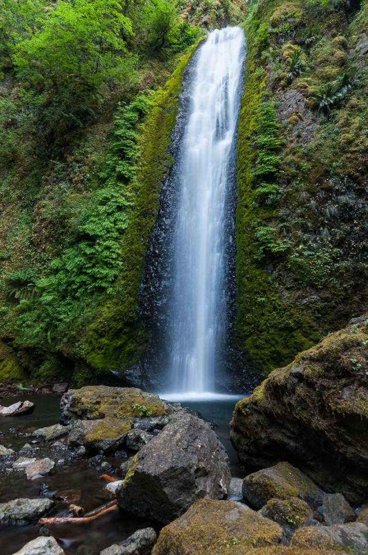
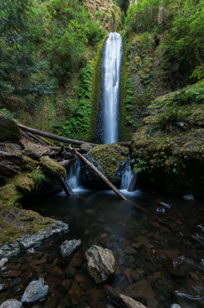
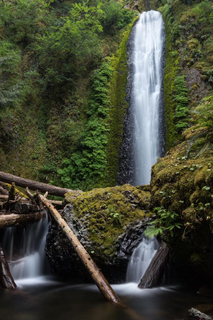
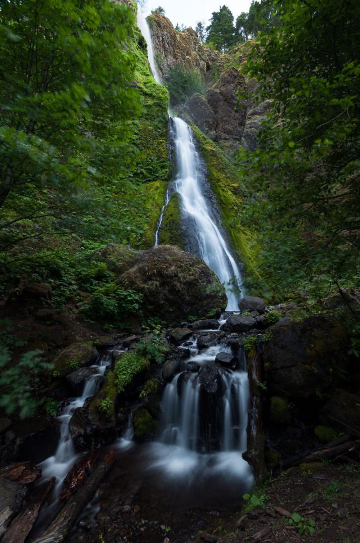
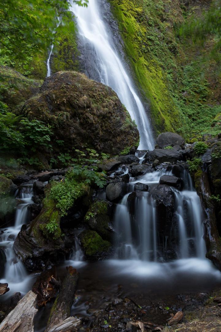
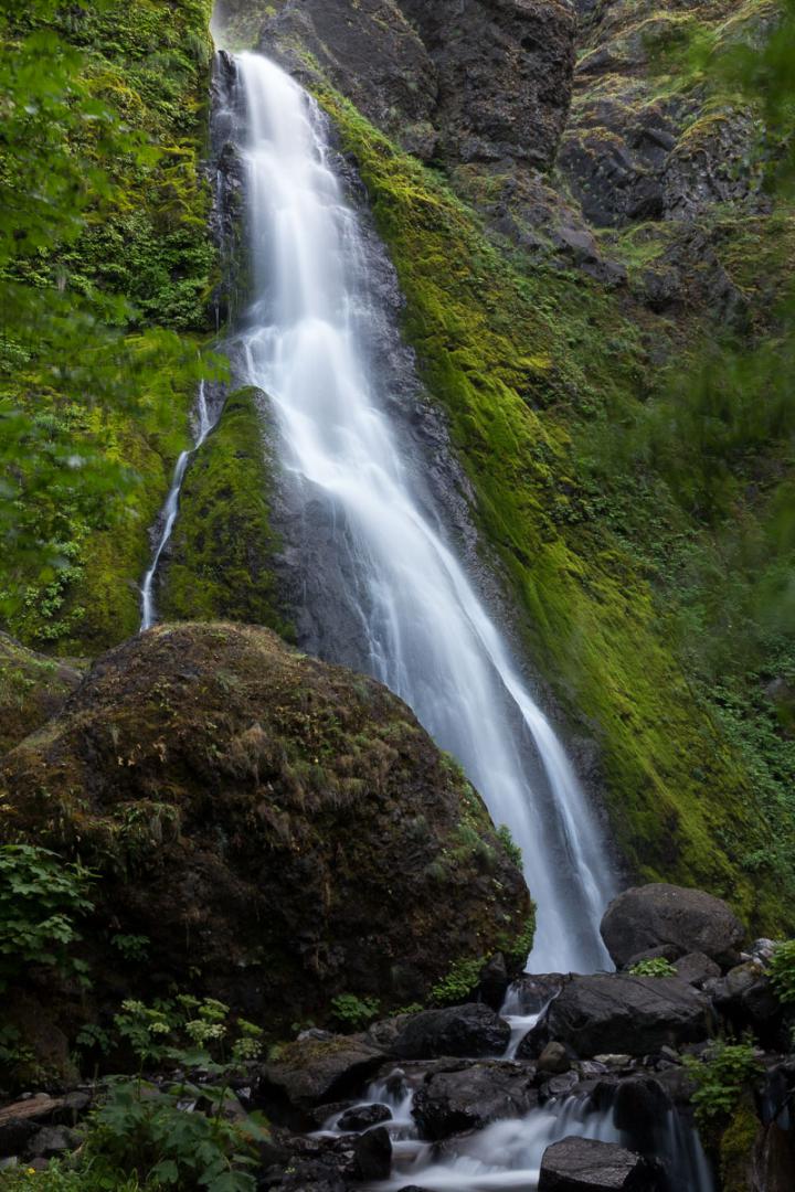
Gorton Creek Falls
![]()
0,5 mile one way
![]() 1 hour
1 hour
![]()
Free
![]()
GPS trail to download
The river that leads to Gordon Falls is very nice and the surrounding forest is striking and disturbing with trees covered with moss. It looks like the Lord of the Rings. The waterfall is quite pretty. It is rather high. It is reached after about half a mile one way. However, the trail can be cut in two parts. The first part of approximately 0.3 mile is easy and leads to a small waterfall, sometimes called Emerald pool. The last 0.2 mile are a little more difficult and sometimes require some climbing over rocks to reach Gorton Falls. With a little caution and without special equipment, it is quite feasible.
Access : from Cascade Locks, take I84 east for 5.6 miles. Take exit 51. Turn right and immediately right again on the Wyeth Road. Continue for 270 yards and turn left to the entrance of Wyeth State Park. Park in the parking lot "Day use area".

Wahclella Falls
![]()
1 mile one way
![]() 1 hour
1 hour
![]()
Free
This fall is also inside the John B Yeon State Park. It's beautiful also. The walk is 1 mile one way with some steep portions.
Access : from I84, take exit 40. The parking is at 100 feet.
Starvation Creek Falls
![]()
0,2 mile one way
![]() 30 minutes
30 minutes
![]()
Free
![]()
GPS trail to download
Rather large waterfall. The water of this waterfall does not flow into the void, but trickles along the rock wall. At its base, a small "pool", which gives rise to several small waterfalls.
Access : it is located roughly halfway between Cascade Locks and Hood River. From Cascade Locks, take I84 east for 10.5 miles. Take exit 55 which gives direct access to parking and the trailhead. There is no exit 55 if coming from the west (Hood River). You must, in that case, take exit 51 and turn around to go back on I84 and take exit 55. The waterfall is located within 300 yards of the parking.

Bridal Veil Falls
![]()
0,6 mile one way
![]() 30 minutes
30 minutes
![]()
Free
Cascade of no great interest. The hike to it is 0,6 mile one way.
Access : exit 28 on I84 Est. This exit does not exist if you'redriving West to Esat (Portland / The Dalles).
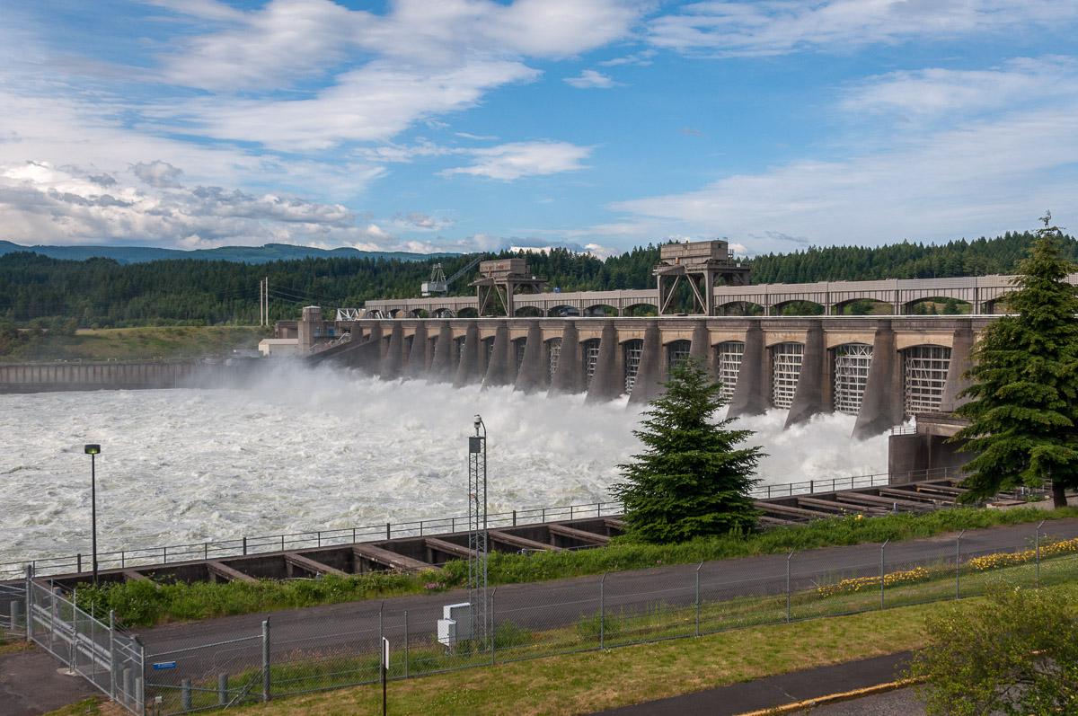
Bonneville Dam
![]()
No hike
![]() 30 minutes
30 minutes
![]()
Free
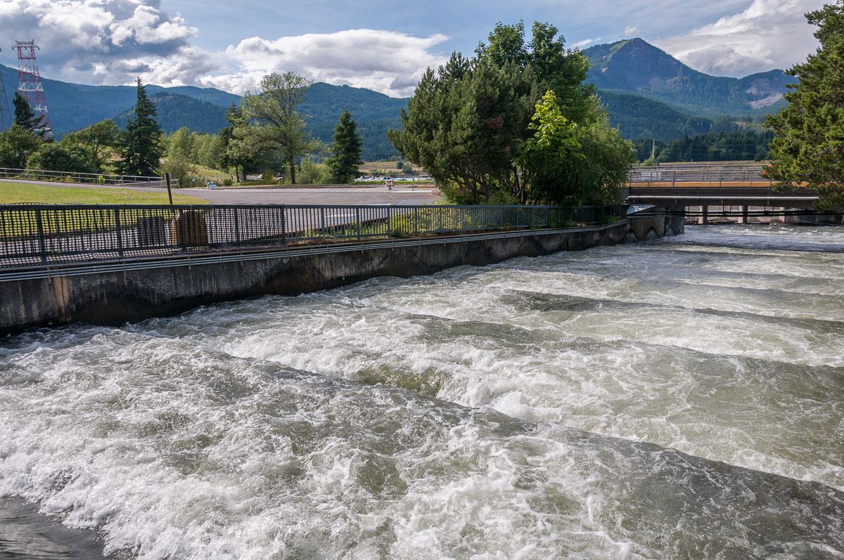
Bonneville Dam is famous for its salmons scales. We can also see the dam. It's easy to visit those scales by going to the Bonneville Dam visitors center. Be careful, it closes à 5 pm. During our trip in june 2012, we could see salmons in the scales. To be seen ...
Access : exit 40 on I84.
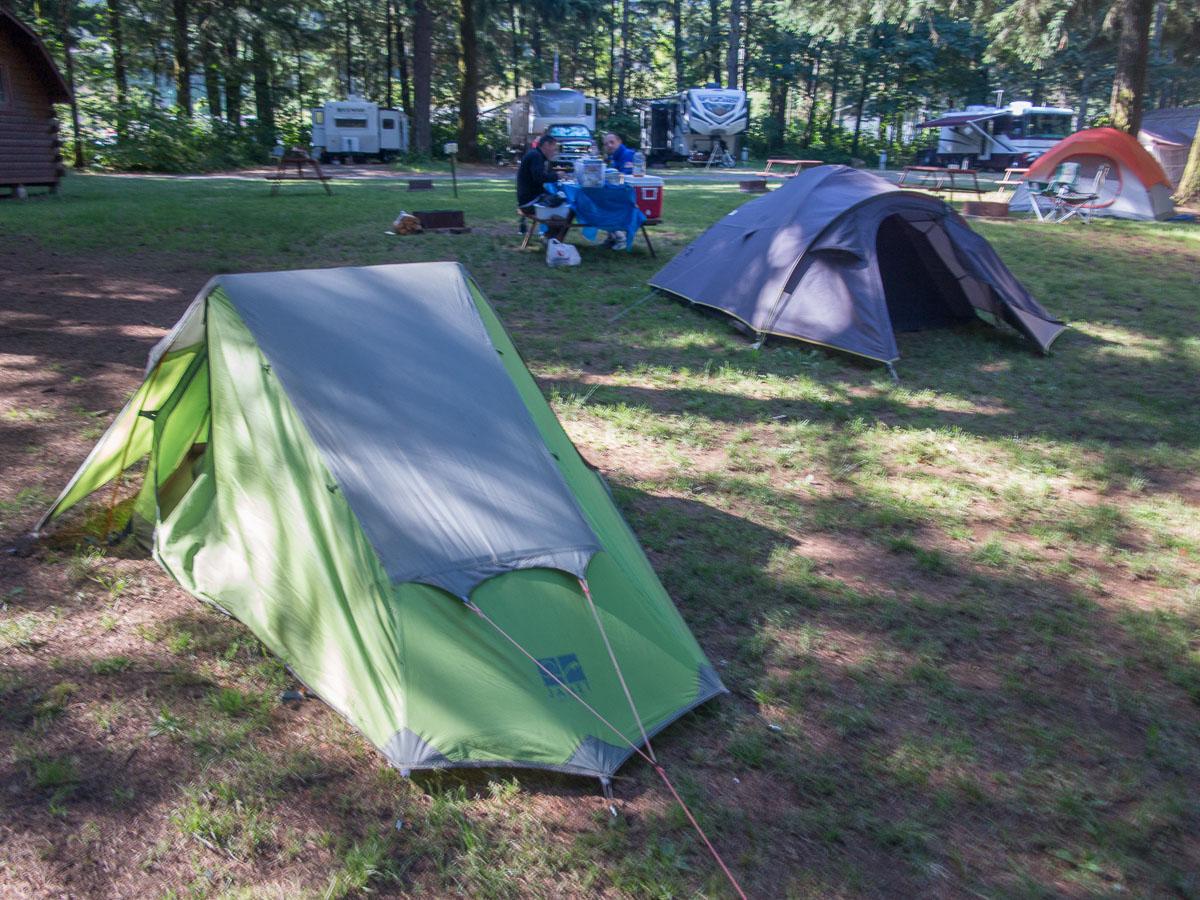
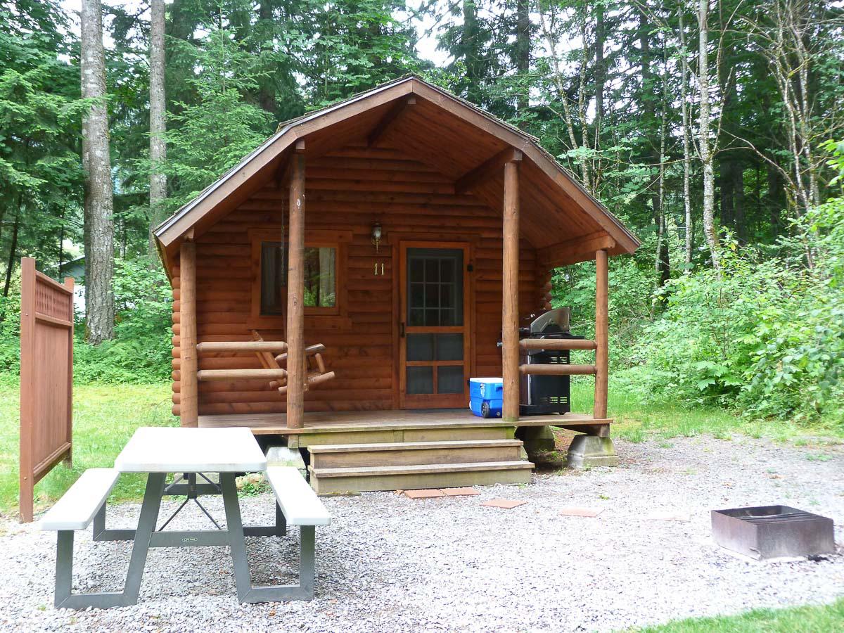
To see around
Lodging
We have tested :
Copyright Magali and David BELLEC